|
This page shows the documentation of the lighthouses of Finland. You can always click on the photo of the light to go to a specific (larger resolution) copy. Each lighthouse name is linked to (in our editorial opinion) the best reference site for that light. I would like to include directions on how to get to these lights. If you know such data, could you eMail me and I'll post it here (with your choice of attribution.) mailme This list was built based on the list maintained by the Amateur Radio Lighthouse Society. My thanks to them for providing this basis for understanding. My apologies to those of you who are Finnish, or love Finland. I've just discovered that all my special characters were damaged. I've fixed that, but am sorry for my errors. w8 Additional data has been collected from the Lighthouse Directory maintained by Russ Rowlett. w6 |
|
| FI 1 |
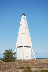
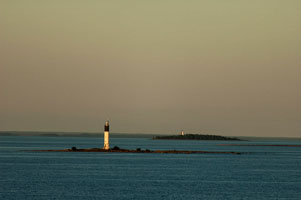
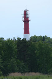
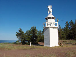
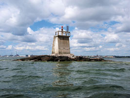
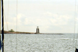
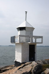
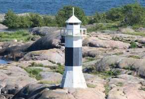
Ulkokalla Island
latitude 64° 20' N longitude 23° 27' E |
Located on a small island about 20 km west of Kalajoki. Boat transportation is available from Kalajoki during the summer. photo
Located on a small island about 20 km west of Kalajoki. Boat transportation is available from Kalajoki during the summer. (C 4192) ARLHS # FIN-069 |
| FI 2 |
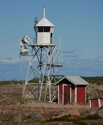
Nahkiainen |
Located on a shoal about 16 km north of Kalajoki and 25 km west of Raahe. (C 4188) ARLHS # FIN-032 |
| FI 3 |
Jaako Beacon
latitude 64° 39' N longitude 24° 19' 60" E |
- - * ARLHS # FIN-070 |
| FI 4 |
Raahe |
Located on a shoal about 12 km west of Raahe (C 4183) ARLHS # FIN-045 |
| FI 5 |
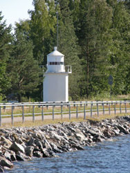
Tasku |
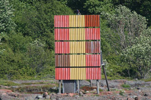
One of several historic daybeacons in service in northern Finland. Located on an island that helps shelter the harbor of Raahe. * |
| FI 6 |
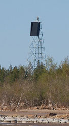
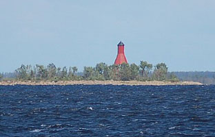
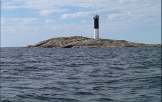
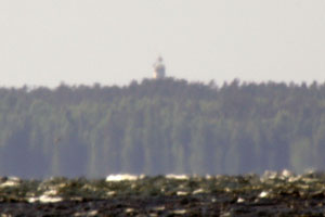
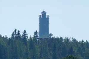
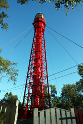
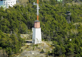
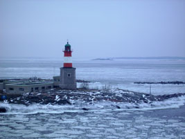
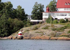
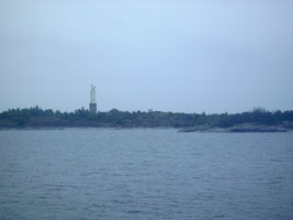
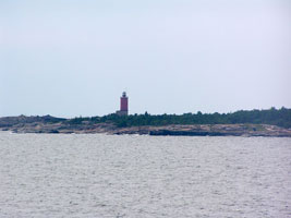
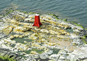
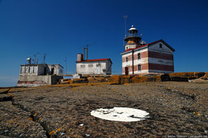
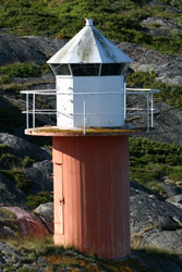
Tauvo
Located on a Low cape about 12 km northeast of Raahe and a similar distance west of Siikajoki. It appears that the lighthouse should be accessible by a fairly short walk on the beach. (C 4172) ARLHS # FIN-067
Photo courtesy Teemu Vehkaoja [wikipedia] |
|
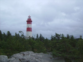
| FI 7 |
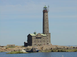
| Marjaniemi (Hailuoto)
This handsome tower is one of the oldest, best known, and most accessible lighthouses of northern Finland. Located on a sharp point at the western tip of the island of Hailuoto, about 50 km west of Oulu. The island is accessible by auto ferry, and the lighthouse is at the end of highway 816, which crosses the island. (C 4142.1) ARLHS # FIN-028
Photo courtesy Teemu Vehkaoja [wikipedia] |
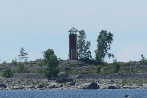
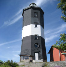
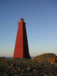
| FI 8 |
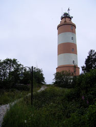
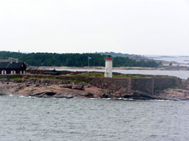
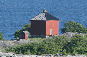
Keskiniemi (1858)
This historic tower has always been a daymarker only
Located on a promontory of Keskiniemi in northwestern part of Hailuoto island in the Gulf of Bothnia. The tower was built to alert the vessels about sandbars reaching northwest from the site. It is the oldest surviving navigational aid on Hailuoto island.
Photo courtesy Teemu Vehkaoja [wikipedia] |
|
| FI 9 |
| Keskiniemi (new) /Hailuoto
This is the front light of a range; the rear light, Hyypänmäki, is on a skeletal tower 7 km southeast on the highest hill of Hailuoto. Located on a promontory on the northwestern coast of Hailuoto.
The light is accessible by foot or car, Located 6.3 km northeast of Marjaniemi Lighthouse. (C 4147.05) ARLHS # FIN-080
Photo courtesy Teemu Vehkaoja [wikipedia] |
| FI 9H |
Hyyppänmäki (Keskiniemi Range Rear)
Inactive; although the rear light has been discontinued the tower is maintained as a daybeacon.
Hyyppänmäki (Hyyppä Hill) is a sand ridge in the center of Hailuoto. Located 7 km southeast of the front light.
Photo courtesy Tve4 [wikipedia] |
|
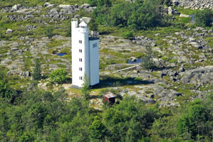
| FI 10 |

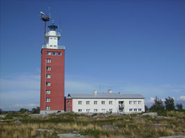
| Oulu 1
This is the outermost of three identical lighthouses built to guide ships around the north side of Hailuoto island to the port of Oulu. Located about 8 km northwest of the Marjaniemi lighthouse. (C 4145) ARLHS # FIN-037
Photo courtesy Captain Theo [ListOfLights] |
| FI 11 |
Oulu 2
Located about 6.5 km north of the Marjaniemi lighthouse (C 4146) ARLHS # FIN-038
Photo courtesy Captain Theo [ListOfLights] |
|
| FI 13 |
Lansiletto (Luodematala Range Rear)
latitude 65° 10' 49.8" N longitude 25° 2' 40.2" E
This range also guides vessels toward Oulu. Located on a small island about 8 km northeast of Hailuoto and a similar distance from the mainland near Haukipudas. (C 4106.1)
Photo courtesy Teemu Vehkaoja [wikipedia] |
|
| FI 13F |
| Nimetön (Luodematala Range Front) (C 4106)
Photo courtesy Alex Trabas [ListOfLights] |
| FI 14 |
Laitakari
One of several historic daybeacons in service in northern Finland, this tower replaced older beacons placed on the island as early as the 1750s. When aligned with the belfry of the Oulu Cathedral the daybeacon guides vessels towards a range leading past the northern coast of Hailuoto island. Located on the small gravel island of Laitakari, approx 5 km east of the easternmost tip of Hailuoto and 16 km west of Oulu. (C 4460.6)
Photo courtesy Teemu Vehkaoja [wikipedia] |
|
| FI 15 |
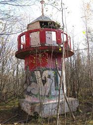
| Koskela (Letonniemi)
The tower carried a directional light guiding vessels into Toppila harbor. Reports say the lighthouse is abandoned and covered with graffiti. Located on the south side of the Letonniemi promontory in Oulu; accessible by a foot path. *
Photo courtesy SeppVei [wikipedia] |
| FI 16 |
Rivinletto
latitude 65° 12' 6" N longitude 25° 14' 54" E
Located on a gravel bar on the south side of the entrance to the Kiiminki River in Haukipudas. (C 4122) ARLHS # FIN-085
Photo courtesy Teemu Vehkaoja [wikipedia] |
|
| FI 17 |
Ulkokrunni (Range Rear) |
One of several historic daybeacons in service in northern Finland. Located on the northeastern tip of Ulkokrunni island in the Krunni archipelago, about 20 km west of the mainland and 40 km northwest of Oulu. The island is a natural preservation area; landing is prohibited unless authorized by the Maakrunni Society. (C 4101.1) ARLHS # FIN-071 |
| FI 18 |
Krassukanletto (Kraasukka) Range Front |
Located on a gravel bar in the Krunni archipelago about 10 km east southeast of the Ulkokrunni lights. photo (C 4105) ARLHS # FIN-081 |
| FI 19 |
Härkäletto |
Located on a small island about 8 km south of Simoniemi near the border of Oulu Province. (C 4100) ARLHS # FIN-053 |
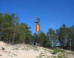
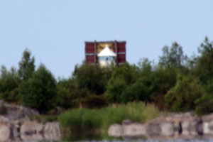
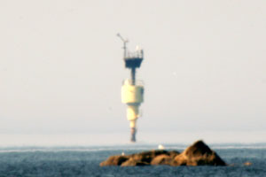
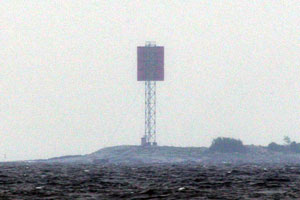
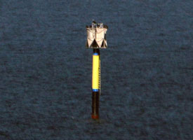
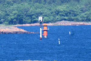
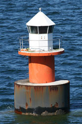
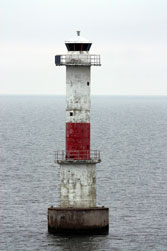
| FI 20 |
Ykskivi
latitude 65° 35' 60" N longitude 24° 42' E
This is one of several historic daybeacons in service in northern Finland. Located on the island of Ykskivi, 3.3 km south of the fishing harbor of Karsikko and about 12 km southeast of Kemi. photo
You can barely see this beacon in the photo below. FI23 (C 4098.5) ARLHS # FIN-091
Photo courtesy Alex Trabas [ListOfLights] |
|
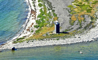
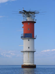
| FI 21 |
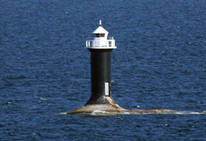
Kemi 1 |
It appears that the original lantern has been removed and the light is now mounted at the edge of the helipad. Located on a shoal about 22 km southwest of Kemi; this Location is very near the Swedish border on the centerline of the gulf. (C 4082) ARLHS # FIN-016 |
| FI 22 |
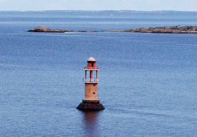
Kemi 2 |
This lighthouse replaced the lightship Kemi, which has been on display at the Maritime Museum of Finland in Kotka since 2008. Located on a shoal about 16 km southwest of Kemi. (C 4082.5) ARLHS # FIN-017 |
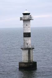
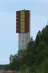
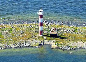
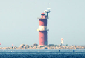
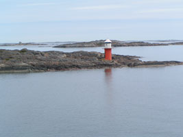
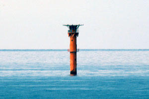
| FI 23 |
Keminkraaseli
latitude 65° 37' N longitude 24° 34' E
Located on a gravel bar about 6 km south of Kemi.
In the background of this photo is Ykskivi. FI20 (C 4083) ARLHS # FIN-018
Photo courtesy Joachim Probst [Flickr] |
|
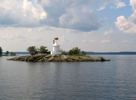
| FI 24 |
| Keskikallio
Located on an islet about 3 km southeast of Isokari. (C 4453) ARLHS # FIN-079
Photo courtesy Grigory Shmerling [panoramio] |
| FI 25 |
Isokari /Kustavi
latitude 60° 43' 5.5" N longitude 21° 40.6" E
This historic lighthouse is the one of oldest of the Gulf of Bothnia. Isokari is an island about 20 km west of Uusi and is accessible by ferry from that port. Located on the highest point of the island, accessible by a short hike from the ferry terminal. (C 4450) ARLHS # FIN-010
Photo courtesy Jukk A [Flickr] |
|
| FI 26 |
Sandbäck |
Located on a shoal about 13 km west of Isokari island. (C 4450.4) ARLHS # FIN-054 |
| FI 27 |
Hylkkari |
Located on an island about 7 km west northwest of Kammela. (C 4445) |
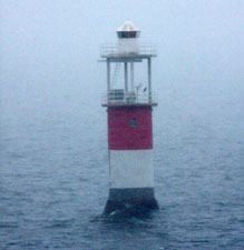
| FI 29 |
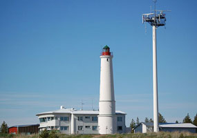
| Kylmäpihlaja
latitude 61° 8' 41.1" N longitude 21° 18' 9.2" E
Located on an island about 10 km west of Rauma; accessible during the summer months by daily passenger ferry service from Rauma. photo (C 4421) ARLHS # FIN-024
Photo courtesy Sari Palomäki [Flickr] |
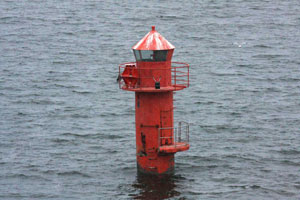
| FI 30 |
Säppi (Björneborg)
latitude 61° 28' 38.5" N longitude 21° 20' 51.4" E
Säppi is an island about 1 mi Long, Located about 10 km southwest of Mäntyluoto. Located on the highest point of the island. photo (C 4398) ARLHS # FIN-055
Photo courtesy Alex Trabas [ListOfLights] |
|
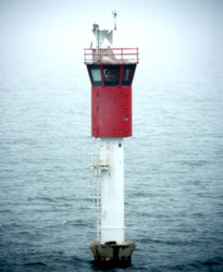
| FI 31 |
| Kallo
latitude 61° 35' 40.4" N longitude 21° 27' 43.9" E
This attractive and historic lighthouse guides vessels into the port of Mäntyluoto, northwest of Pori. Located on the peninsula sheltering the west side of the harbor. (C 4376) ARLHS # FIN-015
Photo courtesy Kallerna [wikipedia] |
| FI 33 |
Reposaari (Commercial Harbor Range Front)
latitude 61° 36' 16.2" N longitude 21° 27' 24.1" E
Reposaari and Mäntyluoto are separated by their common harbor entrance. Located on the Breakwater in the waterfront of Reposaari. (C 4378) ARLHS # FIN-140
Photo courtesy Karri Ojanen [Flickr] |
|
| FI 34 |
| Kaijakari
latitude 61° 36' 51.1" N longitude 21° 21' 52.9" E
Located on Kaija, a small island about 3 km west of Reposaari. (C 4374) ARLHS # FIN-012
Photo courtesy Esa Riihelä [panoramio] |
| FI 35 |
Pori (Porin Majakka) |
Located on a shoal in the Gulf of Bothnia about 12 km northwest of Reposaari. photo (C 4365) ARLHS # FIN-041 |
| FI 36 |
Kasala |
A range light pair. (C 4350) ARLHS # FIN-099 |
| FI 37 |
Kasala Range Rear |
- - (C 4350.1) ARLHS # FIN-126 |
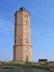
| FI 38 |
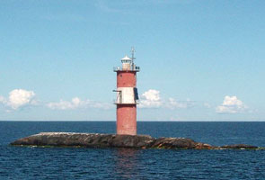
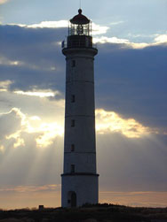
Yttergrund
latitude 61° 58' 45.4" N longitude 21° 17' 40.4" E
This historic tower is Finland's second tallest lighthouse. Located on the island of Södra Yttergrund, at the south side of the entrance to Fladen. photo (C 4348) ARLHS # FIN-077
Photo courtesy Alex Trabas [ListOfLights] |
|
| FI 39 |
Yttergrund Domarklubb Front |
- - * ARLHS # FIN-133 |
| FI 40 |
Yttergrund Ytterberg Rear |
- - * ARLHS # FIN-134 |
| FI 41 |
Kristiinankaupunki (Kristiina) |
Located on a shoal about 12 km southwest of Kristinestad, a predominantly Swedish-speaking port also known by its Finnish name Kristiina or Kristiinankaupunki (Kristiina Township). * ARLHS # FIN-023 |
| FI 42 |
Härkmeri Range Front (Kristinestad)
latitude 62° 11' 33.6" N longitude 21° 19' 38.8" E
Located on the island of Torngrund, about 6 km south southwest of Kristinestad. (C 4330) ARLHS # FIN-101
Photo courtesy Alex Trabas [ListOfLights] |
|
| FI 43 |
| Kristinestad /Harkmeri Rear
latitude 62° 11' 59.2" N longitude 21° 22' 58.1" E
Located on the Hansnäs promontory about 5 km south of Kristinestad (C 4330.1) ARLHS # FIN-128
Photo courtesy Alex Trabas [ListOfLights] |
| FI 44 |
Alesund Range Front
Located on an islet west of Leppasalmi. (C 4329)
Photo courtesy Alex Trabas [ListOfLights] |
|
| FI 45 |
| Sälgrund (Kaskö)
latitude 62° 20' 2.5" N longitude 21° 11' 25.5" E
Located at the southwestern tip of the island of Sälgrund, about 4 km southwest of Kaskinen. Passenger ferry service is available in the summer from Kaskinen. (C 4318) ARLHS # FIN-051
Photo courtesy Sari Palomäki [Flickr] |
| FI 46 |
Rövargrund |
- - ARLHS # FIN-088 |
| FI 47 |
Märigrund
On the Southeast point (C 4314) ARLHS # FIN-137
Photo courtesy Alex Trabas [ListOfLights] |
|
| FI 48 |
Gåshällan
latitude 62° 34' 29" N longitude 21° 2' 40" E |
On the Island of Gåshällan. (C 4312) ARLHS # FIN-136 |
|
|
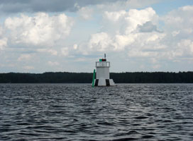
| FI 49 |
Storremmargrund
latitude 62° 19' 49.4" N longitude 21° 12' 30.9" E |
Located on a rocky reef in the entrance to the harbor of Kaskinen, roughly 500 m east southeast of the Sälgrund lighthouse. photo |
| FI 50 |
Svettgrund
latitude 62° 52' 3.1" N longitude 21° 4' 17.8" E
Located on a skerry about 2 km off the northwest coast of Halsön. (C 4302)
Photo courtesy Christer Granstrom [panoramio] |
|
| FI 51 |
Moikepaa |
- - * ARLHS # FIN-117 |
| FI 52 |
Strömmingsbåden
latitude 62° 58' 46.2" N longitude 20° 44' 21.3" E
Ferries crossing the gulf between Vaasa and Sundsvall, Sweden, probably pass cLose to this remote lighthouse. Located on the small island of Norra Kallan, about 45 km west southwest of Vaasa ARLHS # FIN-059
Photo courtesy Sari Palomäk [Flickr] |
|
| FI 53 |
| Veckargrund
Located on a skerry about 35 km west of Vaasa. There may be a view from ferries sailing across the gulf between Vaasa and Sundsvall, Sweden (C 4259)
Photo courtesy Marinas.com [marinas.com] |
| FI 54 |
Norrskär (Quarken)
The lighthouse is built on the island of Västra Norrskär in the center of the Gulf of Bothnia, about 50 km west of Vaasa. Located on a Low hill on the southwestern peninsula of the island. (C 4250) ARLHS # FIN-033
Photo courtesy Christine and Hagen Graf [Flickr] |
|
| FI 55 |
Norrkallan |
Located on the northwestern tip of Västra Norrskär. (C 4251) ARLHS # FIN-082 |
| FI 56 |
Lotsgrund |
Located on a shoal about 13 km southeast of the Norrskär lighthouse. (C 4235.5) |
| FI 57 |
Östra Norrskär
Located on the northeastern tip of the island of Östra Norrskär, about 7 km east northeast of the Norrskär lighthouse (C 4252)
Photo courtesy marinas.com [marinas.com] |
|
| FI 58 |
Norrskaren West |
- - * ARLHS # FIN-035 |
| FI 59 |
Norrskaren East |
Is it possible that this is really in Swedish waters? ARLHS # FIN-034 |
| FI 60 |
Utgrynnan
The lighthouse replaced a lightship station established in 1868. Located on a small island about 20 km north northeast of Norrskär. Ferries crossing the gulf between Vaasa and Umeå, Sweden, probably pass cLose to this lighthouse. (C 4248) ARLHS # FIN-072
Photo courtesy marinas.com [marinas.com] |
|
| FI 61 |
| Korsö
Located on the southeast side of Korsö, an island just off the southwest coast of Replot. photo (C 4236)
Photo courtesy Alex Trabas [ListOfLights] |
| FI 62 |
Norra Gloppsten
Located on a skerry about 5 km southwest of Replot on the southern approach to Vaasa (C 4262)
Photo courtesy Captain Theo [ListOfLights] |
|
| FI 63 |
| Norrhästen (Norra Hästen)
latitude 63° 6' 56.7" N longitude 21° 22' 11.7" E
Located north of GLoppet on the route of ferries between Vaasa and Umeå, Sweden. (C 4275.5)
Photo courtesy Captain Theo [ListOfLights] |
| FI 64 |
Vaasa (Vaasan Majakka)
Located on a shoal about 7 km west southwest of Replot, marking the start of the southern approach to Vaasa. (C 4261) ARLHS # FIN-075
Photo courtesy Captain Theo [ListOfLights] |
|
| FI 65 |
| Valassaaret (Valsörarna)
latitude 63° 25' 17.3" N longitude 21° 4' 3.4" E
Located on the island of Storskär, about 6 km northwest of Panike. (C 4226) ARLHS # FIN-076
Photo courtesy Kristian Lindqvist [Flickr] |
| FI 66 |
Ritgrund
latitude 63° 25' 31.9" N longitude 21° 30' 33.7" E
Located on a small island about 6 km northeast of Björkö, marking the start of the northern approach to Vaasa. (C 4224) ARLHS # FIN-048
Photo courtesy Chris Hart [Flickr] |
|
| FI 67 |
| Stubben
Located on a small island about 3 km off the mainland and about 16 km west of Nykarleby.
Do not confuse this with the light of the same name in Denmark. DK142 (C 4219) ARLHS # FIN-060
Photo courtesy marinas.com [marinas.com] |
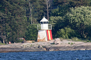
| FI 68 |
Hällgrund (1)
Located on a Low island off the north end of Torsön, about 5 km west of Pörkenäs photo (C 4218)
Photo courtesy Alex Trabas [ListOfLights] |
|
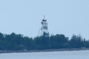
| FI 69 |
Hällgrund (3) (Pentzins grund) |
This light is at the north end of the same island as the historic Hällgrund beacon (previous entry). photo |
| FI 70 |
Pietarsaari (Jakobstad)
Located on a shoal about 9 km northwest of Pietarsaari, a small port more often called by its Swedish name Jakobstad photo (C 4214.3) ARLHS # FIN-040
Photo courtesy Alex Trabas [ListOfLights] |
|
| FI 71 |
| Kallan
Located on a small island about 1 km northwest of the Pietarsaari light. photo (C 4214) ARLHS # FIN-014
Photo courtesy Alex Trabas [ListOfLights] |
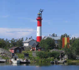
| FI 72 |
Tankar
latitude 63° 56' 58.9" N longitude 22° 50' 48.1" E
In addition to the main light, the rear light of the Tankar Range is shown though a Lower window of the tower at a focal plane of 66 ft. Located on a small island about 15 km west northwest of Kokkola photo (C 4200) ARLHS # FIN-065
Photo courtesy Sari Palomäki [Flickr] |
|
| FI 73 |
Kokkolan |
Located on a shoal about 12 km northwest of Kokkola. (C 4203) ARLHS # FIN-020 |
| FI 74 |
Lipra (Siikasaari Range Rear)
Located in the entrance to the fjord leading to Hailila, about 7 km southwest of Virolahti. (C 4120.41)
Photo courtesy Alex Trabas [ListOfLights] |
|
| FI 75 |
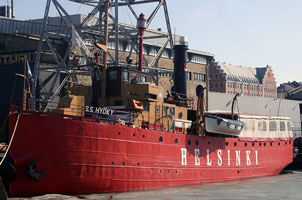
| Lightship Helsinki (Hyöky, Libauskiy)
Normally it is moored at Tervasaari, an island in the harbor of Hamina. ARLHS # FIN-027
Photo courtesy Kari Jokisen [Wikipedia] |
| FI 76 |
Merikarvia
Located on a rocky shoal about 16 km southeast of Kotka. photo (C 4351) ARLHS # FIN-031
Photo courtesy Alex Trabas [ListOfLights] |
|
| FI 77 |
Rankki |
Located on a skerry about 3 km west of the island of Kirkonmaa and 8 km southeast of Kotka. photo (C 5386) |
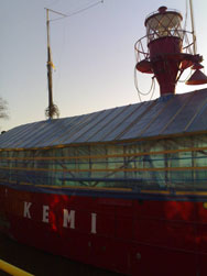
| FI 78 |
Lightship Kemi
At the Maritime Museum of Finland (Museumvirasto) on the island of Hylkysaari in Helsinki. ARLHS # FIN-104
Photo courtesy Esko Kurvinen [Flickr] |
|
| FI 79 |
| Kotka (Kotkan Majakka)
Located on a shoal in the Gulf of Finland about 25 km southwest of Kotka. (C 5380) ARLHS # FIN-021
Photo courtesy marinas.com [marinas.com] |
| FI 80 |
Kaunissaari (Gulf of Finland)
Located on the northern tip of the island of Kaunisaari, about 10 km southwest of Kotka. The island is accessible by ferry from Kotka. (C 5368) ARLHS # FIN-135
Photo courtesy Ari Rotonen [Flickr] |
|
| FI 81 |
Lålätta |
Located on an islet about 5 km southeast of Söderby. (C 5349) |
| FI 82 |
Orrengrund (1760s)
The tower was converted to a pilot station in the 1890s, and the current observation room was built by the Finnish army in 1920. Apparently the tower is now part of a coast guard station. Located near the ferry terminal on the north (?) side of the island.
Photo courtesy marinas.com [marinas.com] |
|
| FI 83 |
Orrengrund (1858) |
Located at the west end of the island. (C 5322) |
| FI 84 |
Tainio |
Located on a shoal about 16 km southeast of Loviisa. (C 5321) ARLHS # FIN-064 |
| FI 85 |
Tiiskeri
latitude 60° 9' 41.7" N longitude 26° 15' 29.6" E
Located on a small island about 20 km south of Loviisa. (C 5318) ARLHS # FIN-068
Photo courtesy marinas.com [marinas.com] |
|
| FI 86 |
Pellinki (Pellinge Skär) |
Located on the island of GLosholm about 1.6 km southwest of Söderby and 3 km southwest of Pellinki. ARLHS # FIN-083 |
| FI 87 |
Kalbådagrund
The lighthouse replaced a lightship station. Located on a dangerous shoal near the centerline of the Gulf of Finland, 12 km from shore and about 25 km south of Porvoo. (C 5239) ARLHS # FIN-013
Photo courtesy Islander [Wikipedia] |
|
| FI 88 |
Porvoo (Borgå) |
The light functions as the front light of a Long range; the rear light is on Larsskär some 5.5 km to the north. Located on a shoal about 3 km north of the Kalbådagrund lighthouse. photo (C 5239.4) ARLHS # FIN-044 |
| FI 89 |
Larsskär (Range Rear)
latitude 60° 8' 44.9" N longitude 25° 37' 39.2" E
Located on a small island 5.5 km north of the Porvoo lighthouse. photo (C 5239.41)
Photo courtesy Alex Trabas [ListOfLights] |
|
| FI 90 |
| Tallörn (Range Front)
Located on a small island about 5 km south of Kalkkiranta. photo (C 5227)
Photo courtesy Alex Trabas [ListOfLights] |
| FI 91 |
Söderskär
This historic lighthouse is Located on a small island in the Gulf of Finland about 12 km south of Kalkstrand. ARLHS # FIN-057
Photo courtesy Miika Silfverberg [Flickr] |
|
| FI 92 |
| Helsinki
Located in the Gulf of Finland about 15 km south of Helsinki. (C 5184) ARLHS # FIN-009
Photo courtesy jje [Flickr] |
| FI 93 |
Harmaja Range Front (Gråhara)
latitude 60° 6' 18.1" N longitude 24° 58' 31.9" E
Stone daybeacons were built on the island as early as the 1500s to guide arriving ships. The original stone lighthouse proved to be too short, so in 1900 its lantern was removed and replaced by the cast iron tower. The Helsinki piLot station and a tall communications tower also occupy the island. Located at the eastern end of the island. photo (C 5190) ARLHS # FIN-008
Photo courtesy Sari Palomäki [Flickr] |
|
| FI 93R |
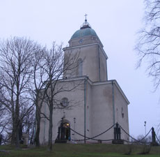
| Suomenlinna (Sveaborg), Harmaja Range Rear)
latitude 60° 8' 52.2" N longitude 24° 59' 10" E
The church of Suomenlinna, a well known Helsinki landmark, was built as a Russian Orthodox cathedral in 1854. The light serves as the rear light of a range, with the front light being the Harmaja lighthouse 4.8 km to the south. Located at the highest point of the island of Suomenlinna, southeast of Helsinki. photo (C 5190.1)
Photo courtesy Sari Palomäki [Flickr] |
| FI 94 |
Korkeasaari
Korkeasaari is an island on the east side of Helsinki. There is a range light system here. (C 4168.3)
Photo courtesy Alex Trabas [ListOfLights] |
|
|
|
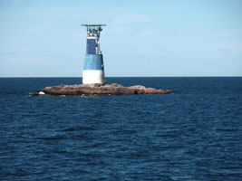
| FI 95 |
| Graskarsbadan
latitude 60° 2' 10.2" N longitude 24° 53' 25.8" E
- - (C 5186) ARLHS # FIN-124
Photo courtesy Rainer Arndt [ListOfLights] |
| FI 96 |
Lokkiluoto Front
latitude 60° 7' 51.6" N longitude 24° 56' 37.8" E
A small lighthouse island outside Helsinki (C 5188.1) ARLHS # FIN-131
Photo courtesy Tok [Wikipedia] |
|
| FI 99 |
| Remmarholmen
latitude 60° 7' 52.2" N longitude 24° 59' 39" E
Located on Reimarisaari, a small island off the southwestern tip of the larger island of Vallisaari, about 3.5 km southeast of Helsinki. photo (C 5195)
Photo courtesy Neal Doan [ListOfLights] |
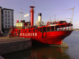
| FI 100 |
Lightship Relandersgrund
Somehow rescued from the wreckers, it reappeared with its old name in Kotka, where it was renovated as a restaurant. In 2005 it was towed to Helsinki, where it continues to function as a restaurant. Located on the waterfront in downtown Helsinki. ARLHS # FIN-108
Photo courtesy Niklas Sjöblom [Flickr] |
|
| FI 101 |
| Valkosaari Range Rear (Blekholm)
latitude 60° 9' 42.2" N longitude 24° 57' 59.7" E
The front light is in a tiny lantern only 2 m (7 ft) tall. Located on a small island on the east side of Helsinki. (C 5170.1)
Photo courtesy Klaus Kern [ListOfLights] |
| FI 102 |
Valkosaari Range Front (Blekholm)
latitude 60° 9' 34.2" N longitude 24° 58' 1.2" E (C 5170)
Photo courtesy Klaus Kern [ListOfLights] |
|
| FI 104 |
| Länsi Mustasaari (Västra Svartö)
latitude 60° 8' 46.2" N longitude 24° 58' 25.7" E
Located at the southwest side of Länsi Musta, an island on the southeast side of Helsinki harbor. (C 5166)
Photo courtesy Stefe [Flickr] |
| FI 105 |
Kustaanmiekka Range Front (Gustavsvård)
latitude 60° 8' 16.6" N longitude 24° 59' 25.8" E
Kustaamiekka (Gustav's Sword) is an island seaward of Suomenlinna; the channel leading onto Helsinki harbor passes through a narrow opening between Kustaamiekka and neighboring island of Vallisaari. The Suomenlinna fortress is actually built on the eastern tip of Kustaamiekka to guard this passage. The lighthouse is on the tip of the island beLow the walls of the fortress. (C 5196)
Photo courtesy Jeaneeem [Flickr] |
|
| FI 105R |
| Iso Mustasaari (Stora Östersvartö)
latitude 60° 8' 36.6" N longitude 24° 59' 33" E
Rear Range for the light above. (C 5196)
Photo courtesy Helmut Seger [ListOfLights] |
| FI 106 |
Abrahaminluoto (Lokkiluoto Range Rear)
latitude 60° 7' 19.4" N longitude 24° 57' 26.9" E
This is an outbound range, guiding ships as they leave Helsinki. Located on a small island about 2 km south of the Helsinki waterfron (C 5188) ARLHS # FIN-121
Photo courtesy Alexander Trabas [ListOfLights] |
|
| FI 107 |
| Tiirakari (Tirgrund)
latitude 60° 7' 42.1" N longitude 24° 55' 37.9" E
Located at the northern tip of a small island about 1.6 km southwest of the entrance to Helsinki harbor. photo (C 5160)
Photo courtesy Larry Myhre [Flickr] |
| FI 108 |
Koirakari (Hundskär)
latitude 60° 7' 25.9" N longitude 24° 54' 36.6" E
Located at the tip of a small island about 1.6 km south of the entrance to Helsinki harbor. photo (C 5156)
Photo courtesy Esa Riihelä |
|
| FI 109 |
| Kotka Rankki
Near Kuutsalo, in the Suomenlahti Bay (C 5386) ARLHS # FIN-127
Photo courtesy marinas.com [marinas.com] |
| FI 110 |
Lellerinsaaret |
- - * ARLHS # FIN-130 |
| FI 111 |
Hietakari
latitude 60° 24' 27" N longitude 27° 14.1" E |
- - (C 5390) ARLHS # FIN-125 |
| FI 112 |
Heponiemi
Saaristomeri (Archipelago Sea) (C 4692) ARLHS # FIN-138
Photo courtesy Alex Trabas [ListOfLights] |
|
| FI 113 |
Rönnskär (1)
latitude 59° 56' 7.8" N longitude 24° 23' 29.2" E |
The original lighthouse, built by Sweden, was destroyed during the war between Sweden and Russia in 1808-09. ARLHS # FIN-086 |
| FI 114 |
Rönnskär (1814)
latitude 59° 56' 7.8" N longitude 23° 23' 29.2" E
Located on a small island about 7.5 km north of the Porkkala lighthouse. photo (C 5310.1) ARLHS # FIN-087
Photo courtesy Sari Palomäki [Flickr] |
|
| FI 115 |
Rönnskär Cliff |
- - ARLHS # FIN-049 |
| FI 116 |
Porkkala Kallbadan
The lighthouse appears to have been inactive during the Soviet occupation; afterward Finnish authorities found it in poor condition and put in back in service with an automated light. The lighthouse is built over a skerry about 8 km southwest of the tip of the peninsula. ARLHS # FIN-043
Photo courtesy Oma Teos [Wikipedia] |
|
| FI 117 |
| Bengtskär
latitude 59° 43' 24" N longitude 22° 30' E
Restored in the early 1990s, the lighthouse now includes overnight accommodations, a lecture hall, conference rooms, a café museum, and post office. Located on a small island about 25 km west southwest of Hanko. Passenger ferry service to the lighthouse is available from Kasnäs in the Åland Islands. (C 4906) ARLHS # FIN-001
Photo courtesy Dronir [Flickr] |
| FI 118 |
Russarö (1838) Hangö |
- - ARLHS # FIN-050 |
| FI 119 |
Russarö (1863) Hangö
latitude 59° 45' 60" N longitude 22° 56' 52" E
Located on the southeastern side of the island of Båklandet about 4 km south of Hanko. The island is accessible by ferry from Hanko. photo (C 4912) ARLHS # FIN-089
Photo courtesy Thomas Quatsling [ListOfLights] |
|
| FI 121 |
Langden |
- - * ARLHS # FIN-026 |
| FI 123 |
Jussarö II |
- - ARLHS # FIN-078 |
| FI 124 |
Gustavsvärn
latitude 59° 48' 4" N longitude 22° 56' 34.7" E
Located on a skerry about 1.5 km due south of Hanko. ARLHS # FIN-007
Photo courtesy Ross McDonald [ListOfLights] |
|
| FI 124U |
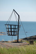
| Utö Island (1753)
The first lighthouse on the island was destroyed during the Russian-Swedish War in 1808. This photo is of the fire basket. ARLHS # FIN-074
Photo courtesy Maija Erkolahti [Flickr] |
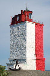
| FI 125 |
Utö Island (1814)
The present lighthouse served as a church and town hall for the islanders during the mid nineteenth century. Located on the highest point of the island. photo (C 4736) ARLHS # FIN-090
Photo courtesy Maija Erkolahti [Flickr] |
|
| FI 126 |
| Ulkomatala Helsinki
- - (C 5185) ARLHS # FIN-132
Photo courtesy Rainer Arndt [ListOfLights] |
| FI 128 |
Kasko Island |
- - * ARLHS # FIN-100 |
| FI 129 |
Saviletto
Saaristomeri (Archipelago Sea) (C 4693) ARLHS # FIN-139
Photo courtesy Alex Trabas [ListOfLights] |
|
| FI 130 |
Sideby |
- -
Is this a duplicate of Yttergrund? FI38 ARLHS # FIN-118 |
| FI 131 |
Warogadden |
- - * ARLHS # FIN-120 |
| FI 132 |
Lightship Aarandsgrund |
- - ARLHS # FIN-116 |
| FI 133 |
Lightship Helsingkallan |
- - ARLHS # FIN-102 |
| FI 134 |
Lightship Kalbadagrund |
- - ARLHS # FIN-103 |
| FI 135 |
Lightship Nahkianien |
- - ARLHS # FIN-105 |
| FI 136 |
Lightship Plevna |
- - ARLHS # FIN-106 |
| FI 137 |
Lightship Qvarken |
- - ARLHS # FIN-107 |
| FI 138 |
Lightship Snipan |
- - ARLHS # FIN-110 |
| FI 139 |
Lightship Storbrotten |
Hist - ARLHS # FIN-112 |
| FI 140 |
Lightship Storkallegrund |
- - ARLHS # FIN-113 |
| FI 141 |
Lightship Taipaleenluoto |
- - ARLHS # FIN-114 |
| FI 142 |
Lightship Werkkonatala |
- - ARLHS # FIN-115 |
Inland Lakes
| FI 143 |
Teisko (Tesikola) |
Located near Teisko, a town on a northeastern arm of lake Näsijärvi. photo |
| FI 144 |
Siilinkari
latitude 61° 31' 3.3" N longitude 23° 45' 14.1" E
Located on a small island in the lake about 1.3 km north of the Tampere waterfront.
Photo courtesy Antti Kivivalli [Flickr] |
|
| FI 145 |
Tallisaari (Suolahti) |
Located on a small island in the harbor of Suolahti, the town at the south end of lake Keitele. photo |
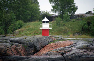
| FI 146 |
Haikka
latitude 62° 7' 55.7" N longitude 25° 47' 5.8" E
Located on a gravel bar sheltering the harbor of Haikka, a village about 20 km south of Jyväskylä on the west side of lake Päijänne.
Photo courtesy Livejungle [Flickr] |
|
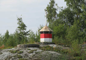
| FI 147 |
Judinsalo
latitude 61° 42' 16.3" N longitude 25° 30' 19.2" E |
Located on a small island east of Lahtela in the central portion of lake Päijänne. photo |
| FI 148 |
Tehinsilmä
latitude 61° 33' 22.8" N longitude 25° 24' 43.7" E |
This lighthouse is said to be in the southern part of lake Päijänne. Located on a rock called Mustalaisluoto, on the SE side of Tehinkärki Point near Kuhmoinen. photo |
| FI 149 |
Pulkkilanharju (Lake Päijänne)
latitude 61° 17' 36.9" N longitude 25° 32' 2.7" E
Pulkkilanharju is an 8 km Long ridge that crosses the southern part of the lake. Highway 314 uses the ridge and several bridges to make the same crossing. Located beside highway 314 near a bridge crossing a gap in the ridge. ARLHS # FIN-084
Photo courtesy Tanja Näätänen [Flickr] |
|
| FI 150 |
Oulunpää
latitude 61° 37' 57.7" N longitude 28° 33' 5.8" E |
The light marks a narrow passage near a right-angled bend in lake Saimaa. Located in the Pihlajavesi portion of Saimaa on the southeastern coast of the island of Oulunsaari. photo |
| FI 151 |
Vuoriluoto
latitude 61° 34' 21.2" N longitude 28° 15' 15" E |
Located on the north end of an island in Haapaselkä about 12 km northeast of Puumala. photo |
| FI 152 |
Puumala
latitude 61° 31' 52.8" N longitude 28° 12' 26.3" E
Located on the west side of Lake Haapaselkä about 2.5 km northeast of Puumala.
Photo courtesy Franz Vieracker [panoramio] |
|
| FI 153 |
Rehusaari (Saukionniemi) |
Located on a small island off the northeast side of the island of Kyläniemi in the southern portion of Saimaa. photo |
| FI 154 |
Rastiluoto
Located on a small island in the Taipalsaari municipality, on a part of Lake Saimaa known as Riutanselkä, about 15 km northwest of Lapeenrenta.
Photo courtesy Eerik Hocksell [panoramio] |
|
Åland Sea
| FI 155 |
| Bogskär
latitude 59° 30' 17" N longitude 20° 20' 47.8" E
Painted in Finland's national colors, this lighthouse greets many travelers arriving by ship. Located on a skerry about 50 km south southeast of Mariehamn, Åland's capital. (C 4486) ARLHS # ALA-002
Photo courtesy Islander [Wikipedia] |
| FI 157 |
Fästorna (Västergrundet)
latitude 59° 51' 22.5" N longitude 20° 20' 33.4" E
This is a historic daybeacon; a sector light was installed in 1951. Located on a skerry about 8 km south of Foglö. (C 4546) ARLHS # ALA-004
Photo courtesy marinas.com [marinas.com] |
|
| FI 158 |
| Soumen Leijona
Located on a shoal about 26 km east southeast of Bogskär and a similar distance south of Kökar, the nearest part of Åland. (C 4487) ARLHS # ALA-018
Photo courtesy Islander [Wikipedia] |
| FI 159 |
Kökarsören (1906) |
The historic light probably no longer stands. It is represented on a stamp. stamp ARLHS # ALA-009 |
| FI 160 |
Kökarsvren (1983) (Kökars Ören) |
Located atop a small island about 10 km southeast of Kökar photo (C 4725) ARLHS # ALA-010 |
| FI 161 |
Flötjan
Located on an isolated skerry about 18 km southwest of Mariehamn. (C 4482) ARLHS # ALA-005
Photo courtesy Islander [Wikipedia] |
|
| FI 162 |
| Storgrund
Located on a shoal about 3 km northeast of the Ledskär beacon (see below). (C 4548)
Photo courtesy Esquilo [Wikipedia] |
| FI 163 |
Ledskär
The daybeacon is reported to be at least the third to have stood at this site. Located on a small island off the southeastern tip of Fasta Åland. photo (C 4536.3) ARLHS # ALA-012
Photo courtesy Alex Trabas [ListOfLights] |
|
| FI 164 |
| Rågrund
Located on a shoal about 1 km east of the Ledskär beacon (previous entry) (C 4546.5) ARLHS # ALA-014
Photo courtesy Alex Trabas [ListOfLights] |
| FI 165 |
Lågskär
The lighthouse was automated in 1961 and comverted to wind power in 1986. The buildings are now in use as an ornithoLogical station. Tours to the island, popular with birders, are available from Mariehamn. Located on the northern tip of the island. (C 4480) ARLHS # ALA-011
Photo courtesy Islander [Wikipedia] |
|
| FI 166 |
| Nyhamn (Lilla Båtskär)
Located on Lilla Båtskär, a small island about 8 km south of Mariehamn. ARLHS # ALA-001
Photo courtesy marinas.com [marinas.com] |
| FI 167 |
Köklubb
Located in the eastern entrance to the channel between the islands of Askö and Järsö, about 5 km southeast of Mariehamn harbor. photo (C 4515)
Photo courtesy Alex Trabas [ListOfLights] |
|
| FI 168 |
| Fjärdhällan Range Front
Located off the southwestern tip of Järsö, about 3 km south of the Mariehamn waterfront. (C 4516)
Photo courtesy Johan Fredriksson [Wikipedia] |
| FI 169 |
Marhällan
A familiar sight for travelers arriving by ferry in Mariehamn, this lighthouse is often photographed. Located on an isolated rock about 6 km southwest of Mariehamn harbor. (C 4490) ARLHS # ALA-013
Photo courtesy Russ McDonald [ListOfLights] |
|
| FI 170 |
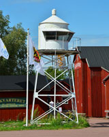
| Mariehamn Sjökvarteret (Stegskär)
The little lighthouse remains active as a harbor light. Located on the waterfront of Mariehamn.
Photo courtesy Johan Fredriksson [Wikipedia] |
| FI 171 |
Armbågan |
Located on a shoal about 50 km south of Mariehamn. photo |
| FI 172 |
Tröskeln Östra |
Restoration of a light was announced in June 2008, but details of the new structure were not given. Located about 2.5 km north of the Armbågan lighthouse. (C 6459.3) |
| FI 173 |
Solovjeva |
Located in the center of the Åland Sea, about halfway between Storby and the Swedish coast. (C 4473.5) |
| FI 174 |
Gisslan |
- - (C 4476) ARLHS # ALA-006 |
| FI 175 |
Signilskär |
Saaristomeri (Archipelago Sea); Ahvenanmeri (Ålands Hav) (C 4475) ARLHS # ALA-017 |
| FI 176 |
Enskär Kobben |
Saaristomeri (Archipelago Sea); Ahvenanmeri (Ålands Hav) (C 4474) ARLHS # ALA-003 |
| FI 177 |
Märket
latitude 60° 18' 3.2" N longitude 19° 7' 52.9" E
Märket is about 30 km west of Fasta Åland and almost exactly the same distance east of the Swedish coast. Transportation to the island is sometimes available from Storby on the island of Eckerö; contact the Finnish Lighthouse Society for details. wikipedia (C 4472) ARLHS # MAR-001
Photo courtesy Niklas Sjöblom [Flickr] |
|
| FI 178 |
| Sälskär
latitude 60° 24' 42.6" N longitude 19° 35' 32.4" E
Located on a small island at the northwestern corner of the Åland archipelago. (C 4466) ARLHS # ALA-016
Photo courtesy jbe500 [Wikipedia] |
| FI 179 |
Kallan
Located on a small island about 5 km north of Lökö. (C 4465.4)
Photo courtesy John Österlund [Flickr] |
|
| FI 180 |
Rannö |
Located on a small island on the north side of the Åland archipelago (C 4464.4) ARLHS # ALA-015 |
| FI 181 |
Långören |
Located on a skerry about 8 km northwest of Fiskö. (C 4462.8) |
| FI 182 |
Torsholma Range Front
Torsholma is an island near the extreme northeastern corner of the Åland archipelago. Located on a skerry just off the waterfront of Torsholma. (C 4648.9)
Photo courtesy Alex Trabas [ListOfLights] |
|
| FI 183 |
| Notö (Nottö)
Located at the western end of Notö, just north of Asterholma and about 4 km east of Lappo. photo (C 4647)
Photo courtesy Alex Trabas [ListOfLights] |
| FI 184 |
Kihti
Located on a shoal about 16 km east of Husö and 12 km northeast of Hellsö. photo (C 4630)
Photo courtesy Alex Trabas [ListOfLights] |
|
| FI 185 |
| Gustaf Dalén (Rödakon)
Located on the Rödakon shoal about 8 km north of Kökar and the same distance east of Husö. (C 4629) ARLHS # ALA-007
Photo courtesy Eget arbete [Wikipedia] |
| FI 185B |
Bogskär Båk
latitude 60° 4' 34.1" N longitude 20° 55' 28.8" E
There is a tiny apartment for the keeper inside the building, which was restored in 1980. Located on a small island about 6 km east of Husö. (C 4628)
Photo courtesy Alex Trabas [ListOfLights] |
|
| FI 186 |
| Sottunga Rödgrund
Located on a small island about 2.5 km northwest of Husö. (C 4613)
Photo courtesy Alex Trabas [ListOfLights] |
| FI 187 |
Sånökubb
Located off the southern tip of the island of Hamnö in eastern Åland. (C 4609)
Photo courtesy Alex Trabas [ListOfLights] |
|
| FI 188 |
Fagervik Range Rear
latitude 60° 6' 56.5" N longitude 20° 18' 3.7" E |
This range guides ferries arriving at the Långnäs terminal from Kökar and other points in eastern Åland. (C 4582) |
| FI 189 |
Karskär (Range Front)
The Hamnö light (next entry) is the rear light of this range. Located on a skerry off the northwestern coast of Hamnö. (C 4728)
Photo courtesy Jennifer Fredrick [Flickr] |
|
| FI 190 |
| Hamnö /Kökar Kirche
The church, known as Sankta Anna Kyrka, was established in 1784, although we do not know if the bell tower is that old. Located on Hamnö on the north side of Kökar, this church is an obvious landmark for arriving vessels. (C 4728.1) ARLHS # ALA-008
Photo courtesy Jennifer Fredrick [Flickr] |
|
|
 Sweden


.jpg)


