|
This page shows the documentation of the Lighthouses on the East Coast of Denmark. You can click on the photo of a light to go to it's specific (larger resolution) copy. Each lighthouse name is linked to (in our editorial opinion) the best reference site for that light. This page is organized from North (point of the Jutland penisula) to East (near Copenhagen) and tends to wrap the curves clockwise. In Danish, a lighthouse is called a "fyr", the front range light is referred to as an "Forfyr" and the rear range light is called an "Bagfyr". The descriptions below follow that naming convention rather than replacing them with English descriptions. I would like to include directions on how to get to these lights. If you know such data, could you eMail me and I'll post it here (with your choice of attribution.) mailme This page is based on the Lighthouse Directory prepared by Russ Rowlett (UNC). My thanks to him for providing this basis for understanding. w6 Geographic coordinates (used to start the mapping pages) were taken from Anke and Jens and the LighthouseDepot w7 |
|
Fyn North Coast (Kattegat)
| DK 91 |
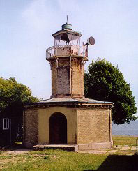
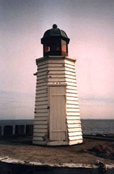
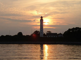
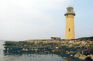
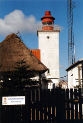
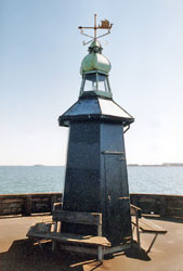
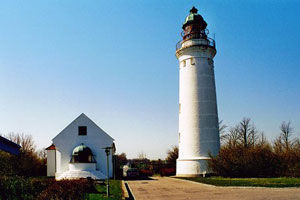
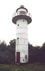
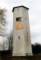
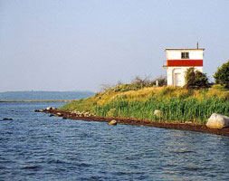
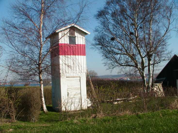
Romsø
Romsø is a low island in the Store Bælt about 4 km off the northeastern corner of Fyn. The lighthouse, which helped mark the entrance to the Store Bælt from the Kattegat, was replaced by a more useful light that stands about 5 km out into the sound. The light station appears to be under private ownership. Located on the eastern tip of Romsø. ARLHS # DEN-033
Photo courtesy Ole Henrik Lemvigh [fyrtårne] |
|
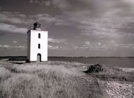
| DK 92 |
| Enebærodde
latitude 55° 30' 57.9" N longitude 10° 33' 39.9" E
This light marks the east side of the entrance to the Odense Fjord from the Kattegat. Located at the end of a peninsula about 3 km west of Midskov. (C 0890) ARLHS # DEN-061
Photo courtesy MBN [Flickr] |
| DK 93 |
Æbelø
latitude 55° 3' 52" N longitude 10° 8' 42.2" E
Æbelø is an island in the Kattegat about 7 km northeast of Bogense. The island is in a large area of shoals and is nearly connected to the mainland of Fyn by sandbars, making this a very dangerous area for navigation. Located at the northern tip of the island. (C 0893.5) ARLHS # DEN-001
Photo courtesy Allan Nielsen [fyrtårne] |
|
Fyn West Coast (Lille Baelt)
| DK 94 |
| Strib
latitude 55° 32' 33.7" N longitude 9° 45' 25.3" E
The original light here was a 6 m cast iron tower that surely proved to be too short. Located on a sharp point of land in Strib, marking the entrance to the Lille Baelt from the Kattegat. (C 0922) ARLHS # DEN-047
Photo courtesy G Trapp [webshots] |
| DK 95 |
Stavrby Skov
latitude 55° 30' 57.8" N longitude 9° 45' 33.1" E
This light guides vessels northbound approaching the E-20 Lille Baelt bridge. Located on the south side of the bridge abutment in Middelfart. (C 0924) ARLHS # DEN-227
Photo courtesy Alex Trabas [ListofLights] |
|
| DK 96 |
Faenø
latitude 55° 29' 25.4" N longitude 9° 46' 35.2" E |
Faenø is an island in the Lille Baelt south of Middelfart. The island is accessible by ferry from Middelfart but the lighthouse appears to be on private property ARLHS # DEN 153 |
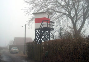
| DK 97 |
Tvingsberg (Forfyr)
latitude 55° 18' 38.3" N longitude 9° 53' 33.6" E
The range light guides northbound ships and the directional light guides southbound vessels. Located on the coast at Tvingsberg, about 3 km north of Assens. (C 0968) ARLHS # DEN-228
Photo courtesy Alex Trabas [ListOfLights] |
|
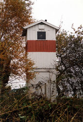
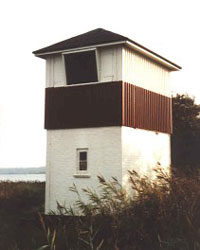
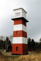
| DK 98 |
| Tvingsberg Bagfyr
Located in a forest just off the Baunevej at Sandager, 2.2 km northeast of the front light. (C 0968.1) ARLHS # DEN-049
Photo courtesy Klaus Huelse [fyrtårne] |
| DK 99 |
Assens
latitude 55° 16' 15.6" N longitude 9° 53' 2.2" E
Located at the end of the breakwater mole protecting the harbor of Assens. (There is also a harbor light that appears to be strictly decorative) light (C 0977) ARLHS # DEN-050
Photo courtesy Alex Trabas [ListOfLights] |
|
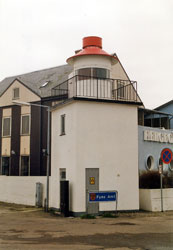
| DK 100 |
| Assens Bagfyr
Located on the Naesvej in Assens, about 150 m southwest of the waterfront. (No, you can't live inside it, it doesn't have an inside. But it does have a light on top, even if the daymark is bigger than the light.) (C 0977.1) ARLHS # DEN-052
Photo courtesy Alex Trabas [ListOfLights] |
| DK 101 |
Bågø
latitude 55° 17' 43.9" N longitude 9° 47' 55.6" E
The island is accessible by ferry from Assens, and the lighthouse is only a short hike from the ferry terminal. Located at the southwestern point of Bågø. (C 0972) ARLHS # DEN-154
Photo courtesy Rudi Steven [Flickr] |
|
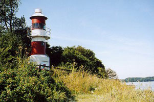
| DK 102 |
| Helnæs (Lindhoved)
latitude 55° 7' 59.8" N longitude 9° 58' 42.9" E
Helnæs is an island off the southwestern corner of Fyn, joined to the mainland by a causeway and bridge. Located on the southwestern point of Helnæs, at the end of the Lindhovedvej. (C 0988) ARLHS # DEN-015
Photo courtesy henkrup [Flickr] |
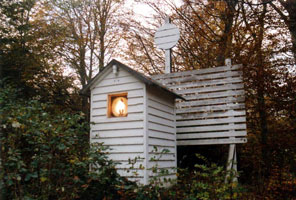
| DK 103 |
Sisserodde (Forfyr)
This light guides ships into the harbor of Fåborg through a narrow passage between the mainland of Fyn and the island of Bjornø. It was formerly the front light of a range, and the rear light survives. Located on the Bjerne Langgyde about 3 km southeast of Bjerne. (C 0992) ARLHS # DEN-053
Photo courtesy Alex Trabas [ListOfLights] |
|
| DK 105 |
Bjørnø
latitude 55° 3' 16.2" N longitude 10° 15' 41.6" E |
The light guides vessels into the harbor of Bjørnø, about 2 km south of Fåborg; the island is accessible by ferry from Fåborg. (C 0991) ARLHS # DEN-155 |
| DK 106 |
Munke
The light guides vessels into the harbor of Munke, on the northeast side of the island of Avernakø about 6 km south of Fåborg; the island is accessible by ferry from Fåborg. (C 1016) ARLHS # DEN-156
Photo courtesy Jakob Pedersen [oz7aie] |
|
| DK 107 |
Nakkeodde
latitude 55° 59.3" N longitude 10° 19' 58.1" E |
Located on the eastern tip of the island of Avernakø about 800 m. east of Munke; the island is accessible by ferry from Fåborg. (C 1020) ARLHS # DEN-157 |
| DK 108 |
Østerhede Forfyr
Located off the Svendborgvej at the eastern entrance to Fåborg harbor. (C 0998) ARLHS # DEN-054
Photo courtesy Alex Trabas [ListOfLights] |
|
| DK 109 |
| Østerhede Bagfyr
Located off the Svendborgvej at the eastern entrance to Fåborg harbor, 212 m northeast of the front light. (C 0998.1) ARLHS # DEN-055
Photo courtesy Alex Trabas [ListOfLights] |
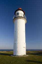
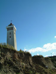
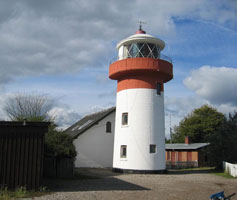
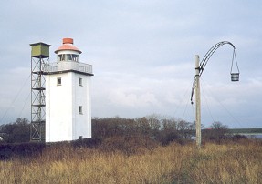
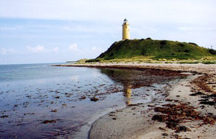
| DK 110 |
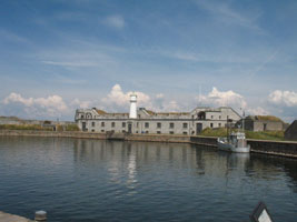
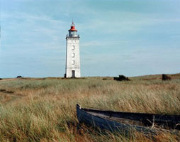
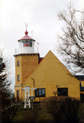
Skjoldnæs
latitude 54° 58' 9" N longitude 10° 12' 24.6" E
This handsome lighthouse was built of granite shipped from Bornholm. In 2006 a golf course was built on the light station and surrounding property, and the keeper's house became the club house for the course. Located at the northwestern tip of Aerø, about 3 km northwest of Søby Havn. (C 1070) ARLHS # DEN-158
Photo courtesy Erik Arthur [webshots] |
|
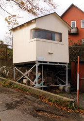
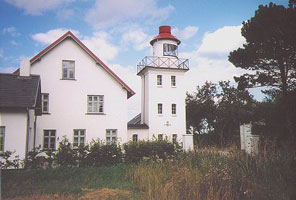
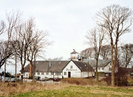
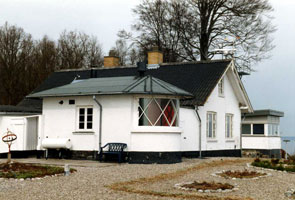
| DK 111 |
| Søby Havn
latitude 54° 56' 35.5" N longitude 10° 15' 31.6" E
Søby Havn is the terminal for ferries from Fåborg and Mommark. Located at the end of the east mole at Søby Havn. (C 1074)
Photo courtesy Klaus Huelse [fyrtårne] |
Svendborg and Tåsinge
| DK 112 |
St.-Jørgens
Located on the Øreodden on the Svendborg waterfront, near St.-Jørgens church and about 250 m. west of the highway 9 bridge across the sound. (C 1591)
Photo courtesy Anke&Jens [seiten] |
|
| DK 113 |
| Svendborg Havn Gasvaerk
latitude 55° 2' 47.4" N longitude 10° 36' 29" E
This lighthouse must be east of the highway 9 bridge on the Svendborg waterfront (C 1596)
Photo courtesy Alex Trabas [ListOfLights] |
|
|
| DK 114 |
Bækkehave
Located on the northwest side of Tåsinge and the south shore of the Svendborg Sund, about 2.5 km northwest of Strammelse. The lighthouse is on farm property, it is possible (but tricky) to reach it by walking along the shore. There are also good views from the ferry between Svendborg and Aerø. (C 1022) ARLHS # DEN-160
Photo courtesy Klaus Huelse [fyrtårne] |
|
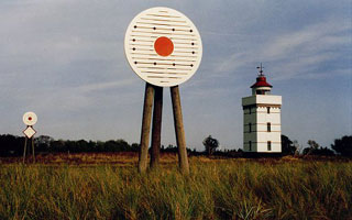
Langeland
| DK 115 |
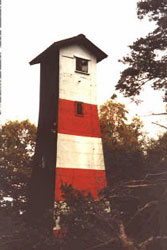
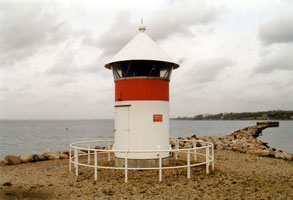
| Keldsnor (Kjelds Nor)
latitude 54° 43' 51.7" N longitude 10° 43' 17.6" E
It replaced the Fakkebjerg Fyr, a much smaller light located several miles to the west. Located at the end of the Rathvej about 4 km southeast of Søndenbro. fyr (C 1706) ARLHS # DEN-163
Photo courtesy S. Bär [Flickr] |
| DK 116 |
Tranekær
latitude 54° 59' 15.3" N longitude 10° 53' 15.7" E
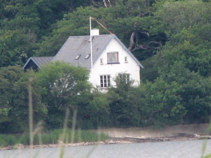
After deactivation, the station was sold as a private residence. Located on the east coast of Langeland, at the end of the Bukkeskovvej, about 4 km east of Tranekaer village. ARLHS # DEN 164
Photo courtesy Allan Nielsen [fyrtårne] |
|
| DK 117 |
| Hov
latitude 55° 8' 47.5" N longitude 10° 57' 18.9" E
Located at the end of the Hov Fyrvej near the northeastern tip of Langeland. (C 1668) ARLHS # DEN-093
Photo courtesy rastkast [webshots] |
| DK 118 |
Frankeklint
latitude 55° 9' 37.4" N longitude 10° 55' 54.3" E
Located atop a dune at the northwestern tip of Langeland. (C 1656) ARLHS # DEN-165
Photo courtesy Alex Trabas [ListOfLights] |
|
| DK 119 |
| Lohals Havn
latitude 55° 8' 6.2" N longitude 10° 54' 9.4" E
Located at the foot of the south mole at Lohals, on the northwestern coast of Langeland. (C 1658) ARLHS # DEN-023
Photo courtesy Alex Trabas [ListOfLights] |
Fyn East Coast (Store Bælt)
| DK 120 |
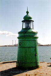
Elsehoved
latitude 55° 6' 5.2" N longitude 10° 46' 29.7" E
This light marks a prominent point projecting into the west side of the Svendborg Sund opposite Lohals, Langeland. Located off the Elsehovedvej about 3 km south of Lundeborg. (C 1590) ARLHS # DEN-006
Photo courtesy Ole Lemvigh [fyrtårne] |
|
| DK 121 |
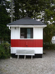
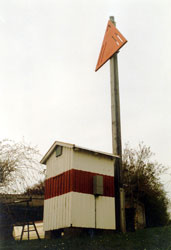
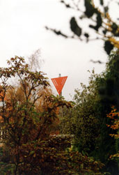
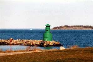
| Nyborg Fjord Bagfyr (Lindholm Havn)
Nyborg is the former terminal for ferries crossing the Store Baelt from Fyn to Sjaelland, but the bridges of the Great Belt Fixed Link (Storebæltsforbindelse) have put the ferries out of business. Located off the Dyrehavevej at Lindholm Havn, on the south side of Nyborg. (C 1564.1)
Photo courtesy Alex Trabas [ListOfLights] |
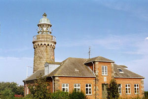
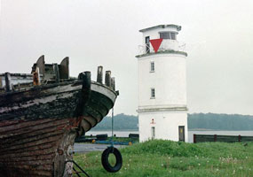
| DK 122 |
Knudshoved
latitude 55° 17' 24.6" N longitude 10° 51' 5" E
Knudshoved is a low spit sheltering the harbor of Nyborg. Located at the end of the spit, about 600 m south of the western end of the Great Belt Fixed Link. The surrounding area is a public park. (C 0200) ARLHS # DEN-020
Photo courtesy Henry O. Nielsen [fyrtårne] |
|
Sjælland West Coast (Store Bælt)
Lights that follow are found on Denmark E2
| DK 123 |
| Langelands Øre (Omø)
latitude 55° 9' 35.2" N longitude 11° 8' 1" E
Despite its name, this lighthouse is not on Langeland but across the Store Baelt on the island of Omø. The island is accessible by passenger ferry from Strignaes on Sjaelland. Located on the western tip of the island. Anke/Jens say the tower is open for climbing. (C 1640)
Photo courtesy Ole Henrik Lemvigh [fyrtårne] |
| DK 124 |
Helleholm
latitude 55° 11' 9" N longitude 11° 12' 32.1" E
Located on the southeastern tip of the island of Agersø, about 3 km southwest of Strignaes. Agersø is accessible by ferry from Strignaes. There's also a good view of this lighthouse from ferries between Strignaes and Omø. (C 1648) ARLHS # DEN-014
Photo courtesy Ole Henrik Lemvigh [fyrtårne] |
|
| DK 125 |
| Sprogø
latitude 55° 19' 50.6" N longitude 10° 58' 11" E
Sprogø is an island in the middle of the Store Baelt between Nyborg and Korsør. The Great Belt Fixed Link now crosses the island, so thousands of vehicles roar past the lighthouse every day. Located on the highest point of the island. (C 1532.2) ARLHS # DEN-062
Photo courtesy Ma1974 [Flickr] |
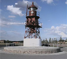
| DK 126 |
Korsør
latitude 55° 20' 9.1" N longitude 11° 8' 4.9" E
This lighthouse formerly stood in the Store Baelt, guiding the ferries from Nyborg on Fyn. In 1998, a local preservation group organized to save the lighthouse, and it was relocated to a position of honor on the Korsør waterfront. ARLHS # DEN 170
Photo courtesy Ole Henrik Lemvigh [fyrtårne] |
|
| DK 127 |
| Røsnæs
latitude 55° 44' 36.6" N longitude 10° 52' 9.2" E
The lighthouse stands on the westernmost point of Sjaelland, at the end of a long, narrow peninsula that protects the north side of the Kalundborg Fjord. Located at the end of the road, near Hellesklint and about 15 km west of Kalundborg. ARLHS # DEN-034 |
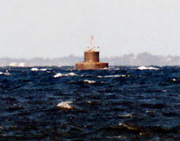
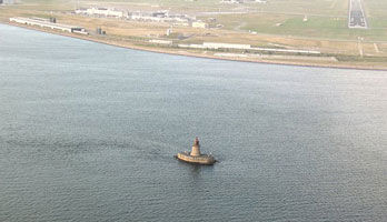
| DK 128 |
Røsnæs Puller
All of this lighthouse has been removed except for the granite lower stage. Located on a shoal about 2 km west of the Røsnaes lighthouse. Accessible only by boat. (C 1498)
Photo courtesy Captain Theo [ListOfLights] |
|
Sjælland North Coast (Kattegat)
| DK 129 |
| Sejerø (Gniben)
latitude 55° 55' 8.8" N longitude 11° 4' 52.9" E
Sejero is a sandy island in the Kattegat about 8 km west of Ordrup Naes. Ferry transportation is available from Havnsø. Located atop a dune at the western tip of the island. (C 1486) ARLHS # DEN-125
Photo courtesy Ole Henrik Lemvigh [fyrtårne] |
| DK 130 |
Sjaellands Rev Nord
Located on a submerged rocky reef (rev) in the Kattegat about 6 km northwest of the tip of the Sjaellands Odde spit. Accessible only by boat. (C 1478) ARLHS # DEN-037
Photo courtesy Alex Trabas [ListOfLights] |
|
| DK 131 |
| Hesselø
latitude 56° 11' 49.3" N longitude 11° 42' 35.3" E
Hesselø is a small, isolated island in the Kattegat about 25 km north of Sjaelland. The island is privately owned and closed to visitors. Located on the highest point of the island. (C 0222) ARLHS # DEN-016
Photo courtesy Alex Trabas [ListOfLights] |
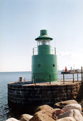
| DK 132 |
Spodsbjerg
latitude 55° 58' 33.5" N longitude 11° 51' 21.9" E
The lighthouse marks the entrance to the Isefjord, a large protected bay on the north coast of Sjaelland. Located at the end of the Fyrstein, off the Spodsbjergvej on the north side of the town of Hundested. (C 0226) ARLHS # DEN-120
Photo courtesy Anne [Flickr] |
|
| DK 133 |
| Roskilde Havn Bagfyr
This range guides boats into the harbor of Roskilde, at the head of the Roskilde Fjord, an eastern branch of the Isefjord that lies in the western suburbs of København. Located several blocks south of the Roskilde waterfront. (C 0239.71)
Photo courtesy Alex Trabas [ListOfLights] |
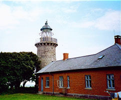
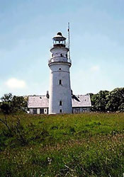
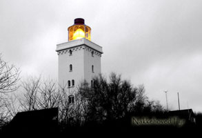
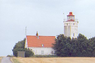
| DK 134 |
Nakkehoved (Vest)
latitude 56° 7' 9" N longitude 12° 20' 35.1" E
This historic and well-known lighthouse stands at on the west side of the entrance to The Sound, the narrow passage between Denmark and Sweden that is the shortest and deepest entrance to the Baltic Sea. Located at the end of the Fyrvejen, off the Nakkehovedstrandvej on the east side of Gilleleje. (C 1872) ARLHS # DEN-028
Photo courtesy Carsten Brix [Flickr] |
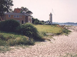
|
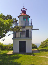
| DK 135 |
| Nakkehoved Øst
In 1898 the eastern lighthouse was deactivated while the western one was raised in height and upgraded to a first order station. The old east lighthouse has been preserved and has been in use recently as a waterfront restaurant. Located on the Fyrvejen in Gilleleje just a few hundred meters from the light above. ARLHS # DEN 027
Photo courtesy Anke&Jens [seiten] |
|
|
Helsingør Area
| DK 136 |
Julebæk
This directional light guides westbound ships that have just passed Helsingør on their way out of the Baltic. Located just off the beach on the east side of Hellebaek, about 4 km northwest of Helsingør. (C 1884) ARLHS # DEN-124
Photo courtesy Ole Henrik Lemvigh [fyrtårne] |
|
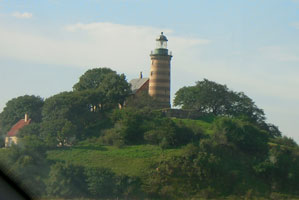
| DK 137 |
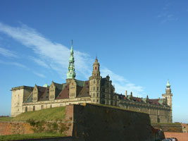
| Kronborg (Helsingør Slot, Elsinore Castle)
latitude 56° 2' 21.8" N longitude 12° 37' 20.5" E
Kronborg is one of the most famous castles of northern Europe, a masterpiece of Renaissance architecture, and the fictional setting of Shakespeare's tragedy Hamlet. It stands on a peninsula marking the narrowest point of the Oresund; the Swedish coast is only 4 km to the east. The light crowns the northeastern tower of the castle, called the Dronningens Tårn (Queen's Tower). (C 1908) ARLHS # DEN-119
Photo courtesy Mike NL [Flickr] |
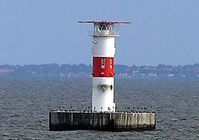
| DK 138 |
Helsingør Nordmole
latitude 56° 2' 5.9" N longitude 12° 37' 9.9" E
Located at the end of the north mole protecting the harbor of Helsingør. (C 1912) ARLHS # DEN-230 |
|
København (Copenhagen) Area
| DK 140 |
Hellerup
latitude 55° 43' 3.3" N longitude 12° 35' 31.3" E
The light may have been relocated to this site; if so, we don't know its origin. Located at the end of the east mole of the yacht harbor at Hellerup, a residential neighborhood on the north side of København. (C 1950)
Photo courtesy Alex Trabas [ListOfLights] |
|
| DK 141 |
| Kalkbrænderihavn Østmole
The modern Kalkbrænderi Havn is north of København's traditional harbor area and includes the wharves used by cruise ships. Located at the end of the Kalkbrænderiløbskaf quay.
Photo courtesy Word Ridden [Flickr] |
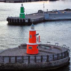
| DK 142 |
Stubben (Frihavn Nordmole)
latitude 55° 42' 32.6" N longitude 12° 36' 40.9" E
Located at the end of a short breakwater on the north side of the northern entrance to København. Note that this photo shows the Sydmole light as well. DK 143 (C 1983)
Photo courtesy Alex Trabas [ListOfLights] |
|
| DK 143 |
| Frihavn Sydmole (Trekroner Breakwater)
latitude 55° 42' 28" N longitude 12° 36' 45.9" E
Located at the end of the long breakwater extending from the north side of the island of Trekroner. (C1982)
Photo courtesy Alex Trabas [ListOfLights] |
| DK 144 |
Kronløbsbassin
latitude 55° 42' 27" N longitude 12° 36' 20.1" E
Located at the end of a short mole in the northwest section of København harbor. (C1994)
Photo courtesy Alex Trabas [ListOfLights] |
|
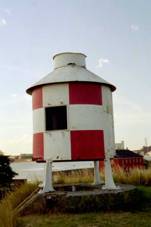
| DK 145 |
| Trekroner (1926)
latitude 55° 42' 11.8" N longitude 12° 36' 52.4" E
The island is accessible by water taxi service from the København waterfront. (C 1978) ARLHS # DEN-044
Photo courtesy Marty Wood [Flickr] |
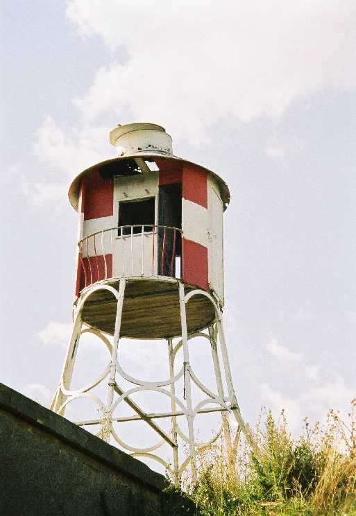
| DK 147 |
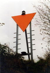
Trekroner Bagfyr |
The abandoned lighthouse has been painted with a red and white checkerboard daymark. Located west of the present lighthouse. |
| DK 148 |
Lynetteløb
latitude 55° 41' 54.7" N longitude 12° 36' 57.7" E
Located at the end of the long breakwater extending from the south side of the island of Trekroner. (C 1986)
Photo courtesy Alex Trabas [ListOfLights] |
|
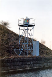
| DK 149 |
| Nordre Røse
latitude 55° 38' 9.5" N longitude 12° 41' 12.6" E
This directional light guides ships through the narrow passage between the mainland of Sjaelland and the island of Saltholm. Located in the Oresund about 600 m northeast of the København airport. Accessible only by boat. (C 2042) ARLHS # DEN-131
Photo courtesy Hans Hammer [fyrtårne] |
| DK 150 |
Dragør Forfyr
Located on the waterfront on the north side of Dragør, a short distance south of the København airport.
Photo courtesy Ole Henrik Lemvigh [fyrtårne] |
|
| DK 151 |
| Dragør Bagfyr
latitude 55° 35' 38.6" N longitude 12° 40' 14" E
Located on the Stationsvej in downtown Dragør. |
| DK 152 |
Dragør Fort
latitude 55° 35' 19.3" N longitude 12° 40' 48.4" E
Located at the southeast corner of the historic Dragør fort. (C 2053)
Photo courtesy Alex Trabas [ListOfLights] |
|
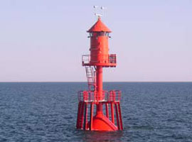
| DK 153 |
| Drogden
Located in the southern entrance to the Oresund about 5 km southeast of Dragør. Accessible only by boat. (C 2060) ARLHS # DEN-132
Photo courtesy Ole Henrik Lemvigh [fyrtårne] |
Southern Sjælland
| DK 154 |
Stevns Klint
latitude 55° 17' 26.5" N longitude 12° 27' 13.1" E
Stevns Klint is the tip of a peninsula that pokes eastward into the Baltic Sea from the southeastern coast of Sjaelland. The area is now a military base, and access to the light station is closed to the public. Located about 5 km east southeast of Stevns.
Photo courtesy Ole Henrik Lemvigh [fyrtårne] |
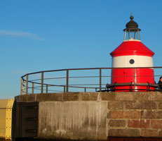
|
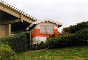
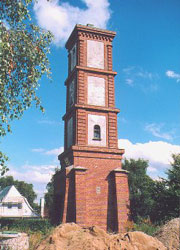
| DK 156 |
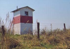
| Roneklint Forfyr
Located on the beach at Roneklint, just east of the entrance to the Praestø Fjord. The rear range is a simple skeletal tower tower ARLHS # DEN-139
Photo courtesy Ole Henrik Lemvigh [fyrtårne] |
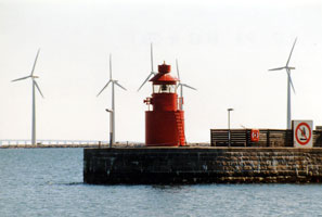
| DK 157 |
Ore
latitude 55° 24.6" N longitude 11° 52' 11.5" E
This light guides ships eastbound into the harbor of Vordingborg, a town at the southern tip of Sjaelland opposite Falster. Located about 1.5 km west of the Vordingborg waterfront. (C 1798) ARLHS # DEN-122
Photo courtesy Alex Trabas [ListOfLights] |
|
Lolland, Falster, and Møn
| DK 158 |
| Vejrø
Vejrø is an island in the Smålands Farvandet, the shallow sound between Lolland and Sjaelland. Located at the northeast point of the island. Accessible only by boat. ARLHS # DEN 045
Photo courtesy Rolf Brems [fyrtårne] |
| DK 159 |
Albuen
latitude 54° 50' 8.5" N longitude 10° 57' 46.2" E
The station stands on a dynamic sandspit, and migration of the spit eventually put the lighthouse in the water; its ruins can be seen in the sound several hundred meters northwest of the present lighthouse. The lighthouse was originally the rear light of a range. Located at the extreme western tip of Lolland, where it marks the southeastern entrance to the Store Baelt. (C 1716.1) ARLHS # DEN-133
Photo courtesy Ole Henrik Lemvigh [fyrtårne] |
|
| DK 160 |
| Hyllekrog
latitude 54° 35' 41.6" N longitude 11° 30' 14" E
After the light was deactivated, the optics were transferred to the Christiansø lighthouse in Bornholm. Located on a small island off the southernmost tip of Lolland, about 9 km southeast of Rødbyhavn. Accessible only by boat. Bornholm ARLHS # DEN-134
Photo courtesy Erik Arthur [webshots] |
| DK 161 |
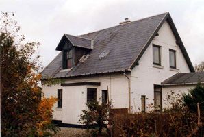
Orehoved Bagfyr
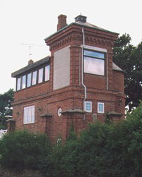
latitude 54° 57' 36.4" N longitude 11° 51' 6.4" E
The lighthouse, which replaced a light on a mast, was raised in height by an additional story in 1933. Located in northwest Falster, on the Havnegade in Orehoved, a short distance west of the Storstrøm Bridge from Vordingborg. (C 1800.1) ARLHS # DEN 135
Photo courtesy Alex Trabas [ListOfLights] |
|
| DK 162 |
| Stubbekøbing
This light guides ships into the harbor of Stubbekøbing, on the south side of the Grønsund opposite Bogø. Located on the west side of the village. (C 1856) ARLHS # DEN-184
Photo courtesy Alex Trabas [ListOfLights] |
| DK 163 |
Grønsund Forfyr
latitude 54° 53' 1.1" N longitude 12° 7' 12.9" E
The rear light is on a skeletal tower. Located on the Gammel Faergevej in the town of Grønsund, at the northeastern corner of Falster. (C 2166) ARLHS # DEN-136
Photo courtesy Alex Trabas [ListOfLights] |
|
| DK 164 |
| Hestehoved
This directional light (one that shows different colors depending on how you approach it) stands on the easternmost point of Falster and marks the entrance to the Grønsund, the sound separating Falster from Møn. Located about 3 km east of Moseby. (C 2152) ARLHS # DEN-137
Photo courtesy Alex Trabas [ListOfLights] |
| DK 165 |
Gedser Odde
This historic lighthouse stands on the southernmost point of Denmark. Located on Gedser Odde, the southern tip of Falster, about 3 km southeast of the town of Gedser. (C 2186) ARLHS # DEN-010
Photo courtesy Ole Henrik Lemvigh [fyrtårne] |
|
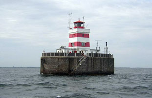
| DK 166 |
| Gedser Rev
Located on a shoal in the Baltic Sea about 12 km southeast of Gedser. Accessible only by boat.
Photo courtesy Farvandsvæsenet [fyrtårne] |
| DK 167 |
Bogø
latitude 54° 56' 10.5" N longitude 11° 59' 40.3" E
The light marked the western entrance to the Grønsund, here separating Bogø from Falster. Bogø is a smaller island northeast of Falster and west of Møn. Highway 287 runs the length of the island and continues on a bridge to Møn. Located at the end of the Vesternaesvej near the western tip of the island. ARLHS # DEN 138
Photo courtesy Ole Henrik Lemvigh [fyrtårne] |
|
| DK 168 |
| Borgsted
latitude 54° 54' 9.5" N longitude 12° 6' 28.2" E
Located just off the Grønsundvej at the southwestern corner of Møn. (C 2178)
Photo courtesy Ole Henrik Lemvigh [fyrtårne] |
| DK 169 |
Møn
Located at the end of the Fyrvej on Møn Klint, the eastern tip of Møn. (C 2142)
Photo courtesy Alex Trabas [ListOfLights] |
|
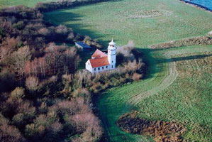
| DK 170 |

| Hellehavn Nakke
latitude 55° 26" N longitude 12° 31' 17.6" E
Møn islands most northeasterly point. The lighthouse can only be reached from Liselund Slot - 500 meters along the steep bank to the west. Don't forget to visit the wonderful garden of the castle. (C 2144) ARLHS # DEN-141
Photo courtesy Erik Arthur [webshots] |
|
|
 West Denmark
 Sweden
