|
This page shows the majority of the Lighthouses of mainland Scotland. You can click on the photo of the light to go to it's specific (larger resolution) copy. Each lighthouse name is linked to (in our editorial opinion) the best reference site for that light. Downloadable copies of this pictures are stored on the web. The pictures below are "active", if you press on one, you'll be directly connected to the site with that picture (or one very similar) at a much higher resolution. |
|
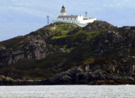
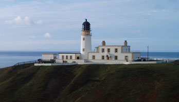
| SC 1 |
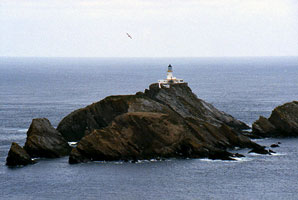
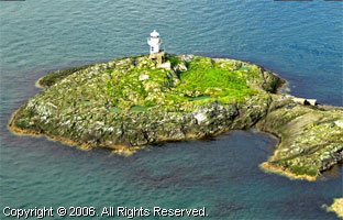
Muckle Flugga
latitude 60° 51' 19.5" N longitude 53' 7.7" W
This is the northern most light in Scotland. It is farther north than Bergen Norway, St. Petersburg Russia or the Alaskan peninsula.
You can take a ferry to Lerwick (Shetland), then proceed to Unst. The trip includes 2 "roll-on roll-off" ferry crossings. Once reaching Herma Nest, you still have along walk to the shore where there is a good view of the light. (A 3832) ARLHS # SCO-139
Photo courtesy Giorgio M. Griffa [Flickr] |
|
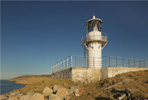
| SC 2 |
| Point of Fethaland
latitude 60° 38' 3.1" N longitude 1° 18' 41.8" W
At the northern tip of the Shetland Islands, if you're up to a 3-4 hour walk, you can get here. (A 3817.5) ARLHS # SCO-173
Photo courtesy Peter Sanderson [Flickr] |
| SC 3 |
Esha Ness
latitude 60° 29' 21" N longitude 1° 37' 39" W
Eshaness is the "get away from it all" lighthouse situated as it is some 64km or 1hours drive away from the bright lights of Lerwick. To make a booking, or to enquire further, please Contact them. amenitytrust (A 3838) ARLHS # SCO-075
Photo courtesy Giorgio M. Griffa [Flickr] |
|
| SC 4 |
| Firths Voe
latitude 60° 27' 12.6" N longitude 1° 10' 37.8" W
Shetland Island, very north (A 3812) ARLHS # SCO-082
Photo courtesy Giorgio M. Griffa [Flickr] |
| SC 5 |
Out Skerries
latitude 60° 25' 28.2" N longitude 43' 40.8" W
("Out" is derived from the Norwegian for "East".) The islands are accessible by a daily ferry. ferry
Located on Bound Skerry, a small island at the extreme eastern end of the island group. Accessible only by boat. (A 3807) ARLHS # SCO-164
Photo courtesy Kees Aalbersberg [ListOfLights] |
|
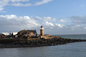
| SC 6 |
| Bressay (Kirkabister Ness)
latitude 60° 7' 11.9" N longitude 1° 7' 17.7" W
South mouth of Lerwick Harbour. (A 3776) ARLHS # SCO-021
Photo courtesy bgn802 [webshots] |
| SC 7 |
Sumburgh Head
latitude 59° 51' 14.2" N longitude 1° 16' 29" W
At the southern tip of Shetlands, right next to the Sumburg airport. (A 3766) ARLHS # SCO-232
Photo courtesy Giorgio M. Griffa [Flickr] |
|
| SC 8 |
| Fair Isle North
latitude 59° 33' 7.6" N longitude 1° 36' 34.4" W
Fair Isle can be reached from the Shetland mainland either by the island mailboat Good Shepherd IV, or by 8-seater 'Islander' aircraft. (A 3756) ARLHS # SCO-078
Photo courtesy Calum MacAulay [Flickr] |
| SC 9 |
Fair Isle South
latitude 59° 30' 49.8" N longitude 1° 39' 9.6" W
Good Shepherd bookings +44 (0)1595 760222 (A 3750) ARLHS # SCO-079
Photo courtesy Calum MacAulay [Flickr] |
|
| SC 10 |
| North Ronaldsay
latitude 59° 23' 3.4" N longitude 2° 22' 16.3" W
Tours are available on Sunday sailing days throughout the summer and by arrangement with B. Muir, lighthouse keeper keeper (A 3722) ARLHS # SCO-155
Photo courtesy marinas.com [marinas.com] |
| SC 11 |
Start Point
latitude 59° 16' 38.4" N longitude 2° 22' 33.6" W
Easternmost lighthouse of the Orkneys, located on a small island off the northeastern tip of Sanday Island. Sanday is accessible by ferry, and the lighthouse can be reached on foot at low tide. Don't confuse this light with the Start Point in Southern England. EN42 (A 3718) ARLHS # SCO-225
Photo courtesy Beth Loft [Flickr] |
|
| SC 12 |
| Noup Head
latitude 59° 19' 51.9" N longitude 3° 4' 13.2" W
Starting from East Kirbest, there is a nature trail (5 miles long) that ends up at the lighthouse. trail (A 3736) ARLHS # SCO-158
Photo courtesy Bruce McAdam [Flickr] |
| SC 13 |
Brough of Birsay
latitude 59° 8' 12.7" N longitude 3° 20' 21" W
The island and lighthouse are only accessible for about 5-6 hours when the tide is low. A concrete path leads across the rocks. (A 3700) ARLHS # SCO-023
Photo courtesy Giorgio M. Griffa [Flickr] |
|
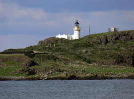
| SC 14 |
| North Rona
latitude 59° 7' 16.6" N longitude 5° 48' 53.3" W
Accessible only by boat in difficult seas (boats can be chartered from Lewis). (A 3869) ARLHS # SCO-153
Photo courtesy Kees Aalbersberg [ListOfLights] |
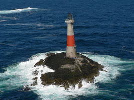
| SC 15 |
Sule Skerry
latitude 59° 5' 4" N longitude 4° 24' 26.2" W
Sule Skerry had the distinction, acknowledged by the Guinness Book of Records of being the remotest manned lighthouse in Scotland (in fact in Britain). Its position is given in the publication as being 35 miles offshore and 45 miles north west of Dunnet Head, Caithness. (A 3868) ARLHS # SCO-231
Photo courtesy Calum MacAulay [Flickr] |
|
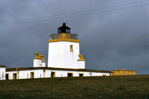
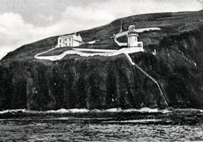
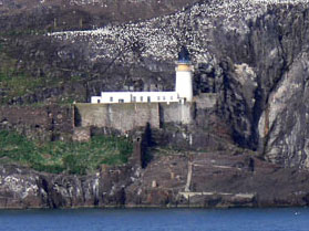
| SC 16 |
| Hoy Low Oxan
latitude 58° 56' 25.2" N longitude 3° 18' 36" W
June 10, 2005
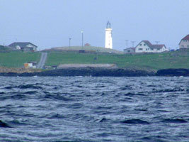
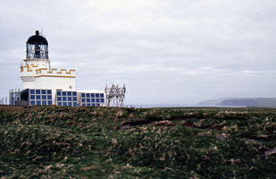
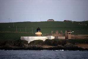
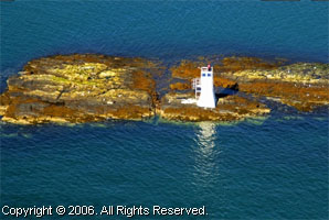
Technically, the Hoy lights are both on the island of Graemsay. These pictures are taken from the road on Main Island, so the lights are still quite a ways out there (and the weather wasn't all that great either) (A 3644) ARLHS # SCO-174 |
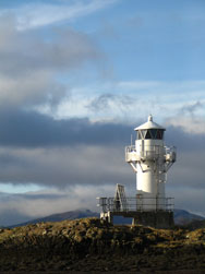
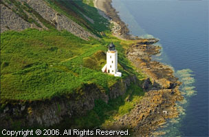
| SC 16a |
Since I think most of you would actually like to know what Hoy Low looks like, here's Giorgio's photo. Note the observation room for artillery to the right of the light - this was the path into Scapa Flow Harbor in World War II, and German boats did come in here.
Photo courtesy Giorgio M. Griffa [Flickr] |
|
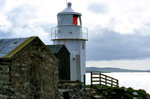
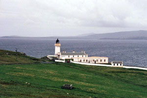
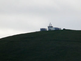
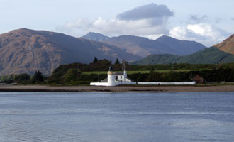
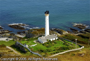
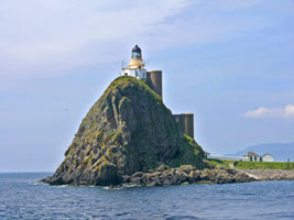
| SC 17 |
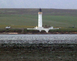
| Hoy High (Taing of Sandside)
latitude 58° 56' 8.4" N longitude 3° 16' 24" W
June 10, 2005
This marks the main channel into the Scapa Flow harbor. Note that the Hoy lights are built as range lights (or Leading Lights as they are called in Europe) to aid navigation through Hoy Sound.
You can reach Graemsay on the passenger-only ferry that sails from Stromness pier to Moaness, calling at Graemsay. (A 3644.1) ARLHS # SCO-104 |
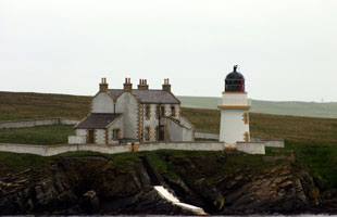
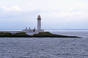
| SC 18 |
Helliar Holm
latitude 59° 1' 8" N longitude 2° 54' 3.7" W
June 11, 2005
The normal channel is to go due North leaving Kirkwall. Since we were in a "small" boat, we turned south as fast as the shore allows and this light was on the port (left) side. (A 3684) ARLHS # SCO-094 |
|
| SC 19 |
| Auskerry
latitude 59° 1' 33.1" N longitude 2° 34' 21.6" W
On Auskerry Island. This is in Stronsay Firth. (A 3680) ARLHS # SCO-011
Photo courtesy Giorgio M. Griffa [Flickr] |
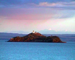
| SC 20 |
Copinsay
latitude 58° 53' 46.2" N longitude 2° 40' 20" W
Copinsay is a small island about 5 km southeast of Point of Ayre on the east side of Orkney Mainland. Formerly inhabited, the island is now a sanctuary owned by the Royal Society for the Protection of Birds. Located on the highest point of the island. Accessible only by boat, should be visible from Point of Ayre. (A 3676) ARLHS # SCO-049
Photo courtesy Calum MacAulay [Flickr] |
|
| SC 21 |
| Tor Ness
latitude 58° 46' 45.1" N longitude 3° 17' 32.3" W
Located at the southwestern corner of Hoy marking the northwestern entrance to Pentland Firth, 13 km north of Dunnet Head Light on the mainland. The site does not appear to be accessible by road. (A 3600) ARLHS # SCO-244
Photo courtesy marinas.com [marinas.com] |
| SC 22 |
Cantick Head
latitude 58° 47' 13.5" N longitude 3° 7' 53.1" W
A self catering holiday on the island of Hoy. (A 3602) ARLHS # SCO-038
Photo courtesy Giorgio M. Griffa [Flickr] |
|
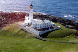
| SC 23 |
| Strathy Point
latitude 58° 35' 55.6" N longitude 4° 1' 7.2" W
This was the last light built (1958) that was intended for manned operation. All later lights were intended for automated operation. It was automated in 1997.
Located at the end of a long promontory on the central north coast, about 6 km north of Strathy. Accessible by road off the A836 highway just west of Strathy. ARLHS # SCO-227
Photo courtesy ChiChi [Flickr] |
| SC 23L |
Loch Eriboll (Whiten Head)
latitude 58° 31' 0.5" N longitude 4° 38' 54.4" W
Located on a headland at the eastern entrance to the loch about 8 km north of Inverhope on the north coast of Scotland. This site does not appear to be accessible by road. (A 3874) ARLHS # SCO-126
Photo courtesy Alex Trabas [ListOfLights] |
|
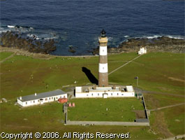
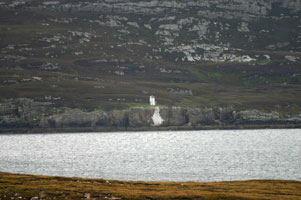
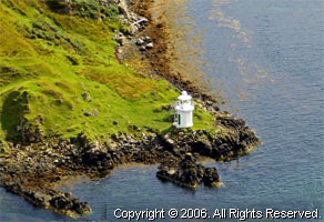
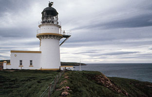
| SC 24 |
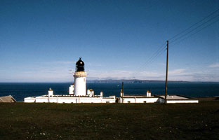
| Dunnet Head
latitude 58° 40' 16.6" N longitude 3° 22' 36.4" W
Most northerly point of the Scottish mainland, 2.4 miles north of John O'Groats. The Visitor Centre is off the A836 Thurso to John O'Groats road, about 15 minutes drive from Thurso. (A 3574) ARLHS # SCO-063
Photo courtesy Giorgio M. Griffa [Flickr] |
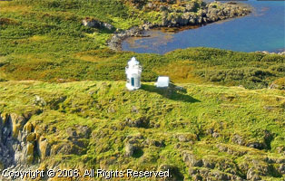
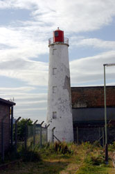
| SC 24A |
Holburn Head
Nestled into the hillside of Thurso Bay, Holburn Head is one of the simplest lights to see. You can see it from the town of Thurso, driving your car west to A836 or from the P&O ferries to the Orkneys. This light was discontinued in August 2003 following alterations to the port facility. ARLHS # SCO-097
Photo courtesy Giorgio M. Griffa [Flickr] |
|
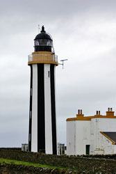
| SC 25 |
| Stroma
latitude 58° 41' 44.9" N longitude 3° 7' 0.1" W
Off the Northern-most point of Stroma, is the Swilkie, the most dangerous whirlpool in the Pentland Firth, occasioned by the meeting of four or five contrary tides. According to Icelandic legend, the Swilkie is the place where the salt which maintains the saltiness of the oceans is ground in a giant quern, stolen from King Frodi by a sea-king named Mysing. (A 3568) ARLHS # SCO-228
Photo courtesy Calum MacAulay [Flickr] |
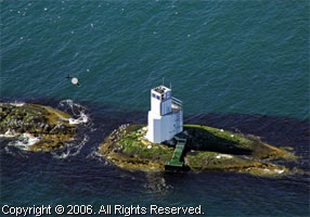
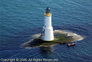
| SC 26 |
Pentland Skerries
latitude 58° 41' 25" N longitude 2° 55' 28.1" W
Twin towers 60' apart. The Pentland Skerries are small rocky islands obstructing the eastern entrance to Pentland Firth. Located on Muckle Skerry, the largest of the group, about 8 km northeast of Duncansby Head on the mainland and 6 km south of Brough Ness, South Ronaldsay, in the Orkneys. (A 3562) ARLHS # SCO-169
Photo courtesy Calum MacAulay [Flickr] |

|
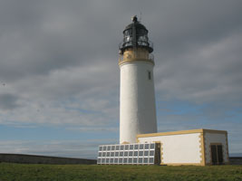
| SC 27 |
| Duncansby Head (Dùn Gasbaith)
latitude 58° 38' 34.8" N longitude 3° 1' 46.2" W
The light station marks the extreme northern end of Scotland's east coast and the southeastern entrance to Pentland Firth, which separates the mainland from the Orkney. Located about 5 km east of Gohn o' Groats.
That is Pentland Skerries (see above) in the distance (A 3558) ARLHS # SCO-062
Photo courtesy Giorgio M. Griffa [Flickr] |
| SC 28 |
Cape Wrath
latitude 58° 37' 32" N longitude 4° 59' 56.3" W
To access the cape Wrath you must first take a ferry across the Kyle of Durness (from Durness, Scotland) which takes approximately a quarter of an hour. On completion of the ferry trip there is an optional bus which takes you to the Cape Wrath Lighthouse. (A 3880) ARLHS # SCO-039
Photo courtesy Giorgio M. Griffa [Flickr] |
|
| SC 29 |
| Butt of Lewis
latitude 58° 30' 55.5" N longitude 6° 15' 40.3" W
It is the northernmost point of the Isle of Lewis (A 3968) ARLHS # SCO-027
Photo courtesy rasmab [webshots] |
| SC 30 |
Stoer Head
latitude 58° 14' 24.1" N longitude 5° 24' 10.9" W
This picture is taken from our Celtic Lands cruise. Situated 10 miles north of the picturesque fishing village of Lochinve, you can rent a flat here. While the tower is short (45'), it's on top of a 200' cliff. rent (A 3882) ARLHS # SCO-226 |
|
| SC 30C |
| Rubha Cadail (Rhue)
latitude 57° 55' 30.8" N longitude 5° 13' 23.1" W
The lighthouse is on the point separating Loch Kanaird and Loch Broom, marking the north side of the entrance to the upper portion of Loch Broom and the harbor of Ullapool. Accessible by a short walk from the village of Rhue, off the A835 highway about 5 km north of Ullapool. ullapool (A 3885) ARLHS # SCO-193
Photo courtesy Trevor Powell [Flickr] |
| SC 30H |
Cailleach Head |
Located on the tip of the peninsula separating Loch Broom and Little Loch Broom, about 16 km southwest of Ullapool. This site does not appear to be accessible by road. (A 3887) ARLHS # SCO-028 |
| SC 31 |
Flannan Islands Eilean Mor
latitude 58° 16' 59.9" N longitude 7° 34' 59.9" W
The Flannan Isles (Scottish Gaelic: na h-Eileanan Flannach) are an island group in the Outer Hebrides of Scotland, lying several miles west of Lewis. (A 4028) ARLHS # SCO-084
Photo courtesy Calum MacAulay [Flickr] |
|
| SC 31A |
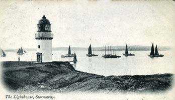
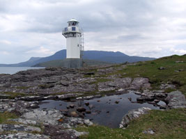
| Arnish Point
latitude 58° 11' 28.6" N longitude 6° 22' 14.2" W
Western entrance to Stornoway Harbour, Western Isles, Scotland. (A 3976) ARLHS # SCO-010
Photo courtesy Giorgio M. Griffa [Flickr] |
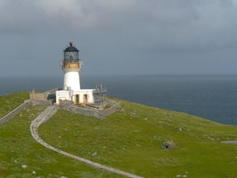
| SC 32 |
Tiumpan Head
latitude 58° 15' 39.2" N longitude 6° 8' 21.5" W
Located at the end of the Eye Peninsula about 14 km northeast of Stornoway. Accessible by road. (A 3972) ARLHS # SCO-242
Photo courtesy Dick Davies [Flickr] |
|
| SC 33 |
| Rubha Reidh
latitude 57° 51' 31.9" N longitude 5° 48' 42.3" W
With improved road, rail and air links to Inverness, getting to the outer reaches of the North West Highlands is easier than you may have thought! There is an excellent public bus service to Gairloch where a taxi can be ordered to take you the 12 miles to the lighthouse. bus (A 3900) ARLHS # SCO-191 |
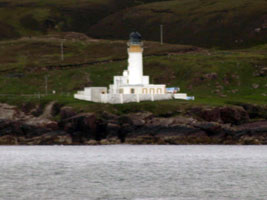
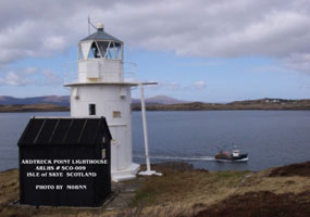
| SC 33A |
Ardtreck Point
latitude 57° 20' 21.8" N longitude 6° 25' 47.4" W
Located on a promontory on the south side of Loch Harport about 3 km northwest of Portnalong on the southwestern side of the Isle of Skye. Site open; it is possible to walk to the light from Portnalong (A 4068) ARLHS # SCO-009
Photo courtesy Bill Newman [MOBMM] |
|
| SC 33V |
| Waternish (Vaternish) Point
latitude 57° 36' 27.7" N longitude 6° 38' 3.1" W
Located at the northwestern point of the Isle of Skye on the tip of the Vaternish peninsula, about 7 km north of Trumpan. Accessible by hiking from the end of the road near Trumpan. (A 4056) ARLHS # SCO-252
Photo courtesy Kathryn Goodenough [Flickr] |
| SC 34 |
Eilean Glas
latitude 57° 51' 24.8" N longitude 6° 38' 31.2" W
Located on the island of Scalpay in the Western Isles of Scotland. (A 3990) ARLHS # SCO-069
Photo courtesy Charles Cook [Flickr] |
|
| SC 35 |
| Rona (South Rona)
latitude 57° 34' 41.2" N longitude 5° 57' 32.8" W
Located northeast of Skye and north of Raasay, the island has been uninhabited since the 1920s but is popular as a wilderness vacation destination. The lighthouse is at the northern tip of the island, marking the entrances to the Sound of Raasay to the west and the Inner Sound to the east. Accessible only by boat. (A 3904) ARLHS # SCO-185
Photo courtesy Kirsty Fyfe [Flickr] |
| SC 35D |
Eyre Point
latitude 57° 20' 0.8" N longitude 6° 1' 17" W
This lighthouse is not to be confused with the Point of Ayre light on the Isle of Man the Point of Ayr Lighthouse in Wales, or the Ayr Harbour light on the Firth of Clyde. The original lighthouse here was replaced by a new structure in 2001. This light is located near the south point of the Isle of Raasay, northeast of Skye. (A 3909.6) ARLHS # SCO-077
Photo courtesy marinas.com [marinas.com] |
|
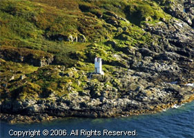
| SC 35E |
| Eilean a Chait
Located on a small island at the entrance to Loch Carron just north of Plockton and about 10 km northeast of Kyle of Lochalsh. Accessible only by boat. ARLHS # SCO-348
Photo courtesy Jon Royle [geograph] |
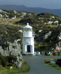
| SC 35F |
Eilean Bàn (Kyleakin)
latitude 57° 16' 39.8" N longitude 5° 44' 32.8" W
The Skye Bridge (A87), completed in 1995, now crosses Eilean Bàn lengthwise. Thus, like the Mackinaw Light in Michigan, the bridge provides a better aid to navigation than the light does. ARLHS # SCO-115
Photo courtesy Trevor Powell [Flickr] |
|
| SC 35G |
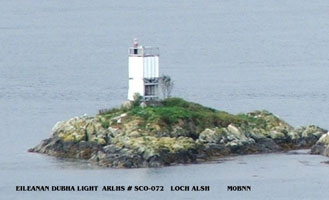
| Eileanan Dubha
Located on a small skerry in Loch Alsh about 1.5 km east of the Eilean Bàn lighthouse. Accessible only by boat, there's a good view from a parking area on the A87 highway on the north (mainland) side of the loch. (A 3927) ARLHS # SCO-072
Photo courtesy Bill Newman [M0BMM] |
| SC 35H |
Kylerhea
latitude 57° 14' 13.7" N longitude 5° 39' 55.7" W
Kyle Rhea is a narrow strait connecting Loch Alsh with the Sound of Sleat to the south, separating the Isle of Skye from the mainland. Located on the west (Isle of Skye) side of the strait about 1 km north of the Kylerhea ferry terminal, clearly visible from the ferry. ARLHS # SCO-116
Photo courtesy Jo Waddell [Flickr] |
|
| SC 35K |
Sandaig (1910) (relocated) |
When a new light was built in 2002, the lighthouse was relocated to Glenelg, on the mainland. Nicely restored, the tower is located next to the Glenelg ferry terminal. ferry |
| SC 35M |
Sandaig (2002) (Camusfearna)
Located on a small island in the Sound of Sleat just off the mainland near Sandaig and about 5 km east of Ornsay. Accessible only by boat. (A 3940) ARLHS # SCO-200
Photo courtesy marinas.com [marinas.com] |
|
| SC 36 |
Neist Point
latitude 57° 17' 54.2" N longitude 7° 11' 37.3" W |
Located on a small island in the western part of the uninhabited Monach group, about 11 km southwest of the western point of North Uist.
Note that by title, this is a duplicate of SC37. The description and the ARLHS reference suggest there are two. SC37 ARLHS # SCO-249 |
|
|
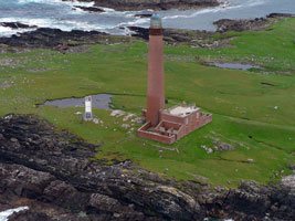
| SC 36M |
Monach Isles (Shillay)
latitude 57° 31' 33.2" N longitude 7° 41' 42.1" W
Located on a small island in the western part of the uninhabited Monach group, about 11 km southwest of the western point of North Uist. Accessible only by boat. This old lighthouse was replaced by the little white tower you see on the left, but work is underway to relight the old tower (A 4020.5) ARLHS # SCO-343
Photo courtesy Calum MacAulay [Flickr] |
|
| SC 37 |
| Neist Point
latitude 57° 25' 24.5" N longitude 6° 47' 17.8" W
At the northwest corner of the Isle of Skye, Duirinish Peninsula, Scotland. It currently has a private owner and 3 self-catering cottages.
Once on the Isle of Skye, head for Dunvegan. Drive south from Dunvegan on the A863, then turn onto B884 until there is a turn for Waterstein. Take this road and drive to the car park. From there it's about an hour walk to the light. (The steps are steep, but have a a handrail) (A 4064) ARLHS # SCO-147 |
| SC 38 |
Ornsay
latitude 57° 9' 3.4" N longitude 5° 46' 53" W
To reach the light, you must drive south after you cross the Skye Bridge. You can drive to the village of Sleat, or you can take a popular walk of 12 miles. The light is on a tidal island so you must arrive at low tide. (A 3942) ARLHS # SCO-161
Photo courtesy Calum MacAulay [Flickr] |
|
| SC 38P |
| Point of Sleat
Located at the southernmost point of the Isle of Skye, marking the west side of the entrance to the Sound of Sleat. There are picnic tables near the light. Accessible by a popular hike of about 13 km roundtrip from Aird of Sleat at the end of the A851 highway. (A 3952) ARLHS # SCO-219
Photo courtesy John Jones [Flickr] |
| SC 38S |
Canna (Sanday)
latitude 57° 2' 49.3" N longitude 6° 27' 57.4" W
Located at the eastern tip of Sanday, an uninhabited island joined to Canna by a footbridge. Canna, westernmost of the Small Isles, is accessible by passenger ferry from Mallaig. The lighthouse is accessible by a hiking trail. ARLHS # SCO-037
Photo courtesy Saint.Tobias [Flickr] |
|
| SC 39 |
| Hyskeir
latitude 56° 58' 9.7" N longitude 6° 40' 49.3" W
Situated on rocks approximately 5 miles south west of Canna and 8 miles west of the island of Rhum. This is so remote that it was the experimental place for resupply by aircraft. In spite of being remote, it also is known for the garden of superb vegetables the keepers kept while the light was manned. (A 4076) ARLHS # SCO-106
Photo courtesy John Jones [Flickr] |
| SC 39E |
Eigg
The Isle of Eigg is accessible by passenger ferry from Mallaig, but the lighthouse is located on a much smaller island, Eilean Chathastail, which shelters Glamisdale, Eigg's only safe harbor, at the southeastern tip of the larger island. Accessible only by boat. ferry (A 4080) ARLHS # SCO-066
Photo courtesy Alex Trabas [ListOfLights] |
|
| SC 40 |
| Ardnamurchan (Àird nam Murchan).
latitude 56° 43' 37.6" N longitude 6° 13' 33.5" W
June 9, 2005
We saw this light as we left Tobermory and sailed north. This is now an exhibition place with interactive displays for children, scientific experiments and exciting graphics. More information can be had from (01972) 510210 (A 4082) ARLHS # SCO-005 |
| SC 40B |
Bunessan (Eileanan Liathanaitch, Gray Islands)
latitude 56° 20' 34" N longitude 6° 16' 22.3" W |
Located on a small island in the entrance to Loch na Lathaich and the harbor of Bunessan, on the north side of the southwestern peninsula of the Isle of Mull. Accessible only by boat (A 4102) ARLHS # SCO-026 |
| SC 41 |
Ardmore
latitude 56° 39' 21.7" N longitude 6° 7' 43" W
North and West of Tobermory (A 4107) ARLHS # SCO-004
Photo courtesy Alan Steward [geograph] |
|
| SC 42 |
| Rubha Nan Gall
latitude 56° 38' 17.9" N longitude 6° 4' 1.2" W
June 9, 2005
Just as you leave Tobermory by water, this light is right (on the left side) on the headlands as the boat turns west (because, if you go due North, you hit land) (A 4112) ARLHS # SCO-194 |
| SC 43 |
Barra Head
latitude 56° 47' 7.5" N longitude 7° 39' 12.9" W
Barra Head only referred to the southernmost headland of Berneray. (A 4020) ARLHS # SCO-016
Photo courtesy Marco Elzi [Flickr] |
|
| SC 43F |
Green Islands (Eileanan Glasa)
latitude 56° 32' 15.4" N longitude 5° 54' 47" W |
Located on the rock known as Dearg Sgeir, northernmost of a small group of islets in the middle of the Sound of Mull about 3 km northeast of Salen. Accessible only by boat. (A 4122) ARLHS # SCO-091 |
| SC 43G |
Ardtornish Point
latitude 56° 31' 5" N longitude 5° 45' 13" W
Located on a headland jutting into the Sound of Mull from the mainland (north) side about 2.5 km east of Lochaline. (A 4124) ARLHS # SCO-008
Photo courtesy marinas.com [marinas.com] |
|
| SC 43H |
| Duart Point (William Black Memorial)
latitude 56° 26' 50.7" N longitude 5° 38' 45.9" W
Located on the easternmost point of the Isle of Mull, about 1200 m south of Duart Castle and 3 km east of Lochdon. Accessible by a short walk. Good views from the ferry between Oban and Craignure on the Isle of Mull. ferry (A 4174) ARLHS # SCO-295
Photo courtesy Alex Trabas [ListOfLights] |
| SC 43K |
Lady's Rock
latitude 56° 26' 54.5" N longitude 5° 37' 2.2" W
The rock is named for the wife of a 16th century Scottish lord; according to the story, he stranded her on the rock when she failed to produce a male heir and assumed she drowned, but she was rescued by a passing fisherman. Located on a rock, submerged at high tide, southwest of Lismore Island off the entrance to Loch Linnhe. Accessible only by boat, good views from the ferry between Oban and Craignure on the Isle of Mull. ferry (A 4172) ARLHS # SCO-118
Photo courtesy marinas.com [marinas.com] |
|
| SC 44 |
Scarinish
latitude 56° 30' 0.9" N longitude 6° 48' 15.8" W |
Nearest Town or City: Hynish, United Kingdom. This light is described in the NGA List (114-4004) as being only 11 ft tall.
There a 3 lights here, one on the south side of the entrance, the others in a leading light range. (A 4092) ARLHS # SCO-204 |
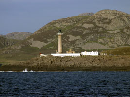
| SC 45 |
Lismore (Lios Mòr)
latitude 56° 27' 19.7" N longitude 5° 36' 26.4" W
The lighthouse marks the entrances from the Firth of Lorn to Loch Linnhe to the north and also to the Sound of Mull to the west. Located on Eilean Musdile, a small island just off the southwestern tip of Lismore Island. Accessible only by boat. (A 4170) ARLHS # SCO-121
Photo courtesy Giorgio M. Griffa [Flickr] |
|
| SC 45E |
| Sgeir Bhuidhe (Appin)
latitude 56° 33' 38.1" N longitude 5° 24' 38" W
Located on a rocky ledge just offshore on the west side of Loch Linnhe about 500 m north of Port Appin, opposite the northeastern end of Lismore Island. (A 4160) ARLHS # SCO-360
Photo courtesy The Amanda [Flickr] |
| SC 45F |
Corran Point (Ardgour)
latitude 56° 43' 15" N longitude 5° 14' 32.4" W
Located on the west side of the Narrows in Corran, just off the A861 highway. Accessible by road and easily viewed from the Corran Ferry, which crosses the loch just north of the Narrows. ferry (A 4132) ARLHS # SCO-051
Photo courtesy Adrian Powter [Flickr] |
|
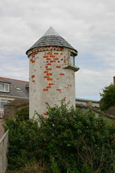
| SC 45G |
| Corpach
latitude 56° 50' 31.2" N longitude 5° 7' 27" W
This lighthouse and the next two are called "pepperpots" and are claimed to be the smallest lighthouses in Britain (there are other claimants). Located on the north side of the entrance to the Caledonian Canal from Loch Linnhe in Corpach, about 3 km north of Fort William. (A 4140) ARLHS # SCO-320
Photo courtesy abstractEffects [Flickr] |
| SC 45H |
Gairlochy
latitude 56° 55' 1.6" N longitude 4° 59' 15.2" W
Located on the south side of the canal's southbound exit from Loch Lochy about 800 m northeast of the locks at Gairlochy, accessible by a short hiking walking path. (A 3480) ARLHS # SCO-322
Photo courtesy Dave [Flickr] |
|
| SC 45K |
| Fort Augustus
latitude 57° 8' 44.9" N longitude 4° 40' 29.4" W
Located at the southwestern end of Loch Ness in Fort Augustus, marking the east side of the canal's southbound exit from Loch Ness to a series of five locks. Accessible by a walking path. (A 3472) ARLHS # SCO-350
Photo courtesy Anthonioo [Flickr] |
| SC 45M |
Bona Narrows |
Located at the northeastern end of Loch Ness in Lochend, marking the west side of the canal's northbound exit from Loch Ness to its smaller extension, Loch Dochfour, about 11 km southwest of Inverness. ARLHS # SCO-347 |
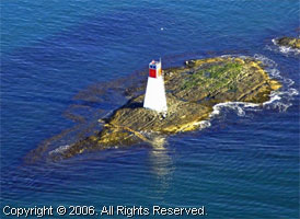
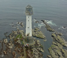
| SC 46 |
Skerryvore
Built on a group of rocks 10 miles south of the Inner Hebridean island of Tiree (and the highest rock is only 10' above Mean High Tide). (A 4096) ARLHS # SCO-215
Photo courtesy Calum MacAulay [Flickr] |
|
| SC 47 |
| Dubh Artach
Located on a rock southwest of Mull and southeast of Skerryvore. Accessible only by helicopter. (A 4098) ARLHS # SCO-060
Photo courtesy Calum MacAulay [Flickr] |
| SC 47C |
Carraig Mhor (Carraig Mòr)
latitude 55° 50' 25.4" N longitude 6° 6' 7.7" W |
Located on the west (Islay) side of the Sound of Islay about 1 km south of the ferry terminal at Port Askaig, marking the beginning of the narrowest portion of the strait separating Islay from Jura. (A 4238) ARLHS # SCO-042 |
| SC 48 |
Ruvaal
latitude 55° 56' 10.9" N longitude 6° 7' 24.4" W
The light station is at the northeastern tip of Islay, marking the northern entrance to the Sound of Islay. The site is not accessible by road, although it is possible to reach it by hiking 12 km roundtrip from Bunnahabhain. (A 4236) ARLHS # SCO-183
Photo courtesy marinas.com [marinas.com] |
|
| SC 49 |
| Mac Arthur's Head
The lighthouse is accessible via a walking trail from Ardtalla, a 10 mile round trip. ARLHS # SCO-134
Photo courtesy Giorgio M. Griffa [Flickr] |
| SC 49E |
Dunollie
latitude 56° 25' 22.4" N longitude 5° 29' 2.8" W
This tiny lighthouse is a directional light guiding ships into Oban Harbour from the Firth of Lorne. Located just off the Corran Esplanade in Dunollie, on the north side of Oban. (A 4178) ARLHS # SCO-064
Photo courtesy marinas.com [marinas.com] |
|
| SC 49F |
| Sgeirean Dubha
latitude 55° 49' 58.1" N longitude 5° 56' 25.5" W
Located on the largest of several rocky islets in the Sound of Kerrara, the southern route from the Firth of Lorne to Oban. Accessible only by boat. (A 4231) ARLHS # SCO-358
Photo courtesy marinas.com [marinas.com] |
| SC 49G |
Fladda
latitude 56° 14' 53.8" N longitude 5° 40' 50" W
Located on a small island about 3 km southwest of Cullipool on the Isle of Luing, marking the entrance to the Sound of Luing. Accessible only by boat. (Ecotours that visit the site are available.) tours (A 4190) ARLHS # SCO-083
Photo courtesy Michael Platt [Flickr] |
|
| SC 49H |
| Dubh Sgeir
latitude 56° 14' 45.8" N longitude 5° 40' 10.8" W
The name, which means Black Rock in Gaelic, should be Sgeir Dubh, but the incorrect word order is traditional on light lists. Located about 800 m west of Cullipool on the largest of several rocky islets in the north end of the Sound of Luing. Accessible only by boat. (A 4192) ARLHS # SCO-061
Photo courtesy marinas.com [marinas.com] |
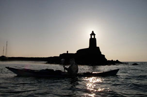
| SC 49K |
The Garvellachs (Isles of the Sea)
latitude 56° 13' 2.7" N longitude 5° 49' 2.6" W
The lighthouse is at the southwestern tip of the archipelago on Eileach an Naoimh, the Isle of the Saints, famous as the site of a sixth century monastery founded by St. Brendan. Accessible only by boat, tours to the island are available. (A 4196) ARLHS # SCO-238
Photo courtesy Dr. Douglas Wilcox [kayak] |
|
| SC 49M |
| Scalasaig
latitude 56° 4' 0.7" N longitude 6° 10' 54.5" W
Scalasaig is the principal town of the Isle of Colonsay, which is accessible by ferry from Oban. Located on a headland on the south side of the harbor entrance, about 500 m southeast of the ferry pier. ferry (A 4200)
Photo courtesy marinas.com [marinas.com] |
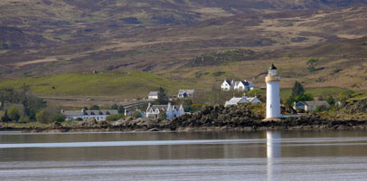
| SC 50 |
Rhinns of Islay
latitude 55° 40' 22.6" N longitude 6° 30' 47.6" W
On the Isle of Orsay, it sits across an inlet from the beautiful fishing village of Portnahaven. To get here, you must take the ferry to Port Ellen, then take A846 to Brigend then travel A847 down the long finger of the Rinns Peninsula where the road will end in Portnahaven. If you want to inspect the lighthouse closely, you'll need to find a local fisherman to take you the 10 minutes across the inlet to Orsay. (A 4256) ARLHS # SCO-184
Photo courtesy Calum MacAulay [Flickr] |
|
| SC 50C |
| Port Charlotte (Rubh' an Duin, Loch Indaal)
latitude 55° 44' 40.8" N longitude 6° 22' 20.1" W
Located on Loch Indaal, on the southeast side of the Rinns of Islay peninsula, at Port Charlotte (A 4254) ARLHS # SCO-198
Photo courtesy JWU [Flickr] |
| SC 50D |
Port Ellen (Carraig Fhada)
latitude 55° 37' 13" N longitude 6° 12' 42.1" W
Located on a rocky point at the western entrance to the harbor of Port Ellen on the southern peninsula of Islay. Accessible by road; the tower can be reached by a walkway at low tide. (A 4248) ARLHS # SCO-176
Photo courtesy Zan Milliagan [Flickr] |
|
| SC 50E |
| Eilean a' Chuirn
latitude 55° 40' 6.8" N longitude 6° 1' 11.7" W
Located on a small island about 1.5 km south of Ardmore, marking the easternmost point of Islay. (A 4242) ARLHS # SCO-349
Photo courtesy marinas.com [marinas.com] |
| SC 50F |
Carragh an t'Struith
latitude 55° 52' 18.1" N longitude 6° 5' 46.8" W
Located on the east (Jura) side of the Sound of Islay about 2.5 km north of the Feolin Ferry terminal. (A 4237) ARLHS # SCO-041
Photo courtesy marinas.com [marinas.com] |
|
| SC 50G |
| Na Cuiltean
Located on a small island in the Sound of Jura about 4 km northeast of Rubha na Traille, the southernmost point of Jura. Accessible only by boat. (A 4232) ARLHS # SCO-146
Photo courtesy marinas.com [marinas.com] |
| SC 50H |
Skervuile
Located on a rocky reef in the Sound of Jura about 3 km southeast of the entrance to Lowlandman's Bay on the southeastern coast of Jura. Accessible only by boat, there may be distant views from the A846 coastal road north of Craighouse. (A 4230) ARLHS # SCO-216
Photo courtesy marinas.com [marinas.com] |
|
| SC 50K |
| Ruadh Sgeir
Located on an isolated rock in middle of the Sound of Jura about 3 km off the northeastern coast of Jura and about 5 km off the coast of the mainland north of Carsaig Island. Accessible only by boat. (A 4226) ARLHS # SCO-188
Photo courtesy marinas.com [marinas.com] |
| SC 50M |
Crinan
latitude 56° 5' 28.5" N longitude 5° 33' 21.8" W
The Crinan Canal, 14.5 km long, provides a shortcut between the Hebrides and the Clyde, eliminating a long trip around the Mull of Kintyre, Britain's longest peninsula. The canal was opened in 1801. Located at the westernmost lock of the canal in Crinan. canal (A 4212) ARLHS # SCO-257
Photo courtesy Rongo [Flickr] |
|
| SC 50N |
| Ardrishaig Breakwater Head
latitude 56° 43.9" N longitude 5° 26' 37.1" W
The lighthouse appears to date from the late 1800s and is probably the second to stand on this site. Located at the end of the south breakwater in Ardrishaig on Loch Gilp, a branch of Loch Fyne, marking the eastern entrance to the canal. (A 4304) ARLHS # SCO-006
Photo courtesy Flickervegian [Flickr] |
| SC 51 |
Mull of Kintyre
latitude 55° 18' 37.4" N longitude 5° 48' 11.8" W
This light was constructed in 1787. Along with Kinnaird Head, it was the first light built in Scotland. This light was automated in 1996.
From Glasgow, take A82 to Tarbet, then take A83 to Tarbert and proceed the length of Kintyre to Campbeltown. There you must proceed south till you find the road that goes west to the lighthouse. This last stretch of road is not for the weak of heart. (A 4272) ARLHS # SCO-145
Photo courtesy Giorgio M. Griffa [Flickr] |
|
| SC 51A |
| Rubh'an Eun
Located at the southeastern tip of the Isle of Bute, marking the west side of the entrance to the Clyde estuary. Accessible by a hike of about 5 km roundtrip from the end of the B88 secondary road in Kilchattan Bay. (A 4344) ARLHS # SCO-182
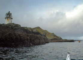
Photo courtesy Dr. Douglas Wilcox [kayak] |
| SC 51C |
Little Cumbrae (1757) (Cumaradh Beag)
One of the first Scottish lighthouses. Located on Lighthouse Hill, the highest point of the island, at an elevation of about 123 m ARLHS # SCO-359 |
|
| SC 51D |
Little Cumbrae (1793) |
Robert Stevenson supervised the construction of the 1793 tower, thus inaugurating the Stevenson family's long association with Scottish lighthouses. Located on the west side of the island marking the east side of the entrance to the Clyde estuary. ARLHS # SCO-316
Photo courtesy Graeme Phanco [Flickr] |
|
|
| SC 51E |
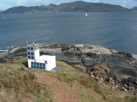
Little Cumbrae (1997)
latitude 55° 43' 13.4" N longitude 4° 58' 1.8" W
Located on the west side of the island marking the east side of the entrance to the Clyde estuary. The 1997 light is the square tower to the right of the 1793 model. (A 4346) ARLHS # SCO-123
Photo courtesy Dr. Douglas Wilcox [kayak] |
|
| SC 51F |
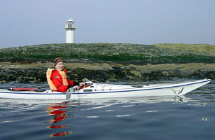
| Sgat Mòr
latitude 55° 50' 51" N longitude 5° 18' 29.4" W
This lighthouse marks the east side of the entrance to Loch Fyne from the Sound of Bute. Located on a small island off the point of Rubha Stillaig about 3 km south of Portavadie. (A 4296) ARLHS # SCO-353
Photo courtesy Dr. Douglas Wilcox [kayak] |
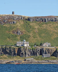
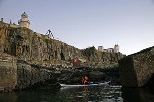
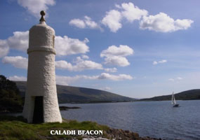
| SC 51G |
Caladh
Located on the west side of the entrance to Loch Riddon about 4 km northeast of Tighnabruaich, not far off the A8003 highway.
Note that the only references to this light I can find relate to Galway Bay in Ireland ARLHS # SCO-304
Photo courtesy Bill Newman [M0BNN] |
|
| SC 51H |
| Toward Point
latitude 55° 51' 44" N longitude 4° 58' 46.4" W
Located on the headland at the junction of the Clyde with the Kyles of Bute, the loch separating the Isle of Bute from the mainland. Accessible by road, just off the end of the A815 highway about 3 km south of Innellan. (A 4362) ARLHS # SCO-245
Photo courtesy Iain Donaldson [Flickr] |
| SC 51K |
Gantock Beacon
latitude 55° 56' 28.5" N longitude 4° 55' 6.4" W
This beacon marks a particularly dangerous rocky ledge, the Gantock Rocks, about 600 m southeast of Dunoon Castle in Dunoon. castle (A 4398) ARLHS # SCO-302
Photo courtesy Robbie Livingstone [geograph] |
|
| SC 51M |
| Carraig nan Ron (Dog Rock)
latitude 56° 5' 60" N longitude 4° 51' 41.4" W
This lighthouse is located at a wild location on Loch Long at the entrance to Loch Goil, roughly 25 km north of Helensburgh. (A 4411.4) ARLHS # SCO-315
Photo courtesy Bill Newman [M0BNN] |
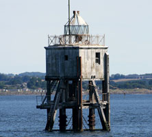
| SC 51N |
Ardencaple Castle (Castle Point Range Rear)
latitude 56° 50" N longitude 4° 45' 56.8" W
The front light is mounted on pilings in the Clyde. Located on Castle Point, the west side of the entrance to Rosneath Bay, west of Helensburgh. (A 4422.1) ARLHS # SCO-329
Photo courtesy ztephen [Flickr] |
|
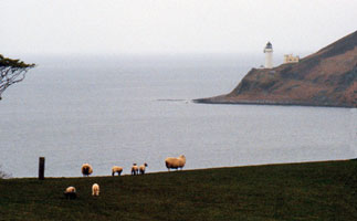
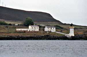
| SC 52 |
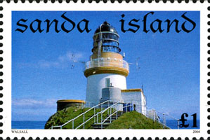
| Sanda
latitude 55° 16' 29.3" N longitude 5° 34' 57.6" W
Looks like a habitated island, but in the Irish Sea. You can take a boat trip (60-90 minutes) from Campbeltown. What makes the lighthouse so different is that the design incorporates a stone tower in 3 steps set against the face of the rock. This allows access to the water level in even the worst storms. (A 4274) ARLHS # SCO-301
Photo courtesy Giorgio M. Griffa [Flickr] |
| SC 53 |
Davaar
latitude 55° 25' 41.1" N longitude 5° 32' 26.8" W
An island east of Trench Flat (take A83 south as far as it goes). (A 4276) ARLHS # SCO-059
Photo courtesy Giorgio M. Griffa [Flickr] |
|
| SC 54 |
| Holy Island Inner Light
latitude 55° 30' 43.3" N longitude 5° 4' 13.6" W
An island east of the Isle of Arran. Boat trips are available from Northumberland +44 (1665) 720 308 boat (A 4330) ARLHS # SCO-101
Photo courtesy Giorgio M. Griffa [Flickr] |
| SC 54P |
Holy Island Outer (Piller Rock Point)
latitude 55° 30' 46.7" N longitude 5° 4' 5.4" W
This lighthouse is the third (after Sanda and Pladda) in the series of lights guiding ships into the Firth of Clyde. Located at Pillar Rock Point, the southeastern point of the island, about 1200 m northeast of the inner lighthouse. Accessible by hiking trail. (A 4332) ARLHS # SCO-100
Photo courtesy marinas.com [marinas.com] |
|
| SC 55 |
| Pladda (High)
latitude 55° 25' 30.3" N longitude 5° 7' 6" W
Pladda is a small island about 1.5 km south of Kildonan, off the southeastern point of the Isle of Arran. The light station guides ships entering the Firth of Clyde. (A 4326) ARLHS # SCO-172
Photo courtesy Calum MacAulay [Flickr] |
| SC 55C |
Port Glasgow
latitude 55° 56' 15.1" N longitude 4° 41' 14.4" W
Located on a rocky ledge about 200 m off the Port Glasgow waterfront. Accessible only by boat, but easily seen from the waterfront. (A 4476) ARLHS # SCO-311
Photo courtesy praatafrikaans [Flickr] |
|
| SC 55D |
| Steamboat Quay
latitude 55° 56' 14.8" N longitude 4° 41' 15.2" W
Located on the quay at Port Glasgow. (A 4478) ARLHS # SCO-312
Photo courtesy Bill Newman [arlhs] |
| SC 55E |
Maurice Clark Point
latitude 55° 56' 36" N longitude 4° 42' 50.4" W
Located at the eastern end of the Garvel Embankment, which shelters the eastern harbor at Greenock. (A 4472) ARLHS # SCO-351
Photo courtesy Alexander Trabas [ListOfLights] |
|
| SC 55F |
| Cloch Point
latitude 55° 56' 32.4" N longitude 4° 52' 43.8" W
This historic light station marks a right-angle curve in the Clyde, where the estuary turns from west to south for ships headed downstream. Located just off the A770 highway about 3 km west of Gourock, directly across the Clyde from Dunoon. (A 4404) ARLHS # SCO-047
Photo courtesy Stevie Manson [Flickr] |
| SC 55G |
Ardrossan Pierhead
latitude 55° 38' 28.1" N longitude 4° 49' 35" W
Located at the end of the ferry pier in Ardrossan, ferries depart from this pier for Brodick on the Isle of Arran. ARLHS # SCO-317
Photo courtesy atomicjeep [Flickr] |
|
| SC 55H |
| Troon Pierhead
latitude 55° 33' 3.9" N longitude 4° 41' 1" W
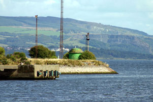
Ferries to Larne, Northern Ireland, pass close to this light as they leave Troon. Located at the end of the west pier, which also functions as a breakwater for Troon Harbour. ferry (A 4554) ARLHS # SCO-247 |
| SC 55K |
Lady Isle
latitude 55° 31' 38.2" N longitude 4° 44' 2.1" W
The island is a privately owned bird sanctuary; landing is forbidden without special permission. Located about 5 km west southwest of Troon, ferries to Larne, Northern Ireland, pass close to this light shortly after leaving Troon. (A 4562) ARLHS # SCO-117
Photo courtesy marinas.com [marinas.com] |
|
| SC 55M |
| Ayr Harbour Range Rear
latitude 55° 28' 8.7" N longitude 4° 38' 15.4" W
The front range light is mounted on or near the pilot house. Located at the foot of Harbour Street in Ayr. (A 4574.1) ARLHS # SCO-294
Photo courtesy John Cullen [Flickr] |
| SC 55N |
Ayr Harbour South Pier
latitude 55° 28' 10.4" N longitude 4° 38' 44.5" W
An unusual old pierhead light. Located at the end of the south breakwater mole at Ayr. (A 4568) ARLHS # SCO-292
Photo courtesy timniblett [Flickr] |
|
| SC 56 |
| Turnberry
latitude 55° 19' 32.9" N longitude 4° 50' 41" W
If being seen on TV is important, this is a very celebrated lighthouse. This light stands just off the 17th green and Turnberry has hosted the British Open in '77, '86 and '94. Located just of the A719 coastal road about 1.5 km north of the A77 at Turnberry. (A 4580) ARLHS # SCO-247
Photo courtesy Giorgio M. Griffa [Flickr] |
| SC 56G |
Girvan South Pierhead
latitude 55° 14' 43.5" N longitude 4° 51' 53.6" W
No lantern, lights mounted on a short mast atop the tower. Located at the end of the breakwater at Girvan. (A 4588) ARLHS # SCO-296
Photo courtesy Eric Firley [Flickr] |
|
| SC 57 |
| Ailsa Craig
latitude 55° 15' 6.8" N longitude 5° 6' 30.4" W
Ailsa Craig is a spectacular conical mountain rising 338 m above the sea about 15 km west of Girvan. The lighthouse is located at Foreland Point on the eastern side of the island. Accessible only by boat, tours from Girvan are available. online (A 4582) ARLHS # SCO-002
Photo courtesy Isobel Craig [Flickr] |
| SC 57L |
Loch Ryan (Cairn Ryan Point)
latitude 54° 58' 28" N longitude 5° 1' 50.9" W
Loch Ryan is the sound behind the northern arm of the hammerhead-shaped Rhins of Galloway. Located directly on the A77 highway at Cairn Ryan, on the east side of the loch. (A 4592) ARLHS # SCO-029
Photo courtesy Bill Newman [M0BNN] |
|
| SC 58 |
| Corsewall
latitude 55° 25.6" N longitude 5° 9' 33.8" W
A 4 star luxury hotel. It's just down the road from the former small fishing village of Kirkcolm. (A 4604) ARLHS # SCO-052
Photo courtesy Martin Luechinger [Flickr] |
| SC 59 |
Killantringan (Black Head)
latitude 54° 51' 42.3" N longitude 5° 8' 49.7" W
Located on Black Head, on the western side of the Rhins of Galloway about 2.5 km north of Portpatrick. Accessible by road off the B738 highway; there is also a hiking trail, the first section of the Southern Upland Way, from Portpatrick. trail ARLHS # SCO-111
Photo courtesy spiderpops [Flickr] |
|
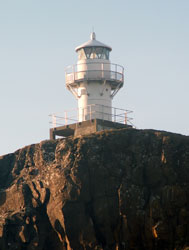
| SC 60 |
| Crammag Head
latitude 54° 39' 54.6" N longitude 4° 57' 53.6" W
There has been a lighthouse on Crammag Head since 1913. The current light was constructed last year and became operational in December 2009. The tower is 7m high and a range of 18 miles. Apparently everything used in the construction of the light was brought in by ship and helicopter, with all waste and leftover material being removed in the same way. (A 4608) ARLHS # SCO-055
Photo courtesy Michael Lindley [Flickr] |
| SC 60G |
Portpatrick
Located on the south side of the harbor entrance in Portpatrick. (A 4607) ARLHS # SCO-177
Photo courtesy Mich's Dad [Flickr] |
|
| SC 60H |
| Port Logan
latitude 54° 43' 26" N longitude 4° 57' 36.6" W
The picturesque village and its lighthouse became well known when they appeared in a popular BBC television drama series Two Thousand Acres of Sky. Located at the south side of the harbor at Port Logan, about 8 km south of Ardwell. ARLHS # SCO-314
Photo courtesy Dr. Douglas Wilcox [kayak] |
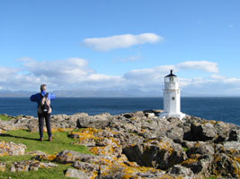
| SC 61 |
Mull of Galloway
latitude 54° 38' 5.2" N longitude 4° 51' 26.5" W
Available for rent. It marks the south-westernmost tip of Scotland. On a clear day, you can see Cumbria Ireland and the Isle of Man from the lighthouse. Located atop a vertical cliff at the southern tip of the Rhins of Galloway about 8 km south of Drummore. (A 4610) ARLHS # SCO-144
Photo courtesy Beth Loft [Flickr] |
|
| SC 62 |
Chicken Rock |
The only such light in the international database is on the Isle of Mann. ARLHS # SCO-046 |
| SC 62A |
Little Ross (Rear range)
latitude 54° 45' 55.9" N longitude 4° 5' 5.3" W
Privately owned, Island of Little Ross, Solway coast of Dumfries and Galloway, west side of the mouth of Kirkudbright bay, Scotland. (A 4634) ARLHS # SCO-125
Photo courtesy Giorgio M. Griffa [Flickr] |
|
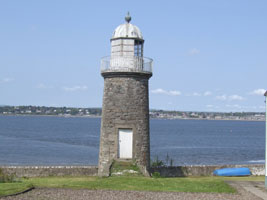
| SC 62S |
| Southerness
latitude 54° 52' 21.9" N longitude 3° 35' 42.8" W
Located on the Southerness headland at the north side of the entrance to Solway Firth. Accessible by road off the A710 highway about 25 km south of Dumfries. ARLHS # SCO-223
Photo courtesy David Holme [Flickr] |
Southeast Scotland
| SC 66T |
Barns Ness
The lighthouse is in a public preserve at East Lothian, east coast of Scotland, North Sea. ARLHS # SCO-015
Photo courtesy Giorgio M. Griffa [Flickr] |
|
| SC 67 |
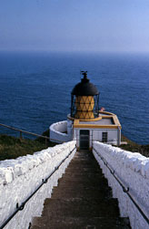
| St. Abbs Head
Located on a spectacular rocky headland about 8 km north of Eyemouth. Accessible by a popular hiking path of about 7 km round trip. path ARLHS # SCO-224
Photo courtesy Giorgio M. Griffa [Flickr] |
| SC 68 |
Inchkeith
latitude 56° 1' 59.8" N longitude 3° 8' 11.8" W
Located atop an island in the middle of the Firth of Forth about 6.5 km north of Leith. Accessible only by boat. path (A 2912) ARLHS # SCO-107
Photo courtesy rongorongo [Flickr] |
|
| SC 68A |
| Bass Rock
latitude 56° 4' 35" N longitude 2° 38' 31.9" W
Can be seen from Tantallon Castle. (His photo is much prettier, this copy is just the lighthouse, not the surroundings) (A 2864) ARLHS # SCO-018
Photo courtesy BK Theman [Flickr] |
| SC 68B |
Beamer Rock
latitude 56° 16.2" N longitude 3° 24' 43.8" W
Near Queensferry in the Firth of Forth. There is both a West light and an East Light. (A 2936) ARLHS # SCO-318
Photo courtesy Maria Pratt [Flickr] |
|
| SC 68C |
| Newhaven East Pier
latitude 55° 59' 21.1" N longitude 3° 11' 4.9" W
Not to be confused with another Newhaven East Pier Light in Sussex, England. Located at the end of the pier off Granton Road in the Newhaven district of Edinburgh, just west of Leigh. ARLHS # SCO-332
Photo courtesy Maria Pratt [Flickr] |
| SC 68D |
Leath West Pier Light
latitude 55° 59' 28.6" N longitude 3° 10' 56.8" W
Near Edinburg ARLHS # SCO-120
Photo courtesy Maria Pratt [Flickr] |
|
| SC 68E |
| Granton
latitude 55° 58' 55.2" N longitude 3° 13' 44.7" W
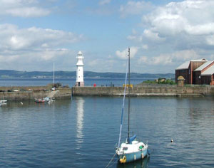
Located on the south shore of the Firth of Forth at 20 West Harbour Road in the Granton neighborhood of Edinburgh. This isn't a lighthouse, but rather a lighthouse shop where lighthouses are sold. The lighthouse on the roof also serves as a test-bed for the lenses that they make. ARLHS # SCO-335
Photo courtesy kyz [Flickr] |
| SC 68F |
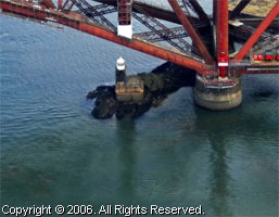
Inch Garvie
latitude 56° 5.1" N longitude 3° 23' 17.5" W
Located on a rock in the middle of the Firth of Forth on the east side of the Forth Railway Bridge at Queensferry. Accessible only by boat. (A 2920) ARLHS # SCO-298
Photo courtesy marinas.com [marinas.com] |
|
| SC 68G |
South Queensferry
latitude 55° 59' 34.6" N longitude 3° 23' 12.6" W |
Located at the old ferry terminal on the south bank of the Firth just west of the Forth Road Bridge. ARLHS # SCO-328 |
| SC 68H |
North Queensferry
latitude 56° 28.5" N longitude 3° 23' 42.8" W
The light was built between 1810 and 1813 and has been dark since 1964. Located at the foot of Ferryhill Street, between the Forth Road and Railroad bridges, near the Deep Sea World aquarium in North Queensferry. ARLHS # SCO-327
Photo courtesy Stevie Spiers [geograph] |
|
| SC 68K |
| Inchcolm
latitude 56° 1' 42.7" N longitude 3° 17' 48.5" W
The island, the site of a historic abbey founded in 1123, is accessible via cruises from Edinburgh. Located at the east point of the island. cruise (A 2916.5) ARLHS # SCO-308
Photo courtesy Douglas Cameron [ListOfLights] |
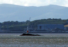
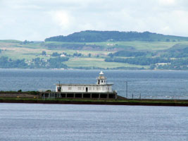
| SC 68M |
Oxcars
Built on a rock in the middle of the Firth of Forth about 4 km southeast of Dalgety Bay. Accessible only by boat. (A 2916) ARLHS # SCO-166 |
|
| SC 68N |
| Burntisland West Pier Outer
latitude 56° 3' 12.6" N longitude 3° 14' 14.6" W
Located at the end of the pier in Burntisland on the north side of the Firth of Forth. The light is easily viewed from shore. (A 3026) ARLHS # SCO-319
Photo courtesy marinas.com [marinas.com] |
| SC 68Q |
| Methil Outer Pier
latitude 56° 10' 45.5" N longitude 3° 28.7" W
Located at the end of the pier in Methil on the north side of the Firth of Forth. (A 3050) ARLHS # SCO-287
Photo courtesy marinas.com [marinas.com] |
| SC 69 |
Fidra
latitude 56° 4' 23.9" N longitude 2° 47' 7.4" W
The island is said to be the inspiration for Robert Louis Stevenson's book Treasure Island. Like Bass Rock, it is an important nesting ground for seabirds. Located about 3 km northwest of North Berwick. (A 2868) ARLHS # SCO-080
Photo courtesy BK Theman [Flickr] |
|
| SC 70 |
| Isle of May
latitude 56° 11' 8" N longitude 2° 33' 27.9" W
The rocky island, located about 8 km east of Anstruther in the northern entrance to the Firth of Forth, is a bird and seal sanctuary, the Isle of May National Nature Reserve. Located at the highest point of the island. (A 3090) ARLHS # SCO-108
Photo courtesy courtesy Magdalen Green Photography [(via Flickr)] |
| SC 70E |
Isle of May (Low)
The keeper's house accommodates a resident warden. The lighthouse was replaced by the North Carr lightship in 1887. Located at the easternmost point of the island. ARLHS # SCO-109
Photo courtesy marinas.com [marinas.com] |
|
| SC 71 |
| Elie Ness
latitude 56° 11' 2.1" N longitude 2° 48' 46.1" W
Located on a headland near Elie on the north side of the Firth of Forth. (A 3060) ARLHS # SCO-074
Photo courtesy Victoria Cormie [Flickr] |
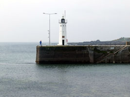
| SC 71B |
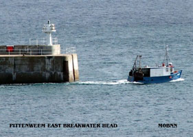
| Pittenweem East Pier
latitude 56° 12' 41.1" N longitude 2° 43' 41.3" W
Located on the east pier of the old harbor of Pittenweem. (A 3073) ARLHS # SCO-288
Photo courtesy Bill Newman [sco493] |
| SC 71C |
Anstruther West Pier
latitude 56° 13' 10.9" N longitude 2° 41' 49.7" W
Located at the end of the pier at Anstruther on the north side of the Firth of Forth. (A 3078)
Photo courtesy Trevor Powell [Flickr] |
|
| SC 72 |
| Fife Ness
latitude 56° 16' 43.8" N longitude 2° 35' 10.8" W
Located at the easternmost point of Fife, marking the north side of the entrance to the Firth of Forth. (A 3102) ARLHS # SCO-081
Photo courtesy marinas.com [marinas.com] |
| SC 72A |
Tayport Pile Light
latitude 56° 27' 10.8" N longitude 2° 52' 20.9" W
This is one of only a few surviving pile lighthouses in the U.K. Located about 500 meters northeast of the Tayport waterfront on the south side of the Firth of Tay. ARLHS # SCO-289
Photo courtesy Gil Campbell [Flickr] |
|
| SC 72H |
| Tayport High Light (aka Tayport West Light)
latitude 56° 27' 10.5" N longitude 2° 53' 32.7" W
This is a private light operated and constructed by the city of Dundee. On the southern entrance to the Firth of Tay. (A 3142) ARLHS # SCO-327
Photo courtesy Stuant63 [Flickr] |
| SC 72L |
Tayport Low (Tayport East)
The lighthouse is usually called the "Eastern Lighthouse" in Tayport. Both low and high lighthouses are on the town's Lighthouse Walk, off Albert Street. ARLHS # SCO-290
Photo courtesy Trevor Powell [Flickr] |
|
| SC 72P |
Buddon Ness Low |
Buddon Ness is the southern tip of the Barry Links, a wedge-shaped sandy promontory at the northern entrance to the Firth of Tay south of Carnoustie. Lighting the point usefully is a problem due to the rapidly shifting channels in the area. The original (1688) lighthouse was replaced in 1753 by a wooden low light built on rollers for ease of relocation. ARLHS # SCO-283 |
| SC 72Q |
Buddon Ness High
latitude 56° 28' 7.9" N longitude 2° 45' 2.3" W |
After deactivation the lighthouse served for some years as an observation post, and for several years after 1987 it carried a radar scanner as part of a Dundee University research project. Located at the southern tip of the Barry Links, marking the entrance to the Firth of Tay. ARLHS # SCO-025 |
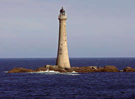
| SC 73 |
Bell Rock
A long and treacherous reef lying in the North Sea, some 12 miles East of Dundee. (A 3108) ARLHS # SCO-020
Photo courtesy Calum MacAulay [Flickr] |
|
| SC 73B |
| Arbroath Signal Tower
latitude 56° 33' 16.8" N longitude 2° 35' 12.9" W
Until 1995 this elegant building was the shore station of the offshore Bell Rock Light, housing off-duty keepers and keepers' families. Today it is the local history museum, including displays on the lighthouse. Located in Arbroath at the northern entrance to the Firth of Tay. ARLHS # SCO-326
Photo courtesy Macieklew [Flickr] |
| SC 73E |
Arbroath East Pier
latitude 56° 33' 14.8" N longitude 2° 34' 57.8" W
Located at the end of the main breakwater pier in Arbroath. (A 3216)
Photo courtesy marinas.com [marinas.com] |
|
| SC 74 |
| Scurdie Ness (Montrose)
latitude 56° 42' 6.3" N longitude 2° 26' 14.3" W
Located at the point on the south side of the entrance to the River South Esk and the harbor of Montrose Basin, about 2 km east of Montrose. Accessible by a popular hiking path. (A 3220) ARLHS # SCO-205
Photo courtesy Gil Campbell [Flickr] |
| SC 74A |
Montrose Front Range
Located on the north side of the entrance to the River South Esk in an area surrounded by commerical development, in Cobden Street off Ferry Road. Note that in this photo, the front range is closest and the rear range is in the background. (A 3222) ARLHS # SCO-336
Photo courtesy Alex Trabas [liteslist] |
|
| SC 74B |
| Montrose Rear Range
latitude 56° 42' 13.2" N longitude 2° 27' 40.2" W (A 3222.1)
Photo courtesy Alex Trabas [liteslist] |
| SC 75 |
| Tod Head
latitude 56° 53' 1.3" N longitude 2° 12' 56.2" W
Located on a headland about 1.5 km south of Catterline and 8 km south of Stonehaven. ARLHS # SCO-243
Photo courtesy Giorgio M. Griffa [Flickr] |
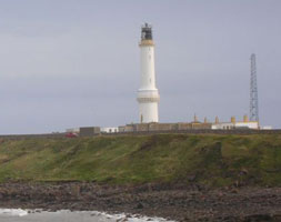
| SC 76 |
Girdle Ness
latitude 57° 8' 20.4" N longitude 2° 2' 55" W
From Aberdeen, follow Greyhope road around the golf course to the tip of the head. (A 3246) ARLHS # SCO-089
Photo courtesy Gil Campbell [Flickr] |
|
| SC 76A |
| Aberdeen South Breakwater
latitude 57° 8' 35.7" N longitude 2° 3' 41.6" W
Located at the end of the breakwater on the south side of the entrance to the River Dee in Aberdeen, about 750 m northwest of Girdle Ness Light. (A 3250) ARLHS # SCO-277
Photo courtesy Gil Campbell [Flickr] |
| SC 76B |
Aberdeen North Pier
latitude 57° 8' 44.4" N longitude 2° 3' 40.8" W
The pier, 1000 m in length, was built partly by John Smeaton in 1775-1781 and extended by Thomas Telford in 1810-1815. Located at the end of the breakwater on the north side of the entrance to the River Dee in Aberdeen. (A 3252)
Photo courtesy Chris Nixon [Flickr] |
|
| SC 76F |
| Torry Range Front
latitude 57° 8' 22.6" N longitude 2° 4' 30.4" W
Located off Sinclair Road on the south bank of the River Dee in the Torry district of Aberdeen. Site and tower closed, but the light can be viewed from outside a fence. (A 3258) ARLHS # SCO-338
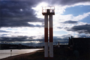
Photo courtesy Alex Trabas [ListOfLights] |
| SC 76R |
Torry Range Rear
latitude 57° 8' 19" N longitude 2° 4' 40.7" W
About 200 m southwest of the front light. (A 3258.1) ARLHS # SCO-339
Photo courtesy Alex Trabas [ListOfLights] |
|
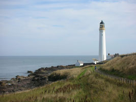
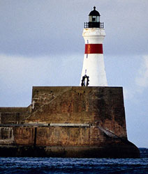
| SC 77 |
| Buchan Ness
This lighthouse marks the easternmost point of the Scottish mainland, although it actually stands on a small island, linked to the mainland by a bridge. Located at Boddam, about 6 km south of Peterhead. (A 3280) ARLHS # SCO-024
Photo courtesy Gil Campbell [Flickr] |
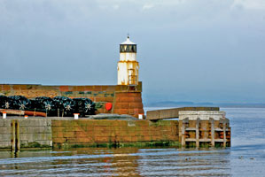
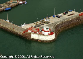
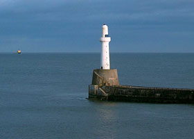
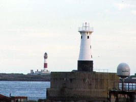
| SC 77A |
Peterhead Harbor South Breakwater
latitude 57° 29' 47.4" N longitude 1° 46' 32.4" W
Peterhead is a deepwater port used heavily to support the oil and gas rigs of the North Sea field. Located at the end of the breakwater at Salthouse Head on the south side of Peterhead. You can clearly see Buchan Ness across the harbor. (A 3284) ARLHS # SCO-281
Photo courtesy Maria Pratt [Flickr] |
|
| SC 78 |
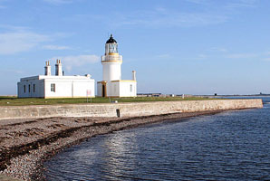
| Chanonry Point
latitude 57° 34' 26.4" N longitude 4° 5' 38.8" W
on the Black Isle.
Chanonry Ness is a sharp point at the end of a sandy spit projecting southward into Moray Firth at the beginning of the approach to Inverness. Located 2.5 km southeast of Fortrose, accessible by car. (A 3440) ARLHS # SCO-045
Photo courtesy Beth Loft [Flickr] |
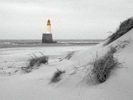
| SC 79 |
Rattray Head
latitude 57° 36' 36.6" N longitude 1° 48' 59.4" W
Located about 13 km north of Peterhead and a similar distance southeast of Fraserburgh. Accessible by car, parking available. It is possible to walk to the lighthouse with caution at low tide. (A 3304) ARLHS # SCO-179
Photo courtesy Gil Campbell [Flickr] |
|
| SC 79B |
| Balaclava Breakwater (Fraserburgh)
latitude 57° 41' 30.8" N longitude 1° 59' 42.8" W
Located at the end of the breakwater on the north side of the harbor at Fraserburgh. (A 3312) ARLHS # SCO-271
Photo courtesy Brian Mcstotts [Flickr] |
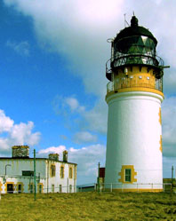
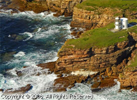
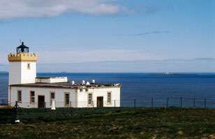
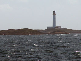
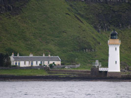
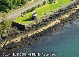
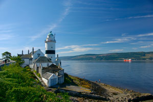
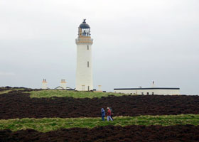
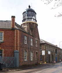
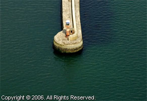
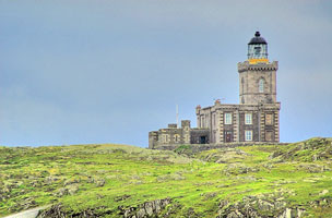
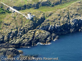
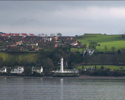
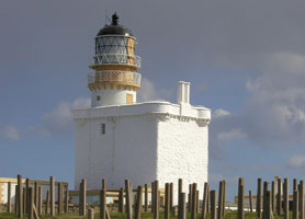
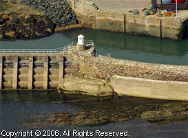
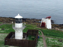
| SC 80 |
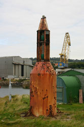
Kinnaird Head (aka Fraserburgh)
latitude 57° 41' 52.4" N longitude 2° 16.2" W
Built in 1787, this and Mull of Kintyre are the first lights built in Scotland. It was automated in 1991. It is open to the public, and there is also a lighthouse museum. The building is a conversion of an earlier castle. (A 3332) ARLHS # SCO-113
Photo courtesy Robin Keymer [Flickr] |
|
| SC 80G |
Rosehearty
latitude 57° 42' 4.2" N longitude 2° 6' 56.4" W
Located at the end of the west pier in Rosehearty, about 6 km west of Fraserburgh. (A 3335)
Photo courtesy Antony Williams [Flickr] |
|
| SC 80M |
| Macduff Pier
latitude 57° 40' 15.6" N longitude 2° 30' 0.6" W
Located at the end of the concrete breakwater sheltering the harbor of Macduff, on Banff Bay. (A 3348) ARLHS # SCO-272
Photo courtesy Tom Gardner [Flickr] |
| SC 80Q |
Buckie Lighthouse
latitude 57° 40' 49.8" N longitude 2° 57' 39.5" W
At the end of the breakwater in the harbor in Moray Firth. (A 3394) ARLHS # SCO-333
Photo courtesy Callum Anderson [Flickr] |
|
| SC 81 |
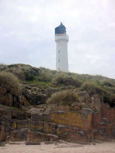
| Covesea Skerries (Lossiemouth)
The skerries are small rocky islands off the south coast of Moray Firth, but the lighthouse is located on the mainland near the islands, about 5 km west of Lossiemouth, just off the coastal road B9040. ARLHS # SCO-053
Photo courtesy Gil Campbell [Flickr] |
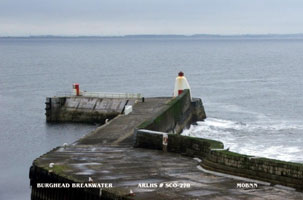
| SC 81A |
Burghead North Pier (Moray Firth)
latitude 57° 42' 5.6" N longitude 3° 30' 1.6" W
Located at the end of the pier in Burghead. (A 3424) ARLHS # SCO-278
Photo courtesy Bill Newman [arlhs] |
|
| SC 81B |
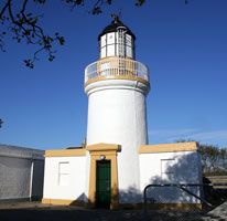
| Cromarty
latitude 57° 40' 58.8" N longitude 4° 2' 11.2" W
Located on George Street in Cromarty, on the south side of the entrance to Cromarty Firth. ARLHS # SCO-056
Photo courtesy bobthelomond [Flickr] |
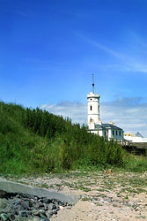
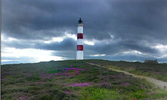
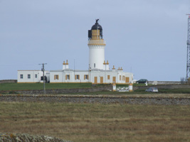
| SC 82 |
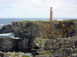
Tarbat Ness (Rubha an Tairbeirt)
latitude 57° 51' 54.2" N longitude 3° 46' 35.7" W
The lighthouse, the third tallest in Scotland, stands on the sharp point separating Dornoch Firth from Moray Firth. Located about 5 km northeast of Portmahomack. (A 3506) ARLHS # SCO-236
Photo courtesy Gil Campbell [Flickr] |
|
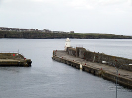
| SC 82L |
| Lybster South Pier
latitude 58° 17' 42.7" N longitude 3° 17' 22.3" W
Located at the foot of the pier sheltering Lybster Harbour. Accessible by car. (A 3522) ARLHS # SCO-299
Photo courtesy Alex Trabas [liteslist] |
| SC 83 |
Clythness
Located atop a cliff about 5 km northeast of Lybster, just off the A99 coastal highway. ARLHS # SCO-048
Photo courtesy marinas.com [marinas.com] |
|
| SC 83S |
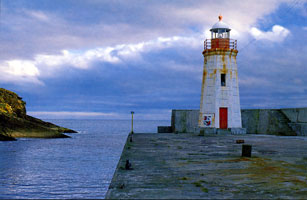
Wick South Pier
latitude 58° 26' 21.1" N longitude 3° 4' 44.7" W
Located at the end of the pier sheltering Wick Harbour. (A 3528) ARLHS # SCO-313
Photo courtesy Trevor Powell [Flickr] |
|
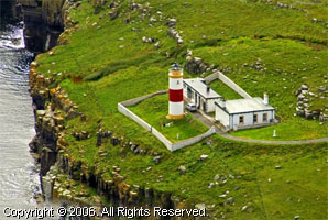
| SC 84 |
| Noss Head
latitude 58° 28' 43.8" N longitude 3° 3' 2.9" W
Located about 4 km northeast of Wick, marking the southern entrance to Sinclair's Bay. (A 3544) ARLHS # SCO-157
Photo courtesy Trevor Powell [Flickr] |
|
|

 Ireland


