|
This page shows the Lighthouses of Ireland. You can click on the photo of the light to go to it's specific (larger resolution) copy. Each lighthouse name is linked to (in our editorial opinion) the best reference site for that light. Directions to the lighthouses have been provided by John Eagle. John was the first to photograph them all. John provides tours of the Irish lights and has both a book on the lights and a complete set of postcards as well. IrishLights |
|
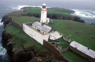
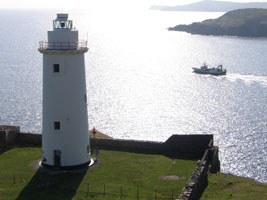
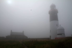
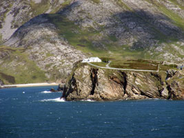
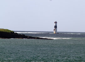
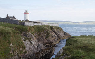
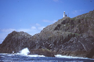
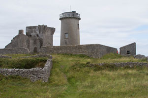
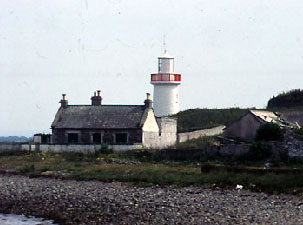
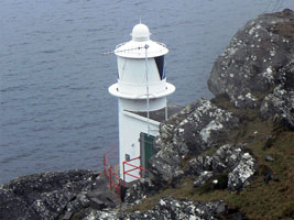
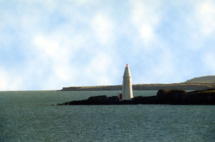
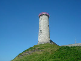
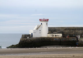
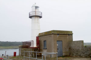
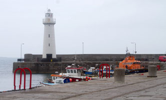
| IR 1 |
Rue Point
latitude 55° 15' 31.4" N longitude 6° 11' 27.9" W
August 22, 2013
South point of Rathlin Island
While this picture looks calm, the boat was moving all over and I've had to straighten it a bit. Note the fog in the picture below, once we left the harbor, there's no sign of it. (A 6060) |
|
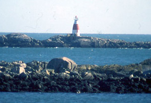
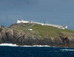
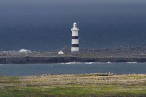
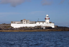
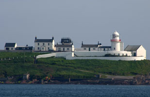
| IR 2 |
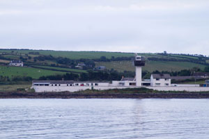
| Rathlin East (Altacarry Head)
latitude 55° 18' 5.5" N longitude 6° 10' 16.9" W
August 22, 2013
Rathlin Island can be reached by ferry from Ballycastle. (A 6062) |
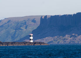
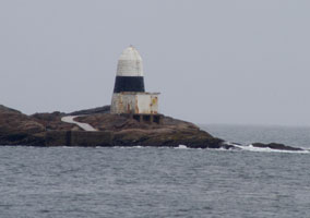
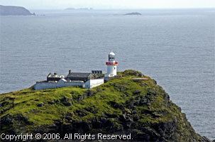
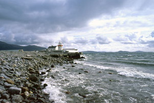
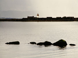
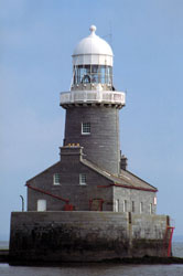
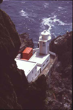
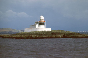
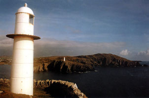
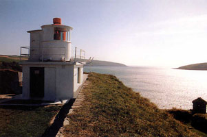
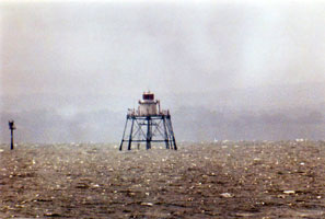
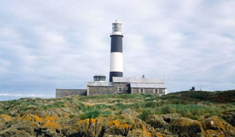
| IR 3 |
Rathlin West
latitude 55° 18' 2.8" N longitude 6° 16' 49" W
August 22, 2013
Access to a viewpoint is available by bus and then walking down the trail. Alternatively, you can rent a bike and ride the 4 miles.
Note that the light is at the bottom of the tower. This is intentional, the light needs to be seen underneath the very prevalent fog banks. (A 6064) |
|
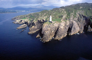
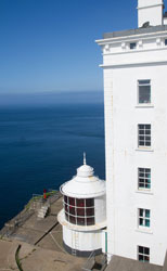
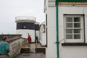
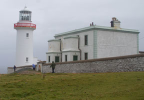
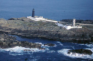
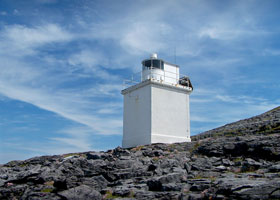
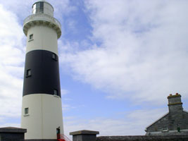
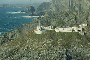
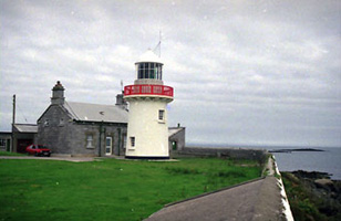
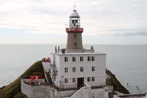
| IR 4 |
| Inishowen
latitude 55° 13' 33" N longitude 6° 55' 44.4" W
August 21, 2013
A cast iron superstructure was built on top of the original stone tower in 1871 to raise the light by 25 feet.
From Letterkenny, follow the signs to Derry. Look for signs to Moville, then Greencastle. The lighthouse is a short way north of Greencastle. (A 6084) ARLHS # IRE-043 |
| IR 4E |
Inishowen East
latitude 55° 13' 35.5" N longitude 6° 55' 37.5" W
August 21, 2013
This was originally a second lighthouse at the east point of Inishowen; it was discontinued in 1961.
Right next to Inishowen, shown above |
|
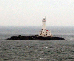
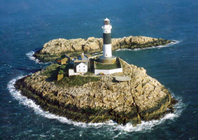
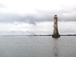
| IR 5 |
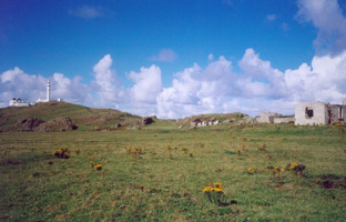
| Inishtrahull
Inishtrahull is a rocky, uninhabited island 10 km north of Malin Head, the northernmost point of the Irish mainland. Inishtrahull Lighthouse is the most northerly Irish lighthouse. Together with the light on Tory Island it forms one of the two main landfall lights for shipping from the Atlantic rounding the north coast of Ireland
The Inishowen Boating Company takes people to the lighthouse from Bunagee Pier, Culdaff. (A 6164) ARLHS # IRE-045
Photo courtesy (c) Danny McL [Flickr] |
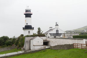
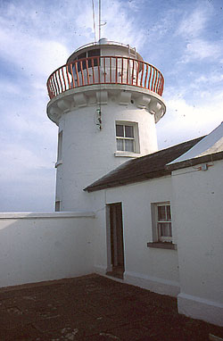
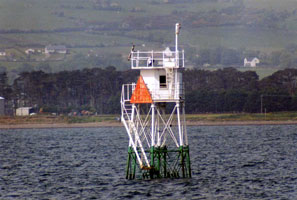
| IR 6 |
Dunree Fort
latitude 55° 11' 46.7" N longitude 7° 33' 15.8" W
Located on a sharp headland on the east side of Lough Swilly opposite Portsalon and about 20 km northwest of Buncrana. (A 6172) ARLHS # IRE-030
Photo courtesy Ken Cox [Flickr] |
|
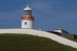
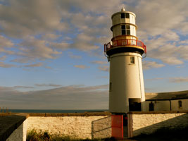
| IR 7 |
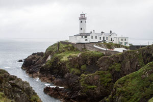
| Fanad Head
latitude 55° 16' 33.2" N longitude 7° 37' 55.8" W
August 21, 2013
Marks the entrance into Lough Swilly
From Letterkenny, drive north on R245. Look for signs to Portsalon on R246. Shortly before Portsalon, turn left for Fanad. (A 6168) ARLHS # IRE-033 |
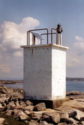
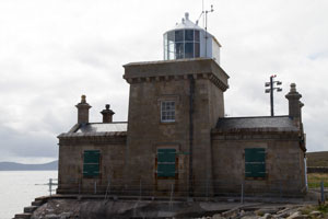
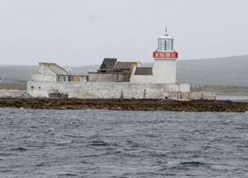
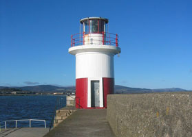
| IR 8 |
Moville
latitude 55° 10' 59.2" N longitude 7° 2' 7" W
August 21, 2013
We spotted this light near Whitecastle. I am told it was built in 1882. We spotted it on the way to Fanad. (A 6090) |
|
| IR 9 |
| Tory Island
Nearest Town or City: Magheroarty, Ireland. Location: Western end of Tory Island, County Donegal
Take N56 north from Letterkenny until you see the sign for Meenlaragh on R257 where a ferry will take you to Tory Island. The walk to the light house could be as much as an hour depending on the wind. (A 6200) ARLHS # IRE-075
Photo courtesy © John Eagle Photography [copies are available for purchase] |
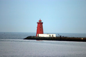
| IR 10 |
Arranmore
latitude 55° 52.4" N longitude 8° 33' 37.5" W
August 20, 2003
Arranmore Island is located just 4 km from the mainland at Burtonport. The island is readily accessible by ferry, with boats running hourly during the summer months. The journey takes 30 minutes. Cars must be booked in advance. Contact the ferry at (353) 75 20532. ARLHS # IRE-002 |
|
| IR 11 |
| Ballagh Rocks
latitude 54° 59' 57.8" N longitude 8° 28' 50.5" W
August 20, 2013
Nearest Town or City: Leabgarrow, Ireland
Location: On small island at northern entrance to Sound of Aran, NW coast of Ireland. (A 6210) ARLHS # IRE-005 |
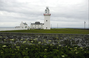
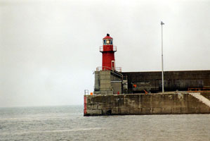
| IR 12S |
| St. John's point
latitude 54° 34' 7" N longitude 8° 27' 33.8" W
August 18, 2013
On the way to Killybeg, turn left and follow the signs to St. John's point. |
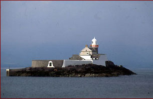
| IR 13 |
Rotten Island
latitude 54° 36' 52.2" N longitude 8° 26' 25.8" W
Located in Killybegs Harbor, the light can only be accessed by boat, but distant views are possible from the mainland or from the St. John's Point peninsula. (A 6224) ARLHS # IRE-065
Photo courtesy © John Eagle Photography [copies are available for purchase] |
|
| IR 14 |
| Black Rock Sligo
latitude 54° 18' 26.3" N longitude 8° 37' 1.2" W
August 19, 2013
Located on a rocky islet, awash at high tide, marking the beginning of the approach to Sligo Harbour from Sligo Bay. Accessible only by boat; distantly visible from Raghley or Rosses Point on the mainland. (A 6232) ARLHS # IRE-011 |
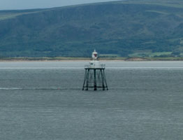
| IR 15 |
Lower Rosses
latitude 54° 20' 8.5" N longitude 8° 33' 56.9" W
This directional light guides ships through the Needles Channel as they enter Sligo Harbour. Located about 200 m offshore and about 1.6 km north of Rosses Point. (A 6236) ARLHS # IRE-063
Photo courtesy Alex Trabas [ListOfLights] |
|
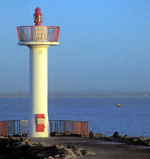
| IR 16 |
| Metal Man Sligo
latitude 54° 18' 14" N longitude 8° 34' 32.1" W
August 19, 2013
This is the front range for Oyster Island (see below) (A 6244) ARLHS # IRE-056 |
| IR 17 |
Oyster Island
latitude 54° 18' 7" N longitude 8° 34' 15.5" W
August 19, 2013
This light serves as a rear range light, with the light known as the Metal Man (about 1/4 mile to the NW) serving as the front light.
Nearest Town or City: Rosses Point, Ireland (A 6244.1) |
|
| IR 18 |
| Broadhaven [Baile Glas]
latitude 54° 16' 3.6" N longitude 9° 53' 19.4" W
August 18, 2013
This is a harbour light and unlike its neighbor on Eagle Island it enjoys comparative peace tucked up on Gubbacashel Point. It guides vessels from seaward clear of a sunken rock on the western side of Broadhaven into a safe anchorage.
From Belmullet, drive west for about 1.6km and turn right. Head north, then east. You are looking for the harbor where the lifeboat is kept. (A 6266) ARLHS # IRE-086 |
| IR 19 |
Eagle Island
latitude 54° 16' 60" N longitude 10° 5' 34" W
August 18, 2013
West end of Eagle Island, off Doonamo Head
This is a hard place to find. We found the Sculpture tour, and you can see it from spots Q and R. (A 6268) ARLHS # IRE-031 |
|
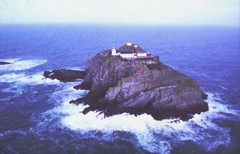
| IR 20 |
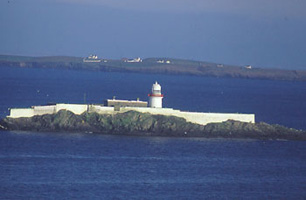
| Black Rock Mayo
Blackrock Mayo is one of the most remote and desolate lighthouse stations on the Irish coast. The station is perched 230 feet above sea level on a pinnacle of almost barren rock, 11 miles out into the Atlantic from Blacksod. (A 6270) ARLHS # IRE-010
Photo courtesy marinas.com [marinas.com] |
| IR 21 |
Blacksod
August 18, 2013
on the west coast of Mayo
From Sligo, follow signs to Ballina, then Belmullet and then to Blacksod. The lighthouse is on the pier and easy to view. (A 6272) ARLHS # IRE-012 |
|
| IR 22 |
| Achillbeg
latitude 53° 51' 29.4" N longitude 9° 56' 51.2" W
South point of Achillbeg Island.
From Westport, drive north then west to Achill Island. Follow the road to the harbor, but you will need a boat as the light is on the far side of Achillbeg Island. (A 6276) ARLHS # IRE-001
Photo courtesy © John Eagle Photography [copies are available for purchase] |
| IR 22C |
Clare Island
latitude 53° 49' 38.7" N longitude 9° 58' 59.7" W |
The light is at North Point Clare Island. The tower dates back to 1806, but was destroyed by fire in 1813. This light is high on the cliffs and is often shrouded in fog.
Drive on R335 from Westport to Louisburgh and take the ferry from Roonagh Quay (6.5 km from Louisburg.) |
| IR 23 |
Inishgort
latitude 53° 49' 36.1" N longitude 9° 40' 13.9" W
Nearest Town or City: Inishgort, Ireland. Location: Westport Bay, west coast of Ireland.
You will need a boat. There are many harbors around the area. (A 6278) ARLHS # IRE-042
Photo courtesy © John Eagle Photography [copies are available for purchase] |
|
|
|
| IR 24 |
| Slyne Head
latitude 53° 23' 58.3" N longitude 10° 14' 1.8" W
The westernmost point of County Galway, (SW of Doonlaughan)
Closest viewpoint is the Connemara Golf at Ballyconnely. This is still not very close. (A 6288) ARLHS # IRE-069
Photo courtesy © John Eagle Photography [copies are available for purchase] |
| IR 25 |
Straw Island
latitude 53° 7' 4.1" N longitude 9° 37' 50.5" W
August 16, 2013
Located on a small island at the entrance to Killeany Harbour near the southeastern end of Inishmore. Accessible only by boat.
The ferries to the Aran Islands go right past this light. (A 6298) ARLHS # IRE-072 |
|
| IR 25N |
| Inishmore (Dún Árainn)
August 16, 2013
At the top of Inishmore Island. |
| IR 26 |
Eeragh
August 16, 2013
Nearest Town or City: Eeragh, Ireland
Location: Northern tip of Aran Islands, County Galway (A 6296) |
|
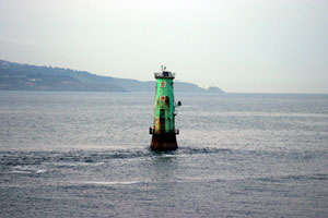
| IR 26M |
| Mutton Island
latitude 53° 15' 13.8" N longitude 9° 3' 15.1" W
On an island connected by a causeway. The light stands adjacent to a water treatment plant, so access may be restricted.
Drive to Galway, go to the Grattan Road and head towards Salthill. On your left will be the sea and a long causeway that goes out to the lighthouse.
Photo courtesy light_arted [Flickr] |
| IR 28 |
| Black Head (Co. Clare)
latitude 53° 9' 14.1" N longitude 9° 15' 53.5" W
Located just off the spectacular R477 highway along the south shore of Galway Bay, about 7.5 km north of Fanore. You can book these properties. (A 6332)
Photo courtesy Gordieryan [Flickr] |
| IR 29 |
Inisheer (Inis Oirr)
latitude 53° 3' 49" N longitude 9° 31' 34.8" W
Inisheer is accessible by passenger ferry from Doolin, and the lighthouse is accessible by hiking trail. Located on the southeastern point of the island. ferry (A 6334) ARLHS # IRE-041
Photo courtesy Scott Jon Siegel and Bonnie Ruberg [Flickr] |
|
| IR 30 |
| Loop Head
latitude 52° 33' 39.3" N longitude 9° 55' 54.1" W
On the northern shore of the Shannon River. It sleeps 5 and you can book it.
On N68 towards Kilrush, turn right for Kilkee, then take a left for Loop Head on R487. You can walk to the gates. (A 6338) ARLHS # IRE-050
Photo courtesy Omar Abiera [PBase] |
| IR 31 |
Kilcredaun Head
latitude 52° 34' 47.6" N longitude 9° 42' 35.7" W
Located on a promontory on the north side of the Shannon estuary about 5 km south of Carrigaholt. Bay of Carrigaholt, County Clare
On your way to Loop Head (see above), there is a straight stretch of road with a right hand bend. Loop Head is around the bend, but you need to drive straight ahead towards a Swiss style chalet. Nearby are yellow signs telling you that you are entering private property. This is the entrance to the light.
Photo courtesy © John Eagle Photography [copies are available for purchase] |
|
| IR 33 |
Corlis Point (rear) (Querrin Quay)
latitude 52° 37' 43.3" N longitude 9° 35' 19.9" W
Shannon Estuary, County Clare (A6340.51) ARLHS # IRE-021
Photo courtesy Alexander Trabas [ListOfLights] |
|
| IR 34 |
| Scattery Island
latitude 52° 36' 19.6" N longitude 9° 31' 4.7" W
Lighthouse located on the south side of the island in the Shannon estuary about 8 km southwest of Kilrush. There are boat trips to the island from Kilrush.
From Ennis, follow signs for Kilrush on N68. From Tralee, drive north on N69 to Tarbert, then take the ferry across the Shannon and turn left for Kilrush. (A 6342) ARLHS # IRE-066
Photo courtesy © John Eagle Photography [copies are available for purchase] |
| IR 34B |
Beeves Rock
latitude 52° 39' 0.4" N longitude 9° 1' 20.5" W
Sited at the mouth of the River Fergus, 4 km from the Aughinish buoy.
You will need to hire a boat. John Eagle went with Shannon Workboats from the Aughinish Pier. (A 6348)
Photo courtesy John Eagle Photography [ListOfLights] |
|
| IR 34T |
Tarbert |
Limited access as it is on Electricity Supply Board property. There is a guard at the gate who may allow you to take a picture.
Best seen from the car ferries that regularly cross the Shannon at this point. (A 3994) |
| IR 35 |
Little Samphire Island
Nearest Town or City: Fenit, Ireland
From Tralee, follow signs to Fenit and drive to the pier. At low tide it is possible to walk out almost as far as the light, but be careful not to get cut off when the tide comes back in. (A 6392) ARLHS # IRE-049
Photo courtesy © John Eagle Photography [copies are available for purchase] |
|
| IR 36 |
| Inishtearaght
On the Blasket Islands, this is the westernmost light in Ireland.
There are boat trips around the Blaskets: Darryl Broe takes people out, but he stresses that it must be calm flat weather to go out this far as the currents and swells make dangerous. (A 6408) ARLHS # IRE-044
Photo courtesy © John Eagle Photography [copies are available for purchase] |
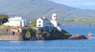
| IR 37 |
Cromwell Point
latitude 51° 56' 1.3" N longitude 10° 19' 16.9" W
Valentia Island is connected to the mainland by a bridge. You can book these properties.
From Killarney, take the north shore drive on the Ring of Kerry to Cahersiveen. About a mile after the town, follow signs to Portmagee. Cross over the bridge, turn right and drive towards Knights Town. Follow signs for Slate quarry. A road drops down steeply to the lighthouse, it might be better to park your car and walk down. (A 6416) ARLHS # IRE-077
Photo courtesy Niall O'Sullivan [Flickr] |
|
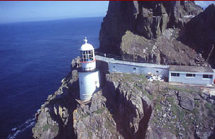
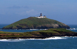
| IR 40 |
| Skellig Michael
Nearest Town or City: Cahersiveen, Ireland. Location: Outermost island of the Skellings, County Kerry, southwest Ireland.
From Killarney, take the north shore drive on the Ring of Kerry to Cahersiveen. About a mile after the town, follow signs to Portmagee. There are numerous boat operators ready and willing to take you out to the Rock. (A 6442) ARLHS # IRE-068
Photo courtesy © John Eagle Photography [copies are available for purchase] |
| IR 41 |
Bull Rock
Off Dursey Island, southwest coast of Ireland. The only access is by boat.
Follow the directions to Calf Rock viewing, then turn 90 degrees to see the Bull. Binoculars or a telephoto lens are very handy. (A 6430) ARLHS # IRE-013
Photo courtesy © John Eagle Photography [copies are available for purchase] |
|
| IR 41C |
Calf Rock |
About 2 km off Dursey Island, southwest coast of Ireland. The only access is by boat.
From Castletown Bearhaven, drive west towards Allihies. After 14km (or so) you will see the turn for Dursey Island. Follow this road to the end and you will arrive at the Cable-Car park. Take the cable car to Dursey, walk to the end of the island and you can see Calf Rock from there. |
| IR 42 |
Sheep's Head
latitude 51° 32' 34.2" N longitude 9° 50' 54.7" W
The southern tip of Bantry Bay.
Heading south from Bantry, pass West Lodge hotel and look for a turn to the right that takes you to Sheep's Head. (A 6432) ARLHS # IRE-067
Photo courtesy mozzercork [Flickr] |
|
| IR 44 |
Mizen Head
latitude 51° 27' 0.6" N longitude 9° 49' 10.2" W
Established as a fog signal in 1909 on Ireland's most southwesterly point, a radio beacon was installed in 1931, then a light was added in 1959.
From Bantry, take N71 to Ballydehob, the R592 through Schull to Toormore. Take R591 to Goleen and from there, follow the signs to Mizen Head. (A 6448) ARLHS # IRE-053
Photo courtesy © John Eagle Photography [copies are available for purchase] |
|
|
|
| IR 46 |
Roancarrigmore
latitude 51° 39' 10.8" N longitude 9° 44' 49.2" W
Located on a small islet off the eastern end of Bere Island, marking the eastern entrance to Castletown Bere from Bantry Bay. Accessible only by boat; should be visible from the eastern end of Bere Island, which is accessible by road. (A 6442) ARLHS # IRE-060
Photo courtesy © John Eagle Photography [copies are available for purchase] |
|
| IR 47 |
| Crookhaven (Rock Island)
latitude 51° 28' 35.2" N longitude 9° 42' 17.3" W
Sited on Rock Island, it was established August 1, 1843.
The best vantage point to see this lighthouse is on the hill beyond the village of Crookhaven. (A 6450) ARLHS # IRE-023
Photo courtesy Ivana Carot (Czech Republic) [Flickr] |
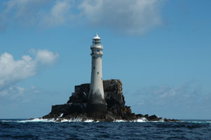
| IR 48 |
Fastnet
Essentially inaccessible, unless you're in a sailboat where it's used as a turning point.
Boat trips can be taken from Schull with Kieran Molloy of Cape Clear Ferries. Or you can go to Baltimore and take the ferry to Cape Clear Island. (A 5702) ARLHS # IRE-034
Photo courtesy Gary Coady [Flickr] |
|
| IR 49 |
| Copper Point
This is a historic day beacon to which a light has now been added, it is not considered to be a lighthouse since it has no interior spaces. Located at the eastern tip of Long Island marking the entrance to Schull from Roaringwater Bay.
From Bantry, take the R586 south. About 8 km from the town center, turn right towards Ballydehob. In the village, turn right towards Schull. From Schull, take the coast road and after 1.5 km, Long Island will come into view. Binoculars or a telephoto lens will allow you to see the light well. (A 5703) ARLHS # IRE-019
Photo courtesy John Eagle [IrishLights] |
| IR 49B |
Barrack Point
On Sherkin Island
Take the ferry from Baltimore pier to Sherkin Island. On the Island, it's a walk of 1.5-3 km up the hill (then turn left) (A 5705)
Photo courtesy John Eagle Photography [ListOfLights] |
|
| IR 50 |
| Galley Head
latitude 51° 31' 47.3" N longitude 8° 57' 8.9" W
On the Dun Dide headland overlooking St. George's Channel. It's a 20 minute drive south of Clonakilty. You can book these properties. book
From Skibbereen, drive east to Rosscarbery. Passing the town on your left, head across the new road spanning the inlet. About 3 km later, turn right for Castlefreke, the look for signs to Galley Head. (A 5708) ARLHS # IRE-035
Photo courtesy Ronán Conroy [Flickr] |
| IR 51 |
Old Head Kinsale
latitude 51° 36' 17.2" N longitude 8° 32' 0.7" W
Lispatrick, Ireland, Currently access is not possible because of a Golf Course on the walk.
From Kinsale, drive south. The road will take you over the river and about 3 km later, there is a sign pointing to the Old Head. Follow the road to a large tower and some gates. Shortly before the gates you should be able to see the lighthouse. (A 5710) ARLHS # IRE-055
Photo courtesy Joshua M. Dragotta [Flickr] |
|
| IR 52 |
| Charles Fort (a.k.a. Kinsale Light)
latitude 51° 41' 44.8" N longitude 8° 29' 57.6" W
The lighthouse is built on one of the ramparts of Charles Fort, a star-shaped late 17th century fort. fort
From Kinsale, follow directions to Charles Fort. This takes you up and around the harbor where the road is often narrow. You will need to pay and admissions fee to the fort, but it is a good investment. (A 5712) ARLHS # IRE-016
Photo courtesy John Eagle [IrishLights] |
| IR 53 |
Roche's Point
latitude 51° 47' 34.7" N longitude 8° 15' 16.3" W
June 6, 2005
This is the point of the harbor leaving Cork (and you can still see downtown from the back of the boat). That implies to me you could get here by surface, but I haven't done so. (A 5718) ARLHS # IRE-061 |
|
| IR 53A |
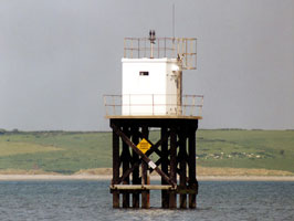
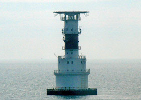
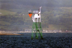
| Spitbank (Port of Cork)
latitude 51° 50' 42.8" N longitude 8° 16' 26.3" W
June 6, 2005
This screwpile light was hard for me to identify until John Eagle recognized it and gave me the correct name. Very unusual structure for a UK light (quite typical in the Chesapeak bay.) Located at the end of a long mud bar in Cork Harbour south of Cobh, marking a sharp turn in the main ship channel. (A 5736) ARLHS # IRE-078 |
| IR 54 |
BallyCotton
latitude 51° 49' 30.2" N longitude 7° 59' 4" W
Located on a small, steep-sided island just off Ballycotton Head at the southern entrance to Ballycotton Bay. Accessible only by boat. (A 5774) ARLHS # IRE-007
Photo courtesy bigeoino [Flickr] |
|
| IR 55 |
| Youghal
latitude 51° 56' 5" N longitude 7° 50' 5" W
The present lighthouse was first lit on February 1st, 1852, converted to acetylene in 1939 and electricity in 1964. The lighthouse is built on the site of a much older lighthouse once operated by the nuns of a St. Anne's Convent from 1190 until dissolved in 1542.
Driving west from Dungarvan into Youghal, you will see the lighthouse on your left in the distance up the bay. Turn left of the roundabout and drive through town and you will see this light beside the road.
(A 5776) ARLHS # IRE-080
Photo courtesy Maj Adev [Flickr] |
| IR 56 |
Mine Head
Between Dungarvan and Ardmore, southeast coast of Ireland.
From Youghal, head east towards Dungarvan on N25 for 13 km. You will pass Grange Church on your right, then you will see Flemings pub at the junction of N25 and D53. Turn right here and continue until you come to a church and a school on your left. Continue about 1 km after John Paul's bar until you see a new factory on your left. Take the second road to your left. This is private property, but leads to the light. (A 5778) ARLHS # IRE-052
Photo courtesy © John Eagle Photography [copies are available for purchase] |
|
| IR 57 |
| Ballinacourty Point
Dungarvan Harbour, south coast of Ireland
Heading east from Dungarvan, follow signs for the Gold Coast Hotel. After the hotel, the road takes a sharp left, then at the next T, take a right. The light is about 1/2 mile down that road on the right. (A 5782) ARLHS # IRE-006
Photo courtesy © John Eagle Photography [copies are available for purchase] |
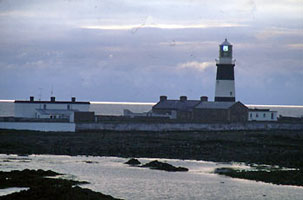
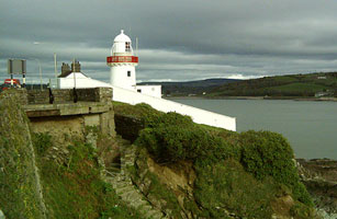
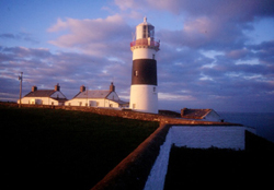
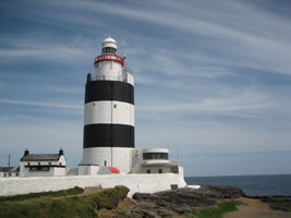
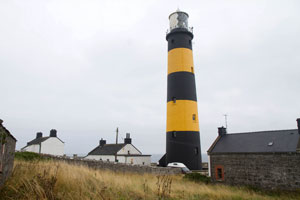
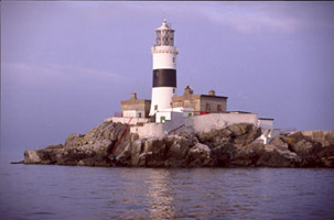
| IR 58 |
Hook Head
latitude 52° 7' 25.7" N longitude 6° 55' 45.1" W
One of the oldest working lighthouses in the world, on the County Wexford coastline.
The Lighthouse is situated on R734, 50 km from Wexford, 29 km from Waterford via the Passage East Car Ferry and 38km from New Ross. (A 5798) ARLHS # IRE-038
Photo courtesy Lawrence Hourahane [Flickr] |
|
| IR 59 |
| Dunmore East
latitude 52° 8' 55.6" N longitude 6° 59' 21.3" W
On pier in Dunmore East, western entrance to Waterford Harbour, County Waterford. (A 5800) ARLHS # IRE-029
Photo courtesy doxella [Flickr] |
| IR 60 |
Tuskar Rock
The first or last (depending on which way your are going) thing you see in the vicinity of Rosslare Harbour. (A 5838) ARLHS # IRE-076
Photo courtesy Lawrence Hourahane [Flickr] |
|
| IR 60R |
| Rosslare
latitude 52° 15' 25.6" N longitude 6° 20' 17" W
Drive south from Wexford following signs to Rosslare. The best view is from one of the ferries as the light is right at the end of the pier. (A 5842)
Photo courtesy John Eagle Photography [ListOfLights] |
| IR 61 |
Wicklow Pier
latitude 52° 58' 58.2" N longitude 6° 2' 1.1" W
In Wicklow Ireland. You can book a room.
Next to the old light. (A 5850) ARLHS # IRE-113
Photo courtesy squaregraph [Flickr] |
|
| IR 61A |
| Wicklow Head
This is the original light on the "head".
Drive south from Wicklow on the Brittas Road for 1-2 km and you will see the light on the left. ARLHS # IRE-084
Photo courtesy Davida3 [Flickr] |
| IR 62 |
Kish
A long way from shore, outside Dublin bay
The best way to see this light is to take the ferry from Dublin or Dun Laoghaire to Wales, as both go right past it. (A 5865) ARLHS # IRE-048
Photo courtesy Steiner62 [Flickr] |
|
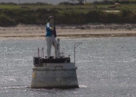
| IR 63A |
Dublin Channel Divider (N Quay Extension)
latitude 53° 20' 44.7" N longitude 6° 13' 0.2" W
June 7, 2005
This light is well buried inside the harbor. It sticks in my mind especially because our ship, which was small, had to back around this divider in order to turn around. (A 5894) |
|
| IR 63B |
| Cardy Rocks
latitude 53° 20' 41.5" N longitude 6° 10' 36" W
June 7, 2005
As our ship left Dublin, this light was on the port (thus north) side. The geography matches this light on the CIL list of Navigation Aids. (A 5886) |
| IR 63C |
Poolbeg (Dublin Harbor)
latitude 53° 20' 31.6" N longitude 6° 9' 5.5" W
June 7, 2005
This is the last pier we saw leaving Dublin harbor. It's on the starboard (thus south) side of the boat. (A 5882) ARLHS # IRE-057 |
|
| IR 63D |
| Dublin North Pierhead (North Bull Wall)
latitude 53° 20' 41.6" N longitude 6° 8' 59.6" W
June 7, 2005
I've labeled this a "Pierhead" because geographically located opposite the light above. Looking at the photo, I don't believe there's any pier under that water. (A 5884) |
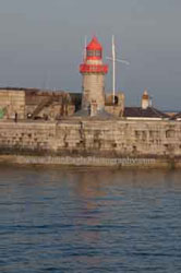
| IR 64 |
Dun Laoghaire east
latitude 53° 18' 8.4" N longitude 6° 7' 37" W
Dún Laoghaire, formerly called Kingstown, is a port at the south entrance to Dublin Bay; it is also the headquarters of the Commissioners of Irish Lights. Lighthouse located at the end of the east pier, a large stone structure. (A 5872) ARLHS # IRE-026
Photo courtesy John Eagle [East tour] |
|
| IR 65 |
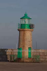
| Dun Laoghaire west
latitude 53° 18' 11.3" N longitude 6° 7' 51.1" W
Lighthouse located at the end of the west pier, a large stone structure.
Take the DART from Dublin heading south and exit at Dun Laogharie. Follow directions to the harbor. (A 5874) ARLHS # IRE-027
Photo courtesy John Eagle [East tour] |
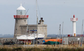
| IR 66 |
Baily
latitude 53° 21' 41.4" N longitude 6° 3' 9.4" W
August 24, 2013
SE tip of Howth Head
As with Howth, take the DART. On leaving the station, turn right and go up the hill. The way to the light is off to the left on one of the smaller roads. (A 5898) ARLHS # IRE-040 |
|
| IR 67 |
| Howth Harbor (1818)
latitude 53° 23' 36.3" N longitude 6° 4' 0.3" W
August 24, 2013
Located at the eastern entrance to Howth Harbour, which is accessible by a bridge from the foot of Watermill Road, Dublin.
Take the DART from Dublin heading north to Howth station. ARLHS # IRE-126 |
| IR 67N |
Howth Harbor (1982)
latitude 53° 23' 38.8" N longitude 6° 4' 0.8" W
This tower qualifies minimally as a lighthouse, since access to the gallery and light is by an interior ladder. Located near the old lighthouse. (A 5900) ARLHS # IRE-039
Photo courtesy Alex Trabas [listOfLights] |
|
| IR 68 |
| Rockabill
latitude 53° 35' 49.1" N longitude 6° 14.5" W
August 24, 2013
5 miles off shore of Skerries (A 5904) ARLHS # IRE-062 |
| IR 68B |
Balbriggan
latitude 53° 36' 46.5" N longitude 6° 10' 42.7" W
August 23, 2013
A white tower at the entrance to the harbor of Balbriggan. It was built in 1769 and retired in 1960.
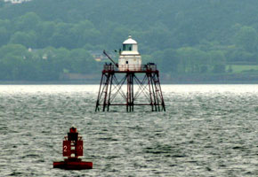
Drive north from Dublin and take the coast road through Rush, then Skerries and the next town is Balbriggan. (A 5908) |
|
| IR 69 |
| Dundalk
One of only three pile lighthouses still in service in the British Isles, Spit Bank Light at Cork being one of the others. Located at the entrance to Dundalk Harbour from Dundalk Bay. Accessible only by boat. spitbank (A 5920) ARLHS # IRE-094
Photo courtesy Alex Trabas [listOfLights] |
| IR 70 |
Haulbowline
latitude 54° 1' 11.6" N longitude 6° 4' 44.4" W
Entrance to Carlingford Lough, County Louth, Northern Ireland.
From Dublin, drive north to Dundalk. North of Dundalk, take the exit signed for Carlingford. Follow the signs through a double roundabout, then stay on the main road until you reach Greenore. Bring your binoculars. (A 5928) ARLHS # IRE-128
Photo courtesy © John Eagle Photography [copies are available for purchase] |
|
| IR 71 |
| Vidal Bank (front)
latitude 54° 1' 47.5" N longitude 6° 5' 25.5" W
With Green Island, a set of lights leading in to Carlingford (A 5932)
Photo courtesy Alex Trabas [ListOfLights] |
| IR 72 |
Green Island (rear)
latitude 54° 1' 57.4" N longitude 6° 5' 44.8" W (A 5934)
Photo courtesy Alex Trabas [ListOfLights] |
|
| IR 72G |
| Greenore
A harbor light established in 1830.
From Dublin, drive north to Dundalk, then take the exit signed for Carlingford. Follow the signs through a double roundabout then stay on the main road till you reach Greenore.
Photo courtesy National Library of Ireland [Flickr] |
| IR 73 |
St. John's (County Down)
latitude 54° 13' 33.9" N longitude 5° 39' 32.7" W
August 24, 2013
Entrance to Dundrum Bay, County Down
From Belfast, take A24 south to Carryduff then A7 to Downpatrick, finally B176 to Killough. (A 5958) ARLHS # IRE-096 |
|
| IR 74 |
| Angus Rock
latitude 54° 19' 49.7" N longitude 5° 31' 30.6" W
This tower clearly was built as a daymark, probably in the nineteenth century. Located on a low rocky islet off The Narrows, the entrance to Strangford Lough, southeast of Strangford. Accessible only by boat. (A 5963.3)
Photo courtesy Alex Trabas [listOfLights] |
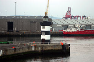
| IR 74D |
Ardglass
latitude 54° 15' 46.7" N longitude 5° 36' 20.4" W
August 23, 2013
This is a little village with a little light. I suspect if they didn't have a nice Cafe, we wouldn't have stopped here. |
|
| IR 75 |
| Donaghadee
latitude 54° 38' 41.1" N longitude 5° 31' 49.5" W
August 23, 2013
Located at the end of the South Pier at Donaghadee, 15 km east of Bangor.
Head east from Belfast on A20, then take A48 from Newtownards. (A 5974) |
| IR 76 |
Mew Island
Mew Island is a small island about 10 km north of Donaghadee. Accessible only by boat.
There are boat trips from Donaghadee's harbor to the Copeland Islands, of which Mew is one. (A 5976)
Photo courtesy aqua invader [Webshots] |
|
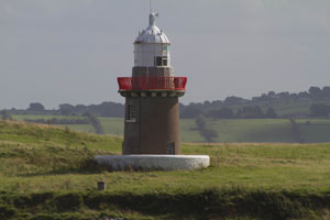
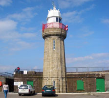
| IR 77 |
| Black Head Antrim
latitude 54° 46' 1.2" N longitude 5° 41' 20.4" W
August 21, 2013
On the North Shore of Belfast Lough. You can book these properties through the Irish Landmark Trust.
From Belfast, take A2 north to Whitehead. (A 6028) ARLHS # IRE-009 |
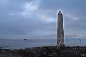
| IR 78 |
Chaine Tower
latitude 54° 51' 16.2" N longitude 5° 47' 52.8" W
August 21, 2013
West entrance to Larne Lough, County Antrim (A 6031) |
|
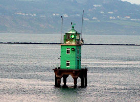
| IR 78F |
| Ferris Point
latitude 54° 51' 4.9" N longitude 5° 47' 23.7" W
August 21, 2013
Directly across the river from Chaine Tower |
| IR 79 |
Maidens Rock
East end of the Maidens Island group, northeast of Larne, County Antrim, Northern Ireland.
The best view can be hand from the Larne to Stranraer ferry, so if you are going to Scotland, look for it.
Photo courtesy © John Eagle Photography [copies are available for purchase] |
|
|
|