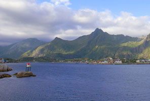
Southern Nordland (Brønnøysund Area)
Map is N
| NO 1271 |
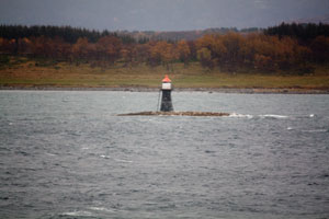
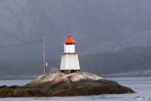
Melsteinen
latitude 65° 11' 15" N longitude 11° 50' 59.4" E |
Northeast side of Melsteinfjord (L 1990) [569000] |
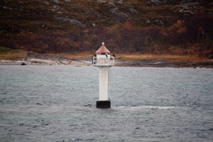
| NO 1272 |
Helgelandsflesa
latitude 65° 12' 59.9" N longitude 11° 53' 11.1" E |
West of Kvaløya (L 1992) [569500] |
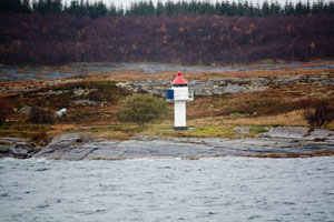
| NO 1273 |
Gimlingen
latitude 65° 12' 3.6" N longitude 11° 56' 37.8" E |
Southwest of Kvaløya, west side of Gimlingen (L 1994) [569800] |
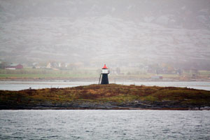
| NO 1274 |
Vennesund Søre
latitude 65° 12' 24" N longitude 12° 2' 19.2" E |
East of Kvaløya (L 1996) [569900] |
| NO 1275 |
Hombornes
latitude 65° 19' 50.4" N longitude 12° 21' 46.8" E |
North of Ursholmen (L 2003) [570800] |
| NO 1276 |
Gaupgavlen
latitude 65° 13' 46.2" N longitude 12° 15' 7.8" E |
Southwest near Gaupa (L 2002) [571000] |
| NO 1277 |
Sandvikholmen
latitude 65° 3' 30.7" N longitude 12° 13' 0.1" E |
Sørfjord on the northern tip of an island in a narrow passage of the Bindalsfjord. (L 2006) [572500] |
| NO 1278 |
Liholmen
latitude 65° 7' 56.4" N longitude 12° 18' 3.6" E |
On the west point. (L 2004) [572000] |
| NO 1279 |
Krabskjær
latitude 65° 17' 3.9" N longitude 11° 40' 28.3" E |
Grimsafjorden (L 1988) [568500] |
| NO 1280 |
Lyngværgalten
latitude 65° 16' 19.1" N longitude 12° 2' 34.8" E |
Lyngværfjord at Tørrfallet. (L 2016) [574100] |
| NO 1281 |
Hellbergsøya
latitude 65° 20' 45.6" N longitude 12° 1' 33.6" E |
South of Torgværet (L 2020) [576000] |
| NO 1282 |
Klubholmen
latitude 65° 22' 10.8" N longitude 11° 57' 36" E |
Located on the south side of the entrance to the Brønnøysund. (L 2022) [577000] |
| NO 1283 |
Blåbakflua
latitude 65° 24' 21.6" N longitude 11° 57' 43.2" E |
Southwest Torget (L 2024) [577800] |
| NO 1284 |
Fleina
latitude 65° 24' 10.7" N longitude 11° 59' 1.3" E |
East near Kvittingan (L 2025) [577000] |
| NO 1285 |
Lyran
latitude 65° 20' 9.3" N longitude 11° 48' 31.7" E |
West of Torget. (L 2040) [582500] |
| NO 1286 |
Sømnes (Jarholmen)
latitude 65° 22' 19.3" N longitude 12° 10' 17.7" E
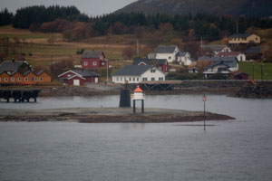
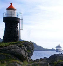
Sømnes is a very small island in the entrance to Berg harbor from the Brønnøysund, the island is accessible by bridge. Located on the southern tip of the island. (L 2044) [584500]
Photo courtesy Elisabeth Spaans Mork [Flickr] |
|
| NO 1287 |
Uttorgflesa
latitude 65° 26' 13.3" N longitude 11° 56' 44.4" E |
Located on a low reef about 3.5 km north of the Blåbakflu light. (L 2027) [578500] ARLHS # NOR-263 |
| NO 1288 |
Stokkholmen
latitude 65° 26' 24" N longitude 12° 9' 37.8" E |
East of Torget. (L 2046) [585000] |
| NO 1289 |
Toftøya
latitude 65° 26' 54.4" N longitude 12° 6' 5.8" E |
Toftsundet (L 2028) [579000] |
| NO 1290 |
Arnlangøya
latitude 65° 28' 29.3" N longitude 12° 3' 18.4" E |
West of Toft (L 2031) [580000] |
| NO 1291 |
Bjørntuva
latitude 65° 28' 49.7" N longitude 12° 9' 9.3" E |
Toftsundet, northwest point of Torget (L 2029) [579300] ARLHS # NOR-263 |
| NO 1292 |
Trollholmen
latitude 65° 29' 40.8" N longitude 12° 5' 22.8" E |
Southwest end of Vegafjorden (L 2030) [579500] |
| NO 1293 |
Hestøyodden
latitude 65° 28' 39.2" N longitude 12° 12' 41.7" E
October 13, 2010
Located just off the northern tip of Nordøya, marking the entrance to the harbor of the town of Brønnøysund. (L 2064) [588200] |
|
| NO 1294 |
Værholmen
latitude 65° 28' 52.2" N longitude 12° 12' 46.3" E |
North of the center. photo (L 2070) [588701] |
| NO 1295 |
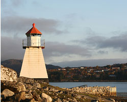
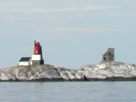
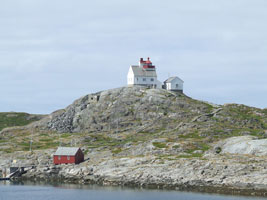
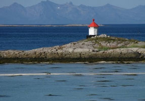
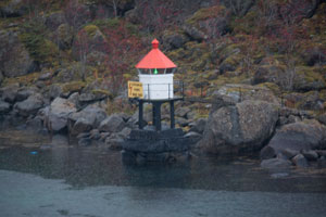
Prestøyan (1862) (Østre Prestøy, Brønnøysund)
latitude 65° 29' 15" N longitude 12° 12' 11.6" E
October 13, 2010
This lighthouse was built on the island of Buholmen near Brønnøysund, then moved to Østre Prestøy in 1896. In the front is the 1935 light (see below). [588701] ARLHS # NOR-062 |
|
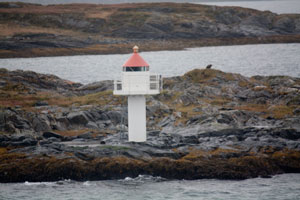
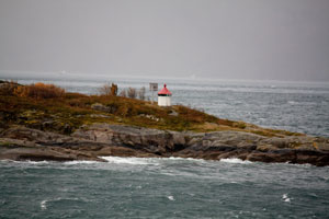
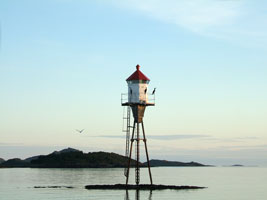
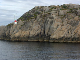
| NO 1296 |
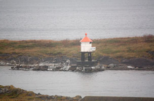
| Prestøyan (1935)
latitude 65° 29' 12.9" N longitude 12° 11' 13.1" E
Located on a small island about 1 km northwest of the town of Brønnøysund. (L 2074) [589100]
Photo courtesy 10/13/2010 |
| NO 1297 |
Strømøyan
latitude 65° 33' 13.4" N longitude 12° 13' 47.7" E |
Ytre Strømøy's south Point (L 2078) [589500] |
| NO 1298 |
Ylvingen
latitude 65° 36' 13.5" N longitude 12° 9' 14.7" E |
Vegafjorden southeast side. (L 2036) [581100] |
| NO 1299 |
Rotvikodden
latitude 65° 37' 27.7" N longitude 12° 7' 53.2" E |
Ylvingens west side (L 2037) [581200] |
| NO 1300 |
Manndauden
latitude 65° 34' 58.7" N longitude 12° 19' 13.7" E |
Inlet to Velfjorden. The light should be visible from the highway 17 ferry from Anddalsvåg to Horn. (L 2080) [589700] |
| NO 1301 |
Nevernes
latitude 65° 26' 34.2" N longitude 12° 34' 32.4" E |
Heggefjorden. On a point north and a bit west of the city of Nevernes. (L 2084) [589900] |
| NO 1302 |
Bindalsflesa
latitude 65° 14' 44.6" N longitude 11° 30' 21.1" E |
North of Horta (L 1987) [568000] |
| NO 1303 |
Storbraken |
South side of Brakdjupet. (L 2041) [583000] |
| NO 1304 |
Ertnbraken
latitude 65° 26' 22.4" N longitude 11° 41' 36.4" E |
North side of Brakdjupet. Located on the highest of a group of dangerous skerries about 15 km west of Torgnes. (L 2042) [583500] |
| NO 1305 |
Kversteinen
latitude 65° 29' 33.9" N longitude 11° 40' 13.9" E |
Burøy south side of Kversteinfjorden. (L 2039) [582000] |
| NO 1306 |
Muddværet
latitude 65° 34' 38" N longitude 11° 40' 45" E |
At south Leikua (L 2116) [602000] |
| NO 1307 |
Høgøy
latitude 65° 45' 3.6" N longitude 11° 44' 50.4" E |
At Høgøyskjærslua; Hysvær. (L 2118) [602500] |
| NO 1308 |
Runden (Hysvær)
latitude 65° 44' 10.3" N longitude 11° 48' 5.7" E |
Hysvær is a large group of small islands off the northwestern corner of Vega; many of the islands have summer cottages. Located on a skerry at the southeastern corner of the Hysvær group (L 2120) [603000] |
| NO 1309 |
Sundsvoll
latitude 65° 41' 41.4" N longitude 11° 47' 29.6" E |
Bremstein on Vega west side (at the west inlet) (L 2122) [603500] |
| NO 1310 |
Båtvikholmen
latitude 65° 37' 25" N longitude 11° 45' 4.5" E |
North Point (L 2126) [604000] |
| NO 1311 |
Håbranden
latitude 65° 36' 14.6" N longitude 11° 46' 0.3" E |
Southwest side of Vega. (L 2128) [604100] |
| NO 1312 |
Bukkholmskjær
latitude 65° 35' 4.2" N longitude 11° 55' 21" E |
West Dypingen, Vega south side (L 2130) [605000] |
| NO 1313 |
Klabben
latitude 65° 34' 6.9" N longitude 11° 59' 45" E |
Vegafjorden (L 2132) [605200] |
| NO 1314 |
Rørøy
latitude 65° 38' 39.2" N longitude 12° 2' 16.4" E |
At Leikua (L 2136) [606000] |
| NO 1315 |
Borgskjær (Igerøya)
latitude 65° 40' 27.8" N longitude 12° 8' 34" E |
East Vega (L 2138) [606550] |
| NO 1316 |
Torsøy
latitude 65° 41' 46.8" N longitude 12° 3' 56.4" E |
North Vega (L 2139) [607000] |
| NO 1317 |
Brokskjær
latitude 65° 43' 14.4" N longitude 12° 5' 6" E |
Northwest of Igerøy, Vega (L 2139.2) [607200] |
| NO 1318 |
Durmålskjæret |
North Vega
All Bing shows is lots of clouds. (L 2139.4) [607400] |
| NO 1319 |
Sandøykråka
latitude 65° 43' 20.4" N longitude 11° 56' 19.2" E |
North Vega (L 2139.6) [607610] |
Sandnessjøen Area
Map is N1
| NO 1321 |
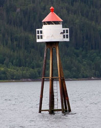
Skjelva (1952)
latitude 65° 43' 17.5" N longitude 12° 18' 23.6" E |
The new light is a 41' iron tripod with a lantern on the top. photo (L 2142) [608000] |
| NO 1322 |
Snertholmen
latitude 65° 43' 18.6" N longitude 12° 27' 51.6" E |
Vevelstadsundet (L 2411) [609000] |
| NO 1323 |
Aunholmen
latitude 65° 42' 2.4" N longitude 12° 37' 25.2" E |
Visten (L 2145) [609500] |
| NO 1324 |
Visten
latitude 65° 39' 3" N longitude 12° 38' 32.4" E |
Visten (L 2146) [609600] |
| NO 1325 |
Juldagan
latitude 65° 50' 46.2" N longitude 12° 21' 40.2" E
October 13, 2010
West Tjøtta west side (L 2158) [612200] |
|
| NO 1326 |
| Rosøygalten
latitude 65° 51' 41.4" N longitude 12° 21' 58.5" E
October 13, 2010
South of Alstadhaug (L 2160) [612400] |
| NO 1327 |
Sørøyholmen Søre
latitude 65° 55' 1.1" N longitude 12° 22' 11.5" E
October 13, 2010
West of Søvika (L 2166) [613100] |
|
| NO 1328 |
| Søvik
latitude 65° 56' 32.4" N longitude 12° 25' 59.6" E
October 13, 2010
At Vikholmen (L 2168) [613500] |
| NO 1329 |
Troholmen Nordre
latitude 65° 48' 8.6" N longitude 12° 31' 2.4" E |
West of Rødøy (L 2149) [610000] |
| NO 1330 |
Pålholmen
latitude 65° 48' 46.4" N longitude 12° 29' 44.3" E |
East of Rødøy, this light is probably visible as the Tjøtta ferry turns south into Forvika. (L 2152) [610500] |
| NO 1331 |
Tjøtta
latitude 65° 48' 46.8" N longitude 12° 26' 33" E |
Langholmens south point, probably visible from the ferry that extends highway 17 from Tjøtta to Forvika. (L 2156) [612000] |
| NO 1332 |
Storskjær
latitude 65° 50' 46.8" N longitude 12° 35' 30.6" E |
North of Rødøy (L 2150) [611000] |
| NO 1333 |
Aspviksundet
latitude 65° 52' 6" N longitude 12° 38' 4.2" E |
North of Rødøy (L 2151) [611300] |
| NO 1334 |
Skjelfiskholmen
latitude 66° 53.4" N longitude 12° 23' 49.2" E |
Southeast of Dønna (L 2171) [614000] |
| NO 1335 |
Åkvikskjær
latitude 65° 59' 3.1" N longitude 12° 51' 35.2" E |
East of Sandnessjøen and off the south coast of Sundøy. (L 2188) [616900] |
| NO 1336 |
Sørnesskjæret
Located on a rocky point at the junction of the Vefsnfjord and the Sørfjord, about 15 km northwest of Vefsn. (L 2190) [617100]
Photo courtesy Per Atle Eliassen [Flickr] |
|
| NO 1337 |
| Alterneset
Located in the Vefsnfjord about 8 km northwest of Mosjøen, it should be visible from the Mosjøen-Vikdal ferry. (L 2192) [617300]
Photo courtesy Per Atle Eliassen [Flickr] |
| NO 1338 |
Trollholmgrunnen
latitude 65° 46' 58.7" N longitude 12° 9' 44.5" E |
Lisøyråsa (L 2271) [640000] |
| NO 1339 |
Skålvær
latitude 65° 51' 29.1" N longitude 12° 10' 50.4" E
Located on an island about 6 km southwest of Stranda. (L 2271.3) [640500]
Photo courtesy Per Atle Eliassen [Flickr] |
|
| NO 1340 |
Langneset
latitude 65° 52' 33.3" N longitude 12° 15' 0.4" E |
East Blomsøya. (L 2273) [642000] |
| NO 1341 |
Springen
latitude 65° 54' 42" N longitude 12° 12' 15.2" E |
West of Altra photo (L 2274.6) [643000] |
| NO 1342 |
Dragan
latitude 65° 55' 40.7" N longitude 12° 10' 15.9" E |
West of Altra (L 2275.3) [643700] |
| NO 1343 |
Trettholmen
latitude 65° 55' 56.4" N longitude 12° 11' 17.4" E |
South of Herøya. (L 2275) [643500] |
| NO 1344 |
Buøy
latitude 65° 55' 48.6" N longitude 12° 18' 16.8" E |
East of Altra. (L 2274) [642500] |
| NO 1345 |
Geithammeren
latitude 65° 57' 0.2" N longitude 12° 13' 7.8" E |
Located on the northwestern coast of the island of Tenna. photo (L 2278) [645000] |
| NO 1346 |
Herøysund
latitude 65° 57' 43.8" N longitude 12° 18' 3" E |
At inlet to Kirkeflua (L 2170) [613708] |
| NO 1347 |
Geitholmen
latitude 65° 59' 3.5" N longitude 12° 13' 51.3" E |
Located on an islet of the southeast coast of Indre Øksingan, about 800 m southwest of Finnbogen. photo (L 2280) [646000] |
| NO 1348 |
Hoholmen
latitude 66° 34.2" N longitude 12° 17' 10" E |
Off the north coast of Nord Herøy, facing the Dønnesund (L 2280.4) [646200] |
| NO 1349 |
Hestøysund
latitude 66° 17.2" N longitude 12° 15' 54.8" E |
Northwest Herøya on the east side of the Hestøysund opposite Indre Øksingan. (L 2281) [646400] |
| NO 1350 |
Svartoksen |
North side of Sildøyfjorden.
Bing shows a high cloud cover. (L 2281.6) [647000] |
| NO 1351 |
Ytre Øksningan
latitude 66° 47.4" N longitude 12° 13' 18.6" E |
Near Fagernes (L 2281.4) [646600] |
| NO 1352 |
Åkvik
latitude 66° 2' 17.4" N longitude 12° 18' 36.3" E |
Southwest Dønna (L 2282) [647200] |
| NO 1353 |
Bremstein |
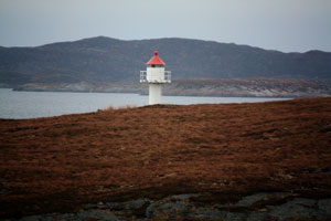
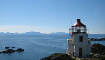
The lighthouse is unique in having two 2° Fresnel lenses, one at 40 m above the sea, the other at 27 m. Located on a small island about 25 km west of Gladstad. Accessible only by boat. photo (L 2098) [600000] ARLHS # NOR-007 |
| NO 1354 |
Bremsteinen (Heimøya) |
Near Heimøya (L 2012) [600100] |
| NO 1355 |
Nordholmen |
North of Bremsteinen photo (L 2104) [600200] |
| NO 1356 |
Brynjulfskaer
latitude 65° 39' 7.8" N longitude 11° 32' 57.7" E |
Northeast of Bremstein (L 2112) [601000] |
| NO 1357 |
Ivarsbraken
latitude 65° 40' 33.8" N longitude 11° 32' 47.9" E |
Northeast of Bremsteinen (L 2114) [601500] |
| NO 1358 |
Bubraken |
Northeast of Bremsteinen (L 2115) [601600] |
| NO 1359 |
Skjærvær
latitude 65° 46' 48.5" N longitude 11° 34' 47.4" E |
On Tennholmen, just north of the Skjærvær harbor. (L 2108) [600500] |
| NO 1360 |
Arenholmen |
South of Lånan (L 2287) [649500] |
| NO 1361 |
Andholmgrunne Nøre (north)
latitude 65° 50' 27" N longitude 11° 47' 40.8" E |
South of Lånan (L 2287.3) [649600] |
| NO 1362 |
Skogsholmen
latitude 65° 49' 26.4" N longitude 12° 2' 38.7" E |
Tåvær - Kilvær's north point. (L 2268.6) [638500] |
| NO 1363 |
Feøynakken
latitude 65° 51' 52.8" N longitude 12° 51.7" E |
Sandvær south end. (L 2291) [651000] |
| NO 1364 |
Kinnarøytaren
latitude 65° 52' 23.4" N longitude 11° 56' 54.2" E |
East of Lånan. (L 2269.6) [639200] |
| NO 1365 |
Sandværoddtaren
latitude 65° 54' 49.2" N longitude 12° 1' 25.2" E |
Sandvær (L 2300) [652500] |
| NO 1366 |
Ytre Flesan
latitude 65° 57' 37.3" N longitude 11° 53' 13.4" E |
North of Sandskjær (L 2310) [653000] |
| NO 1367 |
Steinan |
Located on a small island about 8 km west of Dønna. photo (L 2310) [653500] |
| NO 1368 |
Ytterholmen |
Located on a small island about 20 km northwest of Gladstad. Accessible only by boat. fyr photo (L 2316) [654500] ARLHS # NOR-282 |
| NO 1369 |
Innerholmen |
Northwest of Ytterholmen light (see next light). (L 2314) [654000] |
| NO 1370 |
Storflesan
latitude 66° 1' 45" N longitude 11° 57' 37.2" E |
South of Gåsvær (L 2323) [655400] |
| NO 1371 |
Gåsvær
latitude 66° 3' 52.6" N longitude 12° 2' 45.2" E |
Gåsvær is a former fishing village, abandoned in 1990; the area is now the location of many summer cottages. Located on a small island at the beginning of the northeastern approach to Gåsvær. (L 2320) [655000] |
| NO 1372 |
Djupbåen
latitude 66° 5' 5.4" N longitude 12° 2' 54.2" E |
North of Gåsvær (L 2323.4) [655600] |
| NO 1373 |
Djupsøy
latitude 66° 7' 18" N longitude 12° 3' 54.6" E |
North of Gåsvær (L 2324) [656000] |
| NO 1374 |
Stokskjær
latitude 66° 7' 30" N longitude 12° 54" E |
North of Gåsvær (L 2326) [656100] |
| NO 1375 |
Skarholmen
latitude 66° 7' 18" N longitude 11° 56' 59.7" E |
Northwest Gåsvær (L 2328) [656500] |
| NO 1376 |
Purkskjæret
latitude 66° 8' 14.3" N longitude 11° 58' 17.5" E |
Northwest Gåsvær, near the northwest edge of the Sandsundvær group. (L 2330) [656600] |
Sandnessjøen Area
Map is N1
| NO 1379 |
Sandnessjøen
latitude 66° 1' 30.5" N longitude 12° 38' 17" E
October 13, 2010
On the mole head (end of the "oil" dock) at Ytterst. Located at the tip of the island, near Alstahaug. (L 2178) [615100] |
|
| NO 1380 |
Løvøysund |
Store Løvøy northeast point (L 2174) [614500] |
| NO 1381 |
Jægtholmen |
Located on a skerry off the south coast of Dønna, in the narrow channel between Dønna and Skorpa. (L 2175) [614600] |
| NO 1382 |
Furuneset
latitude 66° 2' 27" N longitude 12° 55' 22.2" E |
East of Sandnessjøen (L 2184) [616500] |
| NO 1383 |
Helgelandsbrua |
Near Brukar, it's just under the highway 17 bridge north of Sandnessjøen. (L 2181) [615500] |
| NO 1384 |
Argarsnes
latitude 66° 4' N longitude 12° 40' 30" E |
North of Sandnessjøen (L 2214) [618300] |
| NO 1385 |
Åsvaer (1876)
latitude 66° 4' N longitude 12° 1' 48" E |
The lighthouse was abandoned after being heavily damaged in a storm in 1917. Located about 100 m from the active lighthouse. photo [657300] ARLHS # NOR-425 |
| NO 1386 |
Åsvaer (1917)
latitude 66° 15' 53.9" N longitude 12° 17' 47.2" E
Located on a small island about 6 km southwest of Lovund and 15 km northwest of Solfjellsjøen on the island of Dønna. Accessible only by boat. (L 2338) [657300] ARLHS # NOR-290
Photo courtesy knut [wikipedia] |
|
| NO 1387 |
Buøyskjær
latitude 66° 6' 48.2" N longitude 12° 22' 44.9" E |
Vikafjord, a deep sound on the west coast of Dønna. (L 2283) [647600] |
| NO 1388 |
Buøya (Sandholmbuøya)
latitude 66° 10' 45.1" N longitude 12° 21' 41.7" E |
Off the harbor of Vandve. (L 2283.4) [647800] |
| NO 1389 |
Åkervågen
latitude 66° 9' 51.1" N longitude 12° 32' 47.6" E |
Vågens' south side. (L 2284) [648000] |
| NO 1390 |
Rensøysundet
latitude 66° 11' 42.6" N longitude 12° 26' 3" E |
North of Rølvåg (L 2284.4) [648400] |
| NO 1390R |
Rølvag (Purkholmen) |
Located on a promontory on the northwest side of Dønna, about 5 km west of Dønnes. photo (L 2284.2) [648200] |
| NO 1391 |
Sørøyvågen
latitude 66° 12' 42.3" N longitude 12° 33' 5.4" E |
Nordskreiingens north side (L 2286) [649000] |
| NO 1392 |
Engelsholmen |
West in Dønna on the northeast point (L 2250) [627200] |
| NO 1394 |
Hovsvåg
latitude 66° 10' 7.6" N longitude 12° 40' 28.7" E |
On Tarholmen; Skibfjord (L 2248) [627000] |
| NO 1395 |
Langneset
latitude 66° 8' 59.7" N longitude 12° 48' 9.2" E |
Løkta north point (L 2216) [619000] |
| NO 1396 |
Feøy
latitude 66° 9' 59.4" N longitude 12° 56' 48.1" E
October 13, 2010
On an island southeast from Ytterhus. (L 2218) [619500] |
|
| NO 1397 |
Gjessnakken
latitude 66° 12' 58.2" N longitude 12° 7' 41.4" E |
At the top of Åsvær (L 2334) [657000] |
| NO 1398 |
Lassan |
Grunnens northeast side (L 2336) [657100] |
| NO 1399 |
Slyngen |
North of the Åsvaer light. (L 2340) [657500] |
| NO 1400 |
Bardalsøy
latitude 66° 13' 56.9" N longitude 13° 20' 29" E |
Rana north side. (L 2222) [620200] |
| NO 1401 |
Sandnes
latitude 66° 14' 31" N longitude 13° 31' 22.1" E |
Located on a headland at the northern end of the Leirfjord township. (L 2223) [620800] |
| NO 1402 |
Haukneset
latitude 66° 17' 21.4" N longitude 14° 2' 40.6" E
About 10 km west of Mo i Rana. It's on a point northwest of E6 north of Hauknes. (L 2226) [622000]
Photo courtesy J.Lien [Flickr] |
|
| NO 1403 |
Straumholmen |
Northeast Hemnesberget (L 2225) [621500] |
| NO 1404 |
Sauragrunnen
latitude 66° 13' 13.4" N longitude 13° 54.1" E |
In the lillesjona fjord about 2.5 km north of Nesna. photo (L 2234.4) [622900] |
| NO 1405 |
Handnesholmen
latitude 66° 13' 24.4" N longitude 12° 53' 41" E
November 13, 2010
Southwest Handnesøy (L 2236) [624000] |
|
| NO 1406 |
Vågholmen |
Åsværfjord (L 2253) [631500] |
| NO 1407 |
Lommøyodden
latitude 66° 18' 55.2" N longitude 12° 47' 49.2" E |
In Tom Fjorden (L 2251.7) [630500] |
| NO 1408 |
Lille Mangvarden
latitude 66° 19' 51.4" N longitude 12° 40' 13.2" E |
At Fangholmen (L 2252) [631200] |
| NO 1409 |
Finneidfjord |
East of Hemnesberget. [621700] |
| NO 1410 |
Nordfjordholmen
latitude 66° 20' 25.8" N longitude 13° 26' 29.4" E |
Sjona. At the point of holmen. (L 2238) [623500] |
| NO 1411 |
Kleivholmen
latitude 66° 21' 13.2" N longitude 12° 58' 58.2" E |
Aldersundet west point (L 2240) [625500] |
Lovund Area
| NO 1413 |
Eggeløysa
latitude 66° 23' 44.2" N longitude 12° 45' 22.5" E |
Northeast Solvær (L 2258) [634500] |
| NO 1414 |
Lurøy
latitude 66° 24' 44.1" N longitude 12° 47' 31.3" E |
At Leiskjær (L 2260) [635000] |
| NO 1415 |
Hagenholmen
latitude 66° 26' 5.8" N longitude 12° 49' 28.1" E |
West Lurøy (L 2262) [636000] |
| NO 1416 |
Sørvær |
West of Lurøy (L 2264) [636500] |
| NO 1417 |
Brimhoman
latitude 66° 22' 12.7" N longitude 12° 39' 9.2" E |
East of Slenese (L 2255.4) [633600] |
| NO 1418 |
Kvartelsøy
latitude 66° 20' 56.8" N longitude 12° 30' 5.4" E |
Northeast of Åsvær lighthouse (L 2254) [632000] |
| NO 1419 |
Bukkholmen |
East of Luvunden (L 2254.5) [633000] |
| NO 1420 |
Naustholmen
latitude 66° 22' 3.8" N longitude 12° 22' 48.2" E |
East of Lovunden (L 2341) [658000] |
| NO 1421 |
Otervær
latitude 66° 22' 19.4" N longitude 12° 25' 34.6" E |
East of Lovunden. Note the light with a duplicate name below. NO 1461 (L 2344) [658800] |
| NO 1422 |
Kvittripskjær |
East of Lovunden (L 2345) [659000] |
| NO 1423 |
Kvalholmen |
Located on a small island about 6 km northeast of Lovund. (L 2346) [659200] |
| NO 1424 |
Træna
latitude 66° 25' 51" N longitude 11° 58' 6.8" E |
Located on a small island about 7 km southwest of Traena. Accessible only by boat. photo (L 2348) [660000] ARLHS # NOR-255 |
| NO 1425 |
Ålvorsneset
latitude 66° 30' 21.6" N longitude 12° 3.3" E |
Sanna west point (L 2356) [661000] |
| NO 1426 |
Røsneset
latitude 66° 29' 29.8" N longitude 12° 1' 41.9" E |
Sanna southwest point (L 2352) [660500] |
| NO 1427 |
Lamholmen
latitude 66° 29' 6.6" N longitude 12° 5' 10.8" E |
South Husøya (L 2350) [660200] |
| NO 1428 |
Ytre Haksholmen |
South of Husøya (L 2360.2) [661700] |
| NO 1429 |
Bergholmen
latitude 66° 30' 11.9" N longitude 12° 8' 13.1" E |
This light guides vessels arriving at Træna harbor. Located on an island about 1.6 km east of the harbor entrance. (L 2360) [662700] |
| NO 1430 |
St. Rauholmen
latitude 66° 31' 48" N longitude 12° 5' 3.6" E |
North of Husøya (L 2359) [661500] |
| NO 1431 |
Ovnholmskjæret
latitude 66° 32' 14.1" N longitude 12° 7' 25.6" E |
About 5 km north of Husøya (L 2358) [661300] |
| NO 1432 |
Dørvær |
Located on an island about 4 km south of Selvær. photo (L 2362) [663500] |
| NO 1433 |
Selvær Søre (south) |
Located on a small island off the entrance to the harbor of Selvær, an island about 13 km north northwest of Lovund. photo (L 2364) [664000] |
| NO 1434 |
Kobbholmen
latitude 66° 35' 34.1" N longitude 12° 12' 40.1" E |
Selvær photo (L 2368) [665000] |
| NO 1435 |
Selvær Nordre (north) |
At Varøykalven (L 2370) [665500] |
| NO 1436 |
Skjærflesa |
Northeast at Trænfjorden (L 2371.4) [666500] |
| NO 1437 |
Kloholmen
latitude 66° 32' 28.2" N longitude 12° 35' 9.9" E |
Nesøy southwest side (L 2372) [666700] |
| NO 1438 |
Oksholmen
latitude 66° 32' 28.2" N longitude 12° 35' 9.9" E |
Nesøy east side (L 2371) [666000] |
| NO 1439 |
Lille Svenningen
latitude 66° 34' 9.5" N longitude 12° 35' 40.7" E |
Nesøy west side (L 2373) [667600] |
| NO 1440 |
Floholmen
latitude 66° 36' 6.3" N longitude 12° 28' 12" E |
Nesøy west side (L 2374) [667700] |
| NO 1441 |
Nesøy |
At Oterholmen (L 2376) [668500] |
| NO 1442 |
Bonnetsjkaer
latitude 66° 29' 23.3" N longitude 12° 59' 3.1" E
October 13, 2010
West in Kvarøy (L 2242) [626200] |
|
| NO 1443 |
| Vikingen
latitude 66° 31' 42.4" N longitude 12° 58' 2.2" E
October 13, 2010
Located at the Arctic Circle, on the island called Viking, about 2 km west northwest of Tonnes. (L 2244) [626400] |
| NO 1444 |
Anklakken |
At Indreskjær on Hestmandøy's south side (L 2265) [637000] |
| NO 1445A |
Store Selsøy (Steinen)
latitude 66° 33' 34.6" N longitude 12° 50' 10.9" E |
Located on the waterfront at Storselsøy, on the north side of Hestmannøy (Hestmona), an island about 7 km west northwest of Tonnes. photo (L 2266) [637100] |
| NO 1445F |
Selsøyflesa |
North of Selsøvær (L 2377) [669000] |
Myken and Støtt Area
| NO 1446 |
Rangsundøy
latitude 66° 34' 16.2" N longitude 13° 3' 58.2" E |
Melfjorden east side (L 2390) [671500] |
| NO 1447 |
Selsøyvik
latitude 66° 34' 36.6" N longitude 12° 58' 44.4" E |
Selsøyvik east side (L 2392) [672000] |
| NO 1448 |
Ørnstolen
latitude 66° 35' 9" N longitude 12° 59' 4.8" E
October 13, 2010
Near Rundholmen (L 2394) [672100] |
|
| NO 1449 |
Kjøbmandskjær
latitude 66° 35' 22.8" N longitude 13° 2' 13.8" E |
North of Rangsundø, on an island in the entrance to the Bergsfjord. (L 2396) [672200] |
| NO 1450 |
Pishammersund
latitude 66° 38' 22.2" N longitude 13° 22.8" E
October 13, 2010
Breisund, on the northwest coast of Gjerdøy. Probably visible as the ferry passes the island. (L 2399) [673800] |
|
| NO 1451 |
Ivarøy
latitude 66° 37' 51" N longitude 13° 15' 55.8" E |
South side of Værangfjorden (L 2400) [674000] |
| NO 1452 |
Sandværken
latitude 66° 39' 13.7" N longitude 13° 5' 49.1" E |
Rødøyfjord Flickr (L 2406) [676000] |
| NO 1453 |
Kirkholmen Nordre
latitude 66° 39' 42.6" N longitude 13° 2' 2.4" E |
Rødøy (L 2412) [677500] |
| NO 1454 |
Rørholmen |
East of Gjesøy (L 2413) [678000] |
| NO 1455 |
Blikværhausen |
Blikvær (L 2384) [669200] |
| NO 1456 |
Kila
latitude 66° 41' 16.8" N longitude 13° 24' 8.4" E |
On the point, south side of the inlet. May be visible from highway 831 as it approaches the coast both east and west of Kila. (L 2404) [675100] |
| NO 1457 |
Risholmen
latitude 66° 42' 20.4" N longitude 13° 16' 14.4" E |
Tjongsfjord east point. On a small island just south of Vågaholmen. (L 2402) [675000] |
| NO 1458 |
Myken
Myken is a small island about 32 km off the mainland and 15 km northeast of Traena. It is accessible by passenger ferry from Tonnes. The lighthouse is available for overnight accommodations (boat and lifejackets provided). Lighthouse located atop a rocky island across the harbor from the Myken waterfront. wikimedia (L 2378) [670000] ARLHS # NOR-032
Photo courtesy Tirill [Flickr] |
|
| NO 1459 |
Skjurøysundet |
Located at the southwestern point of Skjurøy, marking the southern entrance to the narrow sound separating Skjurøy and Myken. (L 2380) [670400] |
| NO 1460 |
Dørgholmsundet |
Located at the northeastern point of Skjurøy, marking the northern entrance to the narrow sound separating Skjurøy and Myken. (L 2382) [670800] |
| NO 1461 |
Otervær
latitude 66° 44' 6" N longitude 13° 47.4" E |
Middle of the fjord at Oterværøya. Note the light with a duplicate name above. NO 1423 (L 2416) [679000] |
| NO 1462 |
Tollevøyene
latitude 66° 45' 33.6" N longitude 13° 5' 1.8" E |
South Tollevøy south point (L 2418) [679200] |
| NO 1463 |
Valvær |
At Inderøy (L 2386) [671000] |
| NO 1464 |
Angersholmen
latitude 66° 45' 46.2" N longitude 13° 15' 3.6" E |
West of Aamno (L 2422) [679500] |
| NO 1465 |
Kalvskjæret
latitude 66° 44' 18.2" N longitude 13° 27' 38.3" E |
West of Farøya (L 2414) [678500] |
| NO 1466 |
Kjørhaugklubben
latitude 66° 47' 13.4" N longitude 13° 20' 50" E |
South side of Meløyfjorden photo (L 2423) [679600] |
| NO 1467 |
Langskjæret
latitude 66° 47' 41.4" N longitude 13° 28' 31.2" E |
Near southeast Langskjær (L 2424) [679800] |
| NO 1468 |
Meløysund
latitude 66° 49' 45.9" N longitude 13° 33' 17" E |
Gjersholmens east point. Probably visible from the Vassdalsvik ferry as it leaves the port. photo (L 2426) [680000] |
| NO 1469 |
Meløyneset (Meløya)
latitude 66° 50' 20.6" N longitude 13° 34' 33.6" E |
Meløy east point (L 2428) [680100] |
| NO 1470 |
Glomneset
latitude 66° 49' 56.4" N longitude 13° 40' 25.2" E
October 7, 2010
Glomfjord north side (L 2430) [680500] |
|
| NO 1471 |
Meløyvær
latitude 66° 49' 48.6" N longitude 13° 18' 40.2" E |
Near Egløisa (L 2442) [681500] |
| NO 1472 |
Kjønskjær
latitude 66° 50' 13.8" N longitude 13° 16' 11.7" E |
Olstokvær in the passage around the west end of Meløya. photo (L 2444) [681700] |
| NO 1473 |
Lille Grønnholmen (Litlgrønholmen)
latitude 66° 49' 23.6" N longitude 13° 9' 38.7" E |
Flatvær on a reef about 10 km west of Meløya. (L 2440) [682100] |
| NO 1474 |
Bremholmen
latitude 66° 52' 6.7" N longitude 13° 19' 34" E |
Ytre Meløyvær, about 5 km northwest of Meløya (L 2446) [682500] |
Bodø Area
Map is N2
| NO 1476 |
Kalsholmen
latitude 66° 54' 49.1" N longitude 13° 5' 30.2" E |
Located on a small island about 15 km northwest of Bolga. Accessible only by boat. photo (L 2448) [683000] ARLHS # NOR-132 |
| NO 1477 |
Sørstøtt
latitude 66° 53' 47.9" N longitude 13° 22' 10" E |
Havnøy west side photo (L 2452) [683500] |
| NO 1478 |
Måøy
latitude 66° 54' 60" N longitude 13° 22' 14.4" E |
Støttvær north point (L 2454) [683700] |
| NO 1479 |
Hestholmen
latitude 66° 54' 18.1" N longitude 13° 21' 47.5" E |
Støttvær west beach (L 2456) [683900] |
| NO 1480 |
Skarvskjær
latitude 66° 55' 10.8" N longitude 13° 28' 42.6" E |
Støttsundet (L 2458) [684000] |
| NO 1481 |
Støtt (Seiskjær) |
Replaced by a post light, the lighthouse was sold and remains in private hands. Located on Seiskjær, a small island off the entrance to the harbor of Støtt, on the island of Husøy. photo (L 2462) [684500] |
| NO 1482 |
Digerflesa
latitude 66° 59' 47.2" N longitude 13° 38' 18.4" E
October 7, 2010
Fugløyfjorden western shore (L 2466) [685000] |
|
| NO 1483 |
Finneset
latitude 66° 58' 42" N longitude 13° 43' 54.6" E |
Fugløyfjorden east side (L 2467) [685200] |
| NO 1484 |
Inndyr |
At Skeineset (L 2475) [686500] |
| NO 1485 |
Hustadsund |
Fugløyfjorden south beach (L 2480) [689000] |
| NO 1486 |
Mårnesskagen
latitude 67° 9' 43.1" N longitude 14° 3' 46.1" E |
Skagens west side of Saltfjorden (L 2484) [689500] |
| NO 1487 |
Fugløy |
Located at the southeastern tip of the island of Fugløy, about 32 km southwest of Bodø. (L 2474) [686000] |
| NO 1488 |
Lyngholmen |
middle of Fugløyvær (L 2492) [690000] |
| NO 1489 |
Altersholmen |
Fleinvær (L 2502) [691000] |
| NO 1490 |
Tangskjær
latitude 67° 10' 26" N longitude 13° 47' 42.6" E |
Stanggrunnleia, about 15 km north of Fugløy. (L 2504) [691200] |
| NO 1491 |
Sandholmen |
Fleinvaer north beach (L 2506) [691400] |
| NO 1492 |
Jonskjærene
latitude 67° 7' 33.4" N longitude 13° 54' 9.9" E |
Fleinsundet, in the passage between Fleina and Arnøy, northwest of Sandhornøy. (L 2507) [692000] |
| NO 1493 |
Oterholmen
latitude 67° 11' 4.1" N longitude 14° 13' 42.8" E |
West of Naustvolden (L 2512) [693000] |
|
|
| NO 1494 |
Holmsundøy
latitude 67° 1' 42.5" N longitude 14° 14' 27.7" E |
Holmsundfjorden west side (L 2478) [687500] |
| NO 1495 |
Reinneset |
At the east side of the entrance to Beiarenfj. (L 2479) [688500] |
| NO 1496 |
Færrissund |
at Kobsteinen (L 2478.5) [688200] |
| NO 1497 |
Voksholmen |
Kjærvær (L 2536) [697500] |
| NO 1498 |
Tennholmen |
Located on a small island about 32 km due west of Bodø. photo (L 2554) [700000] ARLHS # NOR-045 |
| NO 1499 |
Givær |
Kvannøy south point (L 2558) [700500] |
| NO 1500 |
Kvitvardholmen
latitude 67° 16' 57" N longitude 14° 1' 52.4" E
Located on a skerry about 13 km west of Bodø. (L 2532) [696200]
Photo courtesy Per Atle Eliassen [Flickr] |
|
| NO 1501 |
Hjelmøy
latitude 67° 15' 42.4" N longitude 13° 56' 49.4" E |
Off the southern coast of Bliksvær (L 2535) [697000] |
| NO 1502 |
Tangeodden
latitude 67° 8' 8.1" N longitude 15° 24' 57.6" E |
Located at the end of slender, rocky ridge projecting dangerously into the Saltbalsfjord near Øksengård, about 50 km west of Bodø. (L 2530) [695900] |
| NO 1503 |
Øynes |
South in Svefjorden (L 2528) [695600] |
| NO 1504 |
Buneset
latitude 67° 12' 58.8" N longitude 14° 42' 4.2" E |
Svefjorden (L 2524) [694500] |
| NO 1505 |
Seivågskagen
latitude 67° 14' 26.3" N longitude 14° 30' 52" E |
North of Straumøy. (L 2513) [693500] |
| NO 1506 |
Storholmen (old) (Saltstraumen)
The Saltstraumen is a narrow channel between the islands of Straumøya and Knapplandsøya, southeast of Bodø. Located near the east (Knapplandsøya) end of the highway 17 bridge over the Saltstraumen, about 10 km southwest of Løding. [694200] ARLHS # NOR-443
Photo courtesy Raquel Mirna Asplund [Flickr] |
|
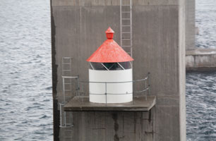
| NO 1507 |
| Storholmen Flickr
Lantern and gallery mounted on a concrete bracket attached to the northeast pier of the highway 17 bridge over the Saltstraumen. (L 2518) [694200] ARLHS # NOR-231
Photo courtesy Tone Linn Sophi Birkeland [Flickr] |
| NO 1508 |
Saltstraumen |
At Brukar (L 2516) [694100] |
| NO 1509 |
Mefallsskjaer (Løding)
latitude 67° 17' 38.6" N longitude 14° 41' 49.3" E |
Located on a small skerry in the Saltfjord about 400 m west of the harbor of Løding. Accessible only by boat. (L 2514) [694000] ARLHS # NOR-437 |
| NO 1510 |
Hernesskagen (Kvannøy)
latitude 67° 15' 16.7" N longitude 14° 16' 45.6" E |
Kvannøy southwest beach (L 2538) [698200] |
| NO 1511 |
Svartoksen
latitude 67° 15' 46.1" N longitude 14° 14' 2.3" E |
Located on a skerry adjoining the entrance channel to Bodø, about 1.6 km west of the airport. (L 2540) [698400] |
| NO 1512 |
Røsøyskjær
latitude 67° 15' 55.8" N longitude 14° 18' 5.1" E
October 7, 2010
Inlet west side (L 2542) [698600] |
|
| NO 1513 |
| Bodø Molja
latitude 67° 17' 6.7" N longitude 14° 21' 46.5" E
October 7, 2010
Located at the end of the mole at the west end of Bodø harbor. (L 2544) [698800] ARLHS # NOR-059 |
| NO 1514 |
Nyholmen (1875)
latitude 67° 17' 10.9" N longitude 14° 21' 53.9" E
Located on the tip of Nyholmen, a narrow island, joined to the mainland by a causeway, that protects the north side of Bodø harbor. [698000] ARLHS # NOR-173
Photo courtesy Roed [wikipedia] |
|
| NO 1515 |
| Nyholmen (1907 ?)
latitude 67° 17' 11.8" N longitude 14° 21' 53.9" E
October 7, 2010
Located at the extreme southwestern tip of Nyholmen.
You can see this light as your ferry leaves Bodø. (L 2537) [698000] ARLHS # NOR-440 |
| NO 1516 |
Lille Hjartøy SW Point
latitude 67° 16' 56.1" N longitude 14° 19' 26.1" E
October 7, 2010
West of Bodø (L 2548) [699000] |
|
| NO 1517 |
Lille Hjartøy NE Point
latitude 67° 17' 46.7" N longitude 14° 22' 19.2" E |
North of Bodø (L 2550) [699100] |
| NO 1518 |
Skivik Mole
latitude 67° 18' 42" N longitude 14° 26' 36" E |
Skivika (L 2571) [703600] |
| NO 1519 |
Grytøy
latitude 67° 23' 23.4" N longitude 13° 50' 45.8" E |
Located in or near Grytøy, near the south end of the Sorvær archipelago, about 25 km northwest of Bodø. (L 2562) [701000] ARLHS # NOR-365 |
| NO 1520 |
Grimsholmen
latitude 67° 23' 16.6" N longitude 13° 51' 28.3" E |
South inlet to Helligvær east side (L 2563) [701200] |
| NO 1521 |
Lyngesøy |
Located on a skerry about 7 km northeast of Grytøy. photo (L 2565) [702200] |
| NO 1522 |
Undersholmen |
Helligvær south side (L 2566) [702400] |
| NO 1523 |
Fenesodden
latitude 67° 22' 20.1" N longitude 14° 11' 59.7" E |
West Landegode southwest point (L 2568) [703000] |
| NO 1524 |
Grasøy Vestre (west) |
Landegodefjorden west side (L 2572) [703700] |
| NO 1525 |
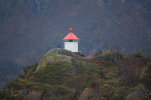
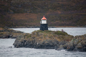
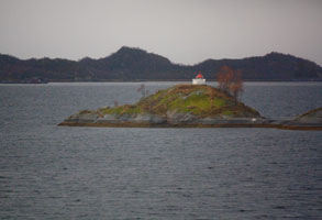
Bjørnøy (1890)
latitude 67° 25' 6.8" N longitude 14° 24' 30.8" E
October 7, 2010
The house is probably in use as a private residence. Located at the east end of the island of Landegode about 8 km east northeast of Bodø.
As you travel north on the Hurtigruten ferry towards Landegode lighthouse, this will be on the left side of the boat about 10 minutes before exiting the channel. [703700] ARLHS # NOR-058 |
|
| NO 1526 |
| Bjørnøy (1972)
latitude 67° 25' 18.7" N longitude 14° 24' 31.3" E
October 7, 2010
This is a 9 m concrete post located just below the historic lighthouse. (L 2574) [704000] ARLHS # NOR-426 |
| NO 1527 |
Kvannholmen
latitude 67° 26' 49.4" N longitude 14° 40' 15" E |
Mistfjord (L 2576) [704200] |
| NO 1528 |
Landegode
latitude 67° 27' 22.8" N longitude 14° 24' 22.9" E
October 7, 2010
The station was sold to Skagen Hotels of Bodø in 1994 and is operated as an inn and conference center. hotel
Located at the northeast tip of the island of Landegode about 8 km north of Bodø. Transportation from Bodø is available. (L 2578) [704500] ARLHS # NOR-148 |
|
| NO 1529 |
Fjærkvitingen |
Southwest of Karlsøyvær (L 2581) [705000] |
| NO 1530 |
Kjerringøy
latitude 67° 31' 27.3" N longitude 14° 45' 42.7" E
Located on a skerry at the entrance to the harbor of Kerringøy and may be seen from the shore. (L 2582) [705500]
Photo courtesy Ronny Engene [Flickr] |
|
| NO 1531 |
Flakholmen Østre (east) |
West of Hellø (L 2586) [705700] |
| NO 1532 |
Helløyskjær
latitude 67° 36' 43.4" N longitude 14° 46' 32.9" E |
North of Helløy (L 2584) [705600] |
| NO 1533 |
Jovik |
Sørfolla (L 2606) [708200] |
| NO 1534 |
Røsvik |
At Røsvikøra (L 2608) [708400] |
| NO 1535 |
Skjerhomen |
Near Hammefall (L 2609) [708600] |
Upper Vestfjord Lights
| NO 1538 |
Prestmåsøy |
At Folla northwest side (L 2605) [708000] |
| NO 1539 |
Svinøya
latitude 67° 39' 36" N longitude 15° 1' 6" E
It is located 12 nautical miles off the Norwegian coast in the open ocean in an area renown locally for some of the wildest weather that Norway can offer. (L 2596) [706000]
Photo courtesy Visit Norway [visitNorway.com] |
|
| NO 1540 |
Stabban |
North of Haakholman in Vinkfjord (L 2600) [706700] |
| NO 1541 |
Gravnesodden |
Belgkjosen (L 2604) [707400] |
| NO 1542 |
Hopneset |
In Mørsvikfjorden. (L 2602) [707000] |
| NO 1543 |
Håkjerringnes |
Mørsvikfjorden (L 2603) [707200] |
| NO 1544 |
Ola-Persøy
latitude 67° 40' 16.2" N longitude 14° 42' 31.8" E |
Brennvika northeast point (L 2612) [709000] |
| NO 1545 |
Bjørnerøy
latitude 67° 43' 15" N longitude 14° 45' 9.6" E |
Brennvika west side (L 2613) [709200] |
| NO 1546 |
Steinsholmen Nedre (front range)
latitude 67° 44' 14.4" N longitude 14° 42' 50.4" E |
Leinesfjorden west beach (L 2614) [709500] |
| NO 1546R |
Steinsholmen Øvre (rear range)
latitude 67° 44' 7.2" N longitude 14° 42' 48" E |
Leinesfjorden south side (L 2614.1) [709400] |
| NO 1548 |
Leines
latitude 67° 44' 33" N longitude 14° 47' 58.2" E |
At Gjestholmdrangan (L 2616) [709800] |
| NO 1549 |
Andholmen |
Husøyvær (L 2622) [710200] |
| NO 1550 |
Store Jensøy
latitude 67° 50' 29.4" N longitude 14° 36' 11.4" E |
Southwest leg of Engelvaer (L 2652) [714000] ARLHS # NOR-169 |
| NO 1551 |
Sildeskjaer
latitude 67° 48' 22.8" N longitude 14° 43' 31.8" E |
Skjærets east side (L 2630) [711500] |
| NO 1552 |
Lille Manshausen
latitude 67° 49' 59.7" N longitude 14° 45' 54.3" E |
Southeast of Grøtøya (L 2638) [711900] |
| NO 1553 |
Skaten
latitude 67° 50' 36.6" N longitude 14° 17' 23.4" E |
Grøtøyledens' northeast (L 2642) [712400] |
| NO 1554 |
Oksholmen (Front Range)
Located near the west side of the harbor entrance at Nordskot. (L 2644) [712500]
Photo courtesy Roger Skog [picasaweb] |
|
| NO 1554R |
Nordskot (Oksholmen Rear Range) |
(L 2644.1) [712600] |
| NO 1555 |
Kjuklingflu
latitude 67° 51' 12.6" N longitude 14° 47' 19.8" E
"Kjuklingflu" means "chicken reef," but the reference here may be to cormorants. Located on a reef at the east side of the harbor entrance at Nordskot. (L 2635) [712900]
Photo courtesy Jan Leversund [Flickr] |
|
| NO 1556 |
| Flatøy
Located at the west end of Faltøy, a small island on the southeast side of the Vestfjord about 7 km west of Engeløya. Accessible only by boat. A similar named light is shown below NO 1995 (L 2658) [714500] ARLHS # NOR-084
Photo courtesy Joakim Dahl [Flickr] |
| NO 1557 |
Hamnholmen
latitude 67° 54' 49.8" N longitude 15° 1' 15" E |
In Flagsundet (L 2662) [714700] |
| NO 1558 |
Kattskjær |
In Flagsund (L 2664) [714800] |
| NO 1559 |
Engeløy bru |
Engeløy bridge (L 2566) [715500] |
| NO 1560 |
Brunvær
latitude 68° 26.4" N longitude 15° 6' 21" E |
Agterøy northwest side (L 2682) [717000] |
| NO 1561 |
Skagstadsund
latitude 67° 57' 55" N longitude 15° 7' 32.1" E |
Sundet west side. In walking distance to the village of Skagstad. (L 2684) [717300] |
| NO 1562 |
Øksnes
latitude 68° 2' 36.6" N longitude 15° 13' 29.4" E |
At Øksnes odden. Lundøy north point (L 2686) [718000] |
| NO 1563 |
Skutvik
latitude 68° 1' 1.8" N longitude 15° 20' 31.2" E |
North side of Økssundet (L 2678) [716600] |
| NO 1564 |
Bolsøygalten |
At Galten varde, north in Sagfjord. (L 2668) [715700] |
| NO 1565 |
Klingenberg
latitude 67° 59' 46.5" N longitude 15° 44' 56.9" E |
At skjæret west, on the Sagfjord west beach (L 2672) [715900] |
| NO 1566 |
Hamsundpollen
latitude 68° 8' 6.4" N longitude 15° 31' 59.7" E |
At Skrattneset (L 2691) [718700] |
| NO 1567 |
Buvåg
latitude 68° 8' 53.4" N longitude 15° 26' 52.2" E |
Located on a promontory at the entrance to Buvåg, about 8 km northwest of Hamsund. photo (L 2690) [718500] |
Narvik Area
Map is N3
| NO 1569 |
Liland
latitude 68° 27' 54" N longitude 16° 54' 32.4" E |
Ungsmaløy south point (L 2752) [727400] |
| NO 1570 |
Skogøy |
Ofotfjord east side (L 2754) [727600] |
| NO 1571 |
Østervik |
Bogen (L 2756) [727800] |
| NO 1573 |
Fornes
latitude 68° 27' 1.2" N longitude 17° 2' 52.8" E |
At Skredneset (L 2764) [728700] |
| NO 1574 |
Narvik
latitude 68° 25' 34.5" N longitude 17° 21' 23.1" E |
At Ankenesstranden southwest from Narvik (L 2771) [729700] |
| NO 1575 |
Trong-Skjomneset |
Located on the south side of the east end of the bridge carrying the E6 highway across the Skjomfjord, a branch of the Ofotfjord, about 12 km west of Narvik. (L 2767) [729000] |
| NO 1576 |
Aspelsund
latitude 68° 17' 2.4" N longitude 17° 22' 24.6" E
Located on the east side of the Skjomfjord about 3 km northwest of Skjombotn. (L 2769) [729300]
Photo courtesy Katalin Orosz [Flickr] |
|
| NO 1577 |
Kårholmen
latitude 68° 22' 24" N longitude 16° 54' 46.2" E |
Ballangen (L 2760) [728200] |
| NO 1578 |
Hamnesholmen
latitude 68° 25' 17" N longitude 16° 34' 52.1" E |
Ofotfjord north point (L 2746) [727000] |
| NO 1579 |
Tjellebotn (Kjeldebotn)
latitude 68° 24' 47.6" N longitude 16° 40' 25.8" E |
Located near Skårnes about 1.5 km northeast of Kjeldebotn, on the south side of the Ofotfjord. (L 2748) [727200] |
| NO 1580 |
Ramsund
latitude 68° 28' 21.2" N longitude 16° 31' 37.1" E |
East side of the sound. Located on highway 824 south of Oldervika. Should be easy to spot from the highway. (L 2774) [731000] |
| NO 1581 |
Rambøskjæret Søre (south)
latitude 68° 29' 51.6" N longitude 16° 28' 37.8" E |
South side of Ramsund sound (L 2775) [731100] |
| NO 1582 |
Sandnesskjæret
latitude 68° 30' 51" N longitude 16° 27' 12" E |
West side of Ramsund sound (L 2779) [732000] |
| NO 1583 |
Stakksvollholmen
latitude 68° 33' 22.8" N longitude 16° 13' 58" E |
Middle of Tjeldsund at the beach. (L 3284) [823500] |
| NO 1584 |
Nordstrandskjær
latitude 68° 29' 38.6" N longitude 16° 8' 31.2" E |
West of Digermulen (L 3282) [823000] |
| NO 1585 |
Hamnholmen
latitude 68° 21' 45.6" N longitude 16° 15' 57.6" E |
West of Skarstad (L 2733) [725600] |
| NO 1586 |
Barøya
Barøy is an island at the upper (east) end of the Vestfjord. the lighthouse marks the entrance to the Ofotfjord, which leads to the port of Narvik. Located at the west end of the island. There should be at least a distant view from ferries sailing for Lødingen in the Lofotens.
This is another light where the house is out of service and a new post light is now active in front of the house. photo (L 2730) [725000] ARLHS # NOR-004
Photo courtesy Oddvar Mørk [panoramio] |
|
| NO 1587 |
Revlsøy |
Ototfjorden east point (L 2732) [725200] |
| NO 1588 |
Formeset
latitude 68° 18' 51.6" N longitude 16° 22' 9" E |
Northeast in Efjord (L 2736) [726500] |
| NO 1589 |
Korsnes
latitude 68° 15' 14.3" N longitude 16° 3' 55.9" E |
Located at the tip of the Korsnes promontory, about 1 km north of Bognes. There should be a view of this light from ferries between Bognes and Lødingen, Lofoten. (L 2718) [722000] |
| NO 1590 |
Hundholmen |
Tysfjord northeast point (L 2724) [722800] |
| NO 1591 |
Drag |
At Hamnneset (L 2726) [723000] |
| NO 1592 |
Nordkilklubben
latitude 68° 9' 41.4" N longitude 15° 52' 17.4" E |
Klubbens southwest side (L 2714) [721500] |
| NO 1593 |
Ansnesholmen
latitude 68° 7' 18.6" N longitude 15° 49' 30.6" E |
Tannøy south side (L 2712) [721000] |
| NO 1594 |
Hamlotskjær |
Tannøysundet (L 2704) [720600] |
| NO 1595 |
Tannøy
latitude 68° 9' 4.2" N longitude 15° 45' 51" E |
Tannøy northwest side (L 2708) [720000] |
| NO 1596 |
Steinsos
latitude 68° 10' 57.2" N longitude 15° 40' 48.4" E |
Located on a skerry about 3 km west of the Tranøy lighthouse. photo (L 2702) [719900] |
| NO 1597 |
Tranøy
The light station has been developed as a tourist attraction; tours and overnight accommodations are available. Located on a small island on the south side of the upper Vestfjord about 12 km north of Hamarøy. Accessible by road; a footbridge leads to the light station. (L 2696) [719500] ARLHS # NOR-047
Photo courtesy © Geir Winther [Flickr] |
|
| NO 1598 |
| Lødingen
Located on a promontory sheltering the south side of the harbor of Lødingen. There should be an excellent view from ferries arriving in Lødingen from the mainland. (L 2783) [734000] ARLHS # NOR-160
Photo courtesy Asbjorn Hansen [Flickr] |
Lofoten Islands
| NO 1600 |
Rotvær
latitude 68° 22' 4.2" N longitude 15° 56' 41.4" E |
Located on a small island in the Vestfjord about 3 km southwest of Lødingen. Accessible only by boat; there should be at least a distant view from ferries sailing for Lødingen. photo (L 2785) [734500] ARLHS # NOR-189 |
| NO 1601 |
Svendsgam
latitude 68° 24' 31.2" N longitude 15° 46' 54" E |
At Aspeneset (L 2787) [734900] |
| NO 1602 |
Rinøy |
Kanstadfjord. Looking at Google Maps, it looks like you can drive to the island of Rinøya and the light is probably in the northeast corner. photo (L 2788) [735500] |
| NO 1603 |
Kjeøy
latitude 68° 19' 23.4" N longitude 15° 39' 48.6" E |
At Skipholmen, a small island south of Ytterstad. (L 2792) [736000] |
| NO 1604 |
Skarvhausen
latitude 68° 18' 7.2" N longitude 15° 39' 40.2" E |
Store Skarvhausen's east point. This is an island south of Offersøy. closeup (L 2794) [736500] |
| NO 1605 |
Seingen
latitude 68° 18' 40.6" N longitude 15° 30' 35" E |
Smidtskjærleden, northeast of Svellingen. Visible only from a boat. (L 2796) [737000] |
| NO 1606 |
Smitskjær
latitude 68° 19' 12.6" N longitude 15° 30' 13.7" E |
On north skjær, a small island. photo (L 2798) [737300] |
| NO 1607 |
Forneset |
On the east side of Øksfjorden (L 2805) [738600] |
| NO 1608 |
Håkjerringholmen |
Located on a little island on the north side of Øksfjorden.You'll need a boat to get here. (L 2804) [738500] |
| NO 1609 |
Steinbakken
latitude 68° 27' 10.8" N longitude 15° 11' 34.2" E
October 12, 2010
Raftsund east side (L 2830) [742400] |
|
| NO 1610 |
| Raftsund
latitude 68° 24' 56.2" N longitude 15° 7' 56.4" E
October 12, 2010
This light marks the narrowest point of the Raftsund, a very narrow passage around the west side of Hinnøya; this is a critical passage in the inside route to Norway's northern coast. (L 2824) [741800] |
| NO 1611 |
Rognholmene |
South Raftsund west beach (L 2820) [741500] |
| NO 1612 |
Digermulen
latitude 68° 18' 55.2" N longitude 14° 58' 52.2" E |
Located on a promontory on the east side of the entrance to the Raftsund southwest of Digermulen; there should be a good view from ferries between Digermulen and Stormolla. photo (L 2818) [741200] |
| NO 1613 |
Ulvågsundet
latitude 68° 17' 18.6" N longitude 14° 57' 48.6" E |
Store Molla east side (L 2816) [741000] |
| NO 1614 |
Årsteinen
latitude 68° 16' 49.8" N longitude 15° 4' 13.8" E |
At the inlet to Bustleivholmen (L 2808) [739000] |
| NO 1615 |
Lysøskjæret
latitude 68° 17' 36.7" N longitude 15° 21' 27" E |
In Svellingleden (L 2809) [739200] |
| NO 1616 |
Risvær |
Seingsdragets south point (L 2810) [739400] |
| NO 1617 |
Langholmen
latitude 68° 15' 19.8" N longitude 14° 44' 44.4" E |
Oddvær (L 2849) [745000] |
| NO 1618 |
Følstadklubben
latitude 68° 16' 43.8" N longitude 14° 42' 57" E |
At the north end of Østnesfjorden (L 2852) [746000] |
| NO 1619 |
Husholmen |
Moldøra north point (L 2846) [744300] |
| NO 1620 |
Soten
latitude 68° 13' 29.4" N longitude 14° 50' 32.4" E |
West Brettesnes (L 2844) [744100] |
| NO 1621 |
Indre Våtvikneset
latitude 68° 12' 58.8" N longitude 14° 49' 44.4" E |
Southeast innseiling (L 2842) [744000] |
Skrova Area
| NO 1623 |
Slåkøy
latitude 68° 10' 48" N longitude 14° 43' 41.4" E |
Skrova south beach (L 2856) [747000] |
| NO 1624 |
Ormtunga Skrova
latitude 68° 10' 22.8" N longitude 14° 40' 54.6" E |
North of Skrova (L 2857) [747100] |
| NO 1625 |
Galgeholmen
latitude 68° 10' 12.6" N longitude 14° 40' 21.6" E |
North Inlet (L 2858) [747300] |
| NO 1626 |
Skrovøy
latitude 68° 9' 57" N longitude 14° 38' 55.2" E
Located on the north side of the entrance to Skrova, about 1.5 km north of the Skrova lighthouse. (L 2859) [747500]
Photo courtesy Randy [Flickr] |
|
| NO 1627 |
Ørsvåg
latitude 68° 11' 46" N longitude 14° 25' E |
At Sagøy (L 2888) [751200] ARLHS # NOR-211 |
| NO 1628 |
Skrova |
Located on a skerry just off the west coast of Skrova. Unlike many of these lights, you can see this one from the village of Skrova. (L 2860.1) ARLHS # NOR-211 |
| NO 1629 |
Risøyan
latitude 68° 14' 10.8" N longitude 14° 35' 43.8" E |
Svolvær north point (L 2866) [748600] |
| NO 1630 |
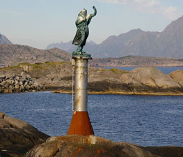
Vabeinskjer Vestre (West)
Located on a rock in Svolvær harbor. This light is unique in Norway as it is a statue on a marble pole. (L 2870) [748900]
Photo courtesy Percita Dittmar [Flickr] |
|
| NO 1631 |
| Vorsetøy
latitude 68° 13' 30" N longitude 14° 33' 29.4" E
Located on an islet in Svolvær harbor. (L 2876) [749600]
Photo courtesy Åsa Franked-Holten [Flickr] |
| NO 1632 |
Dynegrunnen
latitude 68° 13' 13.2" N longitude 14° 33' 30.6" E
Located on a reef in Svolvær harbor. (L 2878) [749800]
Photo courtesy Torbjörn Ivarsson [Flickr] |
|
| NO 1633 |
| Rødholmen
latitude 68° 13' 6" N longitude 14° 33' 14.9" E
Located on a small island off Svolvær. (L 2879) [750000]
Photo courtesy Morten Oddvik [Flickr] |
| NO 1634 |
Kabelvåg
latitude 68° 12' 30" N longitude 14° 29' 24" E
Located on a skerry at the southern entrance to the harbor of Kabelvåg. (L 2884) [752000]
Photo courtesy njaal1301 [Flickr] |
|
| NO 1635 |
Hopen Øvre (rear range) |
At the end of the harbor (L 2892.1) [751600] |
| NO 1636 |
Hopen Nedre (front range) |
At the end of the harbor (L 2892) [751700] |
| NO 1637 |
Lille Bremholmen |
Located on a small island south of Kalle, about 10 km northeast of Henningsvær. (L 2894) [752000] |
| NO 1638 |
Moholmen
latitude 68° 9' 27" N longitude 14° 24' 21" E
This is an unusual design, and the lighthouse may be a rare survivor of its class. Located on a small island in the Vestfjord about 4 km southwest of Kabelvåg. Accessible only by boat. (L 2896) [752500] ARLHS # NOR-165
Photo courtesy Andreas Fritsche, Südbaden [Flickr] |
|
Henningsvær Area
| NO 1640 |
Festvåghalsen |
Gimsøystraumens northern inlet (L 2926) [755500] |
| NO 1641 |
Gimsøy |
At Kristenskjærene (L 2922) [755200] |
| NO 1642 |
Klokkerbåen |
Gimsøystraumen (L 2920) [755000] |
| NO 1643 |
Gimsøybroåen |
On the west end of Gimsøystraumen bru (bridge)(probably mounted on a support post) (L 2919) [754800] |
| NO 1644 |
Lyngvaer Nordre (North) |
The north entrance to the channel below. (L 2916) [754400] |
| NO 1645 |
Lyngvaer Sore (south) |
Located about 5 km north of Henningsvaer, marking the south entrance to the channel between the islands of Austvågøy and Gimsøy. Accessible only by boat. (L 2914) [754200] ARLHS # NOR-436 |
| NO 1646 |
Store Lysøy |
Lyngvær (L 2910) [754000] |
| NO 1647 |
Malnes
latitude 68° 12' 7" N longitude 14° 7' 51" E |
At south Lelholmen (L 2928) [755700] |
| NO 1648 |
Festvåg |
North side of the inlet to Lofoten, inner side (L 2904) [753100] |
| NO 1649 |
Sauøy |
Sauøy is an island on the east side of Henningsvær. Located on the southeastern point of the island. (L 2902) [752900] |
| NO 1650 |
Brødrene |
Located on a skerry about 2.5 km west of Henningsvaer. Accessible only by boat. (L 2898) [752700] ARLHS # NOR-427 |
| NO 1651 |
Hellandsøy |
Located at the south point of Hellandsøy, one of the islands occupied by the town of Hellingsvaer, see below NO 1652 (L 2908) [753500] ARLHS # NOR-431 |
| NO 1652 |
Henningsvær (1856)
Henningsvaer, which calls itself the Venice of the Lofotens, is a town on several small islands off the southwestern tip of Austvågøy, connected to the larger island by a series of bridges. Located on the southwest side of Henningsvaer facing the Vestfjord. [753300] ARLHS # NOR-117
Photo courtesy Mats Anda [Flickr] |
|
Offshore Islands north of Bodø
Map below is N4
| NO 1654 |
Skomvær
Skomvaer is the westernmost island of the Lofoten ridge, 35 km west southwest of Sørland and a similar distance northwest of Myken. Located at the highest point of the island. Accessible only by boat in heavy seas. (L 3028) [771800] ARLHS # NOR-208
Photo courtesy Arne Berge [Flickr] |
|
| NO 1655 |
Sandøyholmene Nordre |
Located on a skerry about 5 km southwest of the Røstholmen light. (L 3027) [771600] |
| NO 1656 |
Ytre Husskjær |
West of Storfjell (L 3030) [772000] |
| NO 1657 |
Ytre Alkskjær |
Located on a skerry just west of the larger islet of Storfjell, about 4 km west southwest of the Røstholmen light. [772100] |
| NO 1658 |
Alkskjær |
West of Røst (L 3031) [772200] |
| NO 1659 |
Hallklakken
latitude 67° 31' 27" N longitude 12° 1' 10.2" E |
In Skarvhomleia (L 3026) [771400] |
| NO 1660 |
Røstholmen
latitude 67° 28' 9.7" N longitude 12° 56.3" E |
Located on a small island south of Vedøy, an island about 10 km southwest of Røst. (L 3022) [771000] |
| NO 1661 |
Prestholmnakken
latitude 67° 30' 13.2" N longitude 12° 3' 35.4" E |
At the inlet to the harbor (L 3024) [771200] |
| NO 1662 |
Værholmnakken
latitude 67° 29' 37.1" N longitude 12° 3' 39.3" E |
Located on a small island at the entrance to the harbor of Røst. (L 3018) [770600] |
| NO 1663 |
Helløy
latitude 67° 30' 32.2" N longitude 12° 8' 34.4" E |
Located on a small island about 500 m southeast of the Mærskjær light. (L 3014) [770200] |
| NO 1664 |
Mærskjær
latitude 67° 30' 37.5" N longitude 12° 7' 58.2" E |
Located on a skerry off the southeast coast of Røst, an island about 25 km southwest of Sørvågen. (L 3016) [770400] |
| NO 1665 |
Brattskjær
latitude 67° 31' 6" N longitude 12° 11' 7.8" E |
On the Island Brattskjær. (L 3012) [770000] |
| NO 1666 |
Elsneset |
On the west side at Værøy. photo (L 3006) [769300] |
| NO 1667 |
Kvalnesset
latitude 67° 38' 17.6" N longitude 12° 41' 41.6" E |
Located on a promontory at the southern end of Værøy. photo (L 3008) [769500] |
| NO 1668 |
Kvitholmen
latitude 67° 41' 46.6" N longitude 12° 46' E |
At the top of Værøy fjord. (L 3003.4) [768500] |
| NO 1669 |
Lamholmen |
South of Kvitholmen (L 3003.7) [768600] |
| NO 1670 |
Aurholmen |
Northeast of Nordlsndsflaget (L 3004) [768700] |
| NO 1671 |
Skarvholmen
latitude 67° 44' 21.2" N longitude 12° 39' 55.5" E |
Vaerøy, also called Sørland, is one of the outermost of the Lofoten Islands, about 18 km west southwest of Sørvågen. Located at the east side of the entrance to the harbor of Sørland. A road leads to or close to the lighthouse. (L 3005) [769000] |
| NO 1672 |
Nordholmen
latitude 67° 50' 32.4" N longitude 12° 46' 45" E |
Lofotodden's west side (L 2997) [767600] |
| NO 1673 |
Helle
latitude 67° 49' 56.4" N longitude 12° 48' 7.2" E |
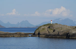
This light marks the southernmost tip of Moskenesøy, and thus the exit from the Vestfjord to the Norwegian Sea. view (L 2996) [767500] |
| NO 1674 |
Yttertuven
latitude 67° 49' 43.2" N longitude 12° 52' 17.7" E |
This light marks the southeasternmost tip of Moskenesøy, and thus the exit from the Vestfjord to the Norwegian Sea. photo (L 2995) [767000] |
| NO 1675 |
Å (Åkerbjerget)
latitude 67° 52' 59.3" N longitude 12° 59' 9.3" E
Located on Åkerbjerget, a promontory on the north side of the entrance to Å harbor. (L 2994) [766000]
Photo courtesy Gregor Samsa [Flickr] |
|
| NO 1676 |
| Glåpen (1857)
Located on a promontory marking the west side of the entrance to the harbor of Sørvågen. Accessible by road. [765400] ARLHS # NOR-098
Photo courtesy Uli Guehring [Flickr] |
| NO 1677 |
Glåpen (1985)
Located in front of the historic lighthouse. (L 2990) [765400] ARLHS # NOR-429
Photo courtesy David Rombaut [Flickr] |
|
| NO 1678 |
Moskenes (Pråsolodden)
latitude 67° 53' 45.2" N longitude 13° 2' 20.1" E |
Located on a rocky promontory at the southern entrance to Moskenes harbor. photo (L 2988) [765000] |
| NO 1679 |
Fiskskjæret
latitude 67° 56' 11" N longitude 13° 6' 8.8" E |
Located on a rock in Moskenes harbor south of Olnisøy view (L 2982) [763800] |
| NO 1680 |
Olnilsøy (Reine)
latitude 67° 56' 9.8" N longitude 13° 6' 40.4" E
The original 2-story lighthouse was swept away by a storm during the winter of 1924-25. Located at the southwestern tip of Olnilsøy, opposite the harbor of Reine. (L 2980) [763600]
Photo courtesy Owen Morgan [panoramio] |
|
| NO 1681 |
Havnøy |
Underneath the bridge at west Brokar (L 2978) [763400] |
| NO 1682 |
Sund (Fisheries Museum)
latitude 67° 59' 53.4" N longitude 13° 12' 10.9" E |
The current lighthouse is located on the southern tip of the island of Grimsholmen, marking the entrance to Sund harbor. The lantern is at the Fisheries Museum. photo (L 2972) [762100] |
| NO 1683 |
Kåkeren
latitude 68° 1' 3" N longitude 13° 11' 3.6" E |
Sundstrømmen (L 2974) [762500] |
| NO 1684 |
Nusfjord (Bonnesodden)
latitude 68° 1' 44.4" N longitude 13° 21' 25.2" E
Located on the south side of the entrance to Nusfjord. (L 2960) [761400]
Photo courtesy David Rombaut [Flickr] |
|
| NO 1685 |
Kubholmen |
Underneath the bridge at northern Brukar (L 3042) [775300] |
| NO 1686 |
Krystad
latitude 68° 3' 33" N longitude 13° 10' 7.8" E |
At Krystad point in Selfjord (L 3044) [775500] |
| NO 1687 |
Ramberg |
Torvøy northeast side (L 3038) [774600] |
| NO 1688 |
Jusholmen
latitude 68° 6' 32.4" N longitude 13° 13' 41.4" E |
Yttersiden Lofoten north point (L 3036) [774400] |
| NO 1689 |
Leiholmen
latitude 68° 6' 35.1" N longitude 13° 10' 11.9" E |
Located on a skerry off the north coast of Moskenesøy, about 2 km southeast of the Moholmen light. (L 3034) [774200] |
| NO 1690 |
Moholmen (Flakstad Moholmen)
latitude 68° 7' 10.7" N longitude 13° 7' 25.9" E |
Located on a small island off the northern tip of Moskenesøy
Note that there are several other identically named lights in Northern Norway. (L 3033) [774000] |
Stamsund and Gravdal Area
| NO 1692 |
Grænvika
latitude 68° 3' 30" N longitude 13° 29' 7.8" E |
South west of Grænen syd, Vestvågøy (L 2962) [761000] |
| NO 1693 |
Sandholmskjæret
latitude 68° 3' 26" N longitude 13° 32' 3.6" E |
South of Balstad (L 2964) [760800] |
| NO 1694 |
Balstad
latitude 68° 2' 56.4" N longitude 13° 32' 36" E |
At Svinøy (L 2961) [760000] |
| NO 1695 |
Balstadøy
latitude 68° 4' 7.8" N longitude 13° 33' 4.8" E
Located at the end of a breakwater on the west side of the entrance to Balstad harbor. (L 2961) [760500]
Photo courtesy Lazy B [Flickr] |
|
| NO 1696 |
| Buksnes
Located on Treborneset, the tip of a long peninsula about about 3 km east of Gravdal, marking the entrance to the harbor. (L 2956) [759400]
Photo courtesy Haakon S. Rist [wikipedia] |
| NO 1697 |
Mortsund Vestre (west)
latitude 68° 4' 49.8" N longitude 13° 38' 39" E |
Gunholmens east point (L 2954) [759200] |
| NO 1698 |
Ure
latitude 68° 5' 3" N longitude 13° 44' 17" E |
At Bjørnerøy (L 2948) [758800] |
| NO 1699 |
Mortsund Østre (east)
latitude 68° 4' 51" N longitude 13° 41' 52.2" E |
At Finholmen (L 2952) [759100] |
| NO 1700 |
Notsskjæret
latitude 68° 5' 40.2" N longitude 13° 44' 1.8" E |
West Ure (L 2950) [759000] |
| NO 1701 |
Steine
latitude 68° 6' 48.5" N longitude 13° 48' 6.5" E |
South side of the inlet to Lofoten (L 2946) [758600] |
| NO 1702 |
Stamsund
latitude 68° 7' 6" N longitude 13° 51' 2.4" E |
The original lighthouse was a frame house with a lantern attached to one side. The second light is located on a large rock on Tørnholmen, a promontory sheltering the harbor of Stamsund. view (L 2936) [756800] |
| NO 1703 |
Buøyhavn
latitude 68° 7' 48" N longitude 13° 51' 35.4" E |
Located on Hellen, a rocky promontory on the north side of Stamsund. (L 2934) [756600] |
| NO 1704 |
Lille Kvanholmen
latitude 68° 9' 40" N longitude 13° 54' 58" E |
At Kvanholmen (L 2930) [755900] |
| NO 1705 |
Valberg
latitude 68° 10' 23.4" N longitude 13° 57' 1.8" E |
Located on a skerry about 1.5 km south of the Valberg waterfront. (L 2932) [756200] |
| NO 1706 |
Okholmen
latitude 68° 10' 21.6" N longitude 14° 1' 30.6" E |
Henningsværstraumen eastmost point (L 2933) [756400] |
| NO 1707 |
Napp
latitude 68° 8' 21.6" N longitude 13° 27' 37.2" E |
Nappholmens east point (L 3046) [775700] |
| NO 1708 |
Hornneset
latitude 68° 10' 10" N longitude 13° 19' 23" E |
North Flakstadøya (L 3050) [776600] |
| NO 1709 |
Hundholmen
latitude 68° 9' 43.1" N longitude 13° 26' 34.7" E |
Located on a skerry off the entrance to the Nappstraum, the channel separating Flakstad from Vestvågøy. (L 3051) [776800] |
| NO 1710 |
Hæsholmene
latitude 68° 13' 30.6" N longitude 13° 26' 18.6" E |
At the top of Storholmen (L 3054) [777000] |
West Coast Lofoten
Map is N4
| NO 1711 |
Bjørnøy
latitude 68° 14' 18.6" N longitude 13° 35' 13.8" E |
On the north side of Lofoten in Steinsfjord (L 3056) [777500] |
| NO 1712 |
Skolmneset |
West of Tangstad (L 3055) [778200] |
| NO 1713 |
Kleivheia
latitude 68° 17' 10.8" N longitude 13° 34' 15" E
Located on a promontory about 1.2 km northwest of Unnstad (L 3058) [778400]
Photo courtesy René Kyllingstad [Flickr] |
|
| NO 1714 |
Eggum
latitude 68° 18' 38.4" N longitude 13° 41' 4.8" E |
Located on a promontory northeast of Eggum, on the north side of Vestvågøy. (L 3060) [778600] |
| NO 1715 |
Nesjeøyene
latitude 68° 18' 18" N longitude 13° 45' 12.6" E |
West of Vestvågøy (L 3064) [779000] |
| NO 1716 |
Vedløysa
latitude 68° 18' 26.4" N longitude 13° 47' 17.4" E |
South of Borgvær (L 3066) [779400] |
| NO 1717 |
Kjeldskjærgrunnen
latitude 68° 19' 14.4" N longitude 13° 47' 28.8" E |
East of Eggum (L 3068) [779600] |
| NO 1718 |
Borgvær
latitude 68° 19' 54" N longitude 13° 47' 45" E |
Storborgen's north point (L 3070) [780000] |
|
|
| NO 1719 |
Borgvær harbor
latitude 68° 19' 45" N longitude 13° 49' E |
Borgværøy northeast point (L 3074) [780200] |
| NO 1720 |
Sand Nedre (front range)
latitude 68° 18' 52.8" N longitude 13° 52' 15.6" E |
These lights are located well above the harbor and it doesn't look there are any well maintained roads leading to them. The front light is about 500 feet from the harbor. (L 3076) [780500] |
| NO 1721 |
Sand Øvre (rear range)
latitude 68° 18' 42" N longitude 13° 52' 34.2" E |
Located in Vestresand, a fishing port in northern Vestvågøy. photo (L 3076.1) [780400] |
| NO 1722 |
Kvalnes
latitude 68° 20' 48.6" N longitude 13° 58' 15" E |
North Vestvågøya (L 3078) [780700] |
| NO 1723 |
Limtåga
latitude 68° 19' 24.6" N longitude 14° 1' 16.8" E |
Sundklakkstraumen. This marks a rock about 1000 feet from shore.
(L 3082) [781300] |
| NO 1724 |
Vikerøy
latitude 68° 20' 16.8" N longitude 14° 2' 55.8" E |
On the bay northeast of Vikerøy (L 3080) [781500] |
| NO 1725 |
Vikspollen
latitude 68° 19' 29.4" N longitude 14° 4' 15" E |
Pollens south side (L 3083) [781600] |
| NO 1726 |
Hovsund
latitude 68° 20' 41.4" N longitude 14° 5' 26.4" E
Located on a rocky promontory near Hov. (L 3086) [783000]
Photo courtesy Krystyna Spinek [Flickr] |
|
Hadseløy Area
| NO 1728 |
| Laukvik
latitude 68° 23' 24.6" N longitude 14° 24' 29.2" E
Laukvik is a fishing village at the northwestern tip of Austvågøy. Accessible by road. (L 3088) [784000] ARLHS # NOR-434
Photo courtesy Michael Homburg [Flickr] |
| NO 1729 |
Strønstad
latitude 68° 26' 51" N longitude 14° 48' 31.8" E |
At Grøttøy (L 3094) [785000] |
| NO 1730 |
Årnøy
latitude 68° 25' 49.8" N longitude 14° 52' 24.6" E |
At east spit of Aarnø in Sløverfjord (L 3095.4) [785600] |
| NO 1731 |
Hanøyholmen
latitude 68° 28' 35.4" N longitude 15° 10' 32.4" E |
Hanøysund (L 3104) [788500] |
| NO 1732 |
Hanøyvekka
latitude 68° 29' 8.4" N longitude 15° 12' 45.6" E
October 12, 2010
At Brattholmen (L 3106) [788600] |
|
| NO 1733 |
| Ersholmene
latitude 68° 29' 45.3" N longitude 15° 11' 17.4" E
October 12, 2010
West Brotøy north side (L 3108) [789000] |
| NO 1734 |
Kartnes
latitude 68° 34' 25.8" N longitude 15° 12' 19.8" E |
At the west spit of Hinnøyhalvøya. (L 3116) [791500] |
| NO 1735 |
Haugkleppan
latitude 68° 29' 9.8" N longitude 14° 45' 14.7" E |
Located on a skerry in the Hadselfjord off the south coast of Hadseløy, about 3 km southwest of Melbu. photo (L 3096) [786000] |
| NO 1736 |
Børholmen |
Located on a skerry off the western tip of Hadseløy view (L 3128) [795000] |
| NO 1737 |
Dragneset
latitude 68° 35' 10.8" N longitude 14° 40' 26.1" E |
Hadseløy northwest point (L 3130) [796000] |
| NO 1738 |
Hadsel bru
latitude 68° 34' 24" N longitude 14° 59' 46.2" E
October 12, 2010
Hadsel bru (bridge) in Stokmarknes. Mounted on the post of the bridge, so invisible from the roadway. (L 3112) [790400] |
|
| NO 1739 |
Kalsnesklubben
latitude 68° 36' 57" N longitude 14° 49' 25.8" E |
Located on a promontory on the north side of the Eidsfjord, southeast of Kallnes. photo (L 3132) [796400] |
| NO 1740 |
Ringstad
latitude 68° 38' 53.4" N longitude 14° 39' 50.4" E |
Near Lilleholmen (L 3138) [798500] |
| NO 1741 |
Seingskjæret |
Located on a skerry on the east side of the Jørnfjord, marking the entrance to Haugsnes. photo (L 3139) [799000] |
| NO 1742 |
Solumholmen
latitude 68° 40' 55.2" N longitude 14° 54' 46.8" E |
Eldsfjord (L 3134) [797000] |
| NO 1743 |
Pollneset |
Northwest of Neset (L 3136) [797500] |
| NO 1744 |
Ørnholmen
latitude 68° 38' 10.2" N longitude 15° 32' 56.4" E
October 12, 2010
Sigerfjord. Visible from the road near Spjutvik. (L 3121) [793200] |
|
| NO 1745 |
Fiskholmen
latitude 68° 44' 27.7" N longitude 15° 26' 3.6" E |
Located on a skerry in the mouth of the Hognfjord, about 3 km northeast of Sortland. photo (L 3123) [794400] |
| NO 1746 |
Stamnes
latitude 68° 48' 47.4" N longitude 15° 27' 32.2" E |
West mole Sortland sundet (L 3124) [794600] |
Vesterålen Area
Map lights below is N5
| NO 1748 |
Litløy (Little Island)
The lighthouse marks the entrance to the Eidsfjord, which separates the northern from the southern Lofotens. Located at the southwestern tip of Litløy, an island about 5 km west of Bø. The keeper's houses are available for overnight rental photos (L 3146) [800000] ARLHS # NOR-435
Photo courtesy Litloy.fry [wikipedia] |
|
| NO 1749 |
Skagen
latitude 68° 36' 27.4" N longitude 14° 26' 43.6" E |
Located at a landing at the end of the Skagenveien, near the southwest end of Langøy. (L 3150) [800400] |
| NO 1750 |
Karvikholmen |
Vesterålsfjorden (L 3151) [800600] |
| NO 1751 |
Flatholmen
latitude 68° 38' 8.5" N longitude 14° 21' 12.2" E |
On the beach north of Gaukværøy. (L 3152) [800800] |
| NO 1752 |
Skårvågen
latitude 68° 40' 33.5" N longitude 14° 22' 35.8" E |
Located on a skerry about 6.5 km north of Litløy. (L 3152) [801500] |
| NO 1753 |
Straumsjøen Nedre (front range)
latitude 68° 42' 22.8" N longitude 14° 25' 46.2" E |
By Hella (The rear range is a lantern on a pole.) (L 3162) [803100] |
| NO 1754 |
Flaskforet
latitude 68° 42' 43.1" N longitude 14° 25' 25.1" E |
Located on a promontory on the west side of Langløy, about 5 km northwest of Straume. closeup (L 3166) [803500] |
| NO 1755 |
Åsanfjord
latitude 68° 44' 11.4" N longitude 14° 26' 58.8" E |
Aasanøy northwest beach. (L 3168) [803700] |
| NO 1756 |
Torvøy
latitude 68° 44' 20" N longitude 14° 30' 30" E |
Near the west point of Assanfjord (L 3170) [803900] |
| NO 1757 |
Nykvåg
Located on a cliff called Bird Mountain on the west side of Nykvåg harbor. (L 3172) [804800]
Photo courtesy Blue Elf [wikipedia] |
|
| NO 1758 |
Nautneset (Hovden)
latitude 68° 48' 44.4" N longitude 14° 32' 1.2" E |
Located on a promontory at the northernmost tip of Langøy, marking the entrance to the harbor of Hovden. Accessible by road. closeup (L 3176) [805000] ARLHS # NOR-438 |
| NO 1759 |
Hovden Front Range
latitude 68° 46' 42" N longitude 14° 28' 4" E |
The range guides vessels to Hovden harbor. Located on a promontory west of Hovden. (L 3174) [804800] |
| NO 1760 |
Hovden --
latitude 68° 49' 3" N longitude 14° 33' 19.8" E |
Located on a short mole at the entrance to Hovden. (L 3178) [805200] |
| NO 1761 |
Frugga Sørpynt (south east point) |
as described in the name. (L 3182) [806000] |
| NO 1762 |
Frugga
latitude 68° 49' 53.4" N longitude 14° 33' 50.7" E |
On the north point. (L 3182.2) [806100] |
| NO 1763 |
Sunderøy |
Senholmens north east side (L 3184) [806800] |
| NO 1764 |
Møkland
latitude 68° 46' 12.8" N longitude 14° 41' 39.4" E |
Located on the west side of the Møksfjord just north of Kråkberget. (L 3188) [807500] |
| NO 1765 |
Bolleøy
latitude 68° 47' 49.2" N longitude 14° 51' 3" E |
Skalflaket (L 3189) [807700] |
| NO 1766 |
Terøy
latitude 68° 51' 30.6" N longitude 14° 46' 23.4" E |
Near the north point in Børøyfjord. (L 3190) [808500] |
| NO 1767 |
Hjellsandøy |
Børøyfjorden (L 3191) [808700] |
| NO 1768 |
Våje
latitude 68° 55' 25.9" N longitude 14° 50' 54.2" E |
At Våjehella. Skogsøy west side. (L 3192) [809000] |
| NO 1769 |
Breistrand (Rundskjæret)
latitude 68° 52' 20.3" N longitude 14° 54' 26.4" E |
Breistrand is on the south side of Skogsøy, an island off the northwest coast of Langløy. The light is located on a reef in the entrance to the harbor. (L 3194) [809400] |
| NO 1770 |
Smines
latitude 68° 51' 58.2" N longitude 14° 58' 4.8" E |
At Kaldhammaren (L 3198) [809700] |
| NO 1771 |
Gjæva
latitude 68° 55' 19.4" N longitude 15° 29.8" E |
Located on a small island in the middle of the Prestfjord, on the east side of Skogsøy and off the entrance to the harbor of Myre. (L 3200) [810000] |
| NO 1772 |
Geltholmen
latitude 68° 56' 46.2" N longitude 14° 55' 55.8" E |
North of Skogsøy. (L 3208) [811000] |
| NO 1773 |
Innerøy
latitude 68° 58' 3.1" N longitude 14° 59' 32.7" E |
At Langøy, west side. (L 3210) [811400] |
| NO 1774 |
Nyksund
latitude 68° 59' 39.6" N longitude 15° 1' 7.2" E |
The fishing village of Nyksund was abandoned in the 1970s, but it has recently revived mostly as a community of summer cottages. Located on a bluff overlooking the entrance to Nyksund harbor on the north coast of Langløy. village (L 3212) [811700] |
| NO 1775 |
Nyksundøy
latitude 68° 59' 49.2" N longitude 15° 33.6" E |
At Nyksundøy on the west side of Langøy (L 3214) [812000] |
| NO 1776 |
Kvalbaken
latitude 69° 46.2" N longitude 15° 4' 46.2" E |
Middle of Nyksund at Langnes. (L 3218) [812200] |
| NO 1777 |
Langenes
latitude 69° 1' 44.4" N longitude 15° 7' 28.2" E |
At the top of Lyngøy. (L 3219) [812500] |
| NO 1778 |
Anda
latitude 69° 3' 59.1" N longitude 15° 10' 13.2" E |
The lighthouse marks a principal entrance to the Vesterålen, as the northwestern Lofotens are called. Located on a small island off the northern tip of Langøya, about 7 km north of Alsvåg. Accessible only by boat. (L 3222) [813500] ARLHS # NOR-304 |
| NO 1779 |
Meværene Nedre (front range)
latitude 68° 58' 3" N longitude 15° 17' 16.2" E |
On a rock, about 1500 feet from the rear range. (L 3250) [818100] |
| NO 1780 |
Meværene Øvre (rear range)
latitude 68° 57' 47.4" N longitude 15° 17' 45" E
Located at the northeastern point of Gisløy, an island off the northeastern end of Langøy. (L 3250.1) [818000]
Photo courtesy T. Strøm [Flickr] |
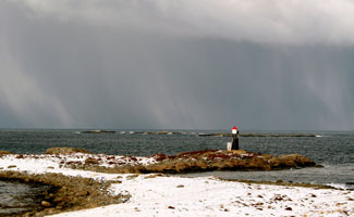
|
| NO 1781 |
Store Sandnes
latitude 68° 54' 3.5" N longitude 15° 24' 58.5" E |
Located at the extreme southwestern tip of Andøy. view (L 3254) [818500] |
| NO 1782 |
Åknes |
Located at Åknes, near the southwestern tip of Andøy. photo (L 3252) [818300] |
| NO 1783 |
Skiplingskjæran |
South of Istøy, Northeast spit (L 3256) [818700] |
| NO 1784 |
Sjåberget (Nordmela)
latitude 69° 8' 16.6" N longitude 15° 40' 17.6" E
Located in the fishing village of Nordmela on the central north coast of Andøya. (L 3228) [814500]
Photo courtesy MR Louie [Flickr] |
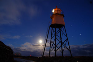
|
| NO 1785 |
Nordmela Mole |
At the head of the mole. (L 3231) [814700] |
| NO 1786 |
Storslettneset
latitude 69° 16' 8.4" N longitude 15° 55' 43.8" E |
West Storslettneset (L 3242) [816300] |
| NO 1787 |
Nattmålskjær
latitude 69° 16' 44.5" N longitude 15° 55' 13.6" E |
Located on a reef about 1.5 km northwest of Bleik. photo (L 3244) [816500] |
| NO 1788 |
Lovik
latitude 68° 58' 15.6" N longitude 15° 44' 10.8" E |
Hinnøy north point (L 3278) [820200] |
| NO 1789 |
Dverberg
latitude 69° 6' 29.2" N longitude 15° 58' 21.7" E |
Located at the end of a short mole at Dverberg, on the east coast of Andøy. photo (L 3442) [820400] |
| NO 1790 |
Skaften
latitude 69° 9' 39.1" N longitude 16° 5' 52.8" E |
East spit at beach of Andfjord. (L 3446) [821000] |
| NO 1791 |
Haugnes |
Located on a point of land at the east end of the Andøy airport. (L 3448) [821200] |
| NO 1792 |
Ballstadstraumen
latitude 68° 33' 24.4" N longitude 16° 19' 45" E |
At Steinvikflu (L 3286) [823900] |
| NO 1793 |
Hol Nedre (front range)
latitude 68° 32' 36" N longitude 16° 24' 51" E |
At Gyltneset. The rear range is a lantern on a post. (L 3290) [824400] |
Andøy Area
| NO 1798 |
Børhella
latitude 69° 6' 17.4" N longitude 15° 34' 4.4" E
Located on the west side of the entrance to Børvågen, on the west coast of Andøy. another photo (L 3227) [821300]
Photo courtesy Svein Solhaug [panoramio] |
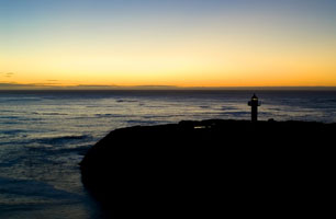
|
| NO 1799 |
Moholmen
latitude 69° 19' 31.7" N longitude 16° 4' 5.8" E |
Located on a small island about 2.5 km due west of Andenes harbor. (L 3462) [821900] |
| NO 1800 |
Storbåen
latitude 68° 34' 21.6" N longitude 16° 32' 12" E |
Southwest of Rødskjæret (L 3310) [825600] |
| NO 1801 |
Kobbsteingrunnen
latitude 68° 34' 19.8" N longitude 16° 31' 41.4" E |
Sandtorgstrømmens north end (L 3312) [825802] |
| NO 1802 |
Fjelldalsholman
latitude 68° 33' 57.8" N longitude 16° 33' 22" E |
At the north beach of Lavangsfjord (L 3316) [825900] |
| NO 1803 |
Nordøygrunnen
latitude 68° 33' 5.4" N longitude 16° 28' 51.6" E |
West of Hundvollen (L 3306) [825300] |
| NO 1804 |
Andenes
latitude 69° 19' 26.4" N longitude 16° 6' 57.8" E
The lighthouse is managed by the nearby Andøy Museum, which offers guided tours during the summer season. Located at the northeastern tip of Andøya in Andenes (Andøy). (L 3456) [822000]
Photo courtesy anymous [wikipedia] |
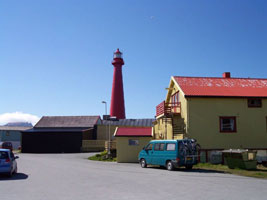
|
| NO 1805 |
Andenes hamn (Andøy Molja)
latitude 69° 19' 39.8" N longitude 16° 7' 10.8" E |
Located at the end of the mole in Andenes (Andøy). photo (L 3460) [821600] ARLHS # NOR-424 |
Harstad Area (Vesterålen)
(Google Map) 5 [825900]
| NO 1806 |
Kinnholmen |
Kvaefjord east side (L 3346) [831100] |
| NO 1807 |
Gapsøy (Gapøy)
latitude 68° 49' 28.2" N longitude 15° 57' 39.9" E |
Located in the Kvæfjord at the south end of Gapøya, about 7 km north of the town of Kvæfjord. photo (L 3347) [831200] |
| NO 1808 |
Lyså |
Southwest of namnet Lysaa (L 3350.4) [831900] |
| NO 1809 |
Eldaflesene |
Located on a skerry in the Kvæfjord about 3 km north of Elde. (L 3345) [831000] |
| NO 1810 |
Grøtavær
latitude 68° 58' 40.8" N longitude 16° 15' 58.8" E |
At the point east of Sandfallet (L 3360) [833600] |
| NO 1811 |
Bårnøyklubben
latitude 69° 1' 25.2" N longitude 16° 28' 32.4" E |
Baarøy south side (L 3466) [833900] |
| NO 1812 |
Tarskjær
latitude 69° 3' 51.1" N longitude 16° 29' 34.1" E |
Southwest of Meløyvær (L 3464) [834300] |
| NO 1813 |
Trollnesgrunnen |
Located on a shoal off the harbor of Bjarkøy. There should be a good view from passing ferries. photo (L 3468) [833800] |
| NO 1814 |
Sandssund (Lille Dyna)
latitude 68° 57' 24.3" N longitude 16° 37' 45.5" E |
Located on a skerry in the Sandssund off the northeastern tip of Grytøya, about 1.5 km northeast of the town of Grytøy and 16 km north of Harstad. (L 3343) [830000] |
| NO 1815 |
Sandsøy
latitude 68° 56' 45.1" N longitude 16° 39' 19.1" E |
Southwest of Søsund at Sandsøy (L 3341) [830200] |
| NO 1816 |
Store Kjeøy
latitude 68° 51' 39.8" N longitude 16° 34' 29.7" E |
northeast point of Vågsfjorden, about 8 km north of Harstad. (L 3334) [829000] |
| NO 1817 |
Mågøy
latitude 68° 49' 24.4" N longitude 16° 37' 8.7" E
October 8, 2010
Located at the southwestern tip of the island of Mågøy, about 5 km northeast of Harstad. (L 3332) [828500] |
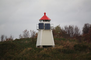
|
| NO 1818 |
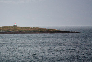
| Stangnesodden
latitude 68° 48' 38.1" N longitude 16° 34' 49.3" E
October 8, 2010
Located 70 m off the tip of the Stangness peninsula east of Harstad. It is visible from passing ferries. (L 3328) [827900] |
| NO 1819 |
Harstad
Located at the south end of Tjuvholmen, an island about 800 m northeast of Stangnesodden. (L 3330) [828100]
Photo courtesy Remi Longva [Flickr] |
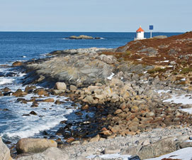
|
| NO 1820 |
Grasholmen
latitude 68° 40' 11.1" N longitude 16° 38' 10.1" E |
Stegholmens northeast point, there should be a good view from passing ferries. (L 3322) [827000] |
| NO 1821 |
Langkvitneset
latitude 68° 37' 53.6" N longitude 16° 35' 23.1" E |
Located at the tip of a headland on the east (mainland) side of the Tjeldsund about 800 m north of the Tjeldsund Bridge. photo (L 3320) [826500] |
Troms County
Map is N7
| NO 1822 |
Rollnesholmen
latitude 68° 43' 21.6" N longitude 16° 46' 24" E |
At Storholmen. May be visible to the south of the Stangnes to Sørrollnes ferry. (L 3326) [835100] |
| NO 1823 |
Årneset (Årsand)
latitude 68° 47' 33.7" N longitude 17° 10' 35" E |
Located on a promontory on the eastern tip of the island Ronna Rålli northeast of Hamnvik. photo (L 3364) [835500] |
| NO 1824 |
Lilleviknes |
In the fjord west of Grov. Only visible from a boat. (L 3366) [835700] |
| NO 1825 |
Lille Grøsnes |
West Ramtua (L 3370) [835900] |
| NO 1826 |
Salangen |
Revholmens northeast point (L 3376) [836000] |
| NO 1827 |
Mjøsund Bro |
at Mjøsundholmen. This looks like it is very near the highway 848 bridge north of Fornes. (L 3379) [836500] ARLHS # NOR-428 |
| NO 1828 |
Engenes
latitude 68° 55' 34.7" N longitude 17° 7' 10" E |
Northwestern tip of Andørja (L 3382) [837000] |
| NO 1829 |
Kastnesskjæret
latitude 68° 59' 48.8" N longitude 17° 28' 28.6" E |
Located on a skerry off a promontory of the mainland marking the entrance to the Dyrøysund. (L 3384) [837500] |
| NO 1830 |
Lekangneset
latitude 69° 1' 43.5" N longitude 17° 13' 50.9" E |
Stanglandets east side, in the village with the same name. (L 3390) [838200] |
| NO 1831 |
Dyrøya
latitude 69° 4' 25.2" N longitude 17° 23' 57" E |
Solbergfjord northwest beach (L 3396) [839000] |
| NO 1832 |
Hyseskjæret
latitude 69° 8' 16.2" N longitude 17° 23' 43.2" E |
West Tranøy (L 3398) [839100] |
| NO 1833 |
Klauvskjærodden
latitude 69° 11' 46.6" N longitude 18° 21.7" E |
Located on a promontory of Senja about 4 km southeast of Finnsnes. (L 3402) [839700] |
| NO 1834 |
Stonglandseidet
latitude 69° 5' 0.3" N longitude 17° 13' 5.1" E |
Located on Risøyskjær, a skerry off the east side of the Stonglandseidet isthmus, which connects Senja's southern peninsula to the rest of the island. (L 3392) [838500] |
| NO 1835 |
Halsvær
latitude 69° 2' 55.7" N longitude 17° 47.8" E |
Located on a skerry of the western tip of Senja's southern peninsula. (L 3474) [845100] |
| NO 1836 |
Dragøyskjær
latitude 69° 3' 56.4" N longitude 17° 1' 3.1" E |
Located on a reef off Senja's south coast about 4 km north of the Halsvær light. (L 3476) [851200] |
| NO 1837 |
Senjehestneset
latitude 69° 3' 30.6" N longitude 16° 45' 39" E
Senja, Norway's second largest island, is accessible from the mainland by the Gisund Bridge.
Located on a skerry about 1 km off the southwestern tip of Senja. * (L 3476) [851400]
Photo courtesy Patrik Engman [glocalnet] |
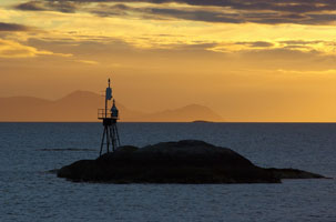
|
| NO 1838 |
Fiskeneset
latitude 69° 9' 0.9" N longitude 16° 59' 36.3" E |
Selfjord, on a point well north of Rødsand view (L 3476) [853000] |
| NO 1839 |
Leikneset
latitude 69° 13' 27" N longitude 16° 52' 45.8" E |
Located on a promontory (the southernmost of three in Torsken) on the west coast of Senja. (L 3494) [853700] |
| NO 1840 |
Bloskeneset |
On a promontory on the west side of the entrance to the Sifjord. (L 3496) [854000] |
| NO 1841 |
Holmenvær |
At Hjemholmen (L 3498) [854800] |
| NO 1842 |
Mefjordingen
latitude 69° 16' 55.2" N longitude 16° 47' 12.6" E |
Holmenvær (L 3502) [854900] |
| NO 1843 |
Hamnneset
latitude 69° 17' 50" N longitude 16° 59' 23" E |
Grunnfarnes harbor (L 3504) [855300] |
| NO 1844 |
Senholmen
latitude 69° 19' 56" N longitude 16° 59' 9.5" E |
Torskenfjord (L 3506) [855500] |
| NO 1845 |
Torsken |
North side of Senja Fjord (L 3508) [855800] |
| NO 1846 |
Månes
latitude 69° 22' 35.8" N longitude 16° 52' 6.2" E |
The building near the light is probably a former keeper's house, but we need information on the history of this historic station. Located on a promontory (the northernmost of three in Torsken) on the west coast of Senja. (L 3510) [856000] |
| NO 1847 |
Teistneset
latitude 69° 24' 16.5" N longitude 16° 56' 28.1" E |
Located on a promontory about 6.5 km northeast of the Månes lighthouse. (L 3514) [856500] |
| NO 1848 |
Hamn |
At Hellandsneset (L 3516) [857000] |
| NO 1849 |
Flatholmen |
West Hamn (L 3520) [857400] |
| NO 1850 |
Kvanholmen
latitude 69° 25' 25.2" N longitude 17° 14' 24" E |
Bergsfjord (L 3522) [858000] |
| NO 1851 |
Flatneset
latitude 69° 25' 26.4" N longitude 17° 17' 50.4" E |
Bergsfjord (L 3528) [858400] |
| NO 1852 |
Bøvær (Lille Bøholmen)
latitude 69° 27' 58.8" N longitude 17° 13' 25.7" E |
Located on a small island, Lille Bøholmen, off the harbor of Bøvær on the west coast of Senja. The neighboring building is a former fish packing factory, now used as a community center; accommodations are available. photo (L 3490) [858600] |
| NO 1853 |
Røra
latitude 69° 29' 49.2" N longitude 17° 11' 55.5" E |
Located on a sharp promontory at the entrance to the Steinfjord, about 7 km north of Bøvær. (L 3532) [859000] |
| NO 1854 |
Kjølva
latitude 69° 36' 3.1" N longitude 17° 29' 32.3" E |
Kjølva is a spectacular peak that rises 440 ft above the sea at the tip of a sharp cape at the northwestern tip of Senja. Located near the base of the cliff. (L 3534) [859500] |
| NO 1855 |
Kjøbmandsøy (rear range) |
Bergsfjord (L 3536.1) [859700] |
| NO 1856 |
Lille Teistholmen (Range Front) |
Bergsfjord, on a small island about 1 km north of the Kjøbmansøy light. (L 3536) [859800] |
| NO 1857 |
Okseneset |
Ytre Senja (L 3538) [860000] |
| NO 1858 |
Tungeneset |
Steinfjord (L 3540) [860300] |
| NO 1859 |
Steinfjorden |
At Høgbåen (L 3542) [860700] |
| NO 1860 |
Mefjord |
At Knuten (L 3544) [861000] |
| NO 1861 |
Øyfjord (House Island)
latitude 69° 32' 49.9" N longitude 17° 39' 14.1" E |
Husøy is an island in the Øyfjord off the northwest coast of Senja. Located at the northern tip of Husøy. Photos (L 3550) [862000] |
| NO 1862 |
Stønnesbotnen
latitude 69° 30' 53.3" N longitude 17° 56' 22.5" E |
Located on a headland at Gavlen, a former fishing village now a summer community on the north coast of Senja. photos (L 3432) [844200] |
| NO 1863 |
Klauva
latitude 69° 10' 36.6" N longitude 17° 57' 27.6" E
October 8, 2010
At Reipneset (L 3400) [839400] |
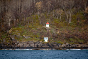
|
| NO 1864 |
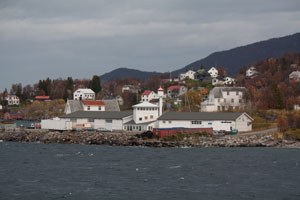
| Finnsnes
latitude 69° 13' 36.3" N longitude 17° 58' 33.7" E
October 8, 2010
This light marks the southern entrance to the Finnsnesrenna, a narrow channel separating the island of Senja from the mainland. Located in the village of Finnsnes. (L 3404) [840000] |
| NO 1865 |
Bjørnhiskjær
latitude 69° 14' 27.6" N longitude 17° 58' 16.8" E
October 8, 2010
At the east end of the Gisundet Bridge. Thus there are 2 lights under this bridge, one at the center, one at the end. NO 1867 (L 3403.9) [840400] |
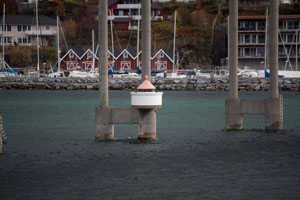
|
| NO 1866 |
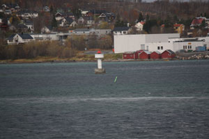
| Finnsnesrenna
latitude 69° 14' 12" N longitude 17° 57' 24" E
October 8, 2010
Rennas west side. This is an island just west of Silsand. (L 3403) [840800] |
| NO 1867 |
Gisundet bru
latitude 69° 14' 33" N longitude 17° 57' 55.8" E
October 8, 2010
It is just at the foot of the bridge piling between Finnsnes and Silsand. (L 3404.7) [841100] |
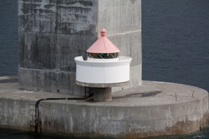
|
| NO 1868 |
Leiknesøyra Nordre
latitude 69° 18' 48.4" N longitude 17° 59' 20.2" E |
In the fjord northwest of Leiknes (L 3411.6) [841900] |
| NO 1869 |
Bukkskinn Øvre (rear range) |
Glaund Sundets east side, probably in the village of Bukkskinn. (L 3412.1) [842100] |
| NO 1870 |
Bukkskinn Nedre (front range) |
On the shore (L 3412) [842200] |
| NO 1871 |
Slettneset
latitude 69° 22' 42.6" N longitude 18° 5' 55" E
October 8, 2010
Located at the tip of a promontory of the mainland about 2 km north of Slettnes. (L 3416) [842600] |
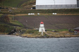
|
| 1872 |
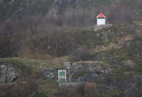
| Rødbergsodden (NO 1872)
latitude 69° 27' 21.3" N longitude 18° 8' 8.5" E
October 8, 2010
This light marks an important turn in the coastal waterway south of Tromsø. Located on a promontory north of Rødbergshamn. (L 3420) [842800] |
| 1873 |
Klavikneset (NO 1873)
Located on the west side of a southern branch of the Malangenfjord south of Kravik. (L 3422) [843200]
Photo courtesy Tatiana Fernandes [Flickr] |
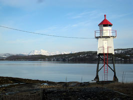
|
| NO 1874 |
Sultindvikneset |
Located on the west side of the Malangenfjord at the entrance to the Målselva. (L 3426) [843400] |
| NO 1875 |
Nordbyneset
latitude 69° 19' 54.2" N longitude 18° 49' 16.6" E |
Located at the tip of a promontory on the north side of the Malangenfjord. photo (L 3428) [843600] |
| NO 1876 |
Hekkingen
latitude 69° 36' 4.8" N longitude 17° 49' 49" E
This light marks the entrance to Malangenfjord. Located on an island about 7 km west of Sommarøy. Accessible only by boat. (L 3552) [862500] ARLHS # NOR-113
Photo courtesy Marius Fiskum [wikipedia] |
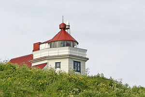
|
| NO 1877 |
Hekkingsundet
latitude 69° 35' 24" N longitude 17° 51' 9.6" E |
At Klubbholmen which is the south end of the chain of islands noted above. (L 3553) [862700] |
| NO 1878 |
Langskjær
latitude 69° 35' 4" N longitude 17° 51' 48" E |
Straumholet (L 3554) [863200] |
| NO 1879 |
Skarvhalsen
latitude 69° 37' 7.2" N longitude 17° 53' 14.4" E |
On the west coast of Edøya (L 3555.4) [863700] |
| NO 1880 |
Skarvskjær
latitude 69° 37' 42.6" N longitude 17° 58' 40.2" E |
On a skerry south of the island of Hillesøya. (L 3556) [863900] |
| NO 1881 |
Lille Lyngøy
latitude 69° 37' 49.8" N longitude 17° 59' 59.4" E |
West Hillesøy (not to be confused with the light below.) NO 1910 (L 3557) [864100] |
| NO 1882 |
Sommarøy
latitude 69° 38' 28.2" N longitude 18° 1' 58.8" E |
Located on an islet off the north coast of Sommarøy. photo (L 3560) [866000] |
| NO 1883 |
Værholmen
latitude 69° 39' 3" N longitude 17° 58' 50.4" E |
Located on an islet off the north coast of Hillesøy. flickr (L 3562) [866300] |
| NO 1884 |
Ørnfløynakken |
South of Sommarøy store (L 3558) [865000] |
| NO 1885 |
Vasstramd
latitude 69° 39' 38.4" N longitude 18° 13' 3" E |
Kattfjord, north of Vasstrand (L 3566) [867000] |
| NO 1886 |
Sessøysund
latitude 69° 42' 34" N longitude 18° 14' 56" E |
At Tennskjær (L 3570) [868000] |
| NO 1887 |
Håja
latitude 69° 44' 34" N longitude 18° 6' 12" E
November 10, 2010
Located on an islet off the northeastern tip of the island of Håja. (L 3568) [867500] |
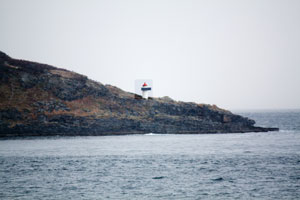
|
| NO 1888 |
Bjørnøy
latitude 69° 46' 10.2" N longitude 18° 9' 25.2" E |
On the northeast side of Dørsundet fjord. (L 3572) [868500] |
| NO 1889 |
Røssholmen |
Located on an islet off the entrance to the Vengsøyfjord, one of the main approaches to Tromsø. (L 3574) [869000] |
Tromsø Municipality Coast
| NO 1890 |
Tomasjordnes |
Balsfjord east side, west of E8 north of Slettmo (L 3629) [879600] |
| NO 1891 |
Storneset
latitude 69° 27' 32.5" N longitude 18° 58' 5.3" E |
Located at the tip of a sharp promontory on the east side of the Balsfjord about 2.5 km northwest of Selnes. (L 3628) [879200] |
| NO 1892 |
Kobben
latitude 69° 31' 2" N longitude 19° 32" E |
At Haugbergneset (L 3628.4) [879400] |
| NO 1893 |
Ryøystraumen
latitude 69° 33' 27.2" N longitude 18° 43' 31.8" E
October 8, 2010
At straumens north side (L 3626) [879000] |
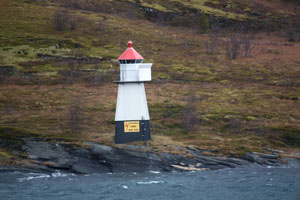
|
| NO 1894 |
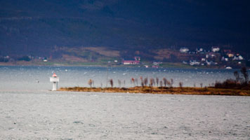
| Balsnesodden
latitude 69° 33' 46.8" N longitude 18° 49' 40.2" E
October 8, 2010
Located at the tip of a promontory at the entrance to the Balsfjord, about 10 km southwest of Tromsø. (L 3627) [879100] |
| NO 1895 |
Skarvegrunnen Vestre (west)
latitude 69° 40' 13.2" N longitude 18° 51' 39.6" E |
West of Tromsøya (L 3638.2) [880400] |
| NO 1896 |
Sandnessundet bru
latitude 69° 41' 31.2" N longitude 18° 53' 59.4" E |
This is the bridge just west of the Tromsø airport on highway 862. (L 3640.94) [880902] |
| NO 1897 |
Nesland
latitude 69° 42' 46.8" N longitude 18° 59' 47.9" E
Located off the Ringvegen at the northern tip of Tromsøya. (L 3642) [881600]
Photo courtesy Per Ivar Somby [Flickr] |
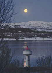
|
| NO 1898 |
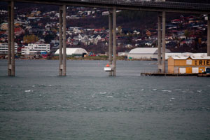
| Tromsø bru
latitude 69° 39' 1.8" N longitude 18° 58' 54" E
October 8, 2010
The light is at the center of Tromsø bridge. (L 3636) [882000] |
| NO 1899 |
Hansmark
latitude 69° 38' 48.2" N longitude 18° 54' 12.5" E |
In the village of Vangberg. (L 3630) [880100] |
| NO 1901 |
Skallen
latitude 69° 45' 19.2" N longitude 19° 5' 43.8" E |
Tromsøysundet north ledge (L 3644) [882600] |
| NO 1902 |
Hansneset
latitude 69° 46' 24.6" N longitude 19° 3' 15" E
Located at the northeastern tip of Kvalsøya, marking the west side of the northern entrance to the Tromsøysund. (L 3646) [883000]
Photo courtesy Dag Hugstmyr [panoramio] |
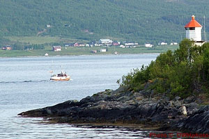
|
| NO 1903 |
Store Ganholmen |
At east holme (L 3582) [870000] |
| NO 1904 |
Kaldfjord
latitude 69° 49' 48" N longitude 18° 39' 35" E |
At Klubbeneset (L 3586) [871000] |
| NO 1905 |
Gjesneset
latitude 69° 49' 13" N longitude 18° 28' 27" E |
Vengsøys south side (L 3584) [870500] |
| NO 1906 |
Rognholmen
latitude 69° 52' 22.2" N longitude 18° 28' 22.2" E |
North of Vengsøy (L 3587) [871500] |
| NO 1907 |
Auvær |
This modest light is an landfall light for Tromsø. Located atop a small island about 32 km west of the entrance to the Vengsøyfjord. (L 3578) [869500] |
Northern Troms Coast
Map is N7 [875800]
| NO 1909 |
Gåsvær
latitude 69° 53' 45" N longitude 18° 40' 18" E |
Kvalsundet south side, west exit. (L 3590) [872500] |
| NO 1910 |
Lille Lyngøy
latitude 69° 55' 28.2" N longitude 18° 27' 54" E |
West of St. Lyngøya (not to be confused with the light above.) NO 440 (L 3592) [872900] |
| NO 1911 |
Simabakleia Nedre (front range)
latitude 69° 55' 43.8" N longitude 18° 28' 15.6" E |
At Kvitholmen (L 3594) [873200] |
| NO 1911R |
Simabakleia Øvre (rear range)
latitude 69° 55' 34.2" N longitude 18° 29' E |
At St. Lyngøy (L 3594.1) [873100] |
| NO 1912 |
Hysholmen
latitude 70° 41.4" N longitude 18° 33' 51" E |
Southwest of Sandøya (L 3604) [874500] |
| NO 1913 |
Sørstabben
latitude 70° 1' 28.2" N longitude 18° 35' 43.2" E |
East of Sandøya (L 3606) [874800] |
| NO 1914 |
Styrsøy
latitude 70° 1' 43.8" N longitude 18° 38' 44.4" E |
Located in the Sandøyfjord near Engvik. closeup (L 3608) [875000] |
| NO 1915 |
Eggeløysa
latitude 70° 7' 56.9" N longitude 18° 38' 52.5" E |
Located on a skerry off the south end of Store Hattøy, an island northwest of Rebbenesøya. (L 3610) [875500] |
| NO 1916 |
Andamsmulen
latitude 70° 8' 5.9" N longitude 18° 48' 18.1" E |
Located at the northern tip of Andammen island. (L 3610.4) [875800] |
| NO 1917 |
Ormholmen
latitude 70° 11' 23" N longitude 18° 53' 57.7" E |
Grøtøy northeast point (L 3616) [877800] |
| NO 1918 |
Bjørn |
Kvaløy west side (L 3614) [877500] |
| NO 1919 |
Langholmbåen
latitude 70° 6' 17" N longitude 19° 6' 45" E |
Bårdsetsundet inlet from south (L 3613) [877000] |
| NO 1920 |
Dyrsnes |
Skagøysundet east side (L 3622) [878400] |
| NO 1921 |
Finnesklubben |
Mikkelvika north side (L 3620) [878200] |
| NO 1922 |
Straumsnes |
Skagøysundet east side (L 3818) [878000] |
| NO 1923 |
Skarsfjorden
latitude 69° 58' 53.4" N longitude 18° 48' 4.2" E |
Located on the north side of the entrance to the Skarsfjord, about 3 km west of Stordal on the west coast of the large island of Ringvassøya. (L 3612) [876200] |
| NO 1924 |
Klokkerhomen
latitude 69° 57' 7.2" N longitude 18° 42' 58.2" E |
Ringvassøy west side (L 3598) [874000] |
| NO 1925 |
Ytre Kråkvika
latitude 69° 52' 37.2" N longitude 18° 51' 31.8" E |
At Meholmen (L 3649) [883500] |
| NO 1926 |
Vågnes
latitude 69° 46' 45" N longitude 19° 16' 27.6" E |
Grøtsundet south side (L 3650) [884000] |
| NO 1927 |
Gammneset
latitude 69° 54' 15.6" N longitude 19° 28' 37.2" E |
Langsundet west side, just east of highway 863 in Gammnes. (L 3660) [884800] |
| NO 1928 |
Langsundet (Skattøra, Skattoyra)
latitude 69° 58' 33.1" N longitude 19° 40' 18.6" E |
The Langsundet (Long Sound) is a narrow passage between the islands of Ringvassøya and Reinøya. Located on a very sharp point of land projecting from Ringvassøya about 4 km northeast of Hansnes. (L 3664) [884900] |
| NO 1929 |
Brennes |
Ringvassøys northeast side (L 3672) [886500] |
| NO 1930 |
Dåfjorden |
Located on Bukkholmen, a small island in the Dåfjord, a wedge-shaped inlet on the north side of Ringvassøya. (L 3670) [886000] |
| NO 1931 |
Helgøya
latitude 70° 6' 33.3" N longitude 19° 22' 16.3" E |
At Skjåholmskjæret, a skerry off the southern tip of Helgøy, an island lying north of Ringvassøya. (L 3668) [885500] |
| NO 1932 |
Vannøyklubben
latitude 70° 5' 48" N longitude 19° 41' 30" E |
Located on a promontory on the southwest coast of Vannøy; probably accessible from the coastal highway. photo (L 3674) [887000] |
| NO 1933 |
Skarvbarden |
Located on a breakwater pier at the southern entrance to Torsvåg harbor. Accessible by walking the pier. (L 3678) [887500] |
| NO 1934 |
Nakkesletta |
Torsvåg (L 3681) [887800] |
| NO 1935 |
Torsvåg
latitude 70° 14' 43.1" N longitude 19° 30' 12.5" E
Located atop a small island off the northwestern tip of Vannøy; the station is connected to Vannøy by a short causeway. (L 3682) [888000] ARLHS # NOR-251
Photo courtesy Morten Dreier [wikipedia] |
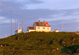
|
| NO 1936 |
Store Grimsholmen
latitude 70° 17' 32.4" N longitude 19° 46' 36" E |
North of Burøya (L 3686) [888500] |
| NO 1937 |
Burøynakken
latitude 70° 15' 45" N longitude 19° 45' 49.9" E |
Burøy north tip (L 3688) [888800] |
| NO 1938 |
Burøysundet
latitude 70° 13' 24.6" N longitude 19° 44' 24.6" E |
Located on the southern tip of Burøy, marking the entrance to the Burøysund, the narrow strait between Burøy and Vannøy. (L 3690) [889000] |
| NO 1939 |
Svartebergan |
Slettnesvika. Vannøy east side (L 3691) [889500] |
| NO 1940 |
Store Skorøya
latitude 70° 8' 39.7" N longitude 20° 2' 31.8" E |
Fugløyfjorden south point (L 3700) [900400] |
| NO 1941 |
Valaneset
latitude 70° 7' 41" N longitude 19° 59' 50" E |
Lille Skorøy south point (L 3701) [901100] |
| NO 1942 |
Vannvåg mole
latitude 70° 4' 24.5" N longitude 19° 59' 33.6" E |
At the end of the mole (L 3705.4) [901300] |
| NO 1943 |
Fugløykalven
latitude 70° 18' 59.8" N longitude 20° 9' 12.9" E
This was considered one of the most isolated and difficult assignments of all Norwegian light stations. Located on a small island off the northwestern tip of Fugløy (Fugløykalven means "calf of Fugløy"). Accessible only by boat, and landing is difficult. (L 3692) [900000] ARLHS # NOR-091
Photo courtesy Norweigen Lighthouse History [fyr] |
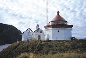
|
| NO 1944 |
Valholmen |
Spenna southeast side (L 3702) [901400] |
Northern Troms Fjord
| NO 1945 |
Karlsøya
latitude 69° 59' 43.3" N longitude 19° 57' 53.1" E
Located at the eastern end of Karlsøy, about 5 km east of the town of the same name. another photo (L 3720) [904200]
Photo courtesy Matilde Martinez [Flickr] |
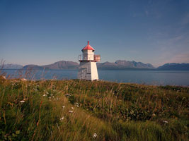
|
| NO 1946 |
Klubbakjær |
Sørfjorden west side (L 3712) [902800] |
| NO 1947 |
Kuberget |
Ullafjord west side (L 3711) [902600] |
| NO 1948 |
Sørlenangen
latitude 69° 50' 48.4" N longitude 19° 59' 36.3" E |
Located at the tip of a promontory projecting into the Ullsfjord north of Ravik. (L 3714) [903200] |
| NO 1949 |
Nordlenangen
latitude 69° 54' 42" N longitude 20° 10' 1.2" E |
Located on a promontory near Nordlenangen. Flickr (L 3716) [903400] |
| NO 1950 |
Lyngstuva
latitude 69° 58' 31.6" N longitude 20° 15' 41.3" E |
Located on a promontory overlooking the Ullsfjord about 8 km north of Nordlenangen. photo (L 3718) [904000] |
| NO 1950N |
Ytre Nortasholmen
latitude 69° 33' 54.6" N longitude 20° 18' 22.2" E |
Located on a small island in the Lyngenfjord off Lyngseidet (L 3748) [906600] |
| NO 1951 |
Lyngsdaløra |
Lyngenfjord's west side (L 3752) [907000] |
| NO 1952 |
Salmenes
latitude 69° 20' 1.7" N longitude 20° 1' 23.3" E |
Located on a promontory on the east side of the Storfjord, an upper branch of the Lyngenfjord. (L 3754) [907200] |
| NO 1953 |
Pergenga
latitude 69° 30' 49" N longitude 20° 47' 10" E |
Kåfjord (L 3744) [906200] |
| NO 1954 |
Mandalsklubben |
Kåfjord. Looks like it is on the coast near highway E6. (L 3742) [906000] |
| NO 1955 |
Olderdalen |
Kåfjorden (L 3740) [905800] |
| NO 1956 |
Spåkenes |
Lyngenfjord's east side (L 3736) [905500] |
| NO 1957 |
Rotsund |
Lyngen fjord (L 3755) [907400] |
| NO 1957V |
Tønsnes
latitude 69° 44' 1.8" N longitude 19° 5' 36" E |
At Lysneset. E6 goes through Djupvik, the light is west of there in Spaakenes. I assume there's a road I can't see that would get you there. (L 3643) [882500] |
| NO 1958 |
Maursund
latitude 69° 55' 9.5" N longitude 20° 52' 17" E |
Located on the south side of the entrance to the Maursund, the passage between the islands of Kågen and Hamneide (L 3730) [905400] |
| NO 1959 |
Vorterøy |
At Vorterøyskagen (L 3726) [904700] |
| NO 1960 |
Arnøya
latitude 70° 2' 2.9" N longitude 20° 32' 13" E
Located at the tip of Haugnes, a promontory on the south coast of Arnøy. (L 3730) [904500]
Photo courtesy Knut Sandaker [Flickr] |
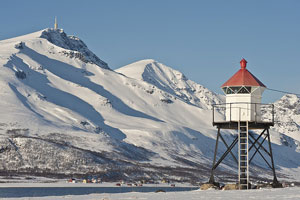
|
| NO 1961 |
Skjåvikneset |
Arnøy west side. Fugløysund [901600] |
| NO 1962 |
Hylla |
Arnøy north tip (L 3792) [913000] |
| NO 1963 |
Lauksund Søre (south)
latitude 70° 6' 16.1" N longitude 20° 44' 59.6" E |
Located on the west side of the Lauksund about 3 km south of Lauksletta. (L 3788) [912400] |
| NO 1963N |
Lauksund Nordre (north) |
Located on the west side of the Lauksund, the narrow passage between Arnøy and Laukøy, about 4 km north of Lauksletta. (L 3790) [912500] |
| NO 1964 |
Kågsund |
Located on a small island off the southeastern tip of Amøya. (L 3756) [908000] |
| NO 1965 |
Skjervøya
latitude 70° 3' 42" N longitude 20° 59' 48" E
Located at the northeastern point of Skjervøya overlooking the broad embayment of the Kvænangenfjord. (L 3760) [908400]
Photo courtesy Idar Hansen [Flickr] |
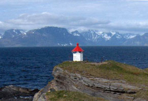
|
| NO 1966 |
Taskebyneset |
Kågens' east point (L 3764) [909500] |
| NO 1967 |
Storneset
latitude 69° 52' 24.6" N longitude 21° 2' 1.8" E |
Located at the entrance to the harbor of Storneshamn. photo (L 3768) [910000] |
| NO 1968 |
Lille Haukøy
latitude 70° 1' 28.2" N longitude 21° 17' 14" E |
Kvænangen north point Haukøysund (L 3772) [910200] |
| NO 1969 |
Skagklubben |
Spildra northwest spit (L 3775) [910400] |
| NO 1970 |
Spildra |
South spit of Spildra (L 3776) [910600] |
| NO 1971 |
Røholmen |
Kvænangen's west side (L 3782) [911200] |
| NO 1972 |
Kvænangstraumen
latitude 69° 50' 36" N longitude 21° 52' 48" E |
The Kvænangstraumen is a narrow strait connecting the Båderfjord and Sørfjord about 25 km south of Burfjord. The E6 highway crosses the strait about 200 m south of the light. Located on the west side of the entrance to the strait from the Båderfjord. (L 3784) [911400] |
| NO 1973 |
Storengnesset
latitude 70° 2' 7.7" N longitude 21° 46' 25.9" E |
Located on a promontory at the junction of the Burfjord and the Jøkelfjord. (L 3780) [911000] |
| NO 1974 |
Jøkelfjord
latitude 70° 3' 38.6" N longitude 21° 51' 26.9" E |
Located on Slettneset, a headland on the south side of the Jøkelfjord. (L 3787) [911800] |
Finnmark County
Map is N8
| NO 1976 |
Vaddekeip |
Located on the east side of the Langfjord near Sopnes, about 25 km southeast of Øksfjord (as the crow flies, not by road!). May be accessible by a short walk from the Hammerfest highway (E6). photo (L 3920) [929100] |
| NO 1977 |
Brynnilen |
Lopphavet northwest beach (L 3796) [913400] |
| NO 1978 |
Andsnes |
At Sørodden (L 3798) [913600] |
| NO 1979 |
Loppekalven |
On the island of Loppa, this is the southeast point (L 3800) [913800] |
| NO 1980 |
Marholmen |
A very small reef runs out into the fjord east of Loppa. This light is at the end of it, so probably accessible only by boat, and with significant risk at the same time. (L 3804) [914000] |
| NO 1981 |
Pannarodden |
Bergsfjord (L 3809) [914800] |
| NO 1982 |
Bergsfjord |
At Klubbholmen. While west of the city of Bergsfjord, it is probably visible from the ferry heading north as it leaves the city. (L 3807) [914400] |
| NO 1983 |
Gammelværneset
latitude 70° 19' 30" N longitude 22° 54" E |
Ulsfjord (L 3810) [915200] |
| NO 1984 |
Nuvsvåg
latitude 70° 16' 24" N longitude 22° 7' E |
Nuvsfjord east side (L 3812) [915800] |
| NO 1985 |
Øksfjord (Ystnes) |
Located on the east side of the entrance to the Øksfjord and the town of Øksfjord. photo (L 3815) [919160] |
| NO 1985K |
Kvitbergskjær |
Located on a skerry in the Lyngenfjord off Kvitberg. There's a good view from the ferry between Lyngseidet and Olderdalen (L 3745) [904000] |
| NO 1986 |
Eldsnes (Langford) |
Langfjord, Just north of Indre Ulvsvag on E6. (L 3918) [928900] |
| NO 1987 |
Langnesholmen
latitude 70° 8' 14.4" N longitude 23° 46" E |
Altafjorden south beach (L 3906) [928700] |
| NO 1988 |
Langgudnes
latitude 70° 6' 45.6" N longitude 23° 22' 7.8" E |
Leirbotn (L 3922) [929300] |
| NO 1989 |
Amtmannsnes
latitude 69° 59' 33.6" N longitude 23° 18' 2.4" E
Located on a promontory projecting into the Altafjord about 5 km northeast of Alta. (L 3926) [929700]
Photo courtesy Trine Sandmo [Flickr] |
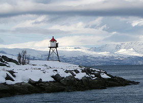
|
| NO 1990 |
Litlenæringen |
Located atop a vertical cliff on the easternmost tip of Sørøya. (L 3881) [924700] |
| NO 1991 |
Tarhalsen
latitude 70° 52' 8.8" N longitude 23° 18' 55.4" E |
Located atop a vertical cliff at the northernmost point of Sørøya. photo (L 3826) [918000] |
| NO 1992 |
Store Kammøy
latitude 70° 49' 57.6" N longitude 23° 4' 6" E |
Kammøysundet north side (L 3830) [918200] |
| NO 1993 |
Skarvfjord
latitude 70° 45' 40" N longitude 23° 5' 20.3" E |
At Skarvholmen (L 3832) [918500] |
| NO 1994 |
Skarvskjæret
latitude 70° 40' 27" N longitude 22° 58' 14" E |
In the bottom of Sandøyfjord (L 3834) [918700] |
| NO 1995 |
Flatøy |
Galtefjord. Northwest point of Sørøy west on the north side. Don't confuse with the light with the same name above. NO 1556 (L 3836) [918900] |
Sørøya Area
| NO 1996 |
Kåja |
Located on a promontory at the entrance to the harbor of Sørvær. photo (L 3844) [919700] |
| NO 1997 |
Sørvær Øvre (rear range) |
Located on a hillside on the west side of Sørvær. (L 3846.1) [919900] |
| NO 1998 |
Sørvær Nedre (front range) |
Located on a skerry inside the entrance to the harbor of Sørvær. photo (L 3846) [920000] |
| NO 1999 |
Breivik (Panseren) |
Located on a skerry in the entrance to the harvor of Breivik, on the west coast of Sørøya. photo (L 3850) [920200] |
| NO 2000 |
Stangeneset
latitude 70° 29' 48.6" N longitude 22° 7' 7.8" E |
Located on a promontory near Hasvåg, about 2 km northwest of Hasvik. photo (L 3854) [920600] |
| NO 2001 |
Hasvik north mole
latitude 70° 28' 53.2" N longitude 22° 10' 2.4" E
Located at the end of the north mole in Hasvik. There's a good view from ferries arriving in Hasvik from Øksfjord. There is only a lantern on the south mole. (L 3861) [921300]
Photo courtesy Frank Ingil [panoramio] |
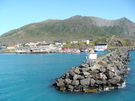
|
| NO 2002 |
Svartskjær
latitude 70° 29' 27.6" N longitude 22° 15' 46.8" E |
Hasfjord (L 3863) [921600] |
| NO 2003 |
Karken
latitude 70° 29' 29.4" N longitude 22° 35' 16.8" E
October 11, 2010
Sørøysundet off the south point. This photo was taken from several miles away and digitally zoomed to show the light. (L 3866) [922200] |
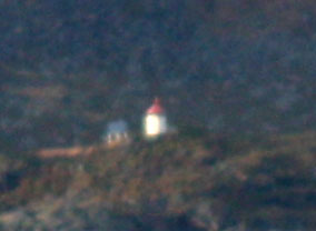
|
| NO 2004 |
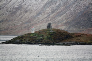
| Vatnholmen
latitude 70° 31' 18" N longitude 22° 56' 18" E
October 11, 2010
Located on an island in the Sørøysund, off the southeast coast of Sørøya. (L 3870) [922500] |
| NO 2005 |
Kårhamn (Kårhavn)
latitude 70° 32' 54.5" N longitude 23° 9' 49.9" E |
Located on a headland on the west side of the entrance to Kårhamn, a fishing port on the north end of the island of Seiland and the south side of the Sørøysund. (L 3872) [923000] |
| NO 2006 |
Vargsundet |
Altafjorden, east side of the sound. (L 3902) [926800] |
| NO 2007 |
Neverfjorden
latitude 70° 27' 11.4" N longitude 23° 46' 36.5" E |
At Kvitnes (L 3896) [926400] |
| NO 2008 |
Slettnesfjord
latitude 70° 37' 45" N longitude 23° 8' 58" E |
Sørøysundet west side (L 3878) [923800] |
Hammerfest Area
| NO 2010 |
Grunnvågnes |
Located atop a high promontory on the northern end of the island of Seiland, about 16 km southwest of Hammerfest. Ferries between Karhamn and Hammerfest pass this light. (L 3877) [924000] |
| NO 2011 |
Mylingen |
Kvaløy northwest point (L 3882) [924600] |
| NO 2012 |
Fugleneset (Hammerfest)
latitude 70° 40' 1.6" N longitude 23° 39' 17.4" E
October 11, 2010
Fuglenes is the neighborhood on the north side of the harbor of Hammerfest. The lighthouse is at the end of a peninsula jutting out from Fuglenes and sheltering the harbor. (L 3884) [924800] ARLHS # NOR-089 |
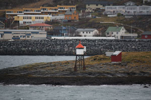
|
| NO 2013 |
Strømmen
latitude 70° 36' 4.3" N longitude 23° 36' 2.9" E |
Located on a headland about 1 km west of Straumsneset and 10 km south of Hammerfest, marking the entrance to the Altafjord. Site status unknown; the site may be accessible by a short hike from the Straumsneset ferry terminal. (L 3890) [926000] |
| NO 2015 |
Kvalsund
latitude 70° 30' 22.2" N longitude 23° 53' 37.9" E |
At Alneset, northwest side of the sound. (L 3900) [926600] |
| NO 2017 |
Mjånes |
Rognsundet (L 3906) [927600] |
| NO 2018 |
Goppl
latitude 70° 14' 49.2" N longitude 23° 25' 19.2" E |
Korsfjord (L 3908) [928000] |
| NO 2019 |
Korsnes
latitude 70° 12' 55.8" N longitude 23° 10' 52.8" E |
At St. Korsnes (L 3910) [928300] |
| NO 2020 |
Stjernsund |
At Luftnes (L 3914) [928500] |
| NO 2027 |
Fægfjordholmen |
Northeast side (L 3932) [930000] |
| NO 2028 |
Skipsholmen |
Skipsholmen is an island north of Hammerfest, about 13 km northeast of Sørøya and 10 km southwest of Rolvsøya. The light guides vessels approaching Hammerfest from the open sea. Located at the west end of the island. (L 3824) [925200] |
| NO 2029 |
Valfjord |
Rolvsøya (L 3977) [936500] |
| NO 2030 |
Revsnes |
Revsnesets north point (L 3934) [930500] |
| NO 2031 |
Måsholmen |
West of Krokneset (L 3935) [930700] |
| NO 2032 |
Bustadsund |
South side of the sound (L 3946) [932800] |
| NO 2033 |
Snefjord |
At skavikneset (L 3948) [933500] |
Rolvsøya Area
(Google Map) 8
| NO 2035 |
Finnes |
Ingøy west side (L 3958) [934000] |
| NO 2036 |
Sandholmen (Fruholmen Lower) |
This auxiliary light guides ships around reefs near the lighthouse. Located at the base of the taller light. photos (L 3960) [934200] ARLHS # NOR-428 |
| NO 2037 |
Fruholmen (Upper) |
Located on a small island off the north side of Ingøy, about 20 km northeast of Hammerfest. (L 3962) [934500] ARLHS # NOR-088 |
| NO 2038 |
Ingøy |
At Avløysninga (L 3964) [934700] |
| NO 2039 |
Store Gåsøy |
At Ingøy off of the northeast point (L 3966) [935200] |
| NO 2040 |
Trollsundet |
At Hammarneset (L 3970) [935400] |
| NO 2041 |
Tufjord
latitude 70° 59' 56.4" N longitude 23° 53' 24.8" E |
Rolfsøy west side (L 3976) [936000] |
| NO 2042 |
Gunnarneset |
Gunnarnes is a village on the east side of Rolvsøy. Accessible only by boat. photo (L 3973) [935800] ARLHS # NOR-430 |
| NO 2043 |
Rolvsøyhamn
latitude 70° 56' 45.6" N longitude 24° 12' 48" E
October 9, 2010
Rolvsøya's east side (L 3978) [936700] |
|
| NO 2044 |
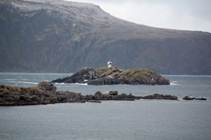
| Rotskjæringsneset
latitude 70° 59' 32.4" N longitude 24° 37' 30.6" E
October 11, 2010
Havøysundet's westerly inlet (L 3980) [937000] |
| NO 2045 |
Garpeskjær (Garpholmen)
latitude 71° 15" N longitude 24° 43' 7.8" E
October 11, 2010
Ferries between Hammerfest and Havøysund pass close by this light. Located on a small island about 3 km east northeast of Havøysund. (L 3989) [937400] |
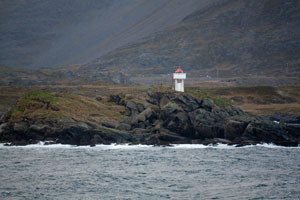
|
| NO 2046 |
Akkarfjord |
Hjelmsøy west side (L 3992) [939700] |
Magerøy (North Cape) Area
(Google Map) 8
| NO 2047 |
Svartviknæringen
latitude 71° 6' 12" N longitude 24° 50' 58.8" E |
Located on a rocky promontory of the mainland marking the western entrance to the Magerøysund, the channel south of the island of Magerøy. (L 3994) [939800] |
| NO 2048 |
Måsøykalven |
Northwest of Måsøya (L 3997) [940000] |
| NO 2049 |
Måsøy (Torvenest)
latitude 71° 28.2" N longitude 25° 2' 1.2" E |
At Torveneset (L 4000) [940600] |
| NO 2050 |
Måsøysund
latitude 70° 59' 46.8" N longitude 24° 58' 12" E |
Måsøy's south point (L 3998) [940200] |
| NO 2051 |
Smedberget |
Kobbfjord west side (L 4009) [942500] |
| NO 2052 |
Store Kobbøy
latitude 70° 55' 9" N longitude 25° 16' 16" E |
In the middle of Kobbfjord (L4009.4) [942600] |
| NO 2053 |
Risvikneset
latitude 70° 57' 43.2" N longitude 25° 25' 52.2" E
October 9, 2010
Magerøysundet south side (L 4012) [943200] |

|
| NO 2054 |
Store Lyngøy
latitude 71° 6' 32.4" N longitude 25° 21' 22.2" E |
West inlet to Gjesvær (L 4004) [941600] |
| NO 2055 |
Avløysningen |
North inlet to Gjesvær (L 4008) [942000] |
| NO 2056 |
Sandholmen |
Located on a small island at the eastern entrance to Gjesvær, a small port on the northwest side of Magerøy. (L 4006) [941800] |
| NO 2057 |
Knivskjærodden (North Cape)
This very modest light marks the northernmost point of Europe, at 71° 11.1' N. Accessible by a hiking trail from the Nordkapp parking area, at the end of the E69 highway, where tens of thousands of tourists every summer stand atop a steep cliff at what is almost the northernmost point of Europe. (L 4041) [947000]
Photo courtesy Giuseppe Venine [panoramio] |
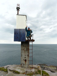
|
| NO 2058 |
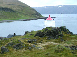
| Kamøyfjord
latitude 71° 2' 54" N longitude 25° 55' E
West Kamøyvær (L 4038) [946200]
Photo courtesy Arnstein Rønning [Flickr] |
| NO 2059 |
Skarsvåg
latitude 71° 7' 42.2" N longitude 25° 52' 16.5" E |
At Borneset (L 4040) [946800] |
| NO 2060 |
Helnes |
This is the second of the Nordkapp (North Cape) lighthouses. Located on a promontory at the eastern end of Magerøy. One of the station buildings is available for overnight accommodations rooms (L 4034) [946000] ARLHS # NOR-023 |
| NO 2061 |
Honningsvåg Søre (south)
latitude 70° 59' 25.2" N longitude 25° 57' 40.8" E
October 9, 2010
Honningsvåg is a small port on the southeast side of Magerøy. Located on a ridge above the waterfront of Honningsvåg. (L 4024) [944200] |
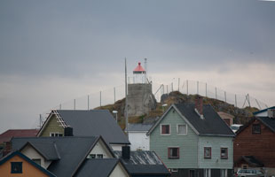
|
| NO 2062 |
Lafjord |
Located on the west side of the entrance to the Lafjord about 2.5 km west of the Magerøy bridge. (L 4018) [943600] |
| NO 2063 |
Repvåg (front range)
latitude 70° 44' 31.8" N longitude 25° 41' 21" E |
At Hamneset (L 4043) [947700] |
| NO 2063H |
Hammnneset |
At Hamneset (L 4044) [948000] |
| NO 2064 |
Olderfjord
latitude 70° 29' 59.4" N longitude 25° 12' 53.4" E |
At Indre Bringnes (L 4052) [949000] |
| NO 2065 |
Kistrand
latitude 70° 25' 40.8" N longitude 25° 15' 10.2" E |
On the island of Sandholmen on the northeast side. This is a small island and only has water access. (L 4054) [949200] |
| NO 2066 |
Ytre Billefjord
latitude 70° 22' 6" N longitude 25° 4' 60" E |
West Iverberget (literally "the man Iver's little mountain".) While just a short distance east of highway E6, north of the city it's named for, it looks like a pretty rugged walk to get to the light. (L 4056) [949400] |
| NO 2067 |
Kolvik |
Trollholmens east side (L 4062) [949600] |
| NO 2068 |
Sommerøy |
East Sommarøy, southeast point. (L 4068) [950400] |
| NO 2069 |
Cuoldagas
latitude 70° 12' 43.8" N longitude 25° 13' 40" E |
North of Skitskjer (L 4067) [950200] |
| NO 2070 |
Ainek
latitude 70° 15' 4" N longitude 25° 21' 18" E |
Porsangerfjord's southern point (L 4066) [950000] |
| NO 2071 |
Skjåholmen
latitude 70° 18' 10.8" N longitude 25° 19' 35.4" E |
Porsangerfjord's southwest point (L 4064) [949800] |
| NO 2072 |
Hjellneset |
Porsangerfjord's east side (L 4046) [948400] |
| NO 2073 |
Hårvikneset
latitude 70° 43' 23.4" N longitude 26° 2' 48" E |
Porsangerfjord's east side (L 4045) [948200] |
Lebesby and Gamvik Area
(Map is) N9
| NO 2079 |
Henrikholmen
latitude 70° 46' 31.2" N longitude 26° 43' 58.8" E |
Ytre Henrikholmen's east side (L 4086) [951300] |
| NO 2080 |
Brattholmen |
Laksefjorden east point (L 4102) [952900] |
| NO 2081 |
Bondøyskjer
latitude 70° 30' 40.2" N longitude 26° 45' 1.8" E |
North of Bondøy (L 4100) [952700] |
| NO 2082 |
Skjånesodden
latitude 70° 32' 49.8" N longitude 26° 57' 7.2" E |
East side of Laksefjorden (L 4096) [952500] |
| NO 2083 |
Lebesby
Located on Stamneset, a promontory on the east side of the Laksefjord about 7 km north of Lebesby. Accessible by road. (L 4094) [951900]
Photo courtesy ein_ton [Flickr] |
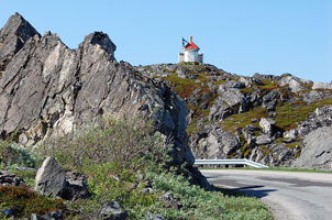
|
| NO 2084 |
Vardnes
latitude 70° 45' 15.6" N longitude 27° 6' 52.2" E |
Nardnessund south side (L 4088) [951500] |
| NO 2085 |
Dyfjord |
West Stormolla (L 4082) [951000] |
| NO 2086 |
Kjøllefjord
latitude 70° 56' 56.4" N longitude 27° 19' 53" E |
At Galgeneset (L 4108) [953300] |
| NO 2087 |
Oksefjord
latitude 70° 58' 23.4" N longitude 27° 33' 19.8" E |
At Slettneset (L 4114) [954400] |
| NO 2088 |
Mehamn
latitude 71° 2' 40.8" N longitude 27° 50' 14.4" E
Located on Hamnenes, a promontory marking the entrance to the traditional harbor of Mehamn, about 400 m west of the ferry terminal. (L 4120) [955500]
Photo courtesy Kristiina Puumalainen [Flickr] |
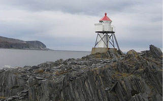
|
| NO 2089 |
Store Kamøy
latitude 71° 5' 20.4" N longitude 27° 58' 50.4" E |
Mehamnfjorden (L 4122) [956000] |
| NO 2090 |
Slettnes
Without question this is the northernmost lighthouse on the mainland of Scandinavia. Located on the Barents Sea coast about 1 km northwest of Gamvik at the end of the Nordkyn road (branch road Rv 888). (L 4126) [956500] ARLHS # NOR-215
Photo courtesy ecololo [Flickr] |
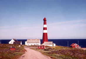
|
| NO 2091 |
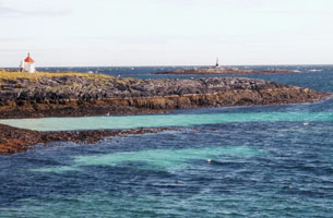
| Flintodden
latitude 71° 3' 47.4" N longitude 28° 16' 4.2" E
Located on the point at the north side of the entrance to Gamvik harbor. (L 4128) [957000]
Photo courtesy ecololo [Flickr] |
| NO 2092 |
Gamvik Beritbukta (Kaveneset)
latitude 71° 3' 37.2" N longitude 28° 15' 9" E
Gamvik harbor south side (L 4032) [957400]
Photo courtesy David Ash [Flickr] |
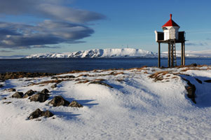
|
| NO 2093 |
Risfjorden
latitude 71° 27.6" N longitude 28° 11' 36.6" E |
At Finvikneset (L 4134) [958000] |
| NO 2094 |
Omgang
latitude 70° 59' 18.6" N longitude 28° 31' 23.4" E |
Inlet to Tanafjord (L 4138) [958200] |
| NO 2095 |
Hopsneset
latitude 70° 47' 26" N longitude 28° 4' 25" E |
Hopsfjord (L 4146) [959100] |
| NO 2096 |
Langfjordskjær
latitude 70° 42' 18.6" N longitude 28° 7' 24.6" E |
Middle of Langfjord (L 4148) [959300] |
| NO 2097 |
Bergholmen
latitude 70° 31' 4.2" N longitude 28° 2' 43.2" E |
Western Tana (L 4060) [961200] |
| NO 2097S |
Steinsvikneset
latitude 70° 27' 0.6" N longitude 28° 2' 38.4" E |
Smalfjord (L 4059) [961000] |
| NO 2098 |
Smalfjord
latitude 70° 30' 40.2" N longitude 28° 14' 48.6" E |
At Smalfjordnes (L 4158) [960800] |
Tana, Berlevåg, and Båtsfjord
(Google Map) 9
| NO 2099 |
Teltnes |
Located at a narrow point in a channel at Lavonjarg, near the southeast corner of the Tanafjord. photo (L 4156) [960600] |
| NO 2100 |
Berlevåg
latitude 70° 51' 33.6" N longitude 29° 2' 3.6" E |
Svartoksmoloen (North Mole)
Located at the end of the north mole at Berlevåg, at the north end of the Varanger Peninsula. (L 4072) [962000] |
| NO 2101 |
Kjølnes (Upper)
latitude 70° 51' 10.8" N longitude 29° 14' 30.6" E
The station is managed by the Polmakmoen Gjestegård (hotel) in nearby Polmak, and overnight accommodations are available. Located on the Barents Sea coast about 4 km east of Berlevåg. (L 4080) [963310] ARLHS # NOR-128
Photo courtesy Udo Posfeld [panoramio] |
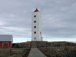
|
| NO 2102 |
Kjølnes (Lower)
latitude 70° 51' 11" N longitude 29° 14' 9.3" E |
This auxiliary light guides ships around reefs near the lighthouse. Located at the base of the taller light. ARLHS # NOR-433 |
| NO 2103 |
Veidnes (Veidnesodden)
latitude 70° 43' 55.8" N longitude 29° 25' 7.2" E |
Located at the end of a sharp peninsula about 6 km northeast of Kongsfjord. photo (L 4084) [963500] |
| NO 2104 |
Kobbkroken
latitude 70° 42' 46.8" N longitude 29° 17' 44.4" E |
Located at the west side of the entrance to the Kongsfjord, about 3 km southwest of the village of Kongsfjord. photo (L 4086) [963700] |
| NO 2105 |
Skrovneset
Located on a promontory on the west side of the Båtsfjord about 5 km northeast of the town of Båtsfjord. (L 4090) [964600]
Photo courtesy Tero Heino [Flickr] |
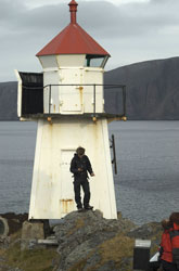
|
| NO 2106 |
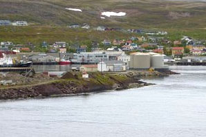
| Båtsfjord
latitude 70° 37' 55.8" N longitude 29° 43' 51" E
Located on a peninsula sheltering the harbor of Båtsfjord. (L 4091) [964800]
Photo courtesy Jørn H.S. Andersen [panoramio] |
| NO 2107 |
Makkaur
latitude 70° 42' 24" N longitude 30° 4' 44" E |
Located on a bluff east of the entrance to the Båtsfjord, about 40 km west of Vardø. Accessible only by boat. (L 4096) [966500] ARLHS # NOR-161 |
| NO 2108 |
Syltefjord
latitude 70° 31' 57" N longitude 30° 8' 46.8" E |
At Veldnesodden (L 4098) [967000] |
| NO 2109 |
Hamningberg
latitude 70° 32' 41.4" N longitude 30° 37' 45.6" E |
Located on a promontory projecting into the Barents Sea near Hamningberg, an abandoned fishing village in the eastern part of Båtsfjord municipality. (L 4200) [967500] |
Vardø and Vadsø Area
(Google Map) 9
| NO 2110 |
Skagodden
latitude 70° 24' 16.2" N longitude 31° 4' 15.6" E |
Located at the northern point of the island of Vardøya, marking the entrance to the harbor of Vardø. Accessible by road. photo (L 4204) [968000] ARLHS # NOR-422 |
| NO 2111 |
Hasselneset
Located on a skerry just off the northern tip of Vardø. (L 4217) [969100]
Photo courtesy Jens Gressmyr [panoramio] |
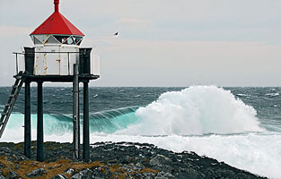
|
| NO 2112 |
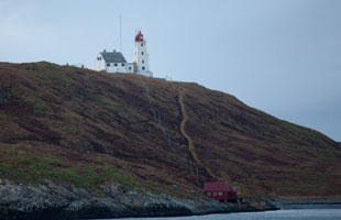
| Vardø
latitude 70° 23' 19.4" N longitude 31° 9' 20.8" E
October 10, 2010
Vardø is at the extreme north easternmost tip of Norway, Russia lies across the Varangerfjord to the southeast. Located atop a huge rock island just off the harbor of Vardø. (L 4210) [968500] ARLHS # NOR-267 |
| NO 2113 |
Vardøhavn (Vardø molofyr)
latitude 70° 22' 39" N longitude 31° 6' 20.4" E
October 11, 2010
Located at the end of the west mole protecting the harbor of Vardø. (L 4212) [968700] |
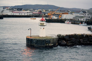
|
| NO 2114 |
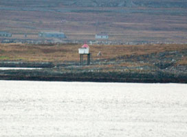
| Reinøysundet
latitude 70° 23' 13.2" N longitude 31° 7' 48.6" E
October 10, 2010
Reinøy south side (L 4218) [969300] |
| NO 2115 |
Guldringnes
latitude 70° 21' 49.1" N longitude 31° 6' 52.2" E |
South vågs east side (L 4220) [969500] |
| NO 2116 |
Svartnes
latitude 70° 21' 41.9" N longitude 31° 3' 9.6" E |
Bussesundet (L 4222) [969700] |
| NO 2117 |
Kibergneset
latitude 70° 17' 17.4" N longitude 31° 3' 14.4" E
October 10, 2010
Located on a promontory about 10 km south of Vardø. Accessible by a hiking trail from Kiberg. (L 4228) [970500] |
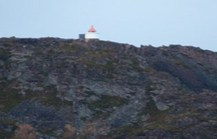
|
| NO 2118 |
Ytre Kiberg
latitude 70° 17' 9" N longitude 30° 59' 17.4" E |
Located above the waterfront of Kiberg. photo (L 4230) [970700] |
| NO 2119 |
Lille Ekkerøy |
Off Varangerfjord's southeast point (L 4240) [972700] |
| NO 2120 |
Store Vadsøya
latitude 70° 4' 2.4" N longitude 29° 43' 58.2" E
October 10, 2010
Located on the hilltop above Vadsø. (L 4244) [973300] |
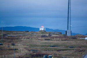
|
| NO 2121 |
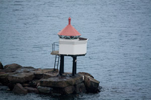
| Vadsø harbor
latitude 70° 4' 29.4" N longitude 29° 42' 52.8" E
October 10, 2010
At the head of the mole at the entrance to Vadsø (L 4245) [973500] |
| NO 2122 |
Jakobselv
latitude 70° 6' 25.2" N longitude 29° 19' 33" E |
Located at the end of the west mole at Vestre Jakobselv, an inlet on the north side of the Varangerfjord about 20 km west of Vadsø. photo (L 4250) [975000] |
| NO 2123 |
Grasbakken |
Located on the upper south side of the Varangerfjord about 20 km southeast of Nesseby. (L 4258) |
| NO 2124 |
Mortensnes
latitude 70° 7' 22.2" N longitude 29° 1' 10" E
Located on a promontory on the north side of the fjord about 25 km east of Nesseby. (L 4252) [975500]
Photo courtesy Ka-line [Flickr] |
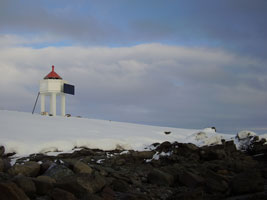
|
| NO 2125 |
Nesseby Molo
latitude 70° 8' 39" N longitude 28° 52' 43" E |
Located at the end of the breakwater mole at Nesseby. (L 4254.5) |
| NO 2126 |
Nesseby
latitude 70° 8' 38" N longitude 28° 50' 22.8" E |
Located on Lokholmen, a small island off the harbor of Nesseby, on the north side of the upper Varangerfjord. Accessible only by boat (L 4254) [976000] ARLHS # NOR-439 |
| NO 2127 |
Mæskfjord Nedre (front range)
latitude 70° 10' 24" N longitude 28° 44' 33" E |
At Moarvneset (L 4256) [977100] |
| NO 2127R |
Mæskfjord Øvre (rear range)
latitude 70° 10' 30.4" N longitude 28° 44' 17" E |
At Moarvneset (L 4256.1) [977000] |
| NO 2129 |
Rabbenes
latitude 70° 7' 52.2" N longitude 28° 40' E |
Karlbotn (L 4255) [976500] |
| NO 2130 |
Veldneset
latitude 70° 5' 15" N longitude 28° 49' 34.8" E |
South of Veidneset (L 4257) [977500] |
| NO 2131 |
Storskjer
latitude 70° 4' 1.8" N longitude 29° 5' 13.2" E |
South side of Varangerfjord (L 4259) [978000] |
| NO 2132 |
Bugøynes |
Bugøynes is a fishing port on the south side of the fjord opposite Vadsø. Located on a promontory sheltering the harbor. (L 4260) [978500] |
| NO 2133 |
Bugøyfjord |
Varangerfjord's west side (L 4260) [979200] |
| NO 2134 |
Brasholmen |
Kjøfjord (L 2134) [979500] |
| NO 2135 |
Straumen |
Kjøfjord (L 4267) [979700] |
| NO 2136 |
Skogerøypynten |
Located on a skerry in the Neidenfjord, which extends southward from the Varangerfjord, in a remote are about 20 km west of Kirkenes. (L 4268) [980000] |
| NO 2137 |
Steinskjernes
latitude 69° 45' 21" N longitude 29° 49' 27.6" E |
Korsfjord (L 4270) [980500] |
| NO 2138 |
Kjelmsøysund
latitude 69° 51' 27.6" N longitude 30° 2' 19.2" E
October 10, 2010
Kjelmsøy southwest side. This is the side of the fjord that boats between Vardo and Kirkenes take. When going to Vadsø, they use the other side. (L 4272) [981000] |
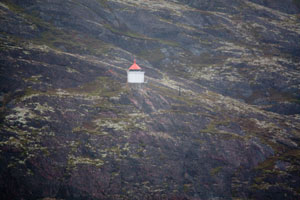
|
| NO 2139 |
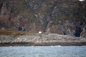
| Kjelmsøy
latitude 69° 51' 45" N longitude 30° 5' 43.8" E
October 10, 2010
Kjelmsøy east point. This light marks the entrance to the east side of the fjord when northbound towards Vadsø. (L 4274) [981500] |
| NO 2140 |
Reinøy
latitude 69° 47' 18" N longitude 30° 6' 27" E
October 10, 2010
Bøkfjorden west side (L 4282) [983500] |
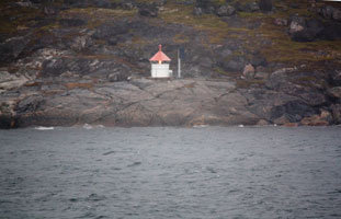
|
| NO 2141 |
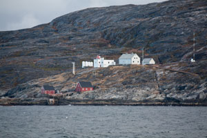
| Hungerneset (Bøkfjord)
latitude 69° 52' 39.6" N longitude 30° 10' 30.6" E
October 10, 2010
Located at the east entrance to the Bøkfjord, which leads from the south side of the Varangerfjord to the port of Sør-Varanger. This location is only 10 km from the Russian border. Accessible only by boat. (L 4276) [982500] ARLHS # NOR-064 |
| NO 2142 |
Sjøgrensen nedre (front range)
latitude 69° 47' 11.4" N longitude 30° 48' 17.4" E |
Grensen Norge - Russia (L 4290) [985000] |
| NO 2142R |
Sjøgrensen Norge Øvre (rear range)
latitude 69° 46' 60" N longitude 30° 47' 60" E |
At Grensen Norge - Russia (L 4290.1) [985100] |
| NO 2144 |
Kapp Linné (Isfjord) |
This is the world's northernmost traditional lighthouse, standing in latitude 78° 03.8' N. Located on the point of the cape, marking the south side of the entrance to the Isfjord. Accessible only by boat or helicopter. photo (L 4314) [986000] |
|
|


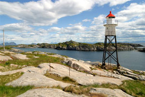


