|
This page shows the documentation of the Lighthouses on the West Coast of Denmark. You can click on the photo of a light to go to it's specific (larger resolution) copy. Each lighthouse name is linked to (in our editorial opinion) the best reference site for that light. This page is organized from South (near Netherlands) to North (near Denmark) and tends to wrap the curves clockwise. In Danish, a lighthouse is called a "fyr", the front range light is referred to as an "Forfyr" and the rear range light is called an "Bagfyr". The descriptions below follow those names rather than replacing them with English descriptions. I would like to include directions on how to get to these lights. If you know such data, could you eMail me and I'll post it here (with your choice of attribution.) mailme This page is based on the Lighthouse Directory prepared by Russ Rowlett (UNC). My thanks to him for providing this basis for understanding. w6 Geographic coordinates (used to start the mapping pages) were taken from Anke and Jens and the LighthouseDepot database. w7 |
|
Esbjerg
| DK 1 |
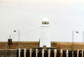
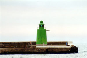
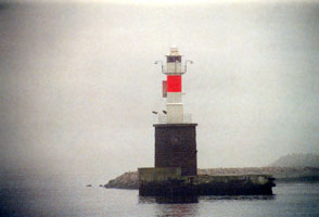
Esbjerg Trafikhavn Sydmole (South Mole)
latitude 55° 28' 4.8" N longitude 8° 25' 31.3" E
The Trafikhavn (Commercial Harbor) is one of several small basins in the harbor facilities at Esbjerg. (B 1796)
Photo courtesy Alex Trabas [ListOfLights] |
|
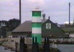
| DK 2 |
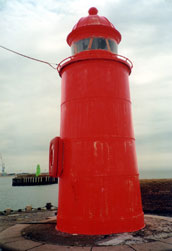
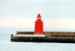
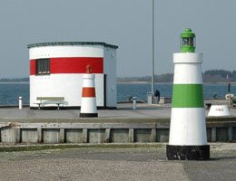
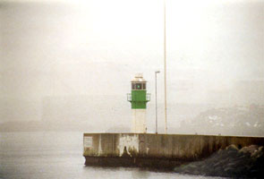
| Esbjerg Trafikhavn Nordmole
latitude 55° 28' 8.1" N longitude 8° 25' 28" E
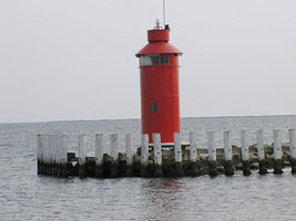
Located at the end of the Trafikhavn North Mole. Note that in this photo, the south mole (above) is Green, not white. (B 1794)
Photo courtesy Alex Trabas [ListOfLights] |
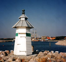
| DK 3 |
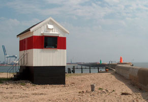
Esbjerg
latitude 55° 28' 12.9" N longitude 8° 25' 25.6" E
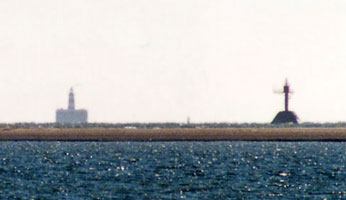
This tiny directional lighthouse guides ships approaching Esbjerg through the narrow channel between the mainland and the island of Fanø. Located at the end of the broad mole separating the Trafikhavn and the Fiskerihavn. (B 1792) ARLHS # DEN-202
Photo courtesy Anke & Jens [seiten] |
|
| DK 4 |
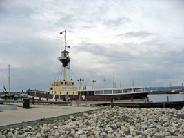
Motorfyrskib 1 Horns Rev |
This lightship spent its entire career on the Vyl and Horns Rev stations west of Esbjerg in the North Sea. This is one of the best preserved lightships in Denmark, or anywhere. Moored in the Fiskerihavn in Esbjerg. |
| DK 5 |
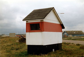
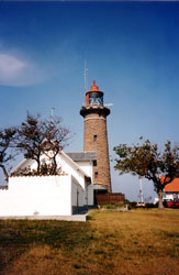
Strandby
latitude 55° 28' 45.5" N longitude 8° 24' 37.8" E
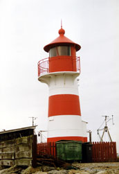
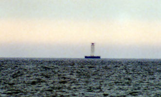
This light guides ships approaching Esbjerg from the North Sea. Located on the Doggerkaj, a broad mole at the northwestern corner of Esbjerg harbor. (B 1782) ARLHS # DEN-203
Photo courtesy Alex Trabas [ListOfLights] |
|
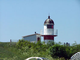
Saedding
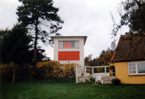
| DK 6 |
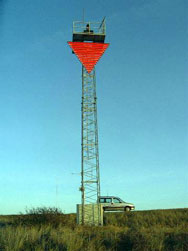
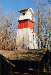
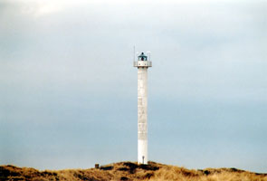
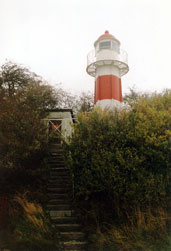
| Sæddingstrand Syd Bagfyr (South Range Rear)
latitude 55° 29' 2.3" N longitude 8° 25' 59.3" E
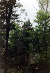
The front light is now on a skeletal tower. Located in a wooded area about 1 km northeast of the harbor area in Esbjerg. (B 1778.1) ARLHS # DEN-118
Photo courtesy Alex Trabas [ListOfLights] |
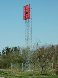
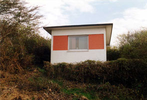
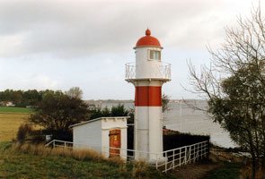
| DK 7 |
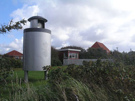
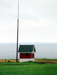
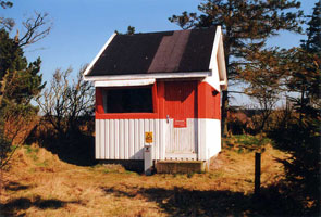
Sæddingstrand Forfyr (Range Front)
Located on the Fyrvej, just off the Sædding Strandvej (beach road) in Sædding, a beach town just northwest of Esbjerg. (B 1772) ARLHS # DEN-114
Photo courtesy Alex Trabas [ListOfLights] |
|
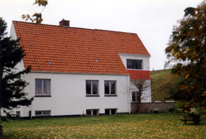
| DK 8 |
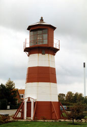
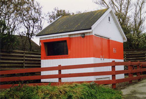
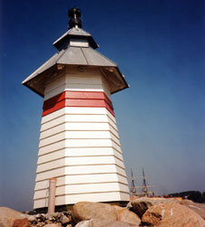
| Sæddingstrand Mellumfyr (Range Middle)
Located on the eastern leg of the Fyrparken, off the Tarphagevej in Sædding. (B 1772.1) ARLHS # DEN-115
Photo courtesy Alex Trabas [ListOfLights] |
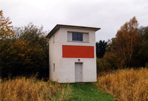
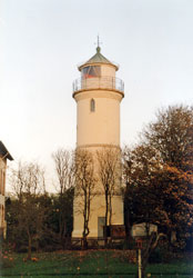
| DK 9 |
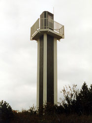
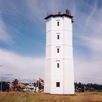
Sæddingstrand Nord Bagfyr (North Range Rear)
latitude 55° 30' 3.5" N longitude 8° 24' 3" E
This very modern tower, designed by the architect Frank Holmelin, is located on the western leg of the Fyrparken, off the Sædding Ringvej (ring road) in Sædding. (B 1779.1) ARLHS # DEN-113
Photo courtesy Alex Trabas [ListOfLights] |
|
Central North Sea Coast
| DK 10 |
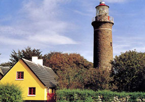
| Blåvandshuk (Blåvand)
latitude 55° 33' 28.1" N longitude 8° 4' 59.8" E
The cape of Blåvandshuk is the westernmost point of Denmark. Located at the point of the cape, at the end of the Fyrvej (Lighthouse Road) in Blåvand-Oksby. (B 1848) ARLHS # DEN-002
Photo courtesy Jan K [Flickr] |
| DK 11 |
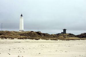
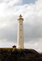
Lyngvig
The lighthouse is built on a barrier spit that encloses the Ringkjøping Fjord, which is a large, shallow sound connected to the sea by a narrow inlet. Located at the end of the Holmsland Klitvej in Nørre Lyngvig. (B 1868) ARLHS # DEN-024
Photo courtesy Alex Trabas [ListOfLights] |
|
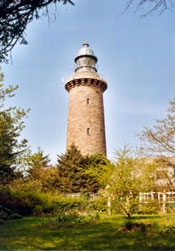
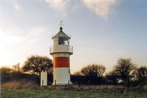
| DK 12 |
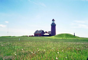
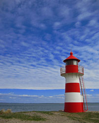
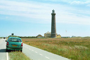
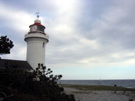
| Bovbjerg
latitude 56° 30' 47.1" N longitude 8° 7' 11" E
Not the tallest Danish lighthouse, but this is one of the country's most handsome. Located on the Fyrvej south of Ferring. (B 1886) ARLHS # DEN-003
Photo courtesy treenaj [webshots] |
Limfjord
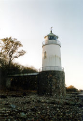
| DK 13 |
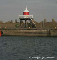
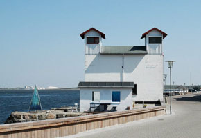
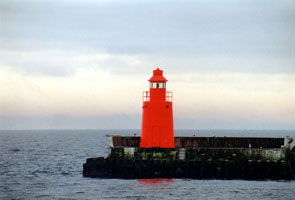
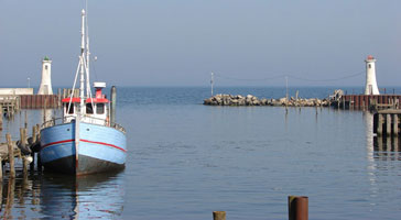
Thyborøn
latitude 56° 42' 21.7" N longitude 8° 13' 24.1" E
This was formerly the front light of a range; the rear light (see next entry) has been relocated to Kongsdal, near Mariager . Located at an elbow bend on the Havregade (breakwater) sheltering the harbor of Thyborøn, on the south side of the inlet leading to the Limfjord. (B 1900) ARLHS # DEN-083
Photo courtesy Michael Lars Thor Rasmussen [Flickr] |
|
| DK 14 |
Thyborøn Bagfyr (relocated to Kongsdal) |
This lighthouse was formerly the rear light of the Thyborøn Range, at the western entrance to the Limfjord (see above). It has been relocated to Kongsdal, where it stands in a parking lot at the Kongsdal Marina. DK 13 |
| DK 15 |
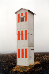
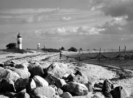
Agger-Tange Forfyr (Range Front)
latitude 56° 42' 27.1" N longitude 8° 14' 32.7" E
The range guides ships entering the inlet leading to the Limfjord. The rear light is 800 m east on a skeletal tower. Located just behind the beach on the north side of the inlet. Apparently accessible by a hike of about 1.2 km across the sand from the Tangevej. (B 1894) ARLHS # DEN-191
Photo courtesy Jakob Pedersen [oz7aei] |
|
| DK 16 |
| Toftum
Located at the eastern end of the west basin of the Limfjord, this directional light guides ships down the length of the basin. Located near the town of Toftum Bjerge, about 2 km southwest of the Oddesund bridge. (B 1946) ARLHS # DEN-076
Photo courtesy Alex Trabas [ListOfLights] |
| DK 17 |
Grisetåodde
latitude 56° 34' 50.3" N longitude 8° 33' 59.4" E
Located on a spit of land marking the east entrance to the Oddesund strait in Oddesund Syd. (B 1954) ARLHS # DEN-075
Photo courtesy Jeanet [Flickr] |
|
| DK 18 |
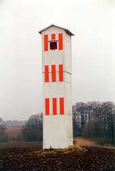
| Sillerslev Forfyr
latitude 56° 40' 55.6" N longitude 8° 43' 51.4" E
This range guides ships heading northeast from the Oddesund area. Located on the waterfront of Sønderby, about 1.2 km southwest of Sillerslev on the south side of the island of Mors. (B 1970) ARLHS # DEN-064
Photo courtesy Alex Trabas [ListOfLights] |
| DK 19 |
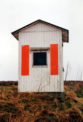
Sillerslev Bagfyr
latitude 56° 41' 29" N longitude 8° 44' 27.2" E
Located on the Gammel Faergevej on the west side of Sillerslev. (B 1970.1) ARLHS # DEN-065
Photo courtesy Alex Trabas [ListOfLights] |
|
| DK 20 |
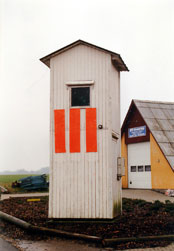
| Langerodde
latitude 56° 42' 46.6" N longitude 8° 50' 2.4" E
This is a directional light guiding ships northeastward from Oddesund to Sallingsund. Located on the south side of the fjord roughly 4 km southwest of Sallingsund, near Vile. (B 1976) ARLHS # DEN-078
Photo courtesy Alex Trabas [ListOfLights] |
| DK 21 |
Glyngøre
latitude 56° 45' 50.5" N longitude 8° 51' 45.5" E
This lighthouse is a twin of the Grisetåodde light. Located at the tip of a promontory on the south side of the fjord in Sallingssund. DK16 (B 1980) ARLHS # DEN-077
Photo courtesy Alex Trabas [ListOfLights] |
|
| DK 22 |
| Vodstrup
The range guides eastbound ships approaching the narrow Aggersund channel of the Limfjord leading to Ålborg. Located on the south side of the fjord on the Havnevej in Løgstør. The left light blinks red, the right light blinks green. (B 2006) ARLHS # DEN-066
Photo courtesy Alex Trabas [ListOfLights] |
| DK 23 |
Fur
latitude 56° 50' 17.6" N longitude 8° 58' 26.6" E |
Located on the northwestern side of Fur, an island in the Limfjord on the south side of the waterway. The island is accessible by ferry from the mainland near Selde. ARLHS # DEN-073 |
| DK 24 |
Løgstør Grunde Forfyr
The range guides eastbound ships approaching the narrow Aggersund channel of the Limfjord leading to Ålborg. Located on the south side of the fjord on the Havnevej in Løgstør. The left light blinks red, the right light blinks green. (B 2050) ARLHS # DEN-109 |
|
| DK 24R |
| Løgstør Grunde Bagfyr
latitude 56° 58' 23.9" N longitude 9° 17' 19.7" E
The rear range is about 2 km away from the front range. The rear light can be reached, coming from the bridge over the Aggersund, while turning to the left into a small residential area (Toldstrupvej) short behind the entry into the town. (B 2050.1)
Photo courtesy Anke & Jens [seiten] |
| DK 25 |
Tårs Forfyr
latitude 57° 3' 32.6" N longitude 9° 53' 35.3" E |
This light stood near the ferry terminal at Tårs, Lolland, guiding ferries arriving from Spodsbjerg, Langeland, on the other side of the Store Baelt. Replaced by a pair of small skeletal towers, the lighthouse has been relocated to the grounds of the maritime museum in Ålborg. towers (C 1712) ARLHS # DEN-183 |
Northwest Coast
| DK 26 |
Lodbjerg
latitude 56° 49' 24.1" N longitude 8° 15' 46.6" E
The lighthouse is located about 1 km from the beach in a maritime forest preserve, the Lodbjerg Klitplantage. In 1999 the deteriorated lantern dome was replaced by an authentic replica. Located on the Lodbjergvej about 8 km by road north of Agger. (B 2070) ARLHS # DEN-191
Photo courtesy Anke & Jens [seiten] |
|
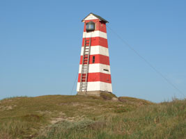
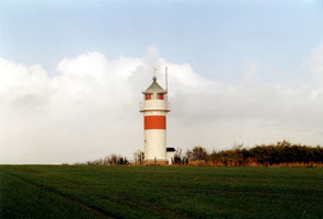
| DK 27 |
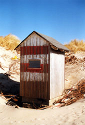
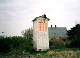
| Vorupør Forfyr
latitude 56° 57' 28.2" N longitude 8° 22' 6.4" E
Located on the dunes at Nørre Vorupør. (B 2072) ARLHS # DEN-063
Photo courtesy Alexander Trabas [ListOfLights] |
|
|
| DK 28 |
Vorupør Bagfyr
latitude 56° 57' 29" N longitude 8° 22' 14.9" E
The Vorupør lights apparently have been moved several times to track changes in the entrance channel. Located 80 m southeast of the front light in Nørre Vorupør. (B 2072.1) ARLHS # DEN-187
Photo courtesy Nordthy [Flickr] |
|
| DK 29 |
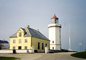
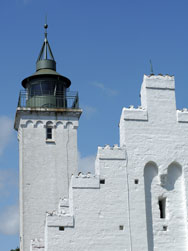
| Hanstholm
latitude 57° 6' 45.9" N longitude 8° 35' 55.1" E
The buildings house a museum of regional history. Located on the Tårnvej in Hanstholm, about 1/4 mile southeast of the waterfront. * (B 2084) ARLHS # DEN-013
Photo courtesy Museumscenter Hanstholm |
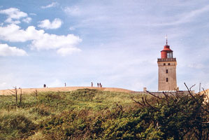
| DK 30 |
Rudbjerg Knude
latitude 57° 26' 55.6" N longitude 9° 46' 28.2" E
The site is now managed by the Vendsyssel Historiske Museum, which maintains a small museum with exhibits on the lighthouse and the natural history of the area. Located on the beach about halfway between Nørre Rudbjerg and Lønstrup. Accessible by a road from the Rudbjergvej. ARLHS # DEN-036
Photo courtesy Nikolaj Fogh-Nielsen [Flickr] |
|
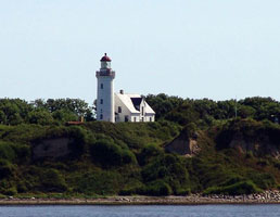
| DK 31 |
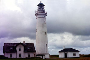
| Hirtshals
latitude 57° 35' 4.9" N longitude 9° 56' 30.9" E
Hirtshals, at the northern end of Jylland, is the southern terminal for ferries crossing the Skagerrak to Oslo, Kristiansand, and Larvik, Norway. Located just off the Kystvej in Hirtshals, about 1 km southwest of the harbor. (B 2106) ARLHS # DEN-017
Photo courtesy Eric Arthur Anderson & Villa Bettum [webshots] |
Skagen and Frederikshavn
The begining of the lights in the Baltic Sea.
| DK 32 |
Skagen Vest
latitude 57° 44' 55.3" N longitude 10° 35' 43.3" E
Located at the northernmost point of Jylland, about 2.8 km northwest of the main Skagen lighthouse. Accessible by hiking from the main light. (C 0001) ARLHS # DEN-041
Photo courtesy Alex Trabas [ListOfLights] |
|
| DK 33 |
| Skagen (1858)
latitude 57° 44' 7.7" N longitude 10° 37' 48.9" E
Marking the entrance to the Baltic Sea, this is probably Denmark's best known lighthouse. A series of groins has been built to slow the erosion. Located on the northeast side of the town of Skagen. (C 0002)
Photo courtesy Eric Arthur Anderson & Villa Bettum [webshots] |
| DK 34 |
Skagen (1747)
latitude 57° 43' 44.5" N longitude 10° 36' 24.3" E
Located at the intersection of the Fyvej and the Batterivej on the northeast side of the town of Skagen, about 1.6 km southwest of the 1858 lighthouse.
Photo courtesy Anke & Jens [seiten] |
|
| DK 35 |

| Skagen Østmole
latitude 57° 42' 52.6" N longitude 10° 35' 39.1" E
It is likely that earlier lighthouses were relocated from the inner breakwaters to the new outer breakwaters in 1970. Located at the end of the east outer breakwater of Skagen. Accessible only by boat (the mole is not walkable). (C 0004.4) ARLHS # DEN-040
Photo courtesy Alex Trabas [ListOfLights] |
| DK 36 |
Skagen Vestmole
latitude 57° 42' 50" N longitude 10° 35' 35.7" E
Located at the end of the west outer breakwater of Skagen. (C 0004.2)
Photo courtesy Alex Trabas [ListOfLights] |
|
| DK 37 |
| Frederikshavn Nordmole
latitude 57° 25' 59.9" N longitude 10° 33' 10.2" E
Located at the end of the north outer breakwater mole of Frederikshavn. Accessible by walking the mole. (C 0028)
Photo courtesy Alex Trabas [ListOfLights] |
| DK 38 |
Frederikshavn Forfyr (Range Front, South Breakwater)
latitude 57° 25' 57.4" N longitude 10° 33' 5.3" E
The rear light is on a skeletal tower at the end of the south inner mole. Located at the end of the south outer breakwater mole of Frederikshavn. This mole is not walkable. (C 0029)
Photo courtesy Alex Trabas [ListOfLights] |
|
| DK 39 |
Hirsholm (1838) (Hirtsholm) |
Hirsholm is a small island in the Kattegat about 7 km northeast of Frederikshavn. Located adjacent to the active lighthouse. Transportation is available from Frederikshavn on the mail boat, three times a week. |
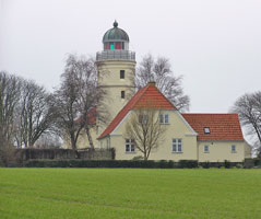
| DK 40 |
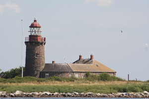
Hirsholm (1886) (Hirtsholm)
latitude 57° 29' 7.4" N longitude 10° 37' 28.9" E
Located in the village of Hirsholm, at the highest point of the island. Site open; tower generally closed but there are guided tours from Frederikshavn several times each year. (C 0020) ARLHS # DEN-067
Photo courtesy Alex Trabas [ListOfLights] |
|
| DK 41 |
| Nordre Rønner
latitude 57° 21' 36.5" N longitude 10° 55' 24.6" E
The station buildings are the only structures on Spirholm, a small, sandy island in the Kattegat about 6 km north of Vesterø Havn, Laesø. Accessible only by boat. (C 0044) ARLHS # DEN-030
Photo courtesy PlanetStar [Flickr] |
| DK 42 |
Læsø Rende
The Læsø Rende is the channel between Læsø and the mainland. Located about 7 km east of the mainland and 11 km west of the western point of Læsø. Accessible only by boat. (C 0061) ARLHS # DEN 021
Photo courtesy Alexander Trabas [ListOfLights] |
|
| DK 43 |
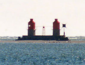
| Hals Barre
Located in the Kattegat about 7 km east of Hals and the Limfjord entrance. Accessible only by boat.
The named light is on the left in the photo. The one on the right is known as Hals Barre Right. (C 0066) ARLHS # DEN 011
Photo courtesy Alexander Trabas [ListOfLights] |
| DK 44 |
Korsholm Forfyr Nord (Egense)
latitude 56° 58' 22.5" N longitude 10° 20' 1.1" E
The Korsholm lights guide ships into the Limfjord entrance. The common rear light for the two Forfyrs is on a skeletal tower onshore 2 km to the west. (C 0072)
Photo courtesy Alex Trabas [ListOfLights] |
|
| DK 45 |
Korsholm Forfyr Syd (Egense)
latitude 56° 58' 22.2" N longitude 10° 20' 0.6" E |
Located about 1.6 km east of Egense, on the south side of the entrance, and a similar distance south of Hals, on the north side. Accessible only by boat.
This is the light on the left in the photo above. (C 0072.1)
Photo courtesy Alex Trabas [liteslist] |
| DK 46 |
Hals Ost Forfyr
The rear light is mounted on a mast 177 m northwest. Located on the north breakwater at Egense (not Hals), on the south side of the Limfjord entrance. Accessible by walking the pier. (C 0076) ARLHS # DEN-193
Photo courtesy Alex Trabas [ListOfLights] |
|
| DK 46A |
| HalsVest
latitude 56° 59' 24.2" N longitude 10° 18' 25.7" E
This photo shows the west pier light in the foreground, the east pier light and the front range light in the background. The rear range light is on a steel lattice west of the harbor. (C 0077,8)
Photo courtesy Anke & Jens [seiten] |
Fornaes Area
| DK 47 |
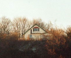
Udbyhøj (1894)
latitude 56° 35' 24" N longitude 10° 19' 12" E
Located on private property on a hill about 1.5 km east of Udbyhoj.
Photo courtesy Anke & Jens [seiten] |
|
| DK 48 |
| Udbyhøj (2002)
latitude 56° 35' 23.6" N longitude 10° 19' 13" E
This directional light guides ships approaching the entrance to the Randers Fjord. Located adjacent to the historic lighthouse. (C 0176) ARLHS # DEN-088
Photo courtesy Alex Trabas [ListOfLights] |
| DK 49 |
Gjerrild
latitude 56° 31' 40.8" N longitude 10° 49' 47.9" E
This lighthouse guides southbound ships around the end of the Djurs peninsula at the southern end of the Kattegat. Located on a bluff on the east side of Nordstrand, near Gjerrild. (C 0200) ARLHS # DEN-089
Photo courtesy Alex Trabas [ListOfLights] |
|
| DK 50 |
| Fornæs
latitude 56° 26' 36.3" N longitude 10° 57' 26.5" E
Fornæs is the easternmost point of Jylland, at the end of the Djurs peninsula. Located on the point of the cape, about 4 km northeast of the Grenå waterfront. (C 0204) ARLHS # DEN-008
Photo courtesy Klaus Kern [ListOfLights] |
| DK 51 |
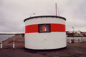
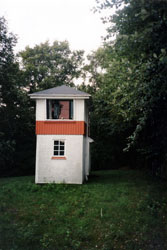
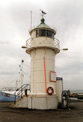
Grenå Mole
The light was shown through a window at the top of the tower. It was located on the waterfront of Grenå. This light not longer exists.
Photo courtesy Anke & Jens [seiten] |
|
Anholt and Western Kattegat
| DK 52 |

| Anholt
latitude 56° 44' 14.4" N longitude 11° 39' 1.3" E
This historic lighthouse guides ships approaching the Sound and entering the Baltic. It is located at the eastern end of the island, a desert region known for its unusual plant and animal life. Access to this ecologically sensitive area is restricted, but it appears that tours to the lighthouse are available. (C 0164) ARLHS # DEN-068
Photo courtesy Karl-Heinz Wellm [ListOfLights] |
|
|
| DK 53 |
Anholt Havn
latitude 56° 42' 52.4" N longitude 11° 30' 27.9" E |
Located at the end of the north outer breakwater at Anholt Havn. The pier does not appear to be walkable, but there are good views from the waterfront or from ferries arriving from Grenå. (C 0166) |
| DK 54 |
Svitringen Rende Syd |
Located in the Ålborg Bugt (Ålborg Bay) about 25 km east southeast of Hals. Accessible only by boat. (C 0066.8) |
Ebeltoft and Århus Area
| DK 55 |
Hjelm
latitude 56° 7' 59.3" N longitude 10° 48' 18.1" E |
Hjelm is an uninhabited island in the southwestern Kattegat about 5 km southeast of Elsegårde and 10 km southeast of Ebeltoft. Located at the highest point of the island. Accessible only by boat. (C 0262) ARLHS # DEN-070 |
| DK 56 |
Ebeltoft Vestmole
latitude 56° 11' 47.8" N longitude 10° 40' 8.8" E
Located at the end of the west (outer) breakwater of beltoft. (C 0776.4) ARLHS # DEN-206
Photo courtesy Klaus Kern [ListOfLights] |
|
| DK 58 |
Fyrskib 21 Skagens Rev
A wooden lightship, now moored on the Ebeltoft waterfront, both a Café and overnight accommodations are available.
Photo courtesy Lone L. Knold [Flickr] |
|
| DK 59 |
| Ebeltoft Vig
latitude 56° 13' 52.2" N longitude 10° 36' 26.4" E
Located on a low hill in Lyngsbaek Strand, at the north end of Ebeltoft Vig (bay) about 7 km west of Ebeltoft. (C 0772) ARLHS # DEN-005
Photo courtesy Klaus Kern [ListOfLights] |
| DK 60 |
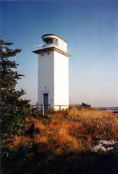
Sletterhage
latitude 56° 5' 41.7" N longitude 10° 30' 47" E
The lighthouse marks the end of the Helgenaes peninsula about 20 km east of Århus. Located on the point of the cape in Slettervang. (C 0786)
Photo courtesy Suga Shane [Flickr] |
|
| DK 61 |
| Århus Vestmole
latitude 56° 8' 57.4" N longitude 10° 13' 41.7" E
Located at the end of the west mole enclosing the traditional inner harbor of Århus. (C 0793)
Photo courtesy Alex Trabas [ListOfLights] |
| DK 62 |
Århus Østmole
latitude 56° 8' 56.4" N longitude 10° 13' 51.6" E
Located off the end of the east mole enclosing the traditional inner harbor of Århus. (C 0792) ARLHS # DEN-226
Photo courtesy Alex Trabas [ListOfLights] |
|
| DK 63 |
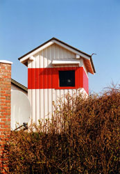
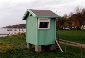
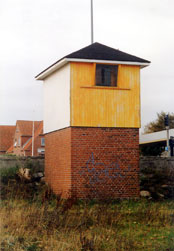
| Hov Havn
latitude 55° 54' 35.5" N longitude 10° 15' 22.8" E
The light is displayed through slit-style window at the top of the tower. Located on the west mole of Hov. (C 0830.5) ARLHS # DEN-093
Photo courtesy Klaus Hülse [ListOfLights] |
| DK 63E |
Hov Havn East Mole
latitude 55° 54' 36.4" N longitude 10° 15' 24.2" E |
The light is displayed through slit-style window at the top of the tower. Located on the East mole of Hov. (C 0830.6) |
Tunø and Samsø, Horsens & Velje Fjords
| DK 64 |
Tunø
latitude 55° 56' 58.4" N longitude 10° 26' 37.4" E
The church caretaker doubles as keeper of the lighthouse and provides guided tours by arrangement, as his time allows. Located in the village of Tunø, at the eastern end of the island. (C 0822) ARLHS # DEN-071
Photo courtesy Kildall [Flickr] |
|
| DK 65 |
| Vesborg
latitude 55° 46' 11.5" N longitude 10° 33' 3.3" E
Located at Vesborg, near the southwestern corner of Samsø, about 2 km south of Kolby. Accessible by road. (C 0842) ARLHS # DEN-046
Photo courtesy Søs & Ole [Flickr] |
| DK 66 |
Hjarnø Forfyr
latitude 55° 49' 24.6" N longitude 10° 3' 51" E
Located on the northwest side of the island of Hjarnø, which lies in the south side of the entrance to the fjord. The island is accessible by ferry from Snaptun. (C 0860) ARLHS # DEN-167
Photo courtesy Alex Trabas [ListOfLights] |
|
| DK 67 |
| Haldrup Forfyr
latitude 55° 52' 48.2" N longitude 9° 58' 44.4" E
Located on the northwest side of the island of Hjarnø, which lies in the south side of the entrance to the fjord. (C 0866) ARLHS # DEN-094
Photo courtesy Alex Trabas [ListOfLights] |
| DK 68 |
Haldrup Bagfyr
latitude 55° 53' 2.6" N longitude 9° 58' 2.8" E
Located on the northwest side of the island of Hjarnø, 600 m west of the front light. (C 0866.1) ARLHS # DEN-095
Photo courtesy Alex Trabas [ListOfLights] |
|
| DK 69 |
| Sejet Forfyr
Located on the south side of the fjord 2 km northeast of Sejet. (C 0870) ARLHS # DEN-168
Photo courtesy Alex Trabas [ListOfLights] |
| DK 70 |
Sejet Bagfyr
Located beside a road 410 m southwest of the front light. (C 0870.1) ARLHS # DEN-169
Photo courtesy Alex Trabas [ListOfLights] |
|
| DK 71 |
Træskohage
latitude 55° 40' 50.1" N longitude 9° 44' 47" E |
Located on a point of and on the north side of the Velje Fjord about 1.6 km west of Fakkegrav. ARLHS # DEN 096 |
Snoghøj Area
| DK 72 |
Snoghøj
This light guides ships northbound in the Lille Baelt approaching the narrows at Snoghøj, where two bridges connect Fyn to the mainland. Located near the shore in a residential neighborhood on the west side of Snoghøj. (C 0936) ARLHS # DEN-098
Photo courtesy Alexander Trabas [ListOfLights] |
|
| DK 73 |
| Børup Nord
latitude 55° 31' 40.2" N longitude 9° 40' 43.2" E
Northbound ships follow the line of this light and then turn to starboard to follow the line of the Snoghøj light (see above). Located near the shore about 1.8 km west of Snoghøj. (C 0934) ARLHS # DEN-211
Photo courtesy Alex Trabas [ListofLights] |
| DK 74 |
Børup Vest
latitude 55° 31' 41.4" N longitude 9° 40' 29.4" E
This light and the next guide southbound ships as they pass under the older Lille Baelt bridge at Snoghøj. Located on the shore about 2.5 km west of Snoghøj. (C 0938) ARLHS # DEN-212
Photo courtesy Alex Trabas [ListOfLights] |
|
| DK 75 |
| Damgård
This light and the previous one guide southbound ships as they pass under the older Lille Baelt bridge at Snoghøj. Located about 100 m north of the Børup Vest light. (C 0944) ARLHS # DEN 166
Photo courtesy Alexander Trabas [ListOfLights] |
| DK 76 |
Drejensodde
This directional light guides ships approaching the harbor of Kolding, on the west side of the Lille Baelt. Located on a point of land at Børnehejm, about 6 km west of Kolding. (C 0956) ARLHS # DEN-099
Photo courtesy Alex Trabas [ListOfLights] |
|
Årosund Area
Lights are now shown on DenmarkW3
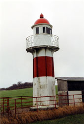
| DK 77 |
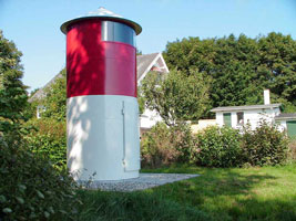
| Årøsund
latitude 55° 15' 42.2" N longitude 9° 42' 47.9" E
One of a series of small cast iron towers prefabricated by the German firm Pintsch in Fürstenwalde. Located on the south mole at Årøsund. (C 0970) ARLHS # DEN-100
Photo courtesy Alex Trabas [ListofLights] |
| DK 78 |
Årø
latitude 55° 15' 25.8" N longitude 9° 43' 36.9" E
Årø is an island off Årøsund, separated from the mainland by a channel 500 m wide. Located on the west side of the island, guiding ships through the channel. (C 0969) ARLHS # DEN-072
Photo courtesy Rudi Steven [Flickr] |
|
Åbenrå and Als Area
| DK 79 |
| Åbenrå (Sønderstrand)
The light guides ships entering the harbor of Åbenrå from the Lille Baelt. Located on the Kystvej near the foot of the Kallemosen in Åbenrå. (C 1048)
Photo courtesy Alex Trabas [ListOfLights] |
| DK 80 |
Ballebro
latitude 54° 59' 50.4" N longitude 9° 40' 22.1" E
The light guides ferries crossing the Als Fjord from Hardeshøj on Als to Blans on the mainland. Located on the Ballebrovej about 200 m east of the ferry terminal at Blans. (C 1066) ARLHS # DEN-101
Photo courtesy Sanni [Flickr] |
|
| DK 81 |
| Nordborg (Augustenhof)
latitude 55° 4' 40.6" N longitude 9° 42' 40.8" E
Located at the northwestern end of Als, on the west side of Købingsmark and about 4 km northwest of Nordborg. Anke&Jens report that that lighthouse is open for climbing (C 1030) ARLHS # DEN-109
Photo courtesy Alex Trabas [ListOfLights] |
| DK 82 |
Tranerodde (Traner Odde)
latitude 55° 2' 44.7" N longitude 9° 51' 5.7" E
Located on a promontory on the northeast side of Als, at the end of the Skaerveagervej about 3 km east of Danfoss. (C 1032) ARLHS # DEN-106
Photo courtesy Alex Trabas [ListOfLights] |
|
| DK 83 |
| Taksensand
latitude 55° 24" N longitude 9° 57' 52.4" E
Located on the beach about 1 km west northwest of Fynshav, the terminal for ferries to Fyn. The lighthouse stands on a beach and is often surrounded by water; access to the tower is by a footbridge from a low bluff behind the beach. (C 1034) ARLHS # DEN-107
Photo courtesy Alex Trabas [ListOfLights] |
| DK 84 |
Mommark Vestmole
latitude 54° 55' 59.4" N longitude 10° 2' 42.3" E
Looking at recent pictures, it looks like this photo no longer exists. The modern light is a simple lamp on the top of a pole. (C 1042)
Photo courtesy Konrad Lischka [Flickr] |
|
| DK 85 |
Mommark Havn
latitude 54° 55' 59.4" N longitude 10° 2' 42.3" E |
Located at the end of the short west mole at Mommack. (C 1046) |
| DK 86 |
Gammel-Pøl (Polshuk)
latitude 54° 52' 53.2" N longitude 10° 4' 10.1" E
Located at the southeastern tip of Als, 3 km east of Neder Lysabild. (C 1100) ARLHS # DEN-108
Photo courtesy Alex Trabas [ListOfLights] |
|
| DK 87 |
| Kegnæs
latitude 54° 51' 11" N longitude 9° 59' 15.3" E
Kegnæs is an island just south of Als, connected to Als by a causeway. The lighthouse is built on the southernmost tip of Kegnaes, close to the south end of the causeway; it marks the north side of the entrance to the Flensborg Fjord. (C 1104) ARLHS # DEN-019
Photo courtesy Bjarne Nielsen [Flickr] |
Flensborg Fjord
| DK 88 |
Skodsbøl Forfyr
latitude 54° 54' 12.2" N longitude 9° 37' 40.9" E
The rear light is on a skeletal tower. Located just off the Brovej (highway 8) between Skodsbøl and Røndbjerg. The lighthouse is in a farm field but can be seen easily from the highway. (C 1136) ARLHS # DEN-104
Photo courtesy Alex Trabas [ListOfLights] |
|
| DK 89 |
| Lågemade Forfyr
latitude 54° 54' 6.4" N longitude 9° 36' 51.6" E
The range guides westbound ships as they make their turn around the peninsula of Schausende on the German side. The rear light is on a skeletal tower. Located in Krademage about 2 km west of the Skodsbøl Forfyr. (C 1140) ARLHS # DEN-109
Photo courtesy Alex Trabas [ListOfLights] |
| DK 90 |
Rinkenaes Forfyr
latitude 54° 53' 16.4" N longitude 9° 34' 32.5" E
The range guides westbound ships as they make their turn around the peninsula of Schausende on the German side. The rear light is on a skeletal tower. Located about 1.2 km southeast of Rinkenaes, halfway between Dalsgård and Sandager. (C 1166) ARLHS # DEN-139
Photo courtesy Alex Trabas [ListOfLights] |
|
|
|


