|
This page shows the documentation of the Lighthouses of Brazil. The pictures below are linked to the relevant photo on the web (thus making available to you a higher resolution picture.) I am very grateful to Russ Rowlett at the University of North Carolina for his excellent Lighthouse Directory for the outline. Each lighthouse is linked to (in our editorial opinion) the best reference site for that light. Many of those are in Portuguese unfortunately. The word lighthouse in Portuguese is Farol. LHdirectory I would like to include directions on how to get to these lights. If you know such data, could you eMail me and I'll post it here (with your choice of attribution.) mailMe |
|
Atlantic Islands
| BR 1 |
Penedos São Pedro e São Paulo (St. Peter and St. Paul Rocks)
The St. Peter and St. Paul Rocks are a small cluster of rocky islets, actually an isolated summit of the Mid-Atlantic Ridge, located in mid-Atlantic about 60 mi north of the Equator.
Photo courtesy SECIRM, Brazilian Federal Government [wikipedia] |
|
| BR 2 |
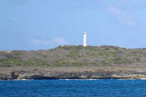
| Ilha Rata
Ilha Rata is the second-largest island of the Fernando de Noronha archipelago, located southeast of the island of Fernando de Noronha itself. Located about 225 mi northeast of Cabo de São Roque.
Photo courtesy Márcio Cabral de Moura [Flickr] |
| BR 3 |
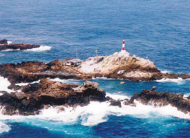
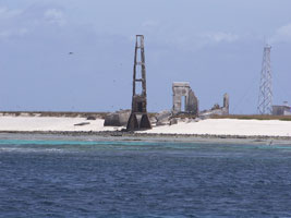
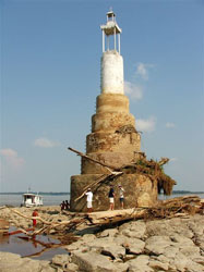
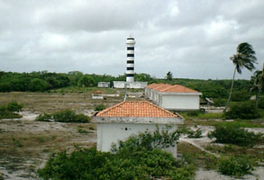
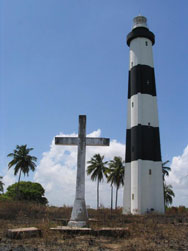
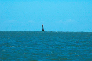
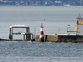
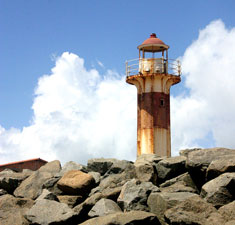
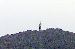
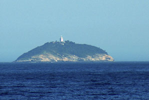
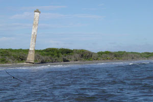
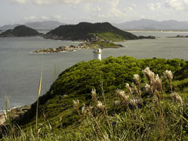
Atol das Rocas
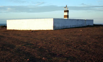
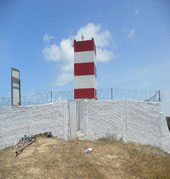
The Atol das Rocas is a group of low, barren islands about 100 miles west of Fernando de Noronha. Invisible from more than two or three miles away, the islands are a notorious hazard to navigation. Located about 150 mi northeast of Cabo de São Roque. Two lights are shown. The foreground is the ruins of the original, the current tower is in the background.
Photo courtesy John Vergri [wikipedia] |
|
Amapá & Pará
| BR 4 |
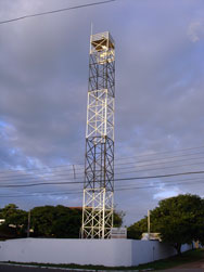
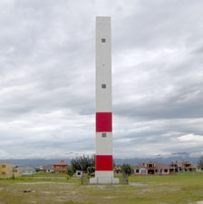
Cabo Orange |
This tall modern lighthouse was built on Brazil's northernmost cape, across the mouth of the Rio Oyapock from French Guiana, to mark the country's northern border. Accessible only by boat photo |
| BR 5 |
Ilha do Pará |
This lighthouse marks the entrance to the Rio do Pará and the city of Belém. (G 0005.5) |
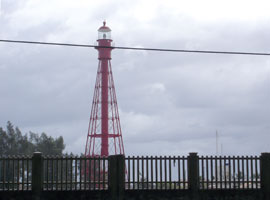
| BR 6 |
Soure
Soure (pronounced 'sorry') is the principal town of the Ilha de Marajó, the large island between the mouths of the Amazon and the Rio do Pará; it is accessible by ferry or package tour from Belém. Located in Soure on the west side of the entrance to the Baía de Guajará. (G 0021.5)
Photo courtesy marcorobs [webshots] |
|
| BR 6J |
| Joanes
There is a church near the lighthouse, and also nearby are the ruins of a 17th century mission that was one of the first European outposts in the area. Located on Ponta da Guarita, a promontory on the west side of the Baía de Marajó about 15 km south of Salvaterra. (G 0024)
Photo courtesy Center of Social Communication of the Navy [mar.mil.br] |
| BR 6S |
Salvaterra (Ilha dos Amores) |
Apparently located on a small island just offshore at Salvaterra, on the west side of the Baía de Marajó. photo (G 0022) |
| BR 7 |
Forte da Barra (Rio do Pará) |
Located on the east side of the Rio do Pará at Val de Cães, about 10 miles north of Belém. |
| BR 8 |
Itaguary
Located on the south side of the Rio Murajó-Assu south of Val de Cães, about 8 km north of Belém.
Photo courtesy Cristiano Malato [panoramio] |
|
| BR 9 |
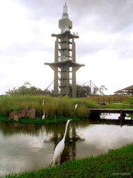
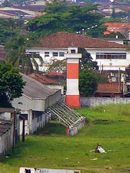
| Belém (Mangal das Garças)
This striking and very modern lighthouse is the centerpiece of a large park, the Mangal das Garças, adjacent to downtown Belém and at the confluence of the Rio Guamá and Rio Acará.
Photo courtesy Breno Peck [Flickr] |
| BR 9A |
Taipú |
This lighthouse marks the east side of the entrance to the Baía de Guajará. Located about 30 km north of Vigia. |
| BR 9C |
Curuçá Ilha Cajutuba |
Located on the northern point of Ilha Cajutuba, about 50 km west of Salinópolis. |
| BR 9M |
Marapanim (Ponta Marapanim)
Located on a low point of land about 25 km west of Salinópolis.
Photo courtesy Andre Leao [Flickr] |
|
| BR 10A |
Quatipuru |
Located on a low point of land about 60 km northeast of Santarém. |
| BR 10B |
Apeú (Ilha do Apeú) |
Located on an island just offshore about 120 km east of Salinópolis. |
Rio Amazonas
(There probably are more lights along the river, but they aren't listed in the international registry)
| BR 10M |
Moronas
Located in mid-river about 35 km east of Manaus. There is some question if this photo is of the Moronas light, or the one below.
Photo courtesy André Stern [Flickr] |
|
| BR 10P |
Pedra do Jacaré |
Located in mid-river about 32 km east of Manaus and 2.5 km southwest of he Moronas lighthouse. |
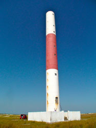
| BR 10 |
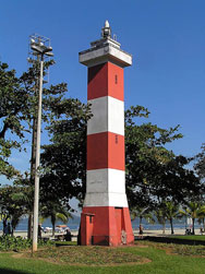
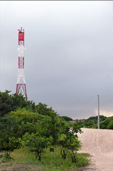
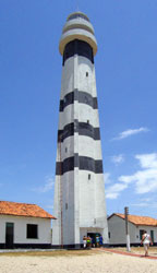
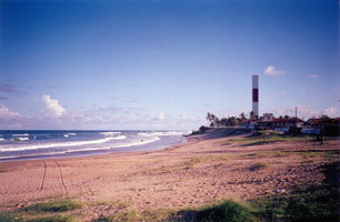
Salinópolis (Salinas)
This lighthouse was shipped to Salinópolis in 1894, but it remained crated until finally assembled in 1937. It is reported that the lighthouse was disassembled and moved at least once to escape beach erosion. Located in Salinópolis, an ocean beach resort about 150 miles northeast of Belém.
Photo courtesy Breno Peck [Flickr] |
|
| BR 11 |
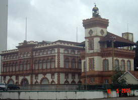
| Manaus
The Alfândega (customs house) of Manaus is one of the city's best-known landmarks; it was prefabricated in Britain, shipped to the Amazon, and reassembled stone by stone. The building is now the Port Captain's office. Located on Av. Marquesa da Santa Cruz in downtown Manaus, the capital of Amazonas, about 750 mi by air west of Belém.
Photo courtesy lebates [webshots] |
Maranhão
| BR 12 |
Ilha Maiau (Ilha São João)
Located on Ilha Maiau, an island about 25 km off the coast and about 210 km northwest of São Luís.
Photo courtesy Serafin Fernandez [panoramio] |
|
| BR 13 |
| Ponta de São Marcos
Located on the Baia de São Marcos in São Luís, the capital of Maranhão, adjacent to the ruins of a 17th century French fort (São Luís was founded as St. Louis by the French in 1612). photo
Photo courtesy Serafín Fernández [picasaweb] |
| BR 13A |
Cajual Island
A small lighthouse is located at the southern tip of Cajual island (São Marcos Bay) indicating the navigable channel between the island and the mainland.
Photo courtesy Márcio Magno [panoramio] |
|
| BR 14 |
Pirarema |
Located about 15 km northwest of São Luis (this must be in or near Alcantara, across the Baia de São Marcos from São Luís). |
| BR 15 |
Ilha do Medo |
Located on the Baia de São Marcos about 6 km southwest of São Luís. |
| BR 16 |
Araçagi
Located just off the beach about 15 km northeast of São Luís.
Photo courtesy Wendell Favacho [Flickr] |
|
| BR 17 |
| Ilha de Santana (1883)
The tower seems safe from the sea (unlike the first 2) but seems about to collapse. It likely has been removed by now.
Photo courtesy Geroge L B [panoramio] |
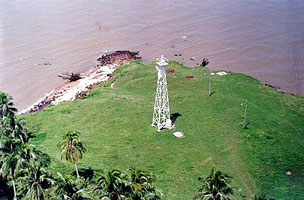
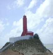
| BR 18 |
Ilha de Santana (1964) |
Located on an island at the east entrance to the Baia de São Marcos.
The picture above shows the new light on the right, and the old light on the left. |
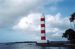
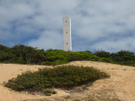
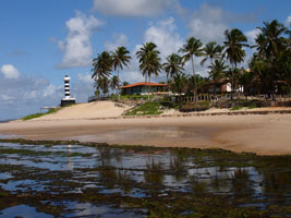
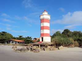
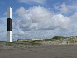
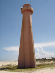
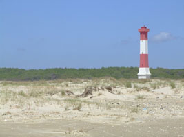
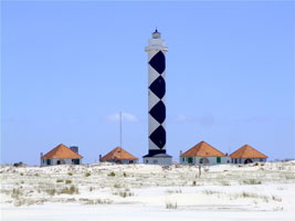
| BR 19 |
Preguiças
By far the best known lighthouse of Maranhão state, the tower is at the edge of the Parque Nacional dos Lençoís, which preserves a vast wilderness of sand dunes and ponds. Located at Mandacaru, on the west side of the Rio Parnaiba, which is the border of Maranhão and Piauí states. park
Photo courtesy Ricardo Ferreira [Flickr] |
|
Piauí & Ceará
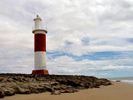
| BR 20 |
| Pedra do Sal
Located on a rocky point north of Parnaíba, west of the principal mouth of the Rio Parnaíba.
Photo courtesy Helder Fontenele [Flickr] |
| BR 21 |
Camocim (Trapiá) |
Located about 5 km northeast of Camocim, a fishing port in the northwestern corner of Ceará. photo |
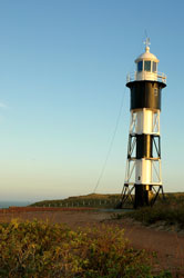
| BR 22 |
Jericoacoara
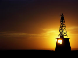
There are probably many small lighthouses of this type in Brazil. Located on a headland projecting into the sea near the popular beach resort of Jericoacoara (this headland is claimed to be the only place in Brazil where the sun both rises and sets over the sea) photo
Photo courtesy arieldiaco [Flickr] |
|
| BR 23 |
| Mundaú
Sibling of Jericoacoara. Located above the beach at Mundaú, about 150 km west of Fortaleza. ARLHS # BRA-019
Photo courtesy Port Authority of Ceara [CPCE] |
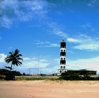
| BR 24 |
Paracurú
Not a traditional lighthouse, but an exceptionally tall aid to navigation and a prominent landmark on the coast. Located on the Ponta Paracurú, a headland about 90 km west of Fortaleza. ARLHS # BRA-276
Photo courtesy Port Authority of Ceara [CPCE] |
|
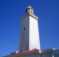
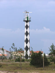
| BR 25 |
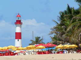
| Mucuripe (1846) (Velho Farol de Fortaleza)
One of the oldest buildings in Fortaleza, the capital of Ceará.
Photo courtesy valegabriel [webshots] |
| BR 26 |
Mucuripe (1958) |
Located above the Praia (beach) de Mucuripe east of downtown Fortaleza. The neighborhood of the lighthouse is described as 'unfriendly.' photo |
| BR 27 |
Morro Branco
This lighthouse appears to be a sibling of Camocim. Located atop well-known white bluffs about 80 km southeast of Fortaleza. BR 21
Photo courtesy Cleiton da Silva Alves [panoramio] |
|
| BR 28 |
| Aracati
Located in Aracati, on the west side of the entrance to the Rio Jaguaribe. view
Photo courtesy Port Authority of Ceara [CPCE] |
Rio Grande do Norte
| BR 29 |
Ponta do Mel
Located on a headland about 80 km east of Areia Branca in western Rio Grande do Norte.
Photo courtesy Mrs. Dalloway [Flickr] |
|
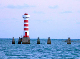
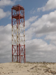
| BR 30 |
Agulha |
The tower is mounted on the Petrobrás PAG-2 oil drilling platform. Located off the coast near the seaport of Guamaré. Accessible only by boat. |
| BR 31 |
Galinhos
This lighthouse is in the water at high tide. Located on the beach about 25 km west of Caiçara.
Photo courtesy Fellipelee [Flickr] |
|
| BR 32 |
Santo Alberto |
The lighthouse has a gallery but no lantern. Located on the beach at Caiçara, about 160 km northwest of Natal. |
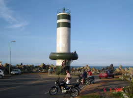
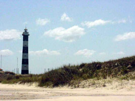
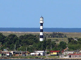
| BR 33 |
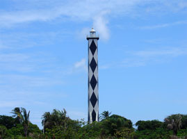
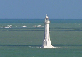
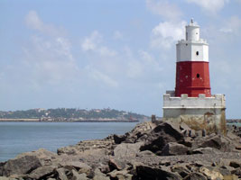
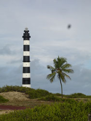
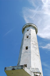
Calcanhar (Touros)
This is Brazil's tallest traditional lighthouse and one of the tallest concrete lighthouses in the world. It marks a headland near the northern end of the great curve of the Cabo de São Roque, the northeastern shoulder of South America. Located on the beach of the Ponta de Calcanhar at Touros, 105 km north of Natal.
Photo courtesy acanto [webshots] |
|
| BR 34 |
Rio do Fogo |
Located at Rio do Fogo on the Canal (Channel) de São Roque, a channel around the cape protected by offshore reefs, about 15 km southeast of Touros. |
| BR 35 |
Teresa Pança |
Located on a reef 2 km offshore from Maxaranguape in the Canal (Channel) de São Roque. Accessible only by boat. |
|
|
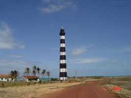
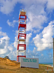
| BR 36 |
São Roque
Located at the southern end of the Cabo de São Roque about 30 km north of Natal.
Photo courtesy Marcos André Madeira [Flickr] |
|
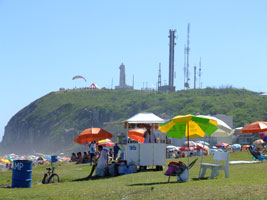
| BR 37 |
| Natal (Mãe Luíza)
Mãe Luíza (Mother Louise) was a parteira (midwife) who ministered to the poor of Natal in the early 1900s. Her name was applied first to the neighborhood in which she lived, and then to the lighthouse in that neighborhood. Located on a bluff in the city of Natal, capital of Rio Grande do Norte.
Photo courtesy luckyshots [Flickr] |
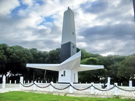
| BR 37S |
Farol do Sol
At the mouth of the River Potengi, this is too small to be a real lighthouse, but it's a beautiful picture. The city Natal is in the the background.
Photo courtesy Fábio Pinheiro [Flickr] |
|
| BR 38 |
Bacopari |
Located on the beach of the Cabo de Bacopari in Baía Formosa, about 100 km south of Natal. photo |
Paraíba & Pernambuco
| BR 39 |
Pedra Seca
Located off the Ponta de Mato at the mouth of the Rio Paraíba, marking the entrance to the port of Cabedelo, about 32 km north of João Passoa. Accessible only by boat but easily visible from the beach. (G 0188)
Photo courtesy Capt. Peter Mosselberger [ListOfLights] |
|
| BR 40 |
| Cabo Branco (Ponta Seixas)
The light is one of the best known tourist attractions of Paraíba, with parking and souvenir shops. Located atop a steep bluff on the Ponta de Seixas, the easternmost point of Cabo Branco, about 15 km east of João Passoa, the capital of Paraíba.
Photo courtesy Nacho Vicent [Flickr] |
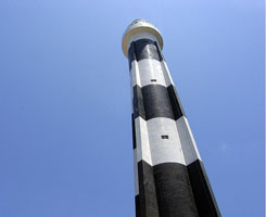
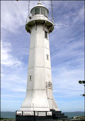
| BR 41 |
Olinda (1941)
This lighthouse is one of the best known landmarks of Olinda and one of the few Brazilian lighthouses open to tourists. Located on a bluff north of the commercial center of Olinda, about 7 km north of Recife. (G 0202)
Photo courtesy Pedro Valadares [Flickr] |
|
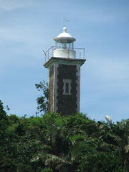
| BR 41O |
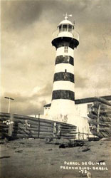
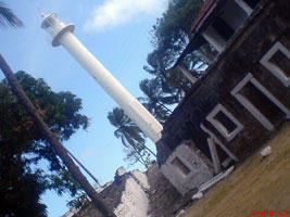
| Olinda (1872)
Having been inaugurated November 18, 1872, the Lighthouse of Olinda is as the oldest one of Pernambuco.
Photo courtesy TC2 [Flickr] |
| BR 42 |
Recife
Located near the end of a natural breakwater on the north side of the city, close to a sculpture park; the reef is accessible from the city's waterfront by passenger ferry. (G 0204)
Photo courtesy TC2 [Flickr] |
|
| BR 45 |
| Tamandaré (Santo Inácio)
The lighthouse stands among the ruins of the Forte do Santo Inácio. Located at Tamandaré, about 50 km southwest of Cabo de Santo Agostinho.
Photo courtesy cyber girl [Flickr] |
Alagoas
| BR 46 |
Porto de Pedras
Sibling of Farol Olinda. Ruins of the base of the original lighthouse are at the foot of the tower. Located on a hill, back from the beach, in Porto de Pedras in northern Alagoas, about 65 miles northeast of Maceió. BR 41 (G 0218)
Photo courtesy andersonroos [webshots] |
|
| BR 47 |
| Ponta Verde
Ponta Vedra is a point of land in the city of Maceió; the lighthouse is located in the surf off the point. Accessible only by boat.
Photo courtesy Julio Cardos Opereira [webshots] |
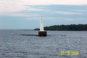
| BR 49 |
São Miguel
Located at the mouth of the Rio São Miguel about 8 km south of Barra da São Miguel.
Photo courtesy Sophia Silva [Flickr] |
|
| BR 50 |
| Coruripe
Located on the beach at Ponta Coruripe, about 50 miles southwest of Maceió near the town of Coruripe (sometimes spelled Coruípe).
Photo courtesy José Luna [Flickr] |
| BR 51 |
Peba (old)
This lighthouse has gone to sea; it is leaning and about to fall, but it was still standing as of December 2004. Accessible only by boat.
Photo courtesy Alberto Gambardella [Flickr] |
|
| BR 52 |
Peba (new) |
Peba is a well-known protected natural area, with a magnificent beach and an extensive dune system, on the north side of the entrance to the Rio São Francisco southeast of Piaçabuçu at the southern edge of Alagoas. |
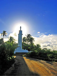
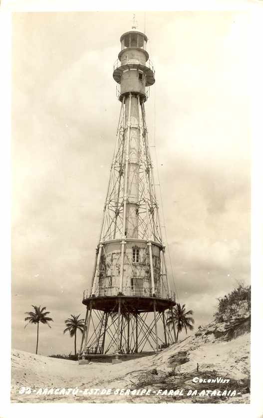
Sergipe
| BR 53 |
Santa Izabel |
Santa Izabel, near the northern border of Sergipe, is a biological reserve. |
| BR 55 |
| Sergipe (new) (Aracaju, Coroa do Meio)
Located in Aracaju, the capital city of Sergipe. (G 0230)
Photo courtesy Henrique Vicente [Flickr] |
Bahia
| BR 58 |
Subaúma
Located at Subaúma, marking the entrance to the river of the same name, about 30 km southwest of Barra do Itariri.
Photo courtesy Gabriela Kastrup (Brazil) [Flickr] |
|
| BR 59 |
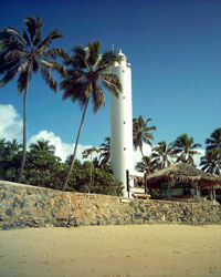
| Garcia d'Ávila (Praia do Forte)
A sea turtle refuge and conservation center called Projeto Tamar is located next to the lighthouse. Located on the beach at Praia do Forte, about 50 miles northeast of Salvador.
Photo courtesy quartominguante [webshots] |
| BR 60 |
Camaçari |
Located in Camaçari, an industrial port about 25 miles northeast of Salvador. |
| BR 61 |
Itapuã
This light is located at the surf line on the beach at Itapuã, about 20 km east northeast of the Farol de Barra (next entry). Don't confuse this with the Itapuã on the south coast. BR 122
Photo courtesy Anonymous [webshots] |
|
| BR 62 |
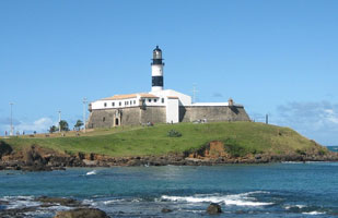
| Santo Antônio da Barra (Farol da Barra)
Located on the Ponta de Santo Antônio marking the northern entrance to the Bahia Todos os Santos, the harbor of Salvador, Bahia's state capital and Brazil's colonial capital. (G 0242)
Photo courtesy Ben Hsu [webshots] |
| BR 62M |
Monte Serrat
Located near the Historic Forte Monte Serrat on a promontory on the east side of the Bahia Todos os Santos, about 10 km north of the Farol da Barra. (G 0249)
Photo courtesy Capt. Peter Mosselberger [ListOfLights] |
|
| BR 62T |
| Caboto
Located on a promontory near the northeastern corner of the Bahia Todos os Santos, about 25 km north of the Farol da Barra. (G 0254)
Photo courtesy Capt. Peter Mosselberger [ListOfLights] |
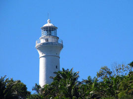
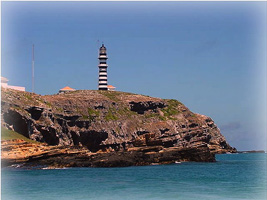
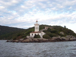
| BR 63 |
Morro de São Paulo (Farol do Morro)
The lighthouse is built uphill from the ruins of a fort built in 1630. Located on the Ilha de Tinharé, about 80 km southwest of Salvador; the island, a popular resort, is accessible by ferry from Valença or Salvador.
Photo courtesy Viviane [Flickr] |
|
| BR 64 |
| Contas
Located on a small island at the mouth of the Rio Contas in Itacaré. Accessible only by boat.
Photo courtesy Maubuch [Flickr] |
| BR 65 |
Comandatuba
Located on the Ilha de Comandatuba about 65 km south of Ilheus. The island, site of several resorts, is accessible by ferry from the mainland.
Photo courtesy Júlio de Oliveira [Flickr] |
|
| BR 66 |

| Belmonte
Prefabricated in France, the lighthouse was moved twice to escape beach erosion, the first time being in 1907. Located in the town of Belmonte, about 70 km Porto Seguro.
Photo courtesy Tarcisio Pereira de Souza [Flickr] |
| BR 67 |
Araripe |
Located on a headland about 30 km north of Porto Seguro. |
| BR 68 |
Alcobaça
Located off the beach (Praia do Farol) in Alcobaça.
Photo courtesy Paulo Moreno [Flickr] |
|
| BR 69 |
| Abrolhos
The Arquipélago de Abrolhos is a group of five rocky islands about 65 km off the south coast of Bahia. Located at the highest point of Santa Bárbara, the largest island of the group.
Photo courtesy Luiz Castro [Flickr] |
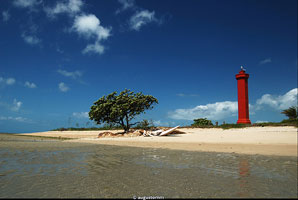
| BR 70 |
Coroa Vermelha
Located on the Ilha de Coroa Vermelha, an island off the coast near Nova Viçosa.
Photo courtesy © Augusto Miranda Martins [Flickr] |
|
| BR 71 |
Mucuri |
Located in Mucuri, the southernmost city of Bahia. |
Espírito Santo
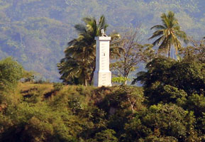
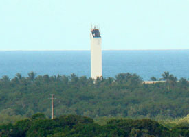
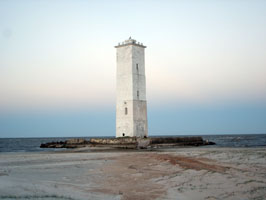
| BR 71M |
São Mateus (1914) (Conceição da Barra)
Formerly in poor condition, the lighthouse has been restored recently. The river's mouth has moved southward. Located near the south end of the beachfront of Conceição da Barra.
Photo courtesy Glaucio Lima [Flickr] |
|
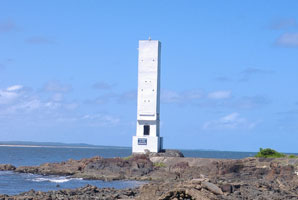
| BR 71N |
São Mateus (1999) |
The light has been moved to a modern fiberglass tower on the south side of the river. |
| BR 73 |

| Rio Doce (1997) (Regência)
Built on one side of the concrete foundation pad of the original lighthouse, on the south side of the entrance to the Rio Doce in Regência.
Photo courtesy Leandro Moreira [Flickr] |
|
|
| BR 74 |
Rio Doce (1895) |
The lighthouse was first built on the north side of the entrance to the Rio Doce, but was relocated to the south side in 1907. photo |
| BR 75 |
Barra do Riacho |
Located in the seaport and resort city of Barra do Riacho about 25 km southwest of Regência. |
| BR 76 |
Santa Luzia
Located on the Ponta Santa Luzia on the north side of the entrance to the Bahia do Espírito Santo and the port of Vitória, the state capital. (G 0320)
Photo courtesy Viviane [Flickr] |
|
| BR 77 |
Ilha Escalvada |
Located on a rocky island about 10 km of the coast near Guarapari. Accessible only by boat. |
| BR 78 |
Ilha do Francês (Ilha dos Franceses)
Located on an island about 20 miles southwest of Guarapari.
Photo courtesy James Altoé Duarte [Flickr] |
|
Rio de Janeiro
| BR 79 |
| Ponta do Retiro
Located about 5 km south of Barra de Itabapoana in the extreme northeast corner of Rio de Janeiro state.
Photo courtesy Ricardo Lugão [Flickr] |
| BR 79A |
Atafona (São João da Barra)
The light is named for the Pontal de Atafona, a former seaside resort nearby that is being destroyed by beach erosion. Located one block off the beach near the north end of São João da Barra, marking the entrance to the Rio Paraíba.
Photo courtesy Ricardo Lugão Pereira [Flickr] |
|
| BR 81 |
São Tomé
Located on the Cabo São Tomé, a prominent headland in the northeastern corner of Rio de Janeiro state, at the end of the Av. Boa Vista in Santo Amaro de Campos about 30 miles southeast of the city of Campos.
Photo courtesy Ricardo Lugão Pereira [Flickr] |
|
| BR 82 |
Quissama |
Evidently located on the beach about 25 km southwest of Cabo São Tomé. * |
| BR 83 |
Macaé (1880) (Imbetiba) |
Some restoration work was done on the tower in 1999. |
| BR 84 |
Macaé (1902) (Ilhas de Santana, Sant'Anna) |
Located on the Ponta da Imbetiba about 3 km south of the center of Macaé, a seaport roughly 70 km northeast of Cabo Frio. |
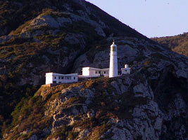
| BR 85 |
Cabo Frio (1836) |
The lighthouse was built on the highest point of the island at an elevation of about 390 m. The island is accessible by boat from Arraial do Cabo on the mainland, but permits from the navy's research institute are required. |
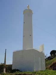
| BR 86 |
Cabo Frio (1925)
The light station is perched on the steep bluff rising from the sea at the point of the cape. (G 0352)
Photo courtesy Captain Theo [ListOfLights] |
|
| BR 87 |
| Ponta Negra
Located on a rocky headland about 13 km southeast of Maricá and 40 km east of the Baía de Guanabara entrance.
Photo courtesy Cleber Moraes [Flickr] |
| BR 88 |
Ilha Maricas
Located atop an island about 15 km southeast of the entrance to the Baía de Guanabara, the harbor of Rio de Janeiro. Accessible only by boat. (G 0358)
Photo courtesy Captain Peter Mosselberger [ListOfLights] |
|
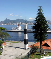
| BR 89 |
| Ilha Rasa
Located on an island about 11 km off the entrance to the Baía de Guanabara, the harbor of Rio de Janeiro. (G 0360)
Photo courtesy L. F. Castro [Flickr] |
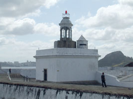
| BR 89F |
Fortaleza de Santa Cruz
Mounted atop the center of the fort. The modern light is mounted on a short post atop the lantern. (G 0367)
Photo courtesy Ricardo Lugão Pereira [Flickr] |
|
| BR 89G |
| Ponta da Armaçao
Located on the southeastern tip of the Ponta D'Areia peninsula in Niterói, on the east side of the harbor of Rio de Janeiro. *
Photo courtesy Center for Marine Signaling and Almirante Moraes Rego [mar.mil.br] |
| BR 89H |
Ponta de Castelhanos (Farol dos Castelhanos)
Located at the eastern end of the Ilha Grande, a large island readily accessible by ferry from Angra dos Reis or Mangaratiba on the mainland, roughly 120 km west of Rio de Janeiro. island (G 0408)
Photo courtesy Capt. Peter Mosselberger [ListOfLights] |
|
São Paulo
| BR 89U |
Ubatuba |
Located at the tip of a narrow peninsula sheltering the bay of Ubatuba. * |
| BR 90 |
Ponta do Boi
latitude 23° 58' 4.5" N longitude 45° 15' 8.2" W
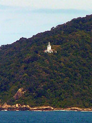
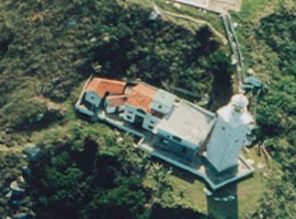
The lighthouse is in a state park, the Parque Estadual de Ilhabela. Located atop a steep bluff on the southeastern tip of the large Ilha São Sebastião about 35 km southeast of the mainland city of São Sebastião.
Photo courtesy Bruno Rocha [panoramio] |
|
| BR 91 |
Ilha da Moela |
Located on an island about 5 km off the entrance to the Baía de Santos, the harbor of São Paulo. |
| BR 92 |
Itapema |
This lighthouse is located in the Forte do Itapema, a sixteenth century fort largely destroyed by fire in 1883. Located on an island on the north side of the Santos Estuary, across from the waterfront of Santos. Accessible only by boat(?). |
| BR 94 |
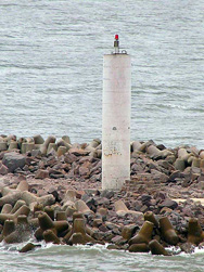
| Rio de Meio Range Front (G 0501)
Photo courtesy Captain Peter Mosselberger [ListOfLights] |
| BR 95 |
Ponta da Praia (Range Rear)
Originally the rear light of a range, but now converted to a leading (directional) light. Located near the east end of the beach in Santos, marking the north side of the entrance to the inner harbor.
Photo courtesy Viviane [Flickr] |
|
| BR 97 |
Ilha Queimada Grande |
Located on one of the summits of a high island about 35 km southeast of Itanhaém. Accessible only by boat, and the island lacks landing facilities. * |
| BR 98 |
Ilha do Bom Abrigo
Located high atop the Ilha do Bom Abrigo, the 'Island of Good Shelter,' outside the entrance to the harbor of Cananéia. Accessible only by boat.
Photo courtesy Gutosantinelli Santinelli [Flickr] |
|
Paraná
| BR 98A |
| Paranaguá Range C Rear
Located on the southwestern tip of the Ilha de Peças, where it formerly guided ships around the north side of the Ilha do Mel into the Paranaguá estuary. To get here, first go to Paranaguá; at port ask for a boat to Ilha das Peças or Superagui.
Photo courtesy Hartmann [Flickr] |
| BR 98C |
Cassual |
Located on the southwestern tip of the Ilha de Peças, where it formerly guided ships around the north side of the Ilha do Mel into the Paranaguá estuary. |
| BR 99 |
Ponta das Conchas (Ilha do Mel)
The beautiful Ilha do Mel, located in the mouth of the Baía de Paranaguá, is a major tourist attraction easily accessible by ferry from Paranaguá or Pontal do Sul. Most of the interior of the island is an ecological preserve. tourist (G 0520)
Photo courtesy Roney [Flickr] |
|
| BR 100 |
| Caraguata
Located near the southern tip of the Ilha do Mel, marking the east side of the entrance to the channel leading to Paranaguá. (G 0524)
Photo courtesy Captain Peter Mosselberger [ListOfLights] |
Santa Catarina
| BR 101 |
Ilha da Paz
The lighthouse guards the entrance to the port of São Francisco do Sul. Located on an island several miles off the coast.
Photo courtesy Flavio Prestes [Flickr] |
|
| BR 102 |
| Trincheira (Itapoá)
latitude 26° 10' 28.1" S longitude 48° 35' 11.1" W
Located on the north side of the Bay of São Francisco do Sul estuary 3.2 km west of the entrance. another photo
Photo courtesy Correa Marcos [eMail] |
| BR 103 |
Itajaí North Breakwater
Located at the end of the north breakwater at the mouth of the Rio Itajaí. Accessible by driving on the breakwater. (G 0554)
Photo courtesy Rodrigo Osorio [Flickr] |
|
| BR 104C |
Ponta das Cabeçudas
Located at the tip of a narrow peninsula projecting northeastward about 8 km southeast of Itajaí. (G 0552)
Photo courtesy Captain Peter Mosselberger [ListOfLights] |
|
| BR 104G |
Ilha da Galé (Pedrada Galé) |
Located atop an island about 10 km east of Canto Grande. |
| BR 105 |
Ilha do Arvoredo |
Along with neighboring islands, the Ilha do Arvoredo is included in the Reserva Biológica Marinha do Arvoredo, an ecological reserve. Tours of the reserve are available, but it's not clear if these include visits to the lighthouse. Located on an island off the northern end of the Ilha de Santa Catarina, the large island that includes the state capital of Florianópolis. * |
| BR 105G |
Ponta de Galheta |
Located on a promontory on the central east coast of the Ilha de Santa Catarina, about 12 km due east of Florianópolis. |
| BR 106 |
Ponta dos Naufragados
There's no road access to the site, but the beach below the lighthouse, popular with surfers, can be reached by a hike of about 40 minutes. Located on a bluff at the southern end of the Ilha de Santa Catarina about 20 miles south of Florianópolis.
Photo courtesy Felipe Abreu [Flickr] |
|
| BR 108 |
Santa Marta
Built by French contractors, this magnificent lighthouse is one of the best known landmarks of the Santa Catarina coast. Located on the Cabo Santa Marta, a prominent headland about 13 km south of the city of Laguna.
Photo courtesy ground.zero [Flickr] |
|
| BR 109 |
| Araranguá (Morro dos Conventos)
This light is no more than 15 m tall and is located on the Morro dos Conventos, a rocky headland at Araranguá, about 80 km southwest of Laguna.
Photo courtesy ekevu [Flickr] |
Northern Rio Grande do Sul Coast
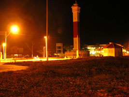
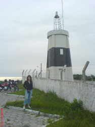
| BR 110 |
Torres (1912)
Located atop a high hill, the Morro do Farol (Lighthouse Bluff) in the northern section of the city of Torres, at the northeastern corner of Rio Grande do Sul.
Photo courtesy Thiago Ferronatto [Flickr] |
|
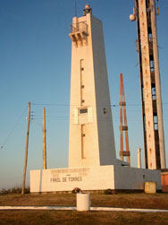
| BR 111 |
| Torres (1952)
Just behind the old light (partly visible above, both lights are visible on the right.)
Photo courtesy Gilberto Otávio Lima [Flickr] |
| BR 112 |
Itapeva (Arroio do Sul)
Located on the beach about 25 km southwest of Torres.
Photo courtesy Jocelei Gonçalves [panoramio] |
|
| BR 114 |
Tramandaí
Located on the beach about 16 km northeast of Cidreira.
Photo courtesy Ivan Bustamante [Flickr] |
|
| BR 116 |
Berta
Located on the beach about 30 km southwest of Cidreira.
Photo courtesy Gilberto Otávio Lima [Flickr] |
|
| BR 117 |
| Solidão
Located on the beach about 70 km northeast of Mostardas and 40 km southwest of Quintão. Accessible by 4WD.
Photo courtesy Rafael Podolano [Flickr] |
| BR 118 |
Mostardas
This lighthouse is located in a national park, the Parque Nacional da Lagoa do Peixe. Located on the beach about 20 km south of the town of Mostardas. Accessible by 4WD from the seaside resort of Balneário Mostardense 9 miles northeast. park
Photo courtesy Cecilia Cassal [webshots] |
|
| BR 119 |
| Capão da Marca
Located on the beach about 11 km southwest of the Mostardas lighthouse. Accessible by 4WD.
Photo courtesy rdallagnol [panoramio] |
| BR 120 |
Conceição
Located on the beach about 65 km northeast of Rio Grande do Sul. Accessible by 4WD.
Photo courtesy Rafael Podolano [Flickr] |
|
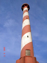
| BR 121 |
| Estreito
Located on the beach about 40 km northeast of Rio Grande do Sul. Accessible by 4WD.
Photo courtesy Klaus Huelse [leuchturm] |
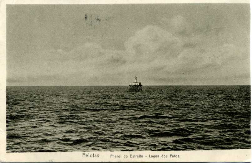
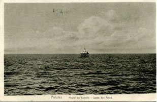
Lagoa dos Pastos
| BR 122 |
Itapuã da Lagoa
Located at the northern end of the Lagoa dos Patos, about 50 km south of Porto Alegre. The lighthouse is included in tours from Itapuã on weekends. Don't confuse this with the northern Itapuã. BR 61
Photo courtesy Paulo Angonese [Flickr] |
|
| BR 123 |
| Cristóvão Pereira
Located on a sandy point projecting into the Lagoa dos Patos about 25 km west of Mostardas. Accessible by 4WD.
Photo courtesy Rafael Podolano [Flickr] |
| BR 123J |
Bujuru |
The ruins are located on a tiny island off a sandy point projecting into the Lagoa dos Patos about 16 km north of the village of Bujuru. Accessible only by boat. |
| BR 123P |
Ponta Alegre
Located on the Praia do Farol, a sandy peninsula on the north side of the Lagoa Mirim, about 25 km southeast of Arroio Grande. Apparently accessible by 4WD.
Photo courtesy Poti Campos [Flickr] |
|
Southern Rio Grande do Sul Coast
| BR 124 |
| Barra Rio Grande
Lights are said to have been shown from this point as early as 1698. Located on the west side of the Rio Grande do Sul. (G 0620)
Photo courtesy Captain Peter Mosselberger [ListOfLights] |
| BR 124E |
Rio Grande do Sul East Mole
Located at the end of the east mole (breakwater) at Rio Grande do Sul. (G 0624)
Photo courtesy Captain Peter Mosselberger [ListOfLights] |
|
| BR 125 |
| Rio Grande do Sul West Mole
In recent years two long (about 2.5 miles) breakwaters or moles (moelhas) were built to protect the entrance to Rio Grande do Sul. These moles are tourist attractions; light sail-powered rail cars carry visitors over a narrow-gauge rail track to the lighthouse at end of the West Mole. (G 0622)
Photo courtesy Captain Peter Mosselberger [ListOfLights] |
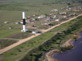
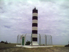
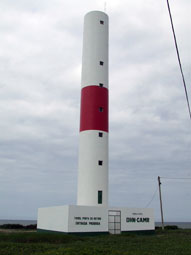
| BR 126 |
Sarita
This lighthouse and the next three on this list are located on one of world's great beaches, a largely deserted strand that stretches about 220 km from Rio Grande do Sul to the Uruguayan border. A 4WD expedition the length of this beach will pass all four lighthouses. Located about 70 km southwest of Rio Grande do Sul.
Photo courtesy Gilberto Lima [Flickr] |
|
| BR 127 |
| Verga
Located on the beach about 110 km northeast of Barra do Chuí.
Photo courtesy Paulo Azambuja [Flickr] |
| BR 128 |
Albardão
Located on the beach about 90 km northeast of Barra do Chuí.
Photo courtesy Gilberto Lima [Flickr] |
|
| BR 128F |
Fronteira Aberta |
Located on the beach about 40 km northeast of Chuí. |
| BR 129 |
Chuí
Located at Barra do Chuí, at the mouth of the Arroio Chuí, which is the Uruguayan border. Accessible by road from BR 471 at Chuí.
Photo courtesy Luci Both [Flickr] |
|
|
|
 Venezuela