|
This page shows what I know about Jamaica. It actually has two lights we visited after Stephen and Tia were married. |
|
| JA 1 |
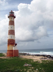
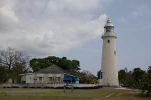
Morant Point
latitude 17° 55' 6" N longitude 76° 11' 3.3" W
Located at Morant Point, the easternmost point of Jamaica. Site open, although not easy to find; the road is considered unreliable and may be impassable in wet weather. ARLHS # JAM-004
Photo courtesy edu-tourise [Flickr] |
|
| JA 2 |
| Plumb Point
latitude 17° 55' 43.2" N longitude 76° 46' 41.5" W
Located at Great Plumb Point on the Palisadoes Peninsula, marking the entrance to Kingston harbor. ARLHS # JAM-005
Photo courtesy Auria Abraham [Flickr] |
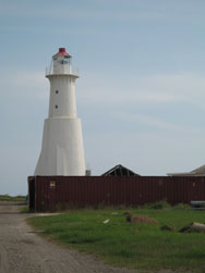
| JA 2L |
Lazaretto Cairn (Rackhams Cay Range Rear)
The range guides vessels westward on their approach to Kingston Harbour. This appears to be a historic day-beacon converted to a lighted aid. Located on a bluff on the west side of the harbor entrance, opposite Port Royal.
Photo courtesy marinas.com [marinas.com] |
|
|
|
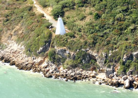
| JA 3 |
Portland Ridge (Portland Point)
latitude 17° 44' 32.4" N longitude 77° 9' 27" W |
Located on the Portland Ridge near the southernmost point of the island. Accessible by a hike of about 8 km (5 mi) (access road gated for cars). (J 5327) ARLHS # JAM-006 |
|
|
| JA 4 |
Lover's Leap
latitude 17° 52' 9.4" N longitude 77° 39' 37.9" W
March 5, 2007
The area has been developed as a tourist attraction, with a restaurant and observation deck near the lighthouse. Located 20 miles south of Mandeville at the top of a spectacular vertical cliff. We used a professional driver, without him, we probably would have gotten lost on this trip. (J 5341) ARLHS # JAM-003 |
|
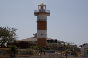
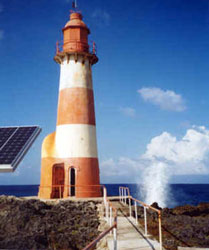
| JA 5 |
| South Negril Point
latitude 18° 14' 54.3" N longitude 78° 21' 37.8" W
March 5, 2007
The Lighthouse Inn, located close to the tower, has a web site with historical information and photos. Elinor DeWire has an account of a visit, with good photos. Located at South Negril Point, the westernmost point of the island, at the end of West End Road. ARLHS # JAM-007 |
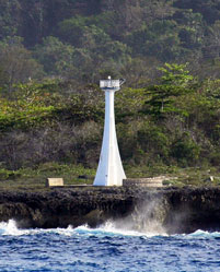
| JA 6 |
Galina Point
latitude 18° 24' 30.4" N longitude 76° 53' 36.4" W
Located near Port Maria on the northern coast of Jamaica. (J 5266) ARLHS # JAM-002
Photo courtesy Captain Theo [ListOfLights] |
|
| JA 7 |
| Folly Point
latitude 18° 24' 30.4" N longitude 76° 53' 36.4" W
Located at the end of the Folly Peninsula east of Port Antonio on the northeastern coast of the island. ARLHS # JAM-001
Photo courtesy Frans Eijgenraam |
|
|
If you have a picture where I have none, I'm interested in putting it here. You maintain copyright and I'll publish that and how to contact you (if you'd like). If you would like copies of any of my pictures, contact me and well discuss arrangements. There are others who do this commercially, I have no intention of competing directly, but you can make a proposal, and I'll react. mailMe

