|
This page the documentation about the Lighthouses of the Dominican Republic. In addition, the pictures below are linked to the relevant photo on the web (thus making available to you a higher resolution picture.) I am very grateful to Russ Rowlett at the University of North Carolina for his excellent Lighthouse Directory from which I built the outline. Each lighthouse is linked to (in our editorial opinion) the best reference site for that light. LHdirectory |
|
North Coast
| DR 1 |
Isla Cabrita (Isla Cabra) |
The island is just northwest of Monte Cristi at the northwestern corner of the country. Located atop a steep bluff on the northwest side of the island. ARLHS # DOM-004 |
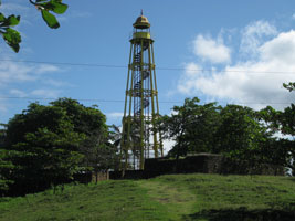
| DR 2 |
El Morro de Monte Cristi |
Monte Cristi is a steep mountain ridge on a peninsula at the northwestern corner of the Dominican Republic. The lighthouse is at the summit of Monte Cristi. ARLHS # DOM-002 |
| DR 3 |
Puerto Plata
latitude 19° 48' 10.8" N longitude 70° 41' 40.9" W
January 21, 2012
Located on the east side of the entrance to the harbor of Puerto Plata on the north coast of the country. ARLHS # DOM-003 |
|
| DR 4 |
Cabo Francés Viejo |
The cape is a prominent headland north of Nagua on the north coast of the country. ARLHS # DOM-001 |
|
|
South Coast
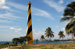
| DR 5 |
Cabo Engano
latitude 18° 36' 5.8" N longitude 68° 19' 29.6" W
The lighthouse marks the easternmost point of the island, overlooking the Mona Passage. ARLHS # DOM-005
Photo courtesy Engineer Alan T Manasala [pBase] |
|
| DR 6 |
| La Romana
La Romana, in the southeast corner of the republic, is well known for its beach resorts. Located on a prominent cape on the east side of the city. (J 5448) ARLHS # DOM-011
Photo courtesy kris6190mp [webshots] |
|
|
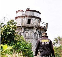
| DR 8 |
Punta Torrecilla
latitude 18° 27' 50.7" N longitude 69° 52' 34.6" W
The original lighthouse was deactivated in 1967 and there was no light until this tower was built in 1986. Located on a promontory east of the entrance to the harbor of Santo Domingo, on the south coast of the country. (J 5457) ARLHS # DOM-006
Photo courtesy Mannydp [webshots] |
|
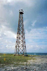
| DR 9 |
Isla Alto Velo |
The lighthouse crowns a small island about 30 km southwest of Cabo Beata; this is the southernmost point of the country and of Hispaniola. Accessible only by boat. ARLHS # DOM-007 |
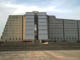
| DR 10 |
Faro a Colón (Columbus Lighthouse)
There is no navigational beacon in the usual sense; the building has 149 searchlights that project a giant cross in the sky overhead. Located in downtown Santo Domingo.
Photo courtesy Jefry Lagrange Reyes [Wikipedia] |
|
|
|

 Antilles
 Haiti
Haiti
