|
All the pictures are available on the Web. We have no plans (but then that can change) to do the Canadian side (most of the lights require a boat to get to them and that's a long way to haul a boat at current Canadian Gas Prices). The pictures below are live, if you click on them you will be taken to the appropriate page of the Flickr site where you will have a picture of that light with much better resolution. Flickr The first stretch of Lake Superior may seem to be from Sault St. Marie to Munising. The lights of Lake Superior are numbered starting from Sault Ste Marie proceeding clockwise around the lake. However, there is also a stretch from the Sault up the St. Mary's River in Ontario. I've chosen to put this stretch at the end of this page. Index data is from Great Lakes Lighthouses American & Canadian p1 |
|
Michigan
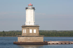
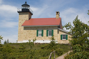
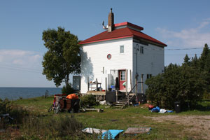
| 1 |
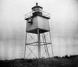
Frying Pan Island (relocated from Lake Huron) (MI 114)
latitude 46° 30' 2.2" N longitude 84° 20' 24.5" W
August 4, 2001 access: car
This light was installed on Frying Pan Island in 1887. However, if you want to see it, you need to go to the Coast Guard Station in Sault Saint Marie where it has been moved to. ARLHS # USA 312 |
|
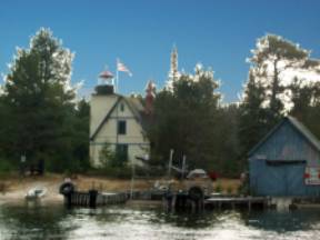
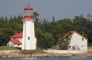
| 2 |
| Pipe Island (MI 115)
latitude 46° 57.4" N longitude 83° 53' 57.8" W
September 8, 2009 access: boat
Pipe Island is privately owned, but in 2005 three cottages and the Victorian keeper's dwelling were made available for overnight stays. island ARLHS # USA 602 |
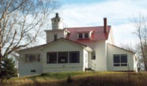
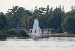
| 3 |
Round Island, St. Marys River (MI 36)
latitude 46° 6' 31.7" N longitude 84° 1' 12" W
September 8, 2009 access: boat
This lighthouse is now a private residence and has been extensively renovated. It is best viewed from the river. ARLHS # USA 709 |
|
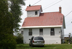
| 3.5 |
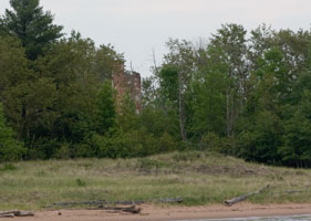
Cedar Point Rear Range (ruins) (MI 35) |
a.k.a. Lower Nicolet West Range? |
| 4 |
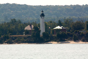
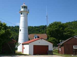
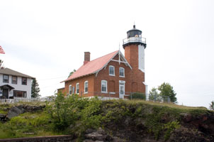
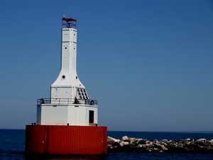
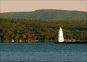
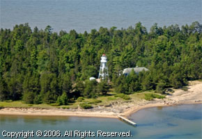
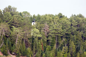
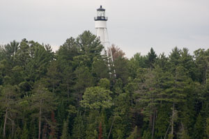
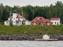
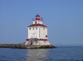
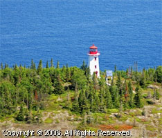
Point Iroquois (MI 34)
latitude 46° 28' 50" N longitude 84° 37' 34.3" W
August 4, 2001 access: car
Built in 1870, this light was to assist traffic heading into the Sault locks (who have a nasty turn here). Currently inactive, it is a National Forest Museum and free to the public. ARLHS # USA 624 |
|
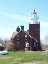
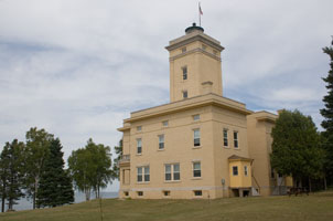
| 5 |
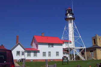
| Whitefish Point (MI 33)
latitude 46° 46' 17.8" N longitude 84° 57' 25.2" W
August 4, 2001 access: car
This is the first light on the Great Lakes established in 1849. This light was erected in 1861. It's co-located with the Great Lakes Ship Wreck museum which is undergoing massive expansion. museum
Located 11 miles north of Paradise MI, it's a long way from anywhere, but worth the trip. ARLHS # USA 887 |
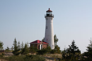
| 6 |
Crisp Point (MI 32)
latitude 46° 45' 10.1" N longitude 85° 15' 25.2" W
September 5, 2009 access: car
Take county road 500 north from Michigan 12, then follow County road 412 (7 miles) to the Lighthouse turn off. This is being newly restored, but the road is still dirt all the way from 123. preservation ARLHS # USA 203 |
|
| 7 |
| Grand Marais Harbor Front Range (MI 31F)
latitude 46° 41' 1.7" N longitude 85° 58' 19.3" W
September 5, 2009 access: car
At the front end of the channel, on the west side. |
| 8 |
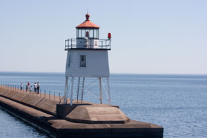
Grand Marais Harbor Rear Range (MI 31)
latitude 46° 40' 36.1" N longitude 85° 58' 17.1" W
September 5, 2009 access: car
From the junction of M77 and County Road 702 in downtown Grand Marais, take CR702 northeast approximately 1/2 mile. ARLHS # USA 1079 |
|
| 9 |
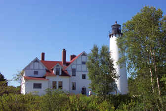
| Au Sable Point (MI 30)
latitude 46° 40' 23.1" N longitude 86° 8' 21.6" W
September 7, 2009 access: walk (1.5 miles)
Just as its keepers once did, visitors today must walk to it, but only 1.5 miles. Take Alger County Road (H-58) at the Pictured Rocks National Lakeshore, a dirt and gravel access road, for about 12 miles. When you reach the Hurricane River Campground, park near the Hurricane River and take the two track access path to the lighthouse and Lake Superior. ARLHS # USA 022 |
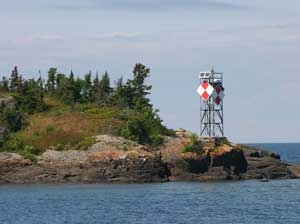
| 9.5 |
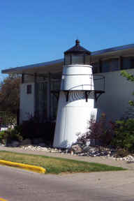
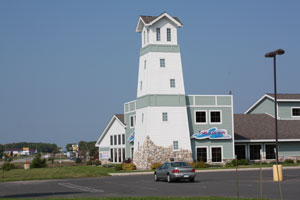
Munising AmericaInn (faux) (MI 29M)
latitude 46° 22' 51" N longitude 86° 36' 30.6" W
September 10, 2009 access: car
While clearly a new, false (faux, sometimes pronounced fox) light, it is just east of Munising on Highway 28. |
|
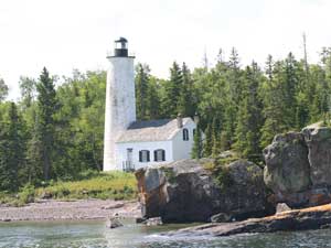
| 10 |
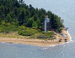
| Grand Island Light (Grand Island North) (MI 29)
latitude 46° 33' 34.5" N longitude 86° 40' 46.2" W
September 7, 2009 access: boat
It sits atop a 165-foot cliff so the best views of it come from the air. Skylane Pictured Rocks & Grand Island Air Tours offer routes that pass over the island. This picture was taken from a GLLKA tour, thus from the water. Grand Island Air Tours |
| 11 |
Grand Island Harbor (East Channel) (MI 28)
latitude 46° 27' 24.8" N longitude 86° 37' 25.5" W
July 6, 2007 access: boat
This picture as taken from the Shipwreck tour from downtown Munising. You also get good views from the Pictured Rocks tours.
Often known as the East Channel Light, this is correctly titled as the "Harbor Light" as it leads you into the Harbor. ARLHS # USA 328 |
|
| 12 |
| Munising Front Range (MI 27)
latitude 46° 24' 54.4" N longitude 86° 39' 40.1" W
July 30, 2004 access: car
This light is used in combination with the rear range shown below. It's tucked just below the main highway through Munising. Turn towards the lake at the west edge of town. ARLHS # USA 948 |
| 13 |
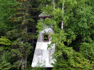
Munising Rear Range (MI 26)
latitude 46° 24' 46.7" N longitude 86° 39' 45.7" W
July 30, 2004 access: car
Tucked in between the trees, at the end of a street, this one is almost impossible to find (unless you know it's there).
From the front range light, go uphill (south) on Hemlock Street and cruise W. Onota Street looking uphill to find the light. ARLHS # USA 949 |
|
| 14 |
| Grand Island Harbor Rear Range (MI 25)
latitude 46° 26' 13.1" N longitude 86° 41' 29.3" W
November 14, 1999 access: car
Matching front range is shown below. These lights are off of route 28, just east of Christmas (MI, not December) and even knowing where they are, they are hard to spot.
This was a range light into Grand Island Harbor, but the channel moved, so the light was turned off. ARLHS # USA-329 |
| 14.5 |
Bay Furnace Light (Grand Island Harbor Front Range) (MI 25A)
latitude 46° 26' 19.6" N longitude 86° 41' 31.5" W
November 14, 1999 access: car
A simple sewer pipe construction to line up with the classic rear range.
Originally part of a range system, the channel didn't cooperate, so this light was renamed. ARLHS # USA-1110 |
|
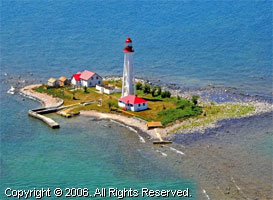
| 15 |
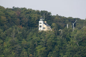
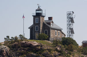
| Marquette Harbor (MI 24)
latitude 46° 32' 47.5" N longitude 87° 22' 34.8" W
September 6, 2009 access: car
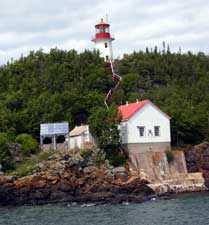
Established 1853 and still an active Coast Guard station. The Marquette Maritime Museum will lease it from the Coast Guard to make it open to the public. ARLHS # USA 477 |
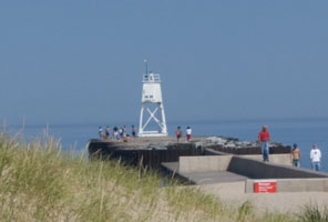
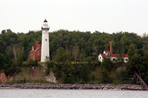
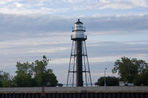
| 16 |
Presque Isle Harbor Breakwater (MI 23)
latitude 46° 34' 26.7" N longitude 87° 22' 28.7" W
July 30, 2004 access: car
This is in the park north of Marquette just behind the loading dock for the oar carriers. When the weather is reasonable, you can walk out the walkway to the light. In high winds, the walkway is quite wet, and therefore dangerous. ARLHS # USA 1111 |
|
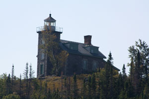
| 17 |
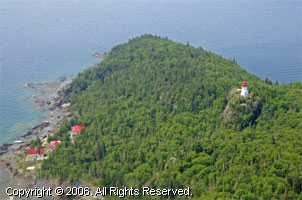
| Granite Island (MI 22)
latitude 46° 43' 52" N longitude 87° 24' 48.1" W
September 6, 2009 access: boat
Located on Lake Superior's Granite Island.
12.5 miles north of Marquette. (If you look at a map, you'll note that this is 12 miles into Lake Superior, so the only way to get here is by boat or air.) ARLHS # USA 333 |
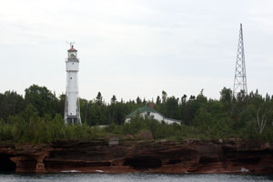
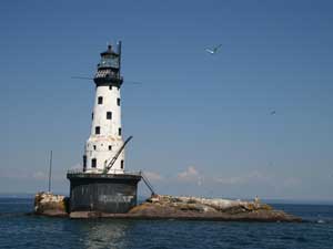
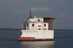
| 18 |
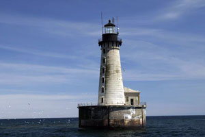
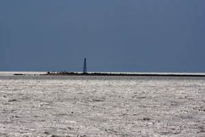
Stannard Rock (MI 21)
latitude 47° 11' 0.2" N longitude 87° 13' 30" W
access: boat
Located in Lake Superior, 24 miles southeast of Manitou Island and 45 miles north of Marquette. You can visit Stannard Rock with Captain Tom of Fishing Fever Charters Charters ARLHS # USA 808
Photo courtesy cmstpprr [Webshots] |
|
| 19 |
| Big Bay Point (MI 20)
latitude 46° 50' 29" N longitude 87° 40' 50.2" W
April 29, 2000 access: car
This lighthouse is now a bed and breakfast. For most of its working life, the only source of contact with the outside world was by boat. It's now an easy drive up from Marquette. ARLHS # USA 053 |
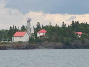
| 20 |
Huron Island (MI 19)
latitude 46° 57' 47.2" N longitude 87° 59' 56.8" W
September 6, 2009 access: car
Located on Lighthouse Island, the westernmost of the Huron Islands. The islands make up the Huron Islands National Wildlife Refuge and are located three miles off the south shore of Lake Superior and 18 miles east of the Keewenaw Peninsula. refuge ARLHS # USA 395 |
|
| 21 |
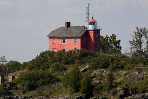
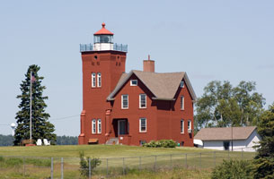
| Sand Point (Baraga) (MI 18)
latitude 46° 47' 0.1" N longitude 88° 28' 1.1" W
November 13, 1999 access: car
The home is a private residence and I suspect the large porch shown here is a recent addition. ARLHS # USA 725 |
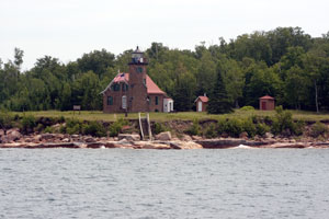
| 22 |
Portage River (Jacobsville) (MI 16)
latitude 46° 58' 41" N longitude 88° 24' 50.8" W
September 6, 2009 access: boat
Aficianado comments imply that cameras are not welcomed. Note that we took this picture from the water.
From Highway 26 in the town of Lake Linden, turn east on 9th Street which will become Bootjack Road. Follow Bootjack Road around Torch Lake and then Portage Lake for roughly 7.5 miles until you come to a fork in the road. Take the left fork, Dreamland Road (Jacobsville Road) and follow it for 8.4 miles where it will tee. Turn right and follow the road to the park at its end. ARLHS # USA 658 |
|
|
|
| 23 |
| Keweenaw Lower Entrance (MI 17)
latitude 46° 58' 7.8" N longitude 88° 25' 52.1" W
July 7, 2007 access: boat
From US 41 North (going towards Houghton), turn east on Portage Entry Road. Keweenaw Excursions used to offer cruises that pass this lighthouse. ARLHS # USA 418 |
| 24 |
Bete Grise (Mendota) (MI 15)
latitude 47° 22' 26.8" N longitude 87° 58' 1.2" W
November 13, 1999 access: car
The public highway brings you in on the wrong side of the river, but it's close enough you get pretty good pictures. ARLHS # USA 489 |
|
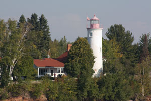
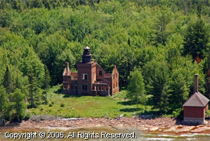
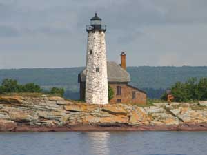
| 25 |
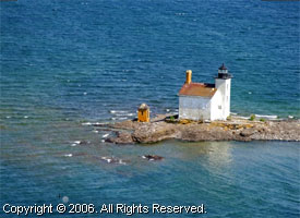
| Gull Rock (MI 13)
latitude 47° 25' 0.8" N longitude 87° 39' 50.4" W
access: boat
Keweenaw Excursions used to offer a couple of Lighthouse Tours each year that pass by the Gull Rock Lighthouse. How you can get there now is an interesting question. ARLHS # USA 361
Photo courtesy Marinas.com [Marinas.com] |
| 26 |
Manitou Island (MI 14)
latitude 47° 25' 6.8" N longitude 87° 35' 18.6" W
access: ferry
Manitou Island Transit offers ferry service and day trips to South Manitou Island from Leland. ferry ARLHS # USA 470
Photo courtesy cmstpprr [Webshots] |
|
| 27 |
| Copper Harbor (MI 11)
latitude 47° 28' 27.2" N longitude 87° 51' 36.3" W
July 7, 2007 access: boat
While you can see this light from the shore, the only good way to see it is to take the lighthouse tour boat out to the end of the peninsula. This place is deceptive, it looks like you should be able to drive there. Believe me please, you can't.
Most of the first light (1848) was used for foundations for this building. ARLHS # USA 193 |
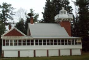
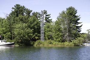
| 27.5 |
Copper Harbor (1933) (MI 11A)
latitude 47° 28' 24.8" N longitude 87° 51' 37.1" W
July 7, 2007 access: boat
This skeleton tower was made the official light in 1933. The original 1848 light is just in front (to the left) of this tower. ARLHS # USA 1073 |
|
| 28 |
| Copper Harbor Range Rear (MI 12)
November 13, 1999 access: car
This light is now the residence of the park manager (as shown by the TV antenna) ARLHS # USA 1074 |
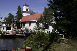
| 28.5 |
Copper Harbor Range Front (MI 12F)
November 13, 1999 access: walk
This is the current Copper Harbor light and shows both the front range light and the rear light. The route into Copper Harbor is quite difficult to run and these lights are still in active service. |
|
| 29 |
| Eagle Harbor (MI 10)
latitude 47° 27' 34.6" N longitude 88° 9' 33.7" W
July 7, 2007 access: car
Established 1851, still active, and a museum as well. ARLHS # USA 253 |
| 29.5 |
Eagle Harbor Rear Range (MI 10A)
latitude 47° 27' 19.5" N longitude 88° 9' 12.5" W
July 7, 2007 access: car
From the town of Eagle Harbor, travel east on Highway 26. Just before the road runs adjacent to the harbor, you will see this former range light, now used as a residence on your left. ARLHS # USA 255 |
|
| 30 |
| Eagle River (MI 9)
latitude 47° 24' 49.9" N longitude 88° 17' 56" W
November 13, 1999 access: car
Now inactive and a private residence. ARLHS # USA-257 |
| 31 |
Sand Hills (MI 8)
latitude 47° 23' 31.1" N longitude 88° 22' 14.8" W
July 7, 2007 access: car
A bed and breakfast north of Ahmeek, Michigan. Follow Highway 41 north to Ahmeek, then turn left on the first street and follow the signs to Five Mile Point Road. The lighthouse is 8 miles from Ahmeek. ARLHS # USA 721 |
|
| 32 |
| Keweenaw Upper Entrance (MI 7)
latitude 47° 14' 3.5" N longitude 88° 37' 51.6" W
July 31, 2004 access: boat
There is a canal that goes through the Keweenaw Peninsula, starts at Houghton, and migrates NW. At the west (upper) end of the canal is this light. ARLHS # USA-419 |
| 33 |
Fourteen Mile Point (MI 6)
access: boat
Located on Fourteen Mile Point, roughly 12.5 miles northeast of Ontonagon. This is currently private property and the trail used by the keepers is now impenetrable. Best bet to see this light is from a boat. ARLHS # USA-944
Photo courtesy Marinas.com [Marinas.com] |
|
| 34 |
| Ontonagon (MI 5)
latitude 46° 52' 23.2" N longitude 89° 19' 34" W
access: tour
The lighthouse is surrounded by a pulp mill and can currently only be visited on escorted visits from the Ontonagon County Historical Society Museum. The museum is located at 422 River Street in Ontonagon not far from the lighthouse. For tour information call (906) 884-6165. ARLHS # USA-569
Photo courtesy Marinas.com [Marinas.com] |
| 35 |
Ontonagon W. Pierhead (MI 5B)
latitude 46° 52' 45.8" N longitude 89° 19' 51.7" W
access: boat
This lighthouse can be viewed from the Ontonagon Lighthouse or from the beach on the eastern side of the Ontonagon River. ARLHS # USA-1084
Photo courtesy Marinas.com [Marinas.com] |
|
Wisconsin
| 36 |
| Ashland Breakwater (WI 9)
latitude 46° 37' 42.6" N longitude 90° 52' 12" W
access: boat
Built at the end of very long detached breakwater which creates the sheltered harbor of Ashland Ashland
Accessible only by boat. There are views from Bayview Park, off US 2 east of downtown. ARLHS # USA-019
Photo courtesy Luiz Castro [Flickr] |
| 37 |
Chequamegon Point (WI 8)
latitude 46° 43' 41.9" N longitude 90° 48' 32.4" W
access: boat
This "D9" tower is similar to many others on the Great Lakes. Built next to the 1895 tower. The photo shows how close the new light is to the old light. ARLHS # USA-164
Photo courtesy Marinas.com [Marinas.com] |
|
| 37.3 |
| Chequamegon Point (1896) (WI 7Q)
access: boat
Located at the western end of Long Island, about 2/3 mile west of LaPointe Light. A Coast Guard helicopter moved the tower back from the eroding shoreline in 1987. Accessible only by boat, water taxi service available in season.
Photo courtesy US Coast Guard [uscg] |
| 37.5 |
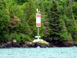
Gull Island (WI 7G)
latitude 46° 54' 23.8" N longitude 90° 26' 35.9" W
July 10, 2007 access: boat
We weren't even supposed to see this light as it wasn't in any of the indexes generally used. However, as we were running from the storm (Gale warnings for this evening in Houghton), we went by it. Thus, this is the best picture I could get. ARLHS # USA-1065 |
|
| 38 |
| La Pointe (Long Island) (WI 7)
latitude 46° 43' 43" N longitude 90° 47' 6.5" W
access: boat
Located on Long Island (and a sibling of the Coney Island Light in New York), in the mouth of Chequamegon Bay northeast of Washburn. NY 49
Accessible only by boat. Water taxi service available in season. taxi ARLHS # USA-423
Photo courtesy Marinas.com [Marinas.com] |
| 39 |
Michigan Island (1857) (WI 6A)
latitude 46° 52' 15.7" N longitude 90° 29' 48.5" W
July 10, 2007 access: boat
The old light is pretty well buried in the trees. Since this land is now a National Park, it may get worse instead of better as the years go by. ARLHS # USA-947 |
|
| 40 |
| Michigan Island (1906) (WI 6B)
latitude 46° 52' 16.9" N longitude 90° 29' 50.3" W
July 10, 2007 access: boat
This skeletal tower really stands high above the trees. It's about 100 feet behind the light shown above. ARLHS # USA-494 |
|
|
| 41 |
Raspberry Island (WI 5)
latitude 46° 58' 13.3" N longitude 90° 48' 18.3" W
July 8, 2007 access: boat
This light was expanded in fairly short order from a single keeper, to two keepers, then three keepers. This building is a substantial rebuild to accommodate the 3 keepers. ARLHS # USA-688 |
|
| 42 |
| Outer Island (WI 4)
latitude 47° 4' 35.2" N longitude 90° 25' 1.3" W
July 8, 2007 access: boat
You really can't get here without a boat. We got this shot from the GLLKA Lake Superior Cruise. The weather was pretty cold (not surprising as the water was 52º.) ARLHS # USA-572 |
| 43 |
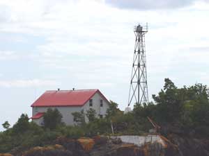
Devils Island (WI 3)
latitude 47° 4' 46.3" N longitude 90° 43' 42.1" W
July 10, 2007 access: boat
The tradition on why this is called Devil's Island is unclear. The story that made sense to me was that the wind going through the wave caves made it sound like the devil was visiting.
The building in the middle is the fog horn, the tower is a radio direction beacon. ARLHS # USA-228 |
|
| 44 |
| Sand Island (WI 2)
latitude 47° 10.9" N longitude 90° 56' 15.6" W
July 8, 2007 access: boat
While this point is clearly all rocks, there are clear sandy beaches both east and west of this point. It's from those beaches that the island got its name. ARLHS # USA-722 |
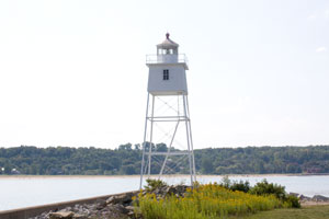
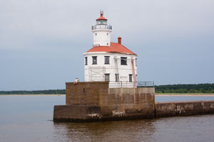
| 45 |
Superior South Breakwater (WI 1)
latitude 46° 42' 36.5" N longitude 92° 22.8" W
July 10, 2007 access: boat
For many years, this was actually the departure point for the bulk of the Coal and Ore. That changed when Duluth put in the canal ARLHS # USA 829 |
|
Minnesota
| 46 |
| Minnesota Point (ruins) (MN 8)
July 10, 2007 access: boat
Heavily over run by trees, we were just able to get a glimpse of this tower as our boat cruised from Superior (WI) to Duluth. ARLHS # USA 499 |
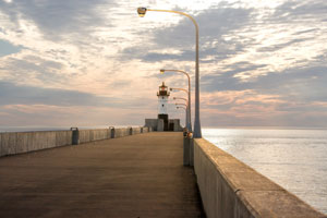
| 47 |
Duluth North Pier (MN 5)
latitude 46° 46' 51.4" N longitude 92° 5' 17.9" W
July 9, 2007 access: walk
This sunrise photo has been digitally edited so you can see both the light and the clouds. It was a beautiful sunrise, but with the sun right behind the light, the foreground was very dark. ARLHS # USA 238 |
|
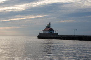
| 48 |
| Duluth South Breakwater Inner (MN 7)
latitude 46° 46' 43.8" N longitude 92° 5' 29.9" W
July 9, 2007 access: walk
This light is right next to the bridge, so I took this photo from across the canal. ARLHS # USA 240 |
| 49 |
Duluth South Breakwater (MN 6)
latitude 46° 46' 48.4" N longitude 92° 5' 16" W
July 92007, access: walk
This looks very similar to the Superior light. That's probably intentional as the canal was cut to compete with Superior. ARLHS # USA 237 |
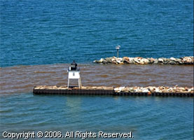
|
| 50 |
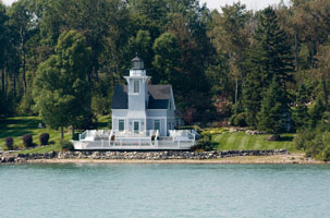
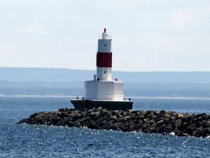
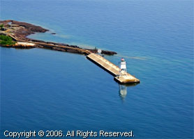
| Two Harbors East Breakwater (MN 4)
latitude 47° 38.2" N longitude 91° 40' 10.4" W
July 9, 2007 access: boat
Note that this light is a [probably the shortest known] range light. The rear range is in the center of the lantern house. The front range is about a meter in front of it. ARLHS # USA 1024 |
| 51 |
Two Harbors (MN 3)
latitude 47° 50.4" N longitude 91° 39' 50.1" W
July 9, 2007 access: boat
Our captain on the Keewenau Star had great fun trying to get us photos of this light. He first did a 360 around the harbor behind the breakwater (above), then took us out front and did a full 720 showing us every angle possible. Looks to me like he found a good one. ARLHS # USA-861 |
|
| 52 |
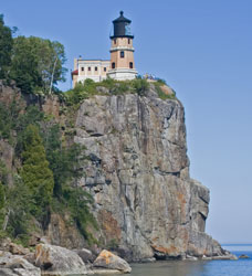
| Split Rock (MN 2)
latitude 47° 11' 60" N longitude 91° 22' 0.9" W
July 9, 2007 access: car
We first viewed this light from the water, then "up top", then I walked down to the bottom to get the classic shot. The funny thing about this light is that it really isn't located at Split Rock, this is Stony Point. But the intention was to build it at Split Rock, so thus it is named. ARLHS # USA-783 |
| 53 |
Grand Marais (MN 1)
latitude 47° 44' 42.4" N longitude 90° 20' 17.6" W
access: car
The tower is located at the end of the eastern harbor breakwater, off US 61 in Grand Marais; this breakwater is not walkable. The keeper's house is onshore at the end of Broadway. ARLHS # USA 330
Photo courtesy Marinas.com [Marinas.com] |
|
Michigan (continued)
| 54 |
| Rock of Ages (MI 4)
latitude 47° 51' 59.1" N longitude 89° 18' 52.6" W
August 1, 2004 access: boat
Just west of Isle Royale, this light is on a ridge of stone, so navigation with your boat is hazardous, but then, you probably are with a commercial boat that knows where it's going. The tower is in poor repair, the rock is eroding so the base is very suspect, it may not last long. All of these July 31, 2004-8/1 lights were part of a GLLKA tour run by Keweenaw Excursions out of Houghton. GLLKA ARLHS # USA 698 |
| 55 |
Menagerie Islands (Isle Royale) (MI 3)
July 31, 2004 access: boat
On this rock, out in the wilds of Northern Lake Superior, the second keeper raised 12 children. We got there on a GLLKA cruise, there are others out of Houghton that go in this direction. (Note carefully the steel shutters on the windows. When the waves come from the south, this is a dangerous place to be). Much historical data about these lights can be found at ARLHS # USA 407 |
|
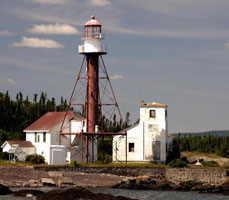
| 56 |
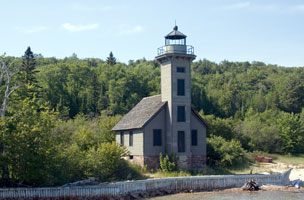
| Rock Harbor (MI 2)
latitude 48° 5' 22.9" N longitude 88° 34' 51.6" W
July 31, 2004 access: boat
All of these lights around Isle Royale were built to protect boats trying to get the ore (mostly copper) out. This one is no exception. But you can note that the title ('Rock Harbor') is not poorly chosen.This light has been restored as part of the National Park System and is in excellent shape. ARLHS # USA 696 |
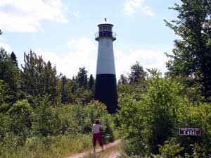
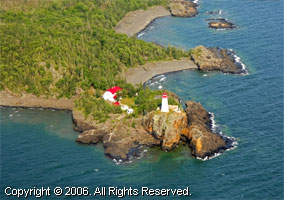
| 57 |
Passage Island (MI 1)
latitude 48° 13' 24.2" N longitude 88° 22' 1.2" W
July 31, 2004 access: boat
This light marks the eastern edge of Thunder Bay. It can only be seen from a boat, and that very carefully as the walls are steep in places, and very shallow in others. This is the Northernmost lighthouse in the continental US. Any farther north and you are in Canada. ARLHS # USA 583 |
|
Ontario
| 58 |
| Thunder Bay Main (ON 78)
latitude 48° 25' 57.3" N longitude 89° 11' 45.3" W
access: boat
Not much documentation exists on this light at the end of the breakwater in Thunder Bay. Not to be confused with the similar named light in Lake Huron MI 93 ARLHS # CAN-501
Photo courtesy R Lee [Flickr] |
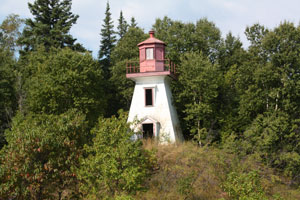
| 58.2 |
Old Pie Island (ON 79)
July 31, 2004 access: boat
This is a classic Canadian lighthouse - wood construction, white with (probably) original Red trim. It's been abandoned, so now it's gray with brown trim. ARLHS # CAN 792 |
|
| 58.5 |
| New Pie Island (ON 80)
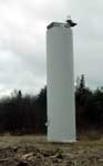
latitude 48° 13' 21.7" N longitude 89° 10' 29.3" W
July 31, 2004 access: boat
The light above has been replaced with a simple channel marker, not really a lighthouse at all. |
| 58.7 |
Angus Island (ON 81)
latitude 48° 14' 7.2" N longitude 89° 25.9" W
July 31, 2004 access: boat
The intent of Pie Island was to identify the old channel into Thunder Bay. The channel has now been moved considerably east (and made much larger) and marked by the new light on Angus Island shown here. According to our captain on the cruise, no amount of paint will make 'ugly' look 'good', so you have his editorial comment has now been recorded ARLHS # CAN 1026 |
|
| 58.9 |
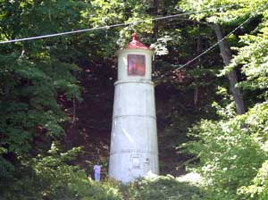
| Thunder Cape (ON 81T)
July 31, 2004 access: boat
This light (it certainly isn't a lighthouse) marks the end of an island that really is pretty dangerous. You can see Passage Island (see below from here, but its still pretty small. The island is now a bird sanctuary. ARLHS # CAN 1086 |
| 59 |
Trowbridge Island (ON 82)
latitude 48° 17' 32.3" N longitude 88° 52' 30.1" W
July 31, 2004 access: boat
Our captain's editorial opinion is that this light is the most beautiful of the entire cruise. The light itself is on the top of the rock (see right), but the buildings are at the bottom, so the keepers got their exercise. ARLHS # CAN 596 |
|
| 60 |
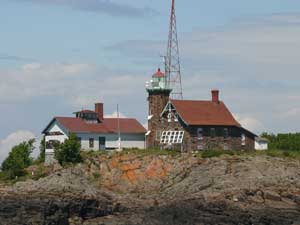
| Porphyry Point (ON 83)
July 31, 2004 access: boat
Once again, a light you can only get to by boat. It's also in Canadian Waters, so we shouldn't have been there. Named for the black volcanic rock it’s perched on, the lighthouse has watched over the entrance to Black Bay since 1873. Only the second Canadian light station established on the great lake, the McKay’s have tended the light for three generations. ARLHS # CAN 584 |
| 60.3 |
Welcome Island (ON 98W) |
The original lighthouse building here was replaced by a single-story bungalow in 1959. The original structure was then demolished. The present skeleton tower is located approximately 100 feet north of the keeper's house. The light was automated in 1974, but was staffed until the end of 1985. ARLHS # CAN-521 |
| 60.6 |
Mission Channel Entrance (ON 98) |
Located at an elbow of the breakwater at the entrance to Mission River, on the south side of Thunder Bay. ARLHS # CAN 1016 |
| 61 |
Shaganash Island (ON 97)
access: boat
Located on a small island east of Edward Island and about 25 km northeast of the village of Silver Islet. Accessible only by boat. ARLHS # CAN 589
Photo courtesy R. C. Walker [reveorange] |

|
| 61.5 |
Lamb Island (ON 96)
latitude 48° 36' 6.7" N longitude 88° 8' 38.3" W |
Located at the western end of the island, south of Rossport. The original lighthouse has been replaced by a skeletal tower. Accessible only by boat. ARLHS # CAN-757 |
| 61.7 |
Round Island (ruins) (ON 95R)
latitude 46° 27' 1.7" N longitude 84° 24' 43.4" W |
|
| 62 |
Battle Island (ON 95)
access: boat
Located at the western end of the island, south of Rossport. Accessible only by boat. ARLHS # CAN-547
Photo courtesy Marinas.com [Marinas.com] |
|
| 63 |
| Slate Islands (ON 94)
access: boat
The Slate Islands, located about 11 km southeast of Terrace Bay, are included in a provincial park. Lighthouse located on a bluff on the south side of Patterson Island. Accessible only by boat. slate islands ARLHS # CAN-589
Photo courtesy Marinas.com [Marinas.com] |
| 64 |
Otter Island (ON 93) |
Located on a small island off the most remote section of the lakeshore. Accessible only by boat; tours by sea kayak available kayak ARLHS # CAN-582 |
| 65 |
Davieaux Island (ON 92)
access: boat
Located on the summit of a small island sheltering Québec Harbour on the south side of Michipicoten Island. Accessible only by boat. ARLHS # CAN-559 |
|
| 66 |
Michipicoten Island East End (ON 91) |
Michipicoten Island is a large (200 sq. mi.) wilderness island 15 km south of the north shore of the lake and 65 km southwest of Wawa. The entire island is a provincial park. Tours by sea kayak are available. Lighthouse located at the eastern end of the island. Accessible only by boat. kayak ARLHS # CAN-1319 |
| 67 |
Caribou Island (ON 90)
access: boat
Caribou Island is about 55 km off Agawa Bay on the east shore of the lake. Lighthouse located on a small island southwest of Caribou Island itself. Accessible only by boat.
ARLHS # CAN-631
Photo courtesy Marinas.com [Marinas.com] |
|
| 68 |
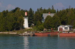
| Coppermine Point (ON 89)
latitude 47° 42.3" N longitude 84° 46' 29.5" W
September 4, 2009 access: car
Originally located on the cape, about 20 km northwest of Batchawana Bay. After deactivation, the lighthouse was sold and relocated to a restaurant and campground at Hibbard Bay, about 3 km to the north. These businesses are now closed and are a private residence. The lighthouse still stands beside ON 17 about 100 km north of Sault Sainte Marie and pictures can be taken from the road. ARLHS # CAN-147 |
| 68.5 |
Corbeil Point (ON 88)
latitude 46° 53' 21.2" N longitude 84° 36' 56.7" W
September 4, 2009 access: car
Located on a prominent cape at the west side of the entrance to Batchawana Bay, about 3 km southwest of the town of Batchawana Bay. This is now a private residence and marked no-trespassing. This photo is taken from the public road ARLHS # CAN-1028 |
|
| 69 |
| Île Parisienne (ON 87)
latitude 46° 38' 41.2" N longitude 84° 43' 25" W
September 7, 2009 access: boat
Île Parisienne is an uninhabited 2200 acre island in Whitefish Bay southeast of Whitefish Point, Michigan, and northwest of the entrance to the St. Mary's River. The lighthouse is located at the southwest corner of the island. Accessible only by boat. ARLHS # CAN-567 |
| 70 |
Gros Cap Reef (ON 86)
latitude 46° 30' 43.7" N longitude 84° 36' 55" W
September 7, 2009 access: boat
The lighthouse is mounted on a unique concrete crib that has a knife-edge similar to a ship's prow pointed northwest, this design splits ice floes in the winter. Located on the southwest edge of the reef guarding the entrance to the river from Lake Superior. ARLHS # CAN-565 |
|
| 71 |
| Pointe aux Pins Range Front (ON 84)
latitude 46° 28' 3.8" N longitude 84° 28' 20.8" W
August 20, 2011 access: boat
This is an "upbound" (westbound) range guiding ships around a sharp bend in the river above the Soo Locks. Despite its name, the lighthouse is on Pointe Louise, not Pointe aux Pins. Located on the point, at the end of Pointe Louise Road on the west side of Sault Sainte Marie. Soo Locks Boat Tours has a lighthouse cruise that provides a view of this (and several more) lighthouse(s). ARLHS # CAN-889 |
| 72 |
Pointe aux Pins Range Rear (ON 85)
latitude 46° 27' 58.1" N longitude 84° 28' 30.9" W
August 20, 2011 access: car
Located near the end of Point Louise Road on the west side of Sault Sainte Marie. ARLHS # CAN-890 |
|
| 72.5 |
| Pointe Louise Coast Guard Station (faux ?) (ON 85C)
latitude 46° 28' 0.8" N longitude 84° 28' 24" W
August 20, 2011 access: car
The Coast Guard Station just upstream of the Pointe aux Pins front range now has a facade that looks like its replica. I'm assuming this is a faux light until I hear otherwise. |
|
|
If you would like copies of any of my pictures, contact me and we'll discuss arrangements. There are others who do this commercially, I have no intention of competing directly, but you can make a proposal, and I'll react. mail me


