|
This page shows the Lighthouses of Portugal including the Islands of Madeira and the Azores. You can usually click on the picture of the light to go to it's specific (larger resolution) copy. Each lighthouse name is linked to (in our editorial opinion) the best reference site for that light. |
|
Coast Verde
| PT 1 |
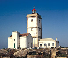
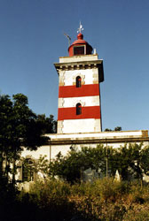
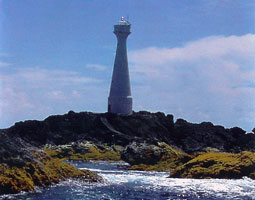
Insúa
latitude 41° 51' 33.3" N longitude 8° 52' 30.8" W
South side of the entrance to the Rio Minho (which is the Spanish border on the north), just off coastal N13 about 1.5 miles SW of Caminha. (D 2002)
Photo courtesy Alex Trabas [ListOfLights] |
|
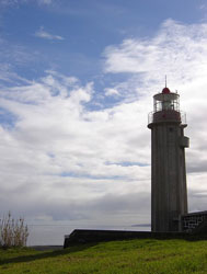
| PT 3 |
| Montedor
latitude 41° 44' 59" N longitude 8° 52' 44.1" W
This northernmost major Portuguese lighthouse is located on a headland at Montedor, just off the coastal N13 highway about 8 km north of Viana do Castelo.
Photo courtesy Sergio Cabral [Flickr] |
| PT 4 |
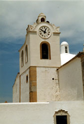
Lapa (Póvoa de Varzim Front Range) |
This was a skeletal tower next to the church and no longer exists |
| PT 5 |
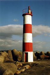
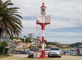
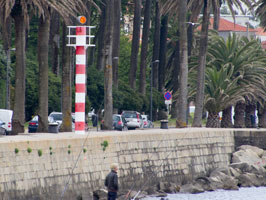
Regufe (Póvoa de Varzim Rear Range)
On the west side of N13 just south of town. Located at the end of the long outer breakwater of Viana do Castelo.
Photo courtesy Marinha de Portugal [Rowlett] |
|
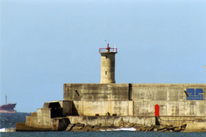
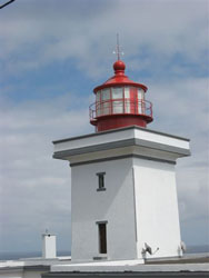
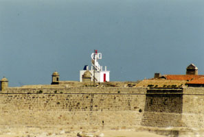
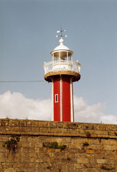
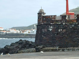
| PT 7 |
Viana do Castelo Range Front (Forte Santiago da Barra)
latitude 41° 41' 19.3" N longitude 8° 50' 20.6" W
Located within the walls of the fort, on the North side of the Rio Lima entrance. (D 2012)
Photo courtesy Alex Trabas [ListOfLights] |
|
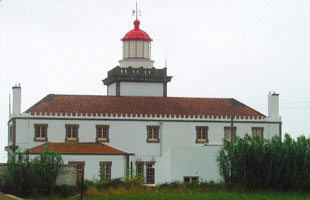
| PT 10 |
| Esposende
On the north side of the Rio Cavad, it is partly within the walls of the Fort São João Baptista.
Photo courtesy Andrew Crowther [Flickr] |
| PT 11 |
Azurara Rear Range
Mounted on the gable of a masonry building, it is near Estrada Velha on the south side of Vila do Conde. (D 2023.1)
Photo courtesy Alex Trabas [ListOfLights] |
|
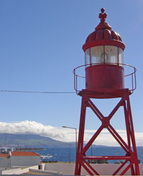
| PT 12 |
| Leça (Boa Nova)
Located in Leça da Palmeira, on the north side of Matosinhos, adjacent to a huge petroleum tank farm.
Photo courtesy reinvented [Flickr] |
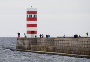
| PT 15 |
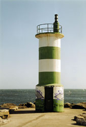
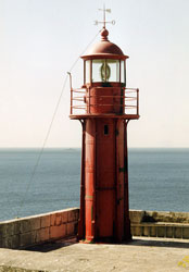
Felgueiras (Rio Douro North Breakwater)
latitude 41° 8' 48.4" N longitude 8° 40' 39" W
May 27, 2014
In actual fact, this light is no longer on the North Breakwater, so is retained for historical interest only. |
|
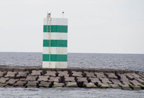
| PT 15N |
| Rio Douro North Breakwater
latitude 41° 8' 43" N longitude 8° 40' 42.9" W
May 27, 2014 |
| PT 15S |
Rio Douro South Breakwater
latitude 41° 8' 40" N longitude 8° 40' 31.7" W
May 27, 2014 |
|
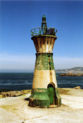
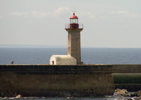
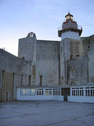
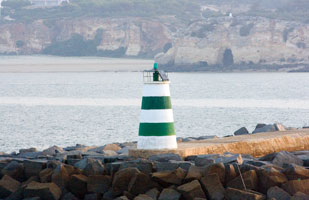
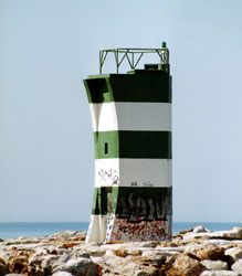
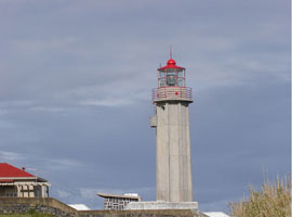
| PT 16 |
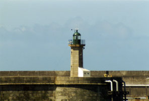
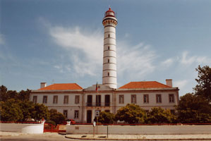
| São Miguel o Anjo
latitude 41° 8' 47.7" N longitude 8° 40' 1.4" W
May 27, 2014
The building, constructed by the Italian engineer Francesco de Cremona, is certainly Portugal's oldest lighthouse and one of the few lighthouses surviving from the early days of European expansion and discovery. Located on the old breakwater mole on the north side of the Douro entrance, just off the waterfront. |
| PT 17 |
Cantareira Range Front
May 27, 2014
Located on the north side of the Douro off the Rua das Sobreiras right next to São Miguel o Anjo. (D 2048) |
|
| PT 17R |
| Cantareira Range Rear
latitude 41° 8' 51" N longitude 8° 40' 15.6" W
May 27, 2014
Located on the north side of the Douro off the Rua das Sobreiras about 800 m east of São Miguel o Anjo. |
Coast de Prata
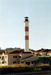
| PT 18 |
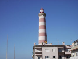
Aveiro (Farol do Barra)
latitude 40° 38' 34.3" N longitude 8° 44' 52.6" W
Located on the south side of the entrance to the Ria de Aveiro in Barra.
Photo courtesy J. Cornelius [Flickr] |
|
| PT 20 |
Aveiro Range Rear
latitude 40° 38' 46.8" N longitude 8° 43' 55.6" W |
The tower is built within the walls of the ancient Forte de Santo Antônio da Barra. Located near the harbor in Barra. Do not confuse with the Forte de Barra in Brazil. |
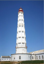
| PT 22 |
| Cabo Mondego
latitude 40° 11' 27.4" N longitude 8° 54' 18.5" W
Located on the western end of a forested ridge protected as the Parque Florestal da Serra da Boa Viagem, about 5 km northwest of Figueira da Foz.
Photo courtesy J. Cornelius [Flickr] |
| PT 23 |
Figueira da Foz (Forte de Santa Catarina)
latitude 40° 8' 52.7" N longitude 8° 51' 59.3" W
Located within the walls of the late 16th century Forte de Santa Catarina, on the north side of the entrance to the Rio Mondego.
Photo courtesy Piedo Vierra [Flickr] |
|
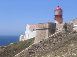
| PT 26 |
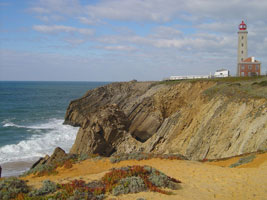
| Penedo da Saudade
latitude 39° 45' 50.6" N longitude 9° 1' 52.2" W
Located directly on the coastal road about 800 m north of São Pedro de Moel.
Photo courtesy "Portuguese eyes" [Flickr] |
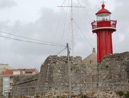
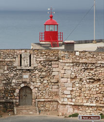
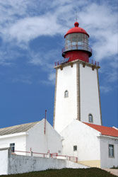
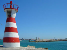
| PT 27 |
Nazaré (Forte de São Miguel)
latitude 39° 36' 15.9" N longitude 9° 5' 6.9" W
Located on a headland at the west end of the town of Nazaré
Photo courtesy Celopes [Flickr] |
|
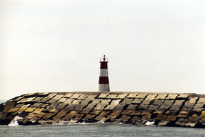
| PT 29 |
Berlenga
Located at the highest point of the western side of the island. (about 9 km west northwest of Cabo Carvoeiro.
Photo courtesy Celopes [Flickr] |
|
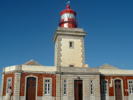
| PT 30 |
| Cabo Carvoeiro
latitude 39° 21' 38" N longitude 9° 24' 28" W
Located at the end of a promontory about 3 km west of the Peniche waterfront.
Photo courtesy Iguana Jo [Flickr] |
| PT 33 |
Peniche East Mole
latitude 39° 20' 58.9" N longitude 9° 22' 27.3" W
Here we are standing behind the light above, looking over at the East mole.
Photo courtesy Torres Vedras [webshots] |
|
Lisbon
| PT 35 |
Cabo da Roca
latitude 38° 46' 54.8" N longitude 9° 29' 50.5" W
This is the westernmost point on the Eurasian continent. Located atop a spectacular headland at Azóia, about 12 km west of Sintra.
Photo courtesy starrynight1 [Flickr] |
|
| PT 36 |
| Belem
May 20, 2014
Note that this is decorative, not functional. Not to be confused with the Tower of Belem, see below. PT 46
Photo courtesy brunurb [Flickr] |
|
|
| PT 37 |
Cabo Raso
latitude 38° 42' 33.8" N longitude 9° 29' 9.8" W
Located on a headland 8 km west of Cascais, accessible by the N247 coastal highway.
Photo courtesy Hugo [Flickr] |
|
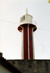
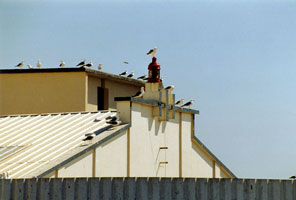
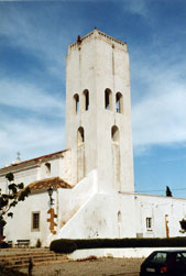
| PT 37G |
| Guia
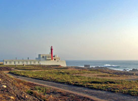
For arriving ships it serves as a landfall light for Lisbon, and for departing ships it is the rear light of a range that indicates the proper course through the bar of the Tagus. The lighthouse was extensively restored in 2002-03. Located directly on the coastal road (N247) on the west side of Cascais.
Photo courtesy "Portuguese eyes" [Flickr] |
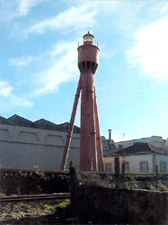
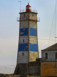
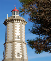
| PT 38 |
Santa Marta
This lighthouse serves general navigation and also serves as the front light of the Barra do Norte Range, the Farol de Guia being the rear light.
Photo courtesy João Campos [Flickr] |
|
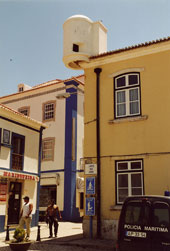
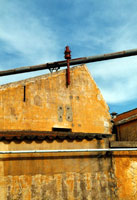
| PT 39 |
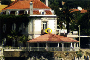
| Albatroz
a light mounted atop the porch of a waterfront building in Cascais. Highlighted so you can even see it. (D 2122)
Photo courtesy Alex Trabas [ListOfLights] |
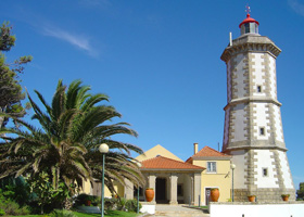
| PT 40 |
Farol da Guia
Located directly on the coastal road (N247) on the west side of Cascais.
Photo courtesy Rosino [Flickr] |
|
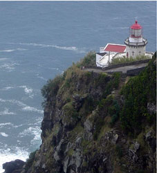
| PT 41 |
| São Julião
latitude 38° 40' 28.2" N longitude 9° 19' 31.5" W
Located in the center of the fort.
Photo courtesy Graça Vargas [Flickr] |
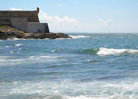
| PT 42 |
Bugio
latitude 38° 39' 37.8" N longitude 9° 17' 56.5" W
The Fortaleza de São Lourenço da Cabeça Seca is built on a small island in the center of the entrance to the Rio Tejo (Tagus). Navigational lights were being displayed from the fort in 1693, perhaps much earlier. Located about 2.8 km southeast of the Fortaleza de São Julião da Barra.
Photo courtesy Pedro Vidigal [Flickr] |
|
| PT 44 |
Gibalta (Barra do Sul Range Front)
latitude 38° 41' 56.8" N longitude 9° 15' 58.6" W
Located on the north bank of the Tejo in Oeiras about 8 km east northeast of the Fortaleza de São Julião da Barra. (D 2127)
Photo courtesy Alex Trabas [ListOfLights] |
|
| PT 45 |
| Esteiro (Barra do Sul Range Rear)
latitude 38° 42' 13.8" N longitude 9° 15' 35.3" W
Located in a city park about 760 m northeast of the Gibalta lighthouse. (D 2127.1)
Photo courtesy Alex Trabas [ListOfLights] |
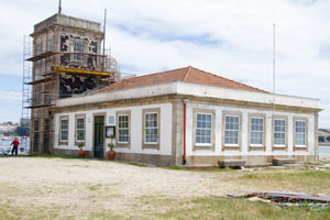
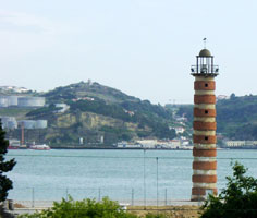
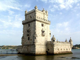
| PT 46 |
Torre de Belém
latitude 38° 41' 29.7" N longitude 9° 12' 57.4" W
May 20, 2014
A 5-story fortified lighthouse located in the Belém district of Lisbon, Portugal. It was constructed between 1515 and 1521 on the orders of Manuel I (1515-1520) in order to defend the port at Belém, as well as the nearby Mosteiro dos Jerónimos. The tower stood on an island in the middle of the River Tagus until the course of the river was diverted by an earthquake in 1777, the tower had previously survived the 1755 Lisbon earthquake. Located on the north bank of the old (Tagus) in the Belem neighborhood about 3 km west of the Ponte 25 de Abril.
Photo courtesy Joaom Santos [webshots] |
|
Costa Alentejo
| PT 47 |
| Chibata
Located atop a hill about 4 km southeast of the mouth of the Rio Tejo. (D 2138)
Photo courtesy Alex Trabas [ListOfLights] |
| PT 48 |
Cabo Espichel
latitude 38° 24' 54.9" N longitude 9° 12' 59.4" W
Located atop a spectacular vertical cliff about 11 km west of Sesimbra.
Photo courtesy Colby Stuart [Flickr] |
|
| PT 49 |
| Forte do Cavalo (Sesimbra)
Located on the Ponta do Cavalo, at the western entrance to the harbor of Sesimbra. (D 2140)
Photo courtesy Alex Trabas [ListOfLights] |
| PT 50 |
Outão
latitude 38° 29' 19.7" N longitude 8° 56' 2.2" W
Located on the coastal road about 9 km west of Setúbal.
Photo courtesy Mário Fernandes [Flickr] |
|
| PT 51 |
| Setúbal Azeda (Range Rear)
latitude 38° 32' 19" N longitude 8° 52' 42.7" W
Located on a hilltop north of the Rua Fernão Lopes in Setúbal, about 2.8 km northeast of the front light. (D 2151.1)
Photo courtesy Alex Trabas [ListOfLights] |
| PT 51A |
Setúbal Azeda Range Front
Photo courtesy "llopes" [Flickr] |
|
| PT 52 |
| Cabo de Sines
latitude 37° 57' 33.6" N longitude 8° 52' 48.9" W
Cabo de Sines is a very prominent headland roughly 40 km south of Setúbal. Located on the point of the cape, about 1.5 km west of the town of Sines.
Photo courtesy Stefan Pajko [Panoramio] |
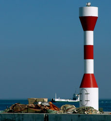
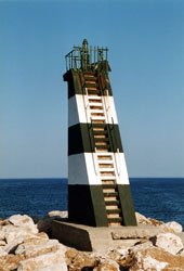
| PT 54 |
| Milfontes (Rio Mira)
latitude 37° 43' 10" N longitude 8° 47' 24.7" W
Located on the north side of the entrance to the Rio Mira in Vila Nova de Milfontes. (D 2162)
Photo courtesy Alex Trabas [ListOfLights] |
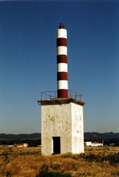
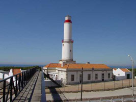
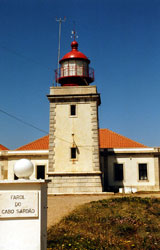
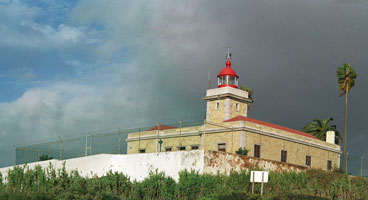
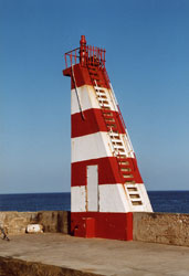
| PT 55 |
Cabo Sardão
latitude 37° 35' 54.3" N longitude 8° 49' 5.9" W
The lighthouse marks the only major promontory on the coast of the Beja district. Located atop vertical cliffs just west of the village of Cavaleiro. (D 2164)
Photo courtesy Alex Trabas [ListOfLights] |
|
Algarve
| PT 56 |
| Ponta da Piedade (Lagos)
latitude 37° 4' 50.1" N longitude 8° 40' 10.7" W
Located at the end of the N536 highway about 2.5 km south of Lagos.
Photo courtesy ak42 [Flickr] |
| PT 57 |
Lagos West Mole
latitude 37° 5' 55.5" N longitude 8° 40' 0.6" W
Located at the end of the mole on the west side of the entrance to Lagos harbor. (D 2175)
Photo courtesy Alex Trabas [ListOfLights] |
|
| PT 58 |
| Lagos East Mole
latitude 37° 5' 58.2" N longitude 8° 39' 56.8" W (D 2176)
Photo courtesy Alex Trabas [ListOfLights] |
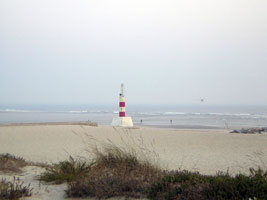
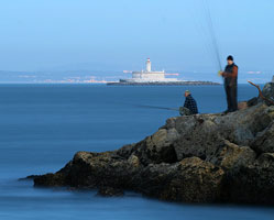
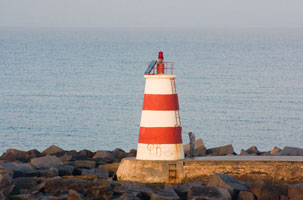
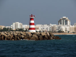
| PT 59 |
Ponta do Altar
latitude 37° 6' 20.9" N longitude 8° 31' 10.4" W
November 10, 2007
Located on a promontory on the east side of the entrance to the harbor of Portimão, about 7 km south southeast of the city. Taken about 2:30 PM from southwest of the light as Le Diamant left the harbor. |
|
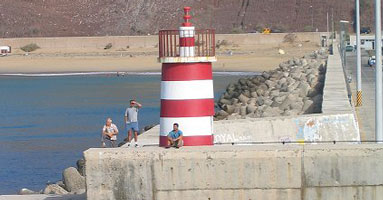
| PT 60 |
| Portimão West Mole
latitude 37° 6' 31.3" N longitude 8° 31' 47" W
November 10, 2007
There are two long stone moles that protect the harbor from storm. This and the light below mark the sides. The center of the course is taken from the church in Farragudo (steer 19.1º). Taken shortly after sunrise as our boat Le Diamant passed into the harbor. |
| PT 61 |
Portimão East Mole
latitude 37° 6' 30.4" N longitude 8° 31' 36" W
November 10, 2007
taken just seconds before the photo above (like about how long it took me to walk from one side of the boat to the other.) |
|
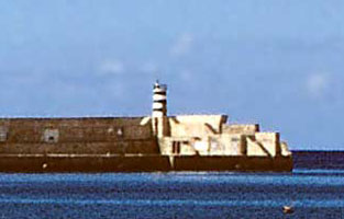
| PT 61N |
| Portimão North Mole
latitude 37° 7' 17.6" N longitude 8° 31' 35" W
November 10, 2007
This doesn't look like much of a lighthouse, but it is so marked on the chart of the Harbour we acquired from the navigator. As you can see, located just north of the Marina in Portimao. |
| PT 61R |
Portimão Range Lights
Technically, the two poles mark the course into the harbor (steer 19.1º). I suspect most navigators use the church as it will be much more visible when you are outside the breakwater. |
|
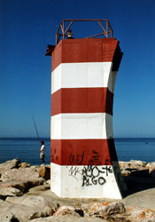
| PT 62 |
| Alfanzina
latitude 37° 5' 14.7" N longitude 8° 26' 43.2" W
Located on a rocky promontory off the N530 highway about 15 km southeast of Lagoa. (D 2192)
Photo courtesy Klaus Kern [ListOfLights] |
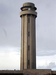
| PT 64 |
Sagres
latitude 36° 59' 41.2" N longitude 8° 56' 56.4" W
Located at the end of the peninsula, about 2 km south of Sagres. Probably accessible by hiking trail.
Photo courtesy Henry [Flickr] |
|
| PT 65 |
| Vilamoura Marina West Mole
latitude 37° 4' 10.8" N longitude 8° 7' 27.9" W
Simon does not clearly mark this light the way I have chosen to do so. It's a good guess, anybody with more data can contact (please!) me
Photo courtesy Simon Pow [Flickr] |
| PT 66 |
Vilamoura
latitude 37° 4' 25.5" N longitude 8° 7' 15" W
Located on the east side of the harbor, about 5 km south of the village of Vilamoura. (D 2197.2)
Photo courtesy Alex Trabas [ListOfLights] |
|
| PT 68 |
Quarteira West Mole
latitude 37° 3' 54.4" N longitude 8° 6' 38.2" W
Located at the end of a mole in Quarteira, about 1.5 km east of the Vilamoura Marina. (D 2198.1)
Photo courtesy Alex Trabas [ListOfLights] |
|
| PT 69 |
| Esporão East Mole
latitude 37° 3' 59.4" N longitude 8° 6' 36" W
Located at the end of a mole in Esporão, on the east side of Quarteira. (D 2198.3)
Photo courtesy Alex Trabas [ListOfLights] |
|
|
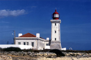
| PT 70 |
Cabo de São Vicente
latitude 37° 1' 23.8" N longitude 8° 59' 46" W
Located atop spectacular cliffs at the point of the cape, about 7 km west of Sagres.
Photo courtesy cybermat [Flickr] |
|
| PT 71 |
| Baleeira (Sagres Breakwater)
latitude 37° 43.3" N longitude 8° 55' 27.6" W
Located at the end of the breakwater on the west side of the bay of Baleeira, the harbor of Sagres. (D 2171)
Photo courtesy Alex Trabas [ListOfLights] |
| PT 72 |
Burgau Posto
Light in only a small red lantern mounted near the top of a 1-story post office building in Burgau. (D 2172.3)
Photo courtesy Alex Trabas [ListOfLights] |
|
| PT 73 |
| Faro Range Front
latitude 37° 7.4" N longitude 7° 55' 20.1" W
According to Trabas, the building is the Fábrica Fritz. Located somewhere on the waterfront of Faro. (D 2214)
Photo courtesy Alex Trabas [ListOfLights] |
| PT 74 |
Faro Range Rear
latitude 37° 30.7" N longitude 7° 55' 34.8" W
Located at the church of Santo António do Alto in Faro. (D 2226.1)
Photo courtesy Jos� Da Palma [ListOfLights] |
|
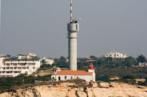
| PT 75 |
| Cabo de Santa Maria
latitude 36° 58' 28.4" N longitude 7° 51' 52.8" W
Located on a barrier island on the east side of the entrance to the channel leading to Faro, about 12 km southeast of the city. Accessible only by boat, tours to the area are available.
Photo courtesy and © [Travel in Portugal] |
| PT 77 |
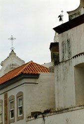
| Olhão Range Rear
Located in downtown Olhão, ¼ mi from the front light, mounted atop a historic church, the 17th century Igreja Matriz de Nossa Senhora do Rosário.
Photo courtesy Jos� Da Palma [ListOfLights] |
| PT 78 |
Fuzeta (Igreja Matriz da Fuzeta)
Located in Fuseta, a small fishing port about 8 km east of Olhão. (D 2230.1)
Photo courtesy Alex Trabas [ListOfLights] |
|
| PT 79 |
| Vila Real de Santo António
latitude 37° 10' 48.7" N longitude 7° 24' 33.3" W
This lighthouse marks the entrance to the Rio Guadiana, which forms the southern border between Portugal and Spain. Located on the west side of the river, on the Estrada da Mata, in Vila Real de Santo António. (D 2246)
Photo courtesy Alex Trabas [ListOfLights] |
Ilha da Porto Santo
| PT 79N |
Porto Santo North Mole
Called North Mole, this is really the west mole.
Photo courtesy Don Amaro [Flickr] |
|
| PT 79M |
| Porto Santo South Mole
Located at the end of the south mole of the new Vila Baleira harbor of Porto Santo. (D 2757)
Photo courtesy Helmut Seger [ListOfLights] |
| PT 79S |
Ilhéu de Cima
latitude 33° 3' 17.1" N longitude 16° 16' 44.7" W
The Ilhéu de Cima is a small (but rather high) island off the northeast coast of the Ilha de Porto Santo, helping to shelter Porto Santo's principal harbor of Vila Baleira.
Photo courtesy Portuguese eyes [Flickr] |
|
| PT 79T |
Ilhéu de Ferro
latitude 33° 2' 20.5" N longitude 16° 24' 21.8" W |
Located on a small island off the southwestern tip of the Ilha de Porto Santo. photo |
Madeira Islands
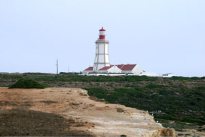
| PT 80 |
São Lourenço
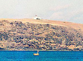
This lighthouse is the oldest in Madeira and stands atop a spectacular conical mountain (an extinct volcano). Located on the Ilhéu de São Lourenço, a small island off the eastern tip of the Ilha de Madeira. Accessible only by boat, and the island is a restricted natural area. We passed by São Lourenço at 5:30, but since sunrise wasn't until 7:30, all you could see were the flashes of light.
Photo courtesy Marinha de Portugal [LHdir] |
|
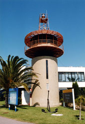
| PT 81 |
| Funchal Breakwater
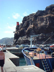
November 12, 2007
Located at the end of the breakwater in Funchal, this actually is a range light. While quite small, the presence of the door indicates it is truly a 'house'. Taken as we entered the harbor at 8:30 AM |
| PT 82 |
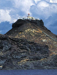
Câmara de Lobos
latitude 32° 38' 49.3" N longitude 16° 58' 32.2" W
November 12, 2007
Located atop a vertical volcanic dike adjacent to the main pier at Câmara de Lobos, a village about 8 km west of Funchal on the south coast of the island. We took this photo from the observation lookout well above the lighthouse (therefore with the long lens) directly into the sun. I was amazed how well it came out. |
|
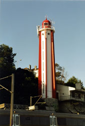
| PT 83 |
| Ribeira Brava
latitude 32° 40' 6.7" N longitude 17° 3' 52" W
Located atop a cliff west of the harbor but east of the downtown area of Ribeira Brava, about 16 km west of Funchal.
Photo courtesy courtesy [Ribeira Brava] |
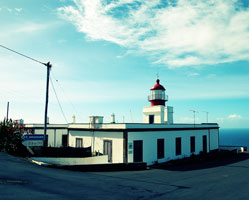
| PT 84 |
Ponta do Pargo
This is Madeira's best-known lighthouse by far, and also one of the highest lighthouses in the world. It commands a spectacular view westward over the Atlantic. Located on the western tip of the island, accessible by road.
Photo courtesy Neha Manoka [Flickr] |
|
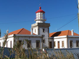
| PT 85 |
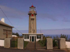
| São Jorge (Rosais)
latitude 32° 50' 4" N longitude 16° 54' 22.7" W
Located high atop the Ponta de São Jorge on the central north coast of the Ilha da Madeira. |
Ilha Desertas Islands
| PT 87 |
Ilhéu do Chão |
Located at the northern tip of the Ilhas Desertas, about 25 km southeast of the São Laurenço lighthouse. The LH directory has a photo. lh Directory |
| PT 88 |
Ponta da Agulha (Ilhéu de Bugio) |
Located near the southeastern tip of the Ilhéu de Bugio, southernmost of the three Ilhas Desertas. |
| PT 89 |
Selvagem Grande
Located atop the Pico de Atalaia, on the west coast of Ilha Selvagem Grande, largest of the Ilhas Selvagens.
Photo courtesy Jefras [Madeira] |
|
| PT 90 |
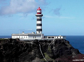
Gonçalo Velho |
Gonçalo Velho Cabral, one of the explorers dispatched by Prince Henry the Navigator, spotted the Formigos rocks in 1431 and returned in 1432 to discover the Ilha de Santa Maria at this spot. Located atop the Ponta do Castelo, a spectaular promontory at the southeastern tip of the Ilha de Santa Maria. ARLHS # AZO-009 |
| PT 91 |
Vila do Porto Molehead
latitude 36° 56' 29.1" N longitude 25° 8' 55.5" W |
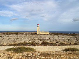
Vila do Porto, on the southwestern side of the Ilha de Santa Maria, is the only protected harbor on the island. photo ARLHS # AZO-030 |
| PT 92 |
Ponta do Malmerendo
latitude 36° 56' 24.9" N longitude 25° 9' 24.9" W |
Located atop a promontory on the west side of the entrance to the harbor. photo |
| PT 93 |
Ilhéus Formigas
The Ilhéus Formigas (formigas means "ants" in Portuguese) are small rocky islets located about 45 km northeast of the Ilha de Santa Maria. Located on the largest of the islets, a rock about 180 m by 40 m. ARLHS # AZO-001
Photo courtesy Jorge Gomes |
|
Ilha de São Miguel
| PT 94 |
| Ponta do Arnel
latitude 37° 49' 26.7" N longitude 25° 8' 8.9" W
This was the first lighthouse built in the Azores, it is the traditional landfall light for ships arriving from mainland Portugal.Located at the eastern tip of the Ilha de São Miguel, accessible by a paved but challenging road. ARLHS # AZO-004
Photo courtesy Jorge Gomes [Flickr] |
| PT 95 |
Ponta da Garça
Located at Ponta da Garça on the south side of the island, about 40 km east of Ponta Delgada. Accessible by road. ARLHS # AZO-012
Photo courtesy Jorge Gomes [Flickr] |
|
| PT 96 |
Varadouro (Vila Franca do Campo) |
Located directly on the waterfront of Vila Franca do Campo, a village about 32 km east of Ponta Delgada. ARLHS # AZO-023 |
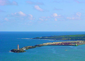
| PT 97 |
Ponta Delgada Breakwater
latitude 37° 44' 10.2" N longitude 25° 39' 22.6" W
There is a light with the identical name in Argentina. ARLHS # AZO-029
Photo courtesy Jorge Gomes [Flickr] |
|
| PT 98 |
| Santa Clara
Located on a promontory ½ mi west of the Ponta Delgada waterfront. ARLHS # AZO-021
Photo courtesy Jorge Gomes [Flickr] |
| PT 99 |
Ferraria
Stands at the western tip of the Ilha de São Miguel. Located atop a cliff near Ginetes, accessible by road.
Photo courtesy vitor [Flickr] |
|
| PT 100 |
Rabo de Peixe |
Located overlooking the sea in the village of Rabo de Peixe about 5 km west of Ribeira Grande on the north coast of the island. photo |
| PT 101 |
Ponta do Cintrão
Located at the end of a peninsula marking the northernmost point of the island, about 4 km northeast of Ribeira Grande. ARLHS # AZO-017
Photo courtesy Jorge Gomes [Flickr] |
|
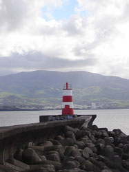
Ilha de Terceira
| PT 102 |
| Praia de Vitória South Mole
Located at the end of the rubblestone south mole at Praia de Vitoria on the east side of the Ilha de Terceira. ARLHS # AZO-027
Photo courtesy Jorge Gomes [Flickr] |
| PT 104 |
Angra do Heroismo Range Front
latitude 38° 39' 15.1" N longitude 27° 13' 5.8" W |
The light is said to be mounted on the east tower of the Igreja (church) da Misericórdia. Located in downtown Angra do Heroismo, on the central southern coast of the island. photo |
| PT 105 |
Serrata
latitude 38° 45' 57.2" N longitude 27° 22' 24.8" W
Residents of Cacilhas stubbornly protested the removal of their lighthouse, and their requests took hold after the lighthouse was deactivated in 2004. In 2007 the Navy agreed to return the lighthouse, and on 18 July 2009 ceremonies were held celebrating its reinstallation.
Located on the Ponta da Queimado, a steep promontory at the northwestern tip of the island.
Photo courtesy José Luís Ávila Silveira [wikipedia] |

|
| PT 106 |
Carapacho |
Sibling of the Ponta da Garça and Ponta do Cintrão Lights on the Ilha de São Miguel. Located on the Ponta do Carapacho, the southeastern tip of the island. Accessible by road. |
| PT 107 |
Fort do Santo (Santa Cruz da Graciosa) |
This is possibly a cast iron tower mounted on the walls of the fort. Located in Santa Cruz da Graciosa, on the north coast of the island. ARLHS # AZO-034 |
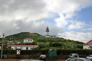
| PT 108 |
Ponta da Barca
Tallest lighthouse of the Azores. Located on a sharp rocky promontory at the northwestern tip of the island, about 7 km west of Santa Cruz da Graciosa. Not to be confused with Punta de la Barca in Spain. SP 88 ARLHS # AZO-011
Photo courtesy Jorge Goncalves [Flickr]] |
|
Ilha de São Jorge
| PT 109 |
| Topo
Located at the eastern tip of the island, accessible by road.
Photo courtesy Leeal103 [Webshots] |
| PT 110 |
Calheta Pierhead
Located on the waterfront of Calheta, on the south coast of the island. ARLHS # AZO-032
Photo courtesy J Avila [Flickr] |
|
| PT 111 |
Cais das Velasn |
Located at the end of the main pier on the waterfront of Velas, on the southwest coast of the island. ARLHS # AZO-031 |
| PT 112 |
Velas Anchorage Range Rear
latitude 38° 40' 56.2" N longitude 28° 12' 54.4" W |
Located on the west side of Velas. photo |
| PT 114 |
Ponta dos Rosais (2005)
Photo courtesy Ritinha Azodom [Flickr] |
|
Ilha do Pico
| PT 116 |
Ponta do São Mateus |
Located on a promontory about ¾ mi southeast of São Mateus on the southwest coast of the island. ARLHS # AZO-024 |
| PT 117 |
Madalena North Mole |
Located at the end of the north breakwater on the waterfront of Madalena, near the northwestern tip of the island. Good view from ferries arriving from Horta on Faial. ARLHS # AZO-028 |
Ilha do Faial
| PT 118 |
Ribeirinha
Located about 3 km east of Ribeirinha at the northeastern tip of the island.
Photo courtesy Luisa [Flickr] |
|
| PT 119 |
Horta Breakwater |
Located at the end of the breakwater at Horta, the principal port of Faial, near the southeastern tip of the island. ARLHS # AZO-026 |
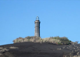
| PT 120 |
Vale Formoso |
This plain modern lighthouse was built to replace the destroyed Capelinhos lighthouse, which was about 2.5 km northwest. Located near Capelo on the south side of the island's western peninsula. ARLHS # AZO-025 |
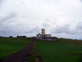
| PT 121 |
Capelinhos
latitude 38° 35' 47.3" N longitude 28° 49' 32.9" W
Built to mark the western tip of Faial, the lighthouse was swamped by volcanic ash in a volcanic eruption that began on September 16, 1957. Located about 2 km northwest of Capelo. ARLHS # AZO-033
Photo courtesy Rae Brune [wikipedia] |
|
Ilha das Flores
| PT 122 |
| Lajes
This is the landfall light for ships arriving in Flores from Portugal. Located atop a vertical cliff at the southeastern point of the island, about 1 km south of Lajes das Flores. ARLHS # AZO-010
Photo courtesy Kelly&DavidFamily [Webshots] |
| PT 123 |
Albarnaz |
Located atop a vertical cliff at the northwestern point of the island, about 2.5 km west of Ponta Delgada. |
Ilha do Corvo
| PT 124 |
Canto da Carneira |
Corvo is the smallest and most remote of the islands, about 35 km north northeast of Flores. Located at the northeastern point of the island. ARLHS # AZO-005 |
|
|
 Northern Spain