|
This page shows the documentation of the North Sea Lighthouses of Germany. You can click on the photo of a light to go to it's specific (larger resolution) copy. Each lighthouse name is linked to (in our editorial opinion) the best reference site for that light. This page is organized from South (near Netherlands) to North (near Denmark) and tends to wrap the curves clockwise. In German, the front range light is referred to as an Unterfeuer (under fire) and the rear range light is called an Oberfeuer (over fire). The descriptions below follow those names rather than replacing them with English descriptions. English speakers should also remember that a German "W" is pronounced like an English "V" and a German "V" is pronounced very much like an "F". I would like to include directions on how to get to these lights. If you know such data, could you eMail me and I'll post it here (with your choice of attribution.) mailme This page is based on the Lighthouse Directory prepared by Russ Rowlett (UNC). My thanks to him for providing this basis for understanding. lhDirectory Geographic coordinates (used to start the mapping pages) were often taken from Anke and Jens seiten |
|
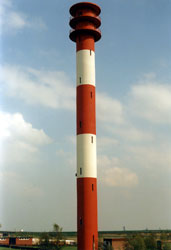
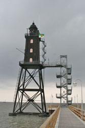
Ems Estuary
| DE 1 |
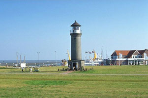
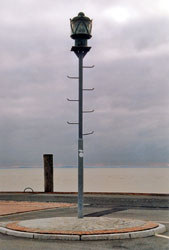
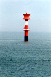
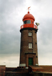
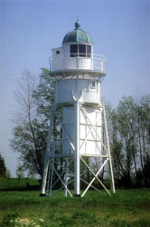
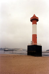
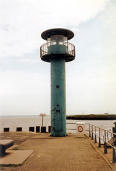
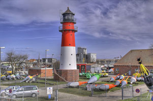
Emden West Mole
latitude 53° 20' 3.9" N longitude 7° 10' 30.1" E
Located at the end of the west pier in Emden harbor. There are good views from the ferries departing for Borkum. (B 1026) ARLHS # FED-081
Photo courtesy Klaus Kern [ListOfLights] |
|
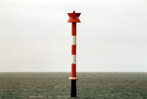
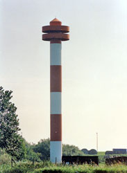
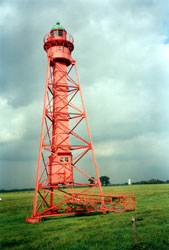
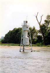
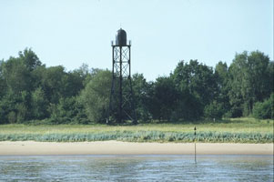
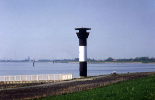
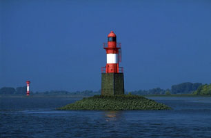
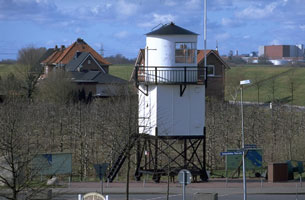
| DE 2 |
| Wybelsum
latitude 53° 20' 10.1" N longitude 7° 6' 29.9" E
Located on the north bank of the estuary about 5 km east of Knock and 10 km west of Emden. (B 1012)
Photo courtesy Ulrich Bode [ListOfLights] |
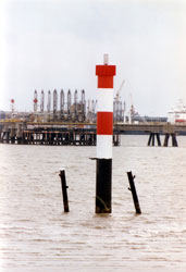
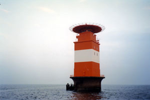
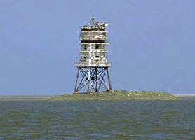
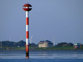
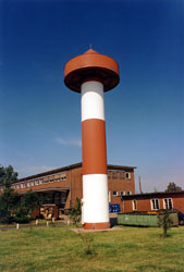
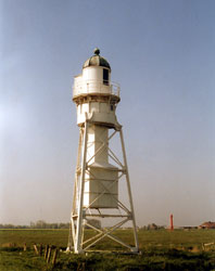
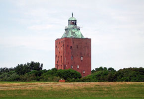
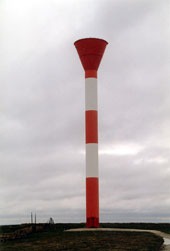
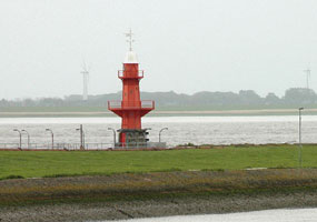
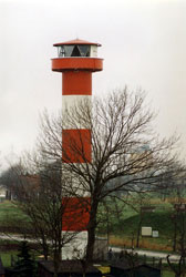
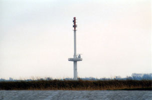
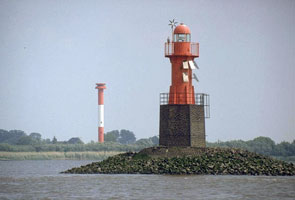
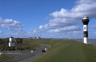
| DE 3 |
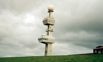
Knock
latitude 53° 20' 18.8" N longitude 7° 1' 24.5" E
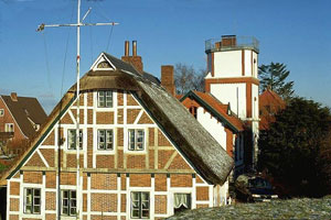
Located at Knock, at a 90° bend in the Ems about 6 km south of Campen and 15 km west of Emden. Accessible by road; there is also a distant view from Delfzijl, across the estuary in the Netherlands. This tower is in first function a radar tower and only in second function a lighthouse. (B 1010)
Photo courtesy Anke and Jens [Seiten] |
|
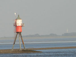
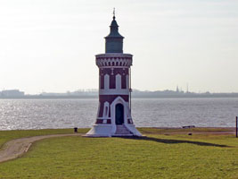
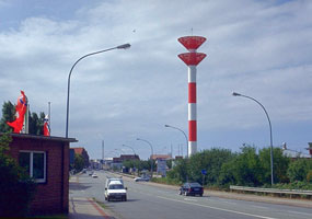
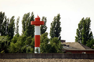
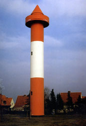
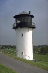
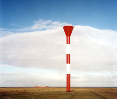
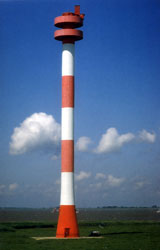
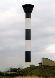
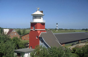
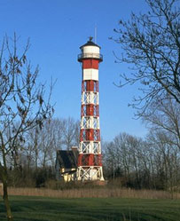
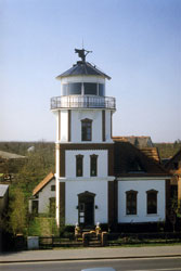
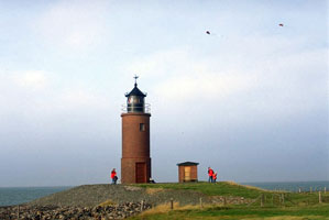
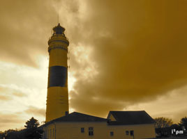
| DE 4 |
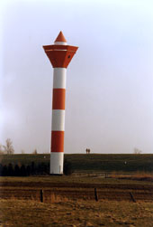
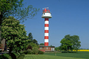
| Campen
latitude 53° 24' 20.2" N longitude 7° 56" E
Located on the west bank of the Ems in Campen, about 17 km west of Emden. (Not to be confused with Kampen which you will note is spelled with a "K") DE 186 (B 0983)
Photo courtesy gerriet [Flickr] |
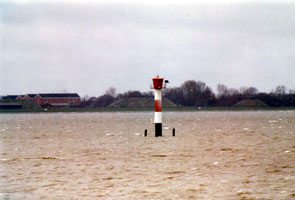
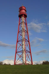
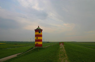
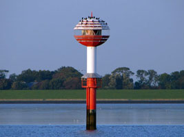
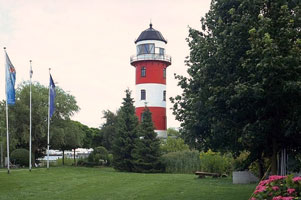
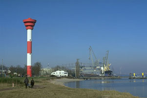
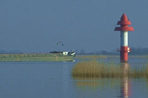
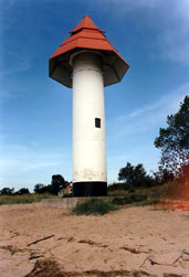
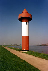
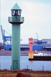
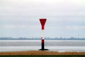
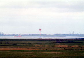
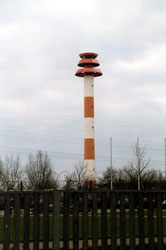
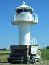
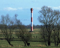
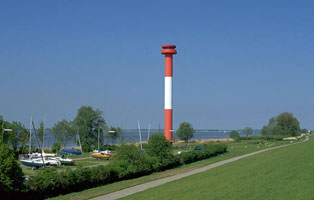
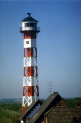
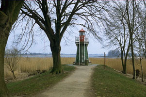
| DE 5 |
Pilsum
latitude 53° 29' 52.4" N longitude 7° 2' 44.5" E
Located on a dike at the eastern entrance to the Ems, about 10 km north of Campen. Accessible by the coastal road.
Photo courtesy "navelfluff" [Flickr] |
|
Borkum Island
| DE 6 |
| Borkum Großer (Greater Borkum)
latitude 53° 35' 19.4" N longitude 6° 39' 43.8" E
It is the landfall light for the Ems estuary and the port of Emden. Recently restored. Located on the main road near the west end of the island. (B 0970)
Photo courtesy Hamburger Jung [Flickr] |
| DE 7 |
Borkum Alter (Older Borkum)
latitude 53° 35' 16.3" N longitude 6° 40' 14.6" E
Located in the center of the town of Borkum.
Photo courtesy Xenocryst [Flickr] |
|
| DE 8 |
| Borkum Kleiner (Lesser Borkum)
latitude 53° 34' 43.1" N longitude 6° 40' 1" E
Located on the southwestern side of the island, south of the town of Borkum.
Photo courtesy Xenocryst [Flickr] |
| DE 9 |
Borkum Düne
Located a short distance south of the Borkum Kleiner lighthouse.
Photo courtesy Leuchtturm [Atlas] |
|
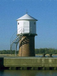
| DE 10 |
| Fischerbalje
latitude 53° 33' 23.9" N longitude 6° 44' 27.5" E
Located off the end of the breakwater at Reede Borkum, the ferry terminal at the south end of the island. Accessible only by boat. (B 0976)
Photo courtesy Xenocryst [Flickr] |
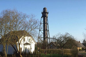
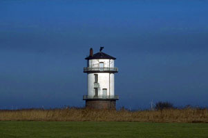
Juist and Norerney
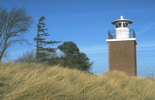
| DE 11 |
Memmert
Located on the waterfront of Juist, near the ferry terminal. This is a 1939 lantern on 1992 tower. (B 1044) ARLHS # FED-152
Photo courtesy Leuchtturm [Atlas] |
|
| DE 12 |
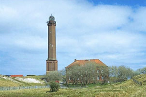
| Norderney
Located in the center of the island of Norderney; accessible by road. The 2-story crew quarters have been converted to vacation housing and a restaurant. (B 1054)
Photo courtesy Leuchtturm [Atlas] |
Wanderooge
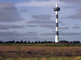
| DE 13 |
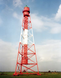
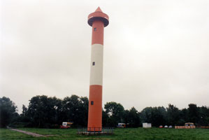
Wangerooge (1969) (Neuer Turm)
latitude 53° 46' 20.4" N longitude 7° 51' 56" E
This huge lighthouse was built as a landfall light for shipping, especially supertankers, arriving in Wilhelmshaven. Located near the west end of Wangerooge. (B 1112)
Photo courtesy Gloria [Flickr] |
|
| DE 14 |
| Westturm (replica)
Although it has never been an official aid to navigation, it is widely recognized as one of Wangerooge's three lighthouses. Located near the southwestern corner of Wangeroode.
Photo courtesy Gloria [Flickr] |
| DE 15 |
Wangerooge (1856) (Alter Turm)
Located near the center of the island about 6 km east of the Neuer Turm.
Photo courtesy Zoernert [Flickr] |
|
Jade Estuary
| DE 16 |
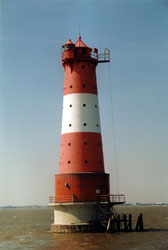
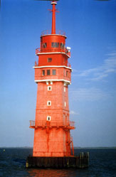
| Mellumplate
This tower was actually completed in 1942, and for the rest of World War II it supported an antiaircraft battery. British occupying forces activated the lighthouse at the end of the war. The lighthouse guides ships past the Mellumplate (Mellum Flats), a broad shallow area in the mouth of the Jade. Located about 6 km east of Schillig. Accessible only by boat. (B 1122) ARLHS # FED-017
Photo courtesy Manfred Schüler [ListOfLights] |
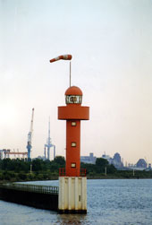
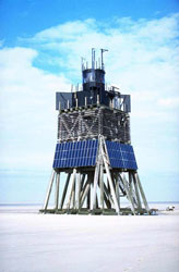
| DE 17 |
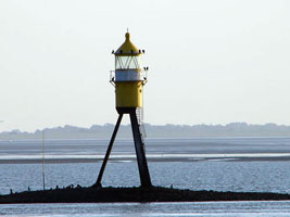
Minsener Oog Buhne A
latitude 53° 45' 8.5" N longitude 8° 1' 27.8" E
Located at the end of a breakwater at Minsen, about 10 km northeast of Schillig, marking the west side of the entrance to the Jade. ARLHS # FED-154
Photo courtesy LeuchtTurm [Atlas] |
|
| DE 18 |
| Minsener Oog Buhne C
latitude 53° 45' 20.6" N longitude 8° 1' 19.5" E
Located about 3 km southeast of the A tower. ARLHS # FED-013
Photo courtesy LeuchtTurm [Atlas] |
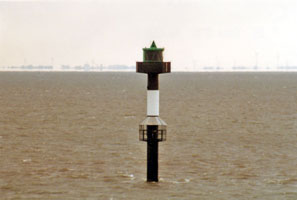
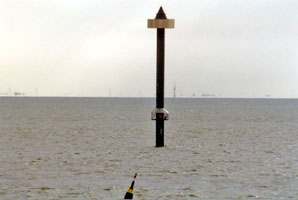
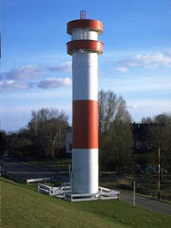
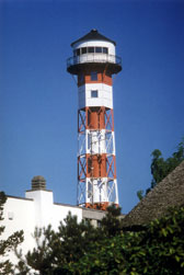
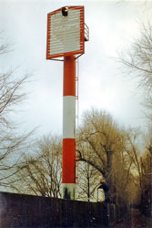
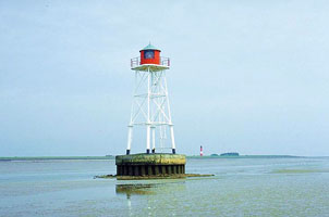
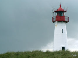
| DE 19 |
Schillig Unterfeuer
latitude 53° 41' 47.5" N longitude 8° 1' 41.6" E
Located on the east bank of the Jade in Schillig. ARLHS # FED-212 |
|
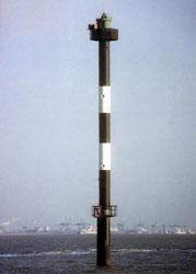
| DE 20 |
Schillig Oberfeuer
latitude 53° 42' 1.4" N longitude 8° 1' 17.1" E |
Located approx. 2 km west of Schillig. ARLHS # FED-214
Photo courtesy LeuchtTurm [Atlas] |
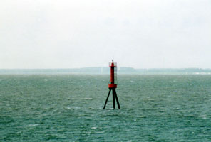
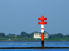
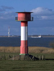
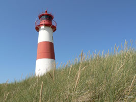
| DE 21 |
Hooksiel Plate
The light was displayed from the platform at the 25 m level. Located in the Jade about 8 km southeast of Schillig. Accessible only by boat. ARLHS # FED-114
Photo courtesy LeuchtTurm [Atlas] |
|
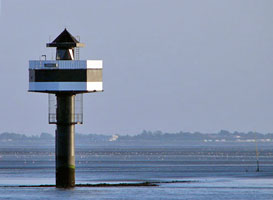
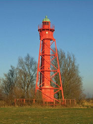
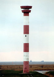
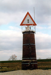
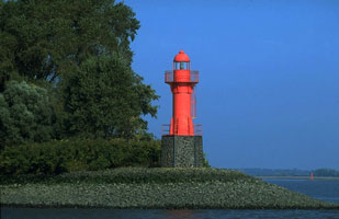
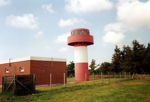
| DE 23 |
Voslapp Oberfeuer
latitude 53° 34' 53.6" N longitude 8° 7' 50.9" E
Located 4.3 km south southwest of the front light, just behind the dike (Geniusdeich) at Voslapp, about 8 km north of Wilhelmshaven. (B 1138.1)
Photo courtesy Manfred Schüler [ListOfLights] |
|
| DE 24 |
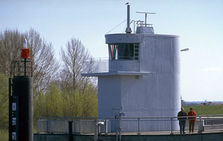
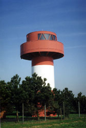
| Wilhelmshaven Vorhafen Oberfeuer (Seeschleusen)
latitude 53° 31' 49" N longitude 8° 9' 36.3" E
The top floor of the building is the control room for the locks. The front light is on a steel post 180 m in front of the building, at the outer edge of the island. (B 1159)
Photo courtesy Alex Trabas [ListOfLights] |
| DE 25 |
Wilhelmshaven Marinemole
latitude 53° 31' 14.2" N longitude 8° 9' 52" E
Located at the end of the north mole at the Dritte Einfahrt (third entry) near the west end of Wilhelmshaven harbor. (B 1166)
Photo courtesy Ulrich Bode [ListOfLights] |
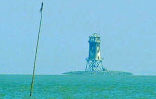
|
| DE 26 |
| Arngast
latitude 53° 28' 52.8" N longitude 8° 10' 53.9" E
This venerable offshore lighthouse stands on a submerged sandbank (formerly an island) in the middle of the Jadebusen (Jade Bay), with its 13 sectors guiding vessels on various courses through the bay's tricky channels. Located about 5 km south of Wilhelmshaven; distantly visible from the Wilhelmshaven waterfront and many other locations around the roughly circular bay. (B 1152)
Photo courtesy Manfred Schüler [ListOfLights] |
| DE 27 |
Eckwarden Oberfeuer
latitude 53° 31' 15.9" N longitude 8° 13' 56.8" E
This lighthouse anchors a southbound range guiding ships to Wilhelmshaven; it is 2350 m south southeast of the front range. Located at Eckwarden on the east side of the Jade directly opposite Wilhelmshaven. (B 1141) ARLHS # FED-078
Photo courtesy Alex Trabas [ListOfLights] |
|
| DE 29 |
Tossens Oberfeuer
latitude 53° 32' 47.1" N longitude 8° 14' 16.2" E
This lighthouse anchors a southbound range guiding ships to Wilhelmshaven; it is 3860 m southeast of the front range. Located just behind the dike on the east side of the Jade about 3 km south of Tossens. (B 1134.1)
Photo courtesy Alex Trabas [ListOfLights] |
|
Außenweser Offshore
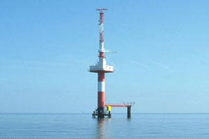
| DE 31 |
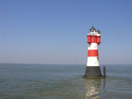
Roter Sand
Located in the North Sea off the entrance to the Weser, about 10 km east of Wangerooge. Accessible only by boat.
Photo courtesy Andreas Graf [Webshots] |
|
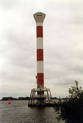
| DE 32 |
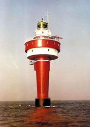
| Alte Weser
Located about 3 km northeast of Roter Sand. Accessible only by boat. This photo is dated 1964. (B 1118)
Photo courtesy Dietrich Lankenau [answers] |
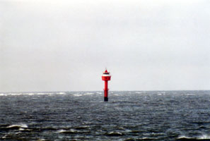
| DE 33 |
Tegeler Plate
This lighthouse replaced the Bremen lightship station. Located about 15 km southeast of Alte Weser. Accessible only by boat. (B 1196)
Photo courtesy Alex Trabas [ListOfLights] |
|
| DE 34 |
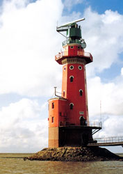
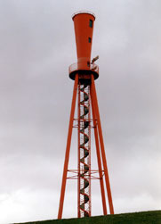
| Hohe Weg
This historic lighthouse guides ships around a dangerous shallow area called the Hohe Weg (high way) off the entrance to the Weser. Located 25 km northwest of Bremerhaven. Accessible only by boat. (B 1198) ARLHS # FED-108
Photo courtesy Klaus Kern [ListOfLights] |
| DE 35 |
Dwarsgat Unterfeuer
Located about 4 km east northeast of the Hohe Weg Light, marking the main channel into the Weser and Bremerhaven. (B 1225) ARLHS # FED-077
Photo courtesy Manfred Schüler [ListOfLights] |
|
| DE 36 |
| Dwarsgat Oberfeuer
Located about 4 km east northeast of the Hohe Weg Light, marking the main channel into the Weser and Bremerhaven. (B 1225.1)
Photo courtesy Alex Trabas [ListOfLights] |
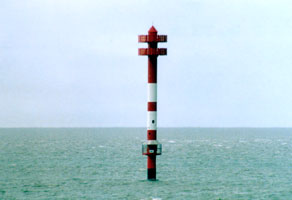
| DE 37 |
Eversand Unterfeuer
The rear range light was successfully relocated to Dorum-Neufeld in 2003. Located about 2 km east of the Dwarsgat Unterfeuer Light. Accessible only by boat. (B 1309) ARLHS # FED-083
Photo courtesy Leuchtturm [Atlas.] |
|
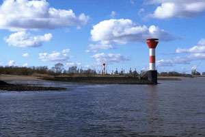
| DE 40 |
| Robbennordsteert
Located about 2 km southeast of Dwarsgat Range Rear Light. Accessible only by boat. (B 1210)
Photo courtesy Thomas Würminghausen [Atlas] |
| DE 41 |
Robbenplate Oberfeuer
Located about 3.5 km southeast of the Robbennordsteert Light, at the west end of the Robbenplate shoal. Accessible only by boat. (B 1214.1)
Photo courtesy Manfred Schüler [ListOfLights] |
|
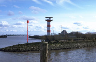
| DE 43 |
Langlütjennordsteert
Located about 2 km east of Robbenplate Range Rear. Accessible only by boat.
Photo courtesy Thomas Würminghausen |
|
| DE 44 |
| Langlütjen Oberfeuer
This is an outbound range, guiding ships leaving the Weser. Located 930 m northwest of the front light. Accessible only by boat. (B 1228.1)
Photo courtesy Alex Trabas [ListOfLights] |
| DE 45 |
Langlütjen Unterfeuer
Located about 5 km southeast of Langlütjennordsteert. Accessible only by boat. (B 1228.1)
Photo courtesy Thomas Würminghausen [Atlas] |
|
| DE 48 |
| Hofe Oberfeuer
Like the Solthörn Range, this is an outbound range, guiding ships leaving the Weser. Located 1300 m north northwest of the front light. Accessible only by boat. (B 1240.1)
Photo courtesy Thomas Würminghausen |
| DE 49 |
Hofe Unterfeuer
Located about 2.5 km west of the coast northwest of Wremer. Accessible only by boat. (B 1240.1)
Photo courtesy Thomas Würminghausen [Atlas] |
|
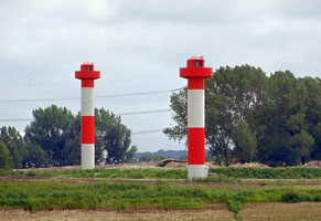
| DE 50 |
| Solthörn Oberfeuer
This is an outbound range, guiding ships leaving the Weser. Located 700 m north northwest of the front light. (B 1239.1) ARLHS # FED-340
Photo courtesy Alex Trabas [ListOfLights] |
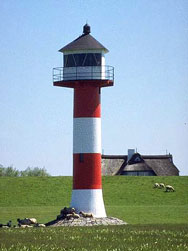
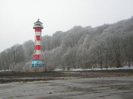
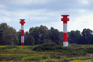
| DE 51 |
Solthörn Unterfeuer
Located about 4 km west of the coast northwest of Wremer. Accessible only by boat. (B 1239) ARLHS # FED-341
Photo courtesy Thomas Würminghausen |
|
Bremerhaven Area
| DE 52 |
| Obereversand (Eversand Oberfeuer) (relocated)
latitude 53° 44' 30.8" N longitude 8° 44' 30.8" E
Located on the waterfront at Dorum. Before it was moved, this light was next to DE74. DE 74
Photo courtesy Olaf Strunck [Flickr] |
| DE 53 |
Wremen (Kleiner-Preuße) (replica)
Located on the waterfront in Wremen, a town between Dorum and Bremerhaven.
Photo courtesy "fighting with light" [Flickr] |
|
| DE 54 |
| Imsum Oberfeuer
latitude 53° 35' 47.3" N longitude 8° 31' 56.5" E
This is the only Außerweser light built on land. Located just north of the Imsum container ship terminal on the west bank of the Weser north of Bremerhaven. (B 1230.1)
Photo courtesy Helmut Seger [ListOfLights] |
|
|
| DE 55 |
Imsum
Located just offshore a short distance southeast of the Imsum Range Rear Light. (B 1230)
Photo courtesy Helmut Seger [ListOfLights] |
|
| DE 56 |
| Kaiserschleuse (Kaiserhafen East Mole, Klingelturm)
Located at the end of the east mole of the harbor entrance, north of downtown Bremerhaven; accessible by walking the mole.
Photo courtesy Thomas Würminghausen |
| DE 57 |
Bremerhaven Unterfeuer (Zwiebelturm, Minarett)
latitude 53° 32' 39.9" N longitude 8° 34' 11.1" E
In recent years the Bremerhaven zoo has expanded along the waterfront and the lighthouse now stands on the zoo grounds. Located on the south side of the entrance to the Neuer Hafen (new harbor) in Bremerhaven.
Photo courtesy Thomas Würminghausen |
|
| DE 58 |
| Bremerhaven Oberfeuer (Loschenturm)
latitude 53° 32' 46.6" N longitude 8° 34' 12.6" E
This elegant lighthouse could not be more different from the front range tower. Located about 200 m (220 yd) north of the front light, near the lock that provides entry to the Neuer Haven.
Photo courtesy Thomas Würminghausen |
| DE 59 |
Sandstedt Unterfeuer (1898) (relocated)
latitude 53° 32' 25.1" N longitude 8° 34' 39.6" E
The lighthouse was relocated in 1983 to the maritime museum on the Hans-Scharoun-Platz in downtown Bremerhaven. It was previously located near Sandstedt. DE 74
Photo courtesy Leuchtturm [Atlas] |
|
| DE 60 |
| Geeste North Mole (Geestemünde)
latitude 53° 32' 9.2" N longitude 8° 34' 30.2" E
The Geeste is the old harbor of Bremerhaven. Located at the end of the north mole, which extends only a short distance into the river. (B 1274)
Photo courtesy Ulrich Bode [ListOfLights] |
| DE 61 |
Geeste South Mole (Geestemünde)
latitude 53° 32' 5.8" N longitude 8° 34' 30.1" E
The south mole does not appear to be open for walking. (B 1275)
Photo courtesy Ulrich Bode [ListOfLights] |
|
| DE 62 |
| Geestemünde Oberfeuer
latitude 53° 32' 6.6" N longitude 8° 34' 49" E
Located on the dike south of downtown Bremerhaven and near the north end of the Fischereihafen.
Photo courtesy Leuchtturm [Atlas] |
| DE 63 |
Geestemünde-Fischereihafen Unterfeuer
latitude 53° 31' 52.6" N longitude 8° 34' 31.4" E
Located on the dike south of downtown Bremerhaven and near the north end of the Fischereihafen. This light is front range both for the light above and for the light below. (B 1257)
Photo courtesy Leuchtturm [Atlas] |
|
| DE 64 |
| Fischereihafen Oberfeuer (Doppelkorn)
latitude 53° 31' 16.5" N longitude 8° 35' 5.4" E
Located in an industrial area on the east side of the Fischereihafen, 1280 m southeast of the front light. (B 1256.9)
Photo courtesy Leuchtturm [Atlas] |
| DE 65 |
Brinkamahof (Weddewarden Unterfeuer, Kleiner Roter
latitude 53° 30' 31.6" N longitude 8° 34' 40.4" E
In 1980 a large floating crane was used to lift the tower and transport it to the Bootshafen Marina on the other side of Bremerhaven, where it has served as a clubhouse and caretaker's residence. Located on the west side of the Wesermarsch harbor on the south side of Bremerhaven. |
|
Lower Weser River
| DE 66 |
| Reitsand Unterfeuer
This is an upstream (southbound) range guiding ships from Bremerhaven southwestward toward Nordenham. Located onshore on the west side of the Weser between Blexen and Nordenham. (B 1279.9)
Photo courtesy Klaus Kern [ListOfLights] |
| DE 67 |
Reitsand-Flagbalgerseil Oberfeuer
latitude 53° 29' 51.3" N longitude 8° 29' 51.6" E
This tower is the rear light for both the upstream Reitsand (see above) and downstream Flagbalgerseil (see below) ranges. Located in farmland about 480 m southwest of the Reitsand Unterfeuer and 580 m north of the Flagbalgerseil Unterfeuer. (B 1280)
Photo courtesy Klaus Kern [ListOfLights] |
|
| DE 68 |
| Flagbalgerseil Unterfeuer
latitude 53° 29' 32.3" N longitude 8° 29' 48.1" E
This is the front light of a downstream (northbound) range. Located behind a dike and adjacent to an industrial property on the west bank of the river somewhere to the north of Nordenham. (B 1280.1)
Photo courtesy Ingo Becker [ListOfLights] |
| DE 69 |
Nordenham Oberfeuer
latitude 53° 28' 51.3" N longitude 8° 29' 10.2" E
This is the rear light of a downstream (northbound) range. Located on the west bank of the river close to the railway station in Nordenham. (B 1286.1)
Photo courtesy Leuchtturm [Atlas] |
|
| DE 70 |
| Nordenham Unterfeuer
latitude 53° 27' 51.9" N longitude 8° 29' 17" E
Located in the water on the west side of the river 1850 m south of Nordenham. Accessible only by boat. (B 1286)
Photo courtesy Leuchtturm [Atlas] |
| DE 71 |
Großenseil Unterfeuer
latitude 53° 28' 6.1" N longitude 8° 28' 21.8" E
Located on the west bank of the river about 2 km south of Nordenham.
Photo courtesy Leuchtturm [Atlas] |
|
| DE 73 |
Sandstedt Oberfeuer (1981)
latitude 53° 21' 52.5" N longitude 8° 30' 46.5" E
Located in a field 420 m north northeast of the front range light and a short distance southeast of the old rear range light, west of the village of Sandstedt. (B 1297.1)
Photo courtesy Ulrich Bode [ListOfLights] |
|
| DE 74 |
| Sandstedt Unterfeuer (1981)
latitude 53° 21' 40.2" N longitude 8° 30' 38.3" E
The original lighthouse was relocated to Bremerhaven. This is a downstream (northbound) range. Located in a field 420 m north northeast of the front range light and a short distance southeast of the old rear range light, west of the village of Sandstedt. DE 59 (B 1297)
Photo courtesy Ulrich Bode [ListOfLights] |
| DE 75 |
Großerpater Unterfeuer
latitude 53° 19' 42.5" N longitude 8° 30' 16.9" E
This is an upstream (southbound) range guiding ships past Sandstedt. Located near the north end of the island of Harriersand, which divides the river for a distance of about 11 km . The island is accessible by passenger ferry from Brake on the west bank or by a bridge from Rade to the southeast. (B 1288)
Photo courtesy Manfred Schüler [ListOfLights] |
|
| DE 77 |
Harriersand Oberfeuer
latitude 53° 19' 26.1" N longitude 8° 29' 50.6" E
This is a downstream (northbound) range. Located near the west side of Harriersand Island, about halfway between the two Großerpater lights. (B 1299.41)
Photo courtesy Manfred Schüler [ListOfLights] |
|
| DE 78 |
| Harriersand Unterfeuer
latitude 53° 18' 55.1" N longitude 8° 29' 44" E
Located near the riverbank on the west side of Harriersand Island, 960 m south southwest of the rear light. (B 1299.4)
Photo courtesy Manfred Schüler [ListOfLights] |
Bremen Area
| DE 79 |
Hohenzollern (Stemplesand-Soltpate Unterfeuer)
latitude 53° 13' 43.9" N longitude 8° 28' 54" E
This lighthouse serves as the front light for both the upstream Stemplesand range and the downstream Soltplate range; the rear range lights are mounted on skeletal towers and are not listed in this index. Located on the west bank of the Weser near Elsfleth. (B 1299.81)
Photo courtesy Erich Hartmann [ListOfLights] |
|
| DE 80 |
| Juliusplate Oberfeuer
latitude 53° 11' 51.6" N longitude 8° 30' 36.7" E
This is the rear light of a downstream (northbound) range. Located on the southwest side of the Weser opposite Farge, near the ferry terminal. (B 1302.41)
Photo courtesy Captain Peter Mosselberger [ListOfLights] |
| DE 81 |
Berne-Juliusplate Unterfeuer
latitude 53° 11' 43.3" N longitude 8° 31' 0.2" E
Located 490 m southeast of the Juliusplate Oberfeuer, in shallow water (often exposed) on the southwest side of the Weser. (B 1302.4)
Photo courtesy Ulrich Bode [ListOfLights] |
|
| DE 82 |
| Berne Oberfeuer
latitude 53° 11' 37.5" N longitude 8° 31' 6.6" E
Located 220 m southeast of the front light, in shallow water (often exposed) on the southwest side of the Weser. (B 1302.39)
Photo courtesy Captain Peter Mosselberger [ListOfLights] |
| DE 83 |
Warfleth Oberfeuer (1898)
latitude 53° 11' 11.7" N longitude 8° 32' 5.4" E
Located on a sandy peninsula, the Warflether Sand, on the southwest side of the Weser about 3 km southeast of the Berne lights; the peninsula is a protected natural area.
Photo courtesy Leuchtturm [Atlas] |
|
| DE 84 |
| Lemwerder Unterfeuer (1983)
latitude 53° 10' 14.9" N longitude 8° 35' 19.7" E
This is the front light of an upstream range guiding ships into the harbor of Bremen. Located on the south bank of the Weser off Industriestraße in Lemwerder, just west of Bremen. (B 1303)
Photo courtesy Ulrich Bode [ListOfLights] |
| DE 85 |
Lemwerder Oberfeuer (old)
latitude 53° 9' 56.3" N longitude 8° 36' 11.6" E
Located south of Industriestraße in Lemwerder, just west of Bremen.
Photo courtesy Leuchtturm [Atlas] |
|
| DE 86 |
| Lemwerder Oberfeuer (1983)
latitude 53° 10' 7.9" N longitude 8° 35' 40.1" E
Located on the south side of Industriestraße in Lemwerder, 430 m southeast of the front light. (B 1303.1)
Photo courtesy Ulrich Bode [ListOfLights] |
| DE 87 |
Seehausen West
latitude 53° 6' 54.5" N longitude 8° 43' 11.1" E
Located on the south side of the Weser at the entrance to the Neustädter Hafen (New City Harbor) in Bremen. (B 1307.2)
Photo courtesy Leuchtturm [Atlas] |
|
| DE 88 |
| Seehausen Ost
latitude 53° 7' 0.7" N longitude 8° 43' 15.9" E
Located on the east mole at the entrance to the Neustädter Hafen (New City Harbor) in Bremen. (B 1307)
Photo courtesy Manfred Schüler [ListofLights] |
| DE 89 |
Bremen (Überseehafen)
latitude 53° 6' 22.2" N longitude 8° 44' 51.8" E
Located at the end of the south mole at the entrance to the old harbor of Bremen; accessible by walking the mole.
(B 1308)
Photo courtesy Ulrich Bode [ListOfLights] |
|
Elbemündung Offshore
| DE 90 |
| Neuwerk
latitude 53° 54' 54.9" N longitude 8° 29' 45.2" E
Located at the southern end of the island. Island accessible by passenger ferry from Cuxhaven. ferry (B 1344) |
| DE 91 |
Großer Vogelsand
Located about 9 km north of Neuwerk and 20 km northwest of Cuxhaven. Accessible only by helicopter.
Photo courtesy © Reinhard Pösch [Flickr] |
|
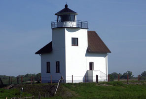
Altenbruch-Cuxhaven Area
| DE 92 |
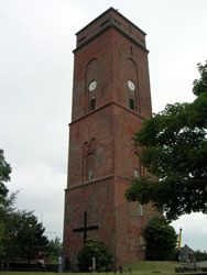
| Duhnen
latitude 53° 53' 4.9" N longitude 8° 38' 9.4" E
The building is a public reading room (Lesehalle) adjacent to a popular seaside resort. Located on the North Sea waterfront of Duhnen, just west of Cuxhaven at the southern entrance to the Elbe estuary.
Photo courtesy Leuchtturm [Atlas] |
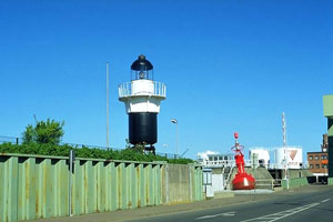
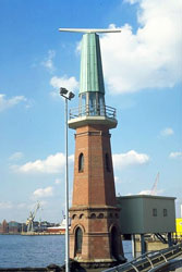
| DE 93 |
Cuxhaven ("Alte Liebe")
latitude 53° 52' 19.1" N longitude 8° 42' 30" E
Located on the old waterfront in downtown Cuxhaven.
Photo courtesy WanderingPhilosopher [Flickr] |
|
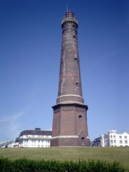
| DE 94 |
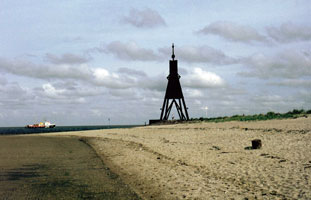
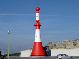
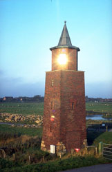
| Cuxhaven Kugelbake
Located on the point of land at the south side of the entrance to the Elbe, at the northwestern corner of Cuxhaven. The 'Kugelbake' marks the geographical border between the river Elbe and the North sea. It is the landmark of Cuxhaven and the symbol on it's emblem. To put this object in scale, there is a person standing under the tower.
Photo courtesy © Reinhard Pösch [Flickr] |
| DE 95 |
Osteriff
Originally located off the entrance to the Oste River from the Elbe, the lighthouse has been relocated to stand outside the headquarters of WSA Cuxhaven. ARLHS # FED 308
Photo courtesy Leuchtturm [Atlas] |
|
| DE 96 |
| Baumrönne Unterfeuer
latitude 53° 51' 11.7" N longitude 8° 44' 9.2" E
This is the front light of an inbound (eastbound) range; the rear light is on the Altenbruch Oberfeuer. Located on the dike at the edge of the Elbe, 2940 m northwest of the rear light and about 8 km southeast of Cuxhaven. DE 99 (B 1360.9)
Photo courtesy Alex Trabas [ListOfLights] |
| DE 97 |
Altenbruch Unterfeuer (1971)
latitude 53° 50' 0.7" N longitude 8° 47' 41.4" E
This lighthouse carries the front lights for both the inbound Wehldorf and outbound Altenbruch ranges. Located in the river, 600 m northwest of the Wehldorf Unterfeuer. (B1361.1)
Photo courtesy Erich Hartmann [ListOfLights] |
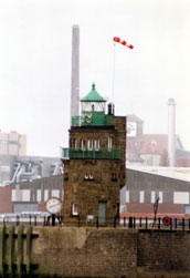
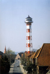
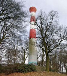
|
| DE 98 |
| Altenbruch Unterfeuer (1897) (Dicke Berta)
latitude 53° 50' 8.7" N longitude 8° 46' 16.8" E
Located near the Altenbruch harbor."Dicke Berta" translates to "fat Bertha". Compare this photo with the image below which is "skinny Bertha".
Photo courtesy Leuchtturm [Atlas] |
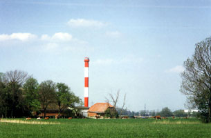
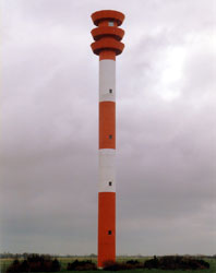
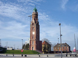
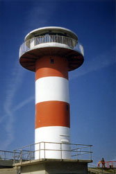
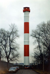
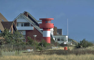
| DE 99 |
Altenbruch Oberfeuer (Neue Schlanke Anna)
latitude 53° 49' 48.3" N longitude 8° 45' 26.7" E
This soaring modern tower, one of Germany's tallest, inherited the traditional nickname Schlanke Anna (Skinny Anna). Located at 73 Bundesstraße in Altenbruch.
Photo courtesy ervano [Webshots] |
|
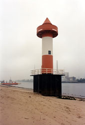
| DE 100 |
| Steubenhöft
latitude 53° 52' 1.5" N longitude 8° 43' 6.7" E
This light guides ships into Amerikahafen, a harbor built on the east side of Cuxhaven for transatlantic liners. Located on the north mole of the harbor. (B 1374) ARLHS # FED-067
Photo courtesy Manfred Schüler [ListOfLights] |
| DE 101 |
Wehldorf Oberfeuer
This is the rear light of an inbound (eastbound) range, one of two guiding ships into the mouth of the Elbe; the front light is carried on the Altenbruch Unterfeuer. Located behind the dike at Altenbruch, about 13 km southeast of Cuxhaven. (B 1361.2)
Photo courtesy Wolfgang Warncke [ListOfLights] |
|
Oste-Otterndorf Area
| DE 102 |
| Otterndorf-Belum Unterfeuer
latitude 53° 50' 7.7" N longitude 8° 56' 7.8" E
This tower carries the front lights for both the inbound Belum and outbound Otterndorf ranges. Located just offshore in the Elbe, 1340 m west of the Belum Oberfeuer and 2660 m east of the Otterndorf Oberfeuer. (B 1396)
Photo courtesy Alex Trabas [ListOfLights] |
| DE 103 |
Otterndorf Oberfeuer
latitude 53° 49' 33.4" N longitude 8° 54' 4.3" E
Located in a marshy area in front of the dike just east of the Otterndorf harbor entrance. (B 1396.1) ARLHS # FED-179
Photo courtesy Wolfgang Warncke [ListOfLights] |
|
| DE 104 |
| Belum Oberfeuer
latitude 53° 50' 4.9" N longitude 8° 57' 20.9" E
This is the rear light of an inbound (eastbound) range. Located in a marshy area in front of the dike about 4 km east of the Otterndorf harbor entrance. (B 1395.9)
Photo courtesy Alex Trabas [ListOfLights] |
| DE 105 |
Balje (1904)
The area is a bird sanctuary (Vogelschutzgebiet), and the lighthouse now houses a ranger station. Located on the south bank of the Elbemündung (mouth of the Elbe), off the coastal road about 10 km northwest of the town of Balje.
Photo courtesy Leuchtturm [Atlas] |
|
| DE 106 |
| Balje Oberfeuer (1979)
This is the rear light of a major range guiding ships into the Elbe; its light reaches some 37 km out to sea. Located quite close to the old lighthouse. (B 1412.1)
Photo courtesy Alex Trabas [ListofLights] |
| DE 107 |
Balje Unterfeuer (1979)
latitude 53° 51' 17.5" N longitude 9° 2' 37" E
Located 2460 m west of the rear light in an area flooded except at very low tide. (B 1412)
Photo courtesy Alex Trabas [ListofLights] |
|
|
|
Brunsbüttel
| DE 108 |
| Brunsbüttel Oberfeuer
latitude 53° 53' 41.1" N longitude 9° 9' 49.6" E
This is the rear light of the range guiding ships to the canal entrance. Located in an industrial park 1.6 km northeast of the canal entrance. (B1416.1)
Photo courtesy Manfred Schüler [ListOfLights] |
| DE 109 |
Brunsbüttel Mole 1
latitude 53° 53' 16.1" N longitude 9° 8' 34.5" E
Located on the south mole at the original canal entrance. (B 1444)
Photo courtesy Alex Trabas [ListofLights] |
|
| DE 111 |
| Brunsbüttel Mole 2
latitude 53° 53' 15" N longitude 9° 8' 17.6" E
Located on the north mole at the original canal entrance. (B 1442)
Photo courtesy Cor Oorthuijsen [Flickr] |
| DE 110 |
Brunsbüttel Unterfeuer (Schleuseninsel)
latitude 53° 53' 19.3" N longitude 9° 8' 28.1" E
Located on the Schleuseninsel, the island between the old and new locks. (B 1416) |
|
| DE 112 |
Brunsbüttel Mole 3
latitude 53° 53' 15" N longitude 9° 8' 6.3" E |
Located on the south mole at the newer canal entrance. (B 1436)
Photo courtesy Fire Warrior [Flickr] |
| DE 113 |
Brunsbüttel Mole 4
latitude 53° 53' 14.8" N longitude 9° 7' 32.7" E
Located on the north mole at the newer canal entrance. (B 1438)
Photo courtesy firewarrior [Flickr] |
|
St. Margarethen Area
| DE 114 |
| St. Margarethen Oberfeuer
latitude 53° 53' 14.3" N longitude 9° 14' 55.5" E
This is the rear light of a downstream (westbound) range; the front light is carried to the Scheelenkuhlen Unterfeuer. Located 1075 m northwest of the front light and about the same distance southwest of St. Margarethen. (B 1453.9)
Photo courtesy Alex Trabas [ListOfLights] |
| DE 115 |
Scheelenkuhlen Unterfeuer
latitude 53° 52' 50.7" N longitude 9° 15' 40" E
Located on the north bank of the Elbe 1810 m west of the rear light and about 3 km south of St. Margarethen on the B431 highway. (B 1454)
Photo courtesy Manfred Schueler [ListOfLights] |
|
Wewelsfleth Area
| DE 117 |
Osterende Unterfeuer
latitude 53° 50' 59.8" N longitude 9° 20' 25.9" E
Located on the northeast bank of the Elbe just west of the Brokdorf nuclear power plant, 1025 m west of the rear light. (B 1457.5) ARLHS # FED-346
Photo courtesy Manfred Schueler [ListOfLights] |
|
| DE 118 |
| Brokdorf Oberfeuer
latitude 53° 51' 9.6" N longitude 9° 20' 47.2" E
The present lighthouse is built in a restricted area on the grounds of the Brokdorf nuclear power plant. Located 1560 m north of the front light. (B 1460)
Photo courtesy Rainer Arndt [ListOfLights] |
| DE 119 |
Osterende Oberfeuer
latitude 53° 50' 45.3" N longitude 9° 21' 16.7" E
The Osterende range is an upsteam (eastbound) range and helps guide ships approaching a major bend in the river. Located on the east side of the Brokdorf nuclear power plant, but apparently accessible. (B 1457.51) ARLHS # FED-345
Photo courtesy Alex Trabas [ListOfLights] |
|
| DE 120 |
| Hollerwettern (1911) Unterfeuer
latitude 53° 50' 27.2" N longitude 9° 21' 9.6" E
Located in the village of Hollerwettern on the northeast side of the Elbe, about 4 km southeast of Wewelsfleth.
Photo courtesy Leuchtturm [Atlas] |
Glückstadt Area
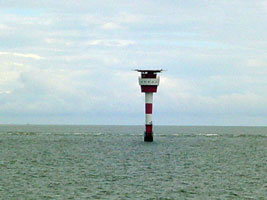
| DE 122 |
| Stör Unterfeuer
Located at the mouth of the Stör River about 4 km north of Glückstadt. Note that you can actually see the rear range in this photo, yes, it's just a light on a horizontal bar. (B 1464) ARLHS # FED-348
Photo courtesy Alex Trabas [ListOfLights] |
| DE 123 |
Glückstadt Unterfeuer
latitude 53° 48' 18.1" N longitude 9° 24' 15.3" E
The directional light leads ferries eastward across the river from Wischhafen. Located on the northeast bank of the Elbe 1250 m northwest of the rear light. (B 1456)
Photo courtesy Leuchtturm [Atlas] |
|
| DE 124 |
| Glückstadt Oberfeuer
latitude 53° 47' 51.1" N longitude 9° 25' 7.1" E
This is the rear light of an upstream (eastbound) range leading ships to Glückstadt. Located on the Neuendeich road on the north side of Glückstadt. (B 1456.1)
Photo courtesy Leuchtturm [Atlas] |
| DE 125 |
Glückstadt Nordmole
latitude 53° 47' 7" N longitude 9° 24' 32.5" E
Located at the northern entrance to Glückstadt harbor, on the northeast side of the Elbe. (B 1476)
Photo courtesy Leuchtturm [Atlas] |
|
| DE 126 |
| Glückstadt Südmole
latitude 53° 47' 4" N longitude 9° 24' 32.2" E
Located at the southern entrance to Glückstadt harbor, on the northeast side of the Elbe. (Note that the atlas did not describe which was North and which was South, so these two lights may be reversed.)
Photo courtesy Leuchtturm [Atlas] |
| DE 127 |
Rhinplatte Süd
latitude 53° 45' 28.9" N longitude 9° 25' 0.3" E
Rhinplatte is a long, narrow island on the northeastern side of the Elbe just off Glückstadt. Located in the river just off the southern tip of the island. Accessible only by boat, but the lighthouse can be viewed from the other side of the river at Krautsand. (B 1489)
Photo courtesy Alex Trabas [ListOfLights] |
|
| DE 128 |
| Bielenberg
latitude 53° 45' 2.2" N longitude 9° 26' 3.9" E
Located on the northeast bank of the Elbe at Bielenberg, roughly opposite the Ruthensand lighthouses.
Photo courtesy Leuchtturm [Atlas] |
Krautsand Area
| DE 129 |
Krautsand Oberfeuer
latitude 53° 45' 32.5" N longitude 9° 22' 28" E
Located 920 m northwest of the front light at Krautsand. (B 1482.1)
Photo courtesy Leuchtturm [Atlas] |
|
| DE 130 |
| Krautsand Unterfeuer
latitude 53° 45' 16.2" N longitude 9° 23' 11" E
Located just behind the dike on the southwest bank of the Elbe at Krautsand. (B 1482)
Photo courtesy Leuchtturm [Atlas] |
| DE 131 |
Ruthensand Unterfeuer
latitude 53° 43' 12.4" N longitude 9° 25' 25.8" E
Located 1000 m north of the rear light, on the south bank of the Elbe about 4 km northeast of Drochtersen and 10 km outheast of Krautsand. (B 1474)
Photo courtesy Leuchtturm [Atlas] |
|
| DE 132 |
| Ruthensand Oberfeuer
latitude 53° 42' 42.9" N longitude 9° 25' 43" E
This is an upsteam (eastbound) range. Located in a pasture on the south bank of the Elbe about 4 km northeast of Drochtersen and 11 km southeast of Krautsand. (B 1474.1)
Photo courtesy Leuchtturm [Atlas] |
Pagensand and Kollmar Area
| DE 133 |
Steindeich (Leuchtturm Elbe)
latitude 53° 44' 0.8" N longitude 9° 27' 28.7" E
Located behind the dike on the northwest bank of the Elbe at Steindeich, about 8 km northwest of Kollmar. ARLHS # FED 229
Photo courtesy Leuchtturm [Atlas] |
|
| DE 134 |
| Kollmar Oberfeuer (Pagensand Nord)
latitude 53° 43' 36.2" N longitude 9° 29' 2.1" E
Located on the northwest bank of the Elbe at Kollmar, 1330 m north of the front light. (B 1498.1)
Photo courtesy Leuchtturm [Atlas] |
| DE 135 |
Pagensand Nord Leitfeuer
latitude 53° 43' 12.1" N longitude 9° 28' 36.3" E
Located on a stony artificial islet in the river northwest of the northern tip of the island. Accessible only by boat. ARLHS # FED 180
Photo courtesy Leuchtturm [Atlas] |
|
| DE 136 |
Pagensand Nord Unterfeuer
latitude 53° 42' 55.5" N longitude 9° 29' 20.6" E |
This light and the Kollmar Oberfeuer (above) form a downstream (westbound) range guiding ships around the west side of the island. Located on an artificial islet in the river off the northern end of the island. Accessible only by boat. ARLHS # FED 182 |
| DE 137 |
Pagensand Mitte (1932)
latitude 53° 42' 3.6" N longitude 9° 30' 2.7" E
Located on a stony artificial islet in the river northwest of the 1992 lighthouse. Accessible only by boat. ARLHS # FED 185
Photo courtesy Leuchtturm [Atlas] |
|
| DE 139 |
Pagensand Mitte Oberfeuer (1992)
latitude 53° 41' 27.6" N longitude 9° 31' 0.9" E |
This range guides upstream (eastbound) traffic as it approaches the island. Located in the middle of Pagensand. ARLHS # FED 183 |
| DE 140 |
Pagensand Süd
latitude 53° 39' 48.7" N longitude 9° 31' 35.7" E
This lighthouse marks the southern tip of the island. ARLHS # FED 186
Photo courtesy Leuchtturm [Atlas] |
|
Stade Area
| DE 141 |
| Bützflethersand Oberfeuer
latitude 53° 38' 5.2" N longitude 9° 31' 3.3" E
The directional light guides upstream (eastbound) traffic. Located just off the riverbank 610 m north of the front light. (B 1524.1) |
| DE 142 |
Bützflethersand Unterfeuer
latitude 53° 37' 53.7" N longitude 9° 31' 27.6" E |
This range guides downstream (westbound) traffic. Located on the southwest bank of the Elbe at Stadersand, about 2 km north of the Stadersand Unterfeuer The columns in the background belong to Dow Chemical GMBH at which your webmaster was once employed. Did he get pictures of these lights? (NO!, sorry) (B 1524)
Photo courtesy Leuchtturm [Atlas] |
| DE 143 |
Stadersand Unterfeuer
latitude 53° 37' 41.8" N longitude 9° 31' 38.8" E
Located at the edge of the river 785 m north of the rear light. (B 1522) ARLHS # FED 227
Photo courtesy Leuchtturm [Atlas] |
|
| DE 144 |
Stadersand Oberfeuer |
This range guides upstream (eastbound) traffic. Located adjacent to a nuclear power generating station at Stadersand on the southwest bank of the Elbe about 10 km northeast of Stade. (B 1522.1) ARLHS # FED-228 |
| DE 145 |
Juelssand
latitude 53° 37' 18" N longitude 9° 33' 22.1" E
Located on the northwestern point of Juelssand about 8 km north northwest of Lühe.
Photo courtesy Leuchtturm [Atlas] |
|
| DE 146 |
| Twielenfleth (1984)
latitude 53° 36' 20.4" N longitude 9° 33' 27.8" E
This light guides upstream (eastbound) traffic. Located in front of the dike on the south bank of the Elbe at Twielenfleth, only a few steps from the older light. (B 1532)
Photo courtesy Leuchtturm [Atlas] |
| DE 147 |
Twielenfleth (1893)
Located behind the dike on the south bank of the Elbe at Twielenfleth, about 16 km east of Stade. Note in the photo above how it is barely visible above the dike.
Photo courtesy Leuchtturm [Atlas] |
|
Lühe Area
| DE 148 |
| Grünendeich (Lühe Oberfeuer)
latitude 53° 34' 25.7" N longitude 9° 36' 34.5" E
Located on the Minneweg in Grünendeich, 1546 m west of the front light. (B 1540.1) ARLHS # FED-097
Photo courtesy Manfred Schueler [ListOfLights] |
| DE 150 |
| Lühe Unterfeuer (1970)
latitude 53° 34' 18.4" N longitude 9° 37' 57.9" E
The Lühe range is a downstream (westbound) range. Located on the south bank of the Elbe very close to the west side of the mouth of the Lühe River. (B 1540) ARLHS # FED-149
Photo courtesy Helmut Seger [ListOfLights] |
| DE 151 |
Mielstack Unterfeuer
latitude 53° 34' 6.1" N longitude 9° 38' 30.6" E
This very attractive lighthouse is located on the main riverbank street in the Mielstack neighborhood of Lühe, 600 m southeast of the mouth of the Lühe River. (B 1534)
Photo courtesy Helmut Seger [ListOfLights] |
|
| DE 152 |
| Somfletherwisch (Mielstack Oberfeuer)
latitude 53° 33' 48.5" N longitude 9° 38' 58.5" E
Located 750 m southeast of the front light, about 2 km southeast of Lühe on the south bank of the Elbe. (B 1534.1)
Photo courtesy Manfred Schueler [ListOfLights] |
Hamburg Area
| DE 153 |
Tinsdal Oberfeuer (Wittenbergen)
latitude 53° 33' 57.3" N longitude 9° 44' 24.4" E
Located off the Tinsdalerweg near Wittenbergen, west of Hamburg, 800 m west of the front light. (B 1568.1)
Photo courtesy Wolfgang Warncke [ListOfLights] |
|
| DE 154 |
| Wittenbergen Unterfeuer (Billerbeck)
latitude 53° 33' 50.1" N longitude 9° 45' 5.4" E
Located on the north bank of the Elbe at Wittenbergen. (B 1568)
Photo courtesy Holger Magnussen [Flickr] |
| DE 155 |
Estemündung
latitude 53° 32' 8.8" N longitude 9° 47' 29.7" E
Located on the south side of the Elbe at the mouth of the Este near Cranz.
Photo courtesy Leuchtturm [Atlas] |
|
| DE 156 |
| Blankenese Unterfeuer
latitude 53° 33' 27.9" N longitude 9° 47' 45" E
Located on a concrete foundation just off the north bank of the Elbe in the Blankenese neighborhood just west of Hamburg; accessible by a short pier. (B 1568.7)
Photo courtesy Wolfgang Warncke [ListOfLights] |
| DE 157 |
Blankenese Oberfeuer
latitude 53° 33' 21.3" N longitude 9° 48' 58.2" E
Located atop a hill on the north bank of the Elbe in the Blankenese neighborhood just west of Hamburg, 1350 m east of the front light. (B 1568.71)
Photo courtesy Hamburger Jung [Flickr] |
|
| DE 158 |
| Bubendey-Ufer Oberfeuer
latitude 53° 32' 13.5" N longitude 9° 54' 2.6" E
Located on the south bank of the Norderelbe near the end of Antwerpenstraße, in the harbor area just downstream from the center of Hamburg. (B 1581.71)
Photo courtesy Wolfgang Warncke [ListOfLights] |
| DE 158A |
Bubendey Bank Unterfeuer
This light is not listed by Rowlett, and looking at the photo, I'm not surprised. I've included it here "just for instance". (B 1581.7)
Photo courtesy Wolfgang Warncke [ListOfLights] |
|
| DE 159 |
| Altenwerder Unterfeuer
latitude 53° 29' 47.2" N longitude 9° 56' 23.8" E
Located north of the new Altenwerder Container Terminal. (B 1594.65) |
| DE 160 |
Altenwerder Oberfeuer
latitude 53° 29' 42.3" N longitude 9° 56' 24.1" E |
Located 110 m south of the front light. (B 1594.651)
Photo courtesy Leuchtturm [Atlas] |
| DE 161 |
Ellerholz Unterfeuer
latitude 53° 29' 44.7" N longitude 9° 56' 40.2" E
Located at the new Altenwerder Container Terminal on the west side of the Köhlbrand. (B 1594.7) |
|
| DE 162 |
Ellerholz Oberfeuer
latitude 53° 29' 41.8" N longitude 9° 56' 41.4" E |
Located 110 m south of the front light. (B 1594.71)
Photo courtesy Leuchtturm [Atlas] |
| DE 163 |
Ellerholzhafen
latitude 53° 31' 54" N longitude 9° 57' 19.6" E
Located at the entrance to the harbor from the Köhlbrand, a north-south channel connecting the Norderelbe and Süderelbe just below Hamburg. (B 1593.96)
Photo courtesy Leuchtturm [Atlas] |
|
| DE 164 |
| Bunthäuser Spitze
latitude 53° 27' 24.6" N longitude 10° 4' 8.6" E
The Bunthäuser Spitze is a narrow point of land dividing the Norderelbe and Süderelbe, the northern and southern branches of the Elbe, on the southeast side of Hamburg; the lighthouse marked this point for boats bound downstream.
Photo courtesy Leuchtturm [Atlas] |
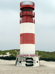
Helgoland
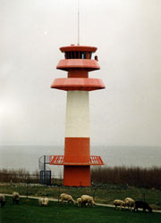
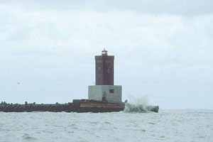
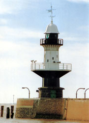
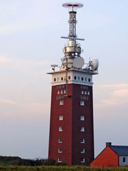
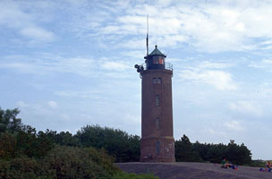
| DE 165 |
Helgoland
latitude 54° 10' 54.5" N longitude 7° 52' 56.8" E
Located on the highest point of Hauptinsel Helgoland. (B 1312)
Photo courtesy Thomas Würminghausen |
|
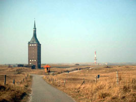
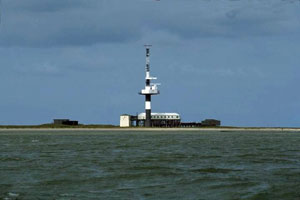
| DE 166 |
| Düne Oberfeuer
latitude 54° 10' 56.1" N longitude 7° 54' 50.6" E
The lighthouse was built from prefabricated segments. The range light is shown to the south southwest, and a directional light is also shown to the northwest; both lines guide ships bound for the harbor on the Hauptinsel. Located 120 m behind the front light, on the beach on the south side of Düne. (B 1326.1)
Photo courtesy Thomas Würminghausen |
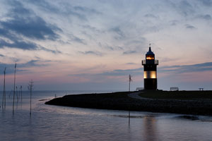
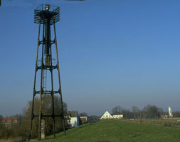
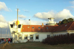
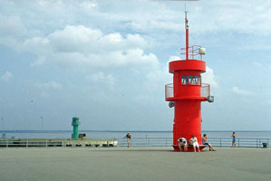
North Frisian Mainland
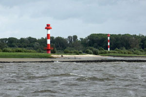
| DE 167 |
Büsum Ostmole
latitude 54° 7' 10.5" N longitude 8° 51' 37.6" E
Büsum is a fishing port north of the Elbe entrance and about 35 km southwest of Tönning. Located on the end of the east mole of Büsum harbor. Note that the Green light is in the distance in this picture. (B 1610) |
|
| DE 168 |

| Büsum Westmole
latitude 54° 7' 9.6" N longitude 8° 51' 30.2" E
Note that the river flows south, so the light in the front (red) is West, and the light in the rear is East.
Photo courtesy Leuchtturm [Atlas] |
| DE 169 |
Büsum
latitude 54° 7' 36.3" N longitude 8° 51' 29.7" E
Located onshore near the foot of the west mole. (B 1606)
Photo courtesy LeicaView [Flickr] |
|
| DE 170 |
| St. Peter Böhl
latitude 54° 17' 14.1" N longitude 8° 39' 7.4" E
The lighthouse stands at the southwestern corner of the Eiderstedt peninsula marking the entrance to the Eider estuary. Located about 3 km southeast of St. Peter and about 30 km west of Tönning. (B 1624) ARLHS # FED-231
Photo courtesy Leuchtturm [Atlas] |
| DE 171 |
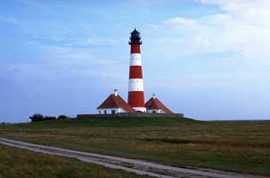
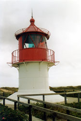
Westerheversand
latitude 54° 22' 23.6" N longitude 8° 38' 23.3" E
Located near the beach at the northwestern corner of the Eiderstedt peninsula, west of Osterhever. (B 1652)
Photo courtesy Leuchtturm [Atlas] |
|
| DE 172 |
| Dagebüll (Unterfeuer)
Located about 1 km southeast of the ferry terminal in Dagebüll. While this is referred to as the front range, there is no mention of the rear range for this light.
Photo courtesy Leuchtturm [Atlas] |
North Frisian Islands
| DE 173 |
Süderoogsand
Located at the south end of the Süderoogsand (a broad area of shallows and sandbars) about 7 km northwest of Westerheversand. (B 1672) ARLHS # FED-235 |
|
| DE 174 |
| Pellworm Unterfeuer
latitude 54° 29' 11.2" N longitude 8° 39' 3.8" E
Located about 1.5 km southwest of the rear light. Accessible only by boat. (B 1676)
Photo courtesy Leuchtturm [Atlas] |
| DE 175 |
Pellworm (Oberfeuer)
latitude 54° 29' 46.6" N longitude 8° 39' 57.4" E
Located on the south side of the island of Pellworm, guiding ships into the harbor. Island accessible by ferry from Nordstrand. ferry (B1676.1)
Photo courtesy Brigit [Flickr] |
|
| DE 176 |
| Oland
Oland is a small island about 11 km south of Dagebüll; its population is about 50. The island is joined tenuously to the mainland by a causeway that can be crossed by 4WD vehicles at low tide, but more often, by narrow gauge train. Located on the village wharf, on the northwest side of the island. (B 1714)
Photo courtesy Ray [Flickr] |
| DE 177 |
Nordmarsch
latitude 54° 37' 32.6" N longitude 8° 31' 47.3" E
Island accessible by ferry from Schlüttsiel; the lighthouse is about 3 km northwest of the ferry terminal at Rixwarft. ferry (B 1700)
Photo courtesy Leuchtturm [Atlas] |
|
| DE 178 |
| Olhörn
latitude 54° 40' 50.6" N longitude 8° 33' 58.7" E
It marks the southeastern corner of Föhr, the largest of the North Frisian Islands, west of Dagebüll. Island accessible by ferry from Dagebüll; the lighthouse is about 2 km south of the ferry terminal at Wyk. ferry (B1704)
Photo courtesy Leuchtturm [Atlas] |
| DE 179 |
Nieblum
latitude 54° 40' 52.8" N longitude 8° 29' 0.3" E
Located on the coastal road on the south side of Föhr about 10 km west of the Olhörn lighthouse. (B 1702)
Photo courtesy Klaus Kern [ListOfLights] |
|
| DE 180 |
| Wittdün
latitude 54° 37' 30.3" N longitude 8° 23' 27" E
Located on the waterfront of Wittdün, at the south end of Amrum, near the ferry terminal.
Photo courtesy Leuchtturm [Atlas] |
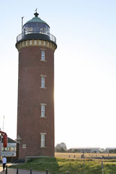
| DE 181 |
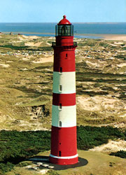
Amrum
latitude 54° 37' 51.9" N longitude 8° 21' 16.7" E
A handsome and historic lighthouse, the first built by Germany on the North Frisian coastline. For northbound ships, this is the first long-range light seen north of Helgoland. Amrum is a barrier island south of Sylt; it is a popular tourist destination readily accessible by ferry from Dagebüll. The lighthouse is built on a high dune northwest of the harbor of Wittdün, the ferry terminal at the south end of the island. ferry (B 1686) ARLHS # FED-032
Photo courtesy Rainer Arndt [ListOfLights] |
|
| DE 182 |
| Nebel
latitude 54° 38' 43.2" N longitude 8° 21' 40.1" E
Located on the east side of Amrum near the center of the island, about 10 km north of Wittdün. (B 1691)
Photo courtesy Manfred Schueler [ListOfLights] |
| DE 183 |
Norddorf
latitude 54° 40' 8.9" N longitude 8° 18' 30.6" E
This little lighthouse is an important sector light for ships approaching the Hörnum pass between Amrum and Sylt. Located on a sandy headland at the northwest corner of Amrum about 7 km southwest of Norddorf village. (B 1728)
Photo courtesy Alex Trabas [ListOfLights] |
|
| DE 184 |
Hörnum Unterfeuer
latitude 54° 44' 48.6" N longitude 8° 17' 22" E |
Located at the south end of the island of Sylt. |
| DE 185 |
Hörnum (Rotes Kliff)
latitude 54° 45' 14.6" N longitude 8° 17' 31.9" E
Located atop a dune at the end of the road at the south end of Sylt. The island is accessible by causeway from the mainland. (B 1735)
Photo courtesy syltisch [Flickr] |
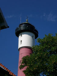
|
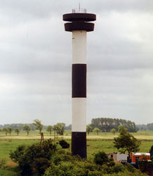
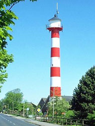
| DE 186 |
| Kampen
latitude 54° 56' 46.2" N longitude 8° 20' 26.4" E
Located atop a bluff (the red cliff) at Kampen in the northern third of Sylt. (Not to be confused with DE 4 which is spelled with a "C".) DE4 (B 1740)
Photo courtesy Robert C. Lemm [Flickr] |
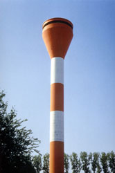
| DE 188 |
| List West
latitude 55° 3' 10.5" N longitude 8° 24' 5" E
This, Germany's northernmost lighthouse, is one of two lighthouses built by the Danish government to guide ships through the channel between Sylt and the adjacent (and still Danish) island of Rømø. Both lighthouses are on the Ellenbogen ("elbow"), a 10 km long sand spit which is a protected natural area. Located at the northwest corner of Sylt, about 10 km by road from the town of List. list (B 1746)
Photo courtesy Robert C. Lemm [Flickr] |
| DE 189 |
List Ost
latitude 55° 2' 57.9" N longitude 8° 26' 37.5" E
Located near the east end of the Ellenbogen about 18 km by road from the town of List. (B 1748)
Photo courtesy Robert C. Lemm [Flickr] |
|
|
|


 Denmark