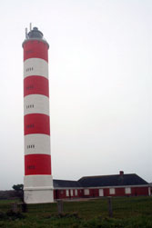
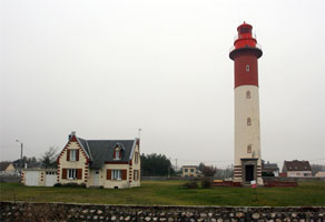
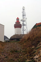
|
This page shows the documentation of the Lighthouses of Northern France (the side that faces England.) You can click on the photo of the light to go to it's specific (larger resolution) copy. Each lighthouse name is linked to (in our editorial opinion) the best reference site for that light. I would like to include directions on how to get to these lights. If you know such data, could you eMail me and I'll post it here (with your choice of attribution.) mailme There has been significant improvements in content by comparing my other data with the Lighthouse Directory prepared by Russ Rowlett. My thanks to him for providing this basis for understanding. w6 |
|
| FR 1 |
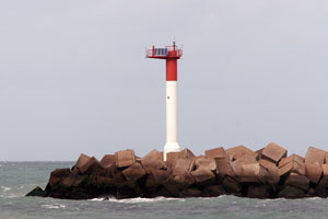
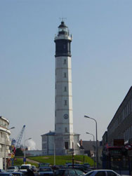
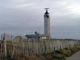
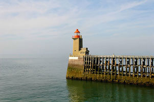
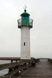
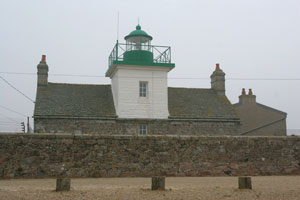
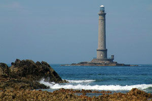
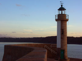
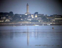
Dunkerque (Risban)
latitude 51° 3' 7.2" N longitude 2° 21' 13.8" E
Located at the foot of the east jetty in Dunkerque. There are also good views from ferries crossing between Dunkerque and Dover. ferry (A 1114) ARLHS # FRA-537
Photo courtesy Marc de Kleijn [Pbase] |
|
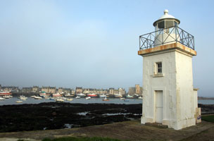
| FR 2 |
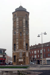
| Leughenaer (Feu Postérieur)
Built in 1548 as part of the defense of Dunkirk. Charles V ordered her to be built on the foundations of the old vestiges dating back to the fortified cities of Vauban. The tower was raised on a few occasions. A light was installed in 1825. Dunkirk, Gravelines and Calais were all fortified in the Vauban-style. ARLHS # FRA-752
Photo courtesy Marc de Kleijn [Pbase] |
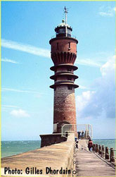
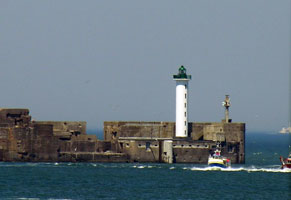
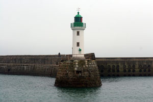
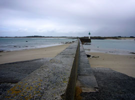
| FR 3 |
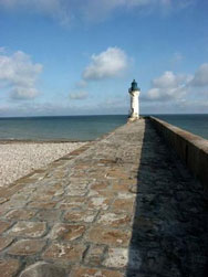
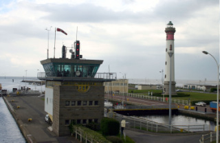
Dunkerque Jetée Ouest (Feu de St. Pol)
latitude 51° 3' 38.3" N longitude 2° 20' 57.4" E
Located at the end of the west jetty at the entrance to Dunkerque harbor; accessible by walking the jetty. There are also good views from ferries crossing between Dunkerque and Dover. ferry (A 1118) ARLHS # FRA-727
Photo courtesy Gilles Dhordain [Carceller] |
|
| FR 4 |
| Dunkerque Ouest Avant-Port Feu Antérieur
latitude 51° 1' 40.2" N longitude 2° 11' 55.2" E
Located near the foot of the Jetée du Clipon. (A 1126) ARLHS # FRA-850
Photo courtesy Thomas Philipp [ListOfLights] |
| FR 5 |
Dunkerque Ouest Avant-Port Feu Postérieur
latitude 51° 1' 30.3" N longitude 2° 12' 21.8" E
Located 600 m southeast of the front light. (A 1126.1)
Photo courtesy Alexander Trabas [ListOfLights] |
|
| FR 6 |
| Dunkerque Ouest Jetée du Clipon
latitude 51° 55.8" N longitude 2° 5' 30.5" E
The Jetée du Clipon is the eastern of two breakwaters sheltering the modern harbor (Nouveau Port) of Dunkerque. Located at the end of the jetty, accessible by walking the breakwater. (A 1127.4) ARLHS # FRA-730
Photo courtesy Alexander Trabas [ListOfLights] |
| FR 7 |
Dunkerque Ouest Jetée du Dyck
latitude 51° 21.2" N longitude 2° 6' 8.3" E
The Jetée du Dyck is the western of two breakwaters sheltering the modern harbor (Nouveau Port) of Dunkerque. Located at the end of the jetty; accessible by walking the breakwater. (A 1127) ARLHS # FRA-731
Photo courtesy Alexander Trabas [ListOfLights] |
|
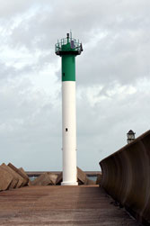
| FR 8 |
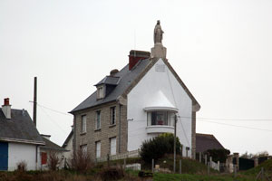
| Gravelines (Petit Fort Philippe)
Located near the foot of the east jetty at the entrance to the Aa River in Petit Fort Philippe, north of Gravelines. ARLHS # FRA-751
Photo courtesy Marc de Kleijn [Pbase] |
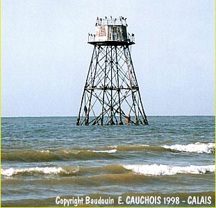
| FR 9 |
Walde
Located on a sandbar about 1 km offshore about 6 km east of Calais. Accessible only by boat. ARLHS # FRA-257
Photo courtesy Baudoin E. Cauchois [Carceller] |
|
| FR 10 |
| Calais
latitude 50° 57' 41" N longitude 1° 51' 13.6" E
Located in the center of Calais, overlooking the harbor. (A 1144) ARLHS # FRA-004
Photo courtesy skippy [Webshots] |
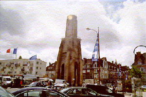
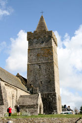
| FR 11 |
Calais Tour du Guet (Watchtower)
The tower was declared a national monument in 1931. Located in the center of the old town of Calais. ARLHS # FRA-514
Photo courtesy Len Riddell [Calais] |
|
| FR 12 |
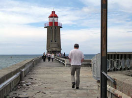
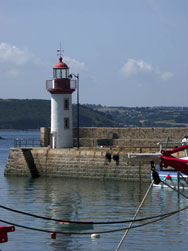
| Calais Jetée de l'Est
latitude 50° 58' 22.8" N longitude 1° 50' 27.6" E
This lighthouse was built to replace an 1864 cast iron tower that was swept away by a storm in December 1893. Located at the end of the east jetty of Calais harbor, accessible by walking the jetty. (A 1146) ARLHS # FRA-134
Photo courtesy Jean-Louis [Flickr] |
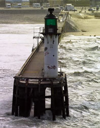
| FR 13 |
Calais Jetée de l'Ouest
latitude 50° 58' 15" N longitude 1° 50' 25.1" E
The location of the lighthouse was relocated in 1925, when the jetty was demolished and rebuilt about 100 m to the west. Located at the end of the west jetty of Calais harbor, accessible by walking the jetty. (A 1148) ARLHS # FRA-156
Photo courtesy Laurence Matsom [PBase] |
|
| FR 14 |
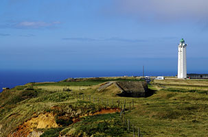
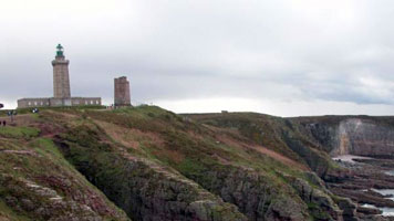
| Cap Gris Nez
latitude 50° 52' 5.4" N longitude 1° 34' 57.6" E
The area has been incorporated into a regional nature park. Located on the cape, the southwestern entrance to the Pas de Calais (Strait of Dover), about 40 km southwest of Calais (A 1166) ARLHS # FRA-086
Photo courtesy sparijs [Webshots] |
FR 15
[FR17] |
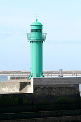
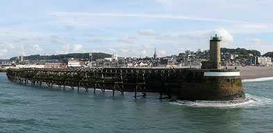
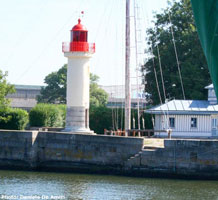
Boulogne Digue Sud (Digue Carnot)
latitude 50° 44' 26.4" N longitude 1° 34' 3" E
The initial light here, erected in 1887, consisted of a beacon on top of a gas tank. It was blown off in a storm a few months later and replaced by a more solid structure. The current lighthouse, built in 1968, was the first automated, remote-controlled light in France. (A 1170) ARLHS # FRA-204
Photo courtesy catmer [Flickr] |
|
FR 16
[FR15] |
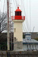
| Boulogne Jetée Nord-Est
latitude 50° 43' 54.2" N longitude 1° 35' 14.2" E
Located on the northeast jetty at the entrance to the old harbor of Boulogne. Accessible by walking the jetty. (A 1178) ARLHS # FRA-054
Photo courtesy kittekop [Webshots] |
FR 17
[FR16] |
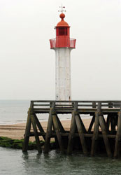
Boulogne Jetée Sud-Ouest
latitude 50° 43' 53.5" N longitude 1° 35' 7.5" E
The Germans demolished the 1928 lighthouse during World War II and replaced it with a concrete blockhouse; after the war a light was placed on a mast atop the blockhouse. In 1999, the blockhouse was removed and the present tower, a fiberglass copy of the 1928 lighthouse, was installed. Located on the southwest jetty at the entrance to the old harbor of Boulogne. Accessible by walking the jetty. (A 1180) ARLHS # FRA-089
Photo courtesy Thomas Philipp [ListOfLights] |
|
| FR 18 |
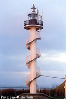
| Cap d'Alprech
latitude 50° 41' 55.2" N longitude 1° 33' 49.3" E
This is the landfall light for Boulogne, located on a promontory about 3 km southwest of the city. (The exterior stairs are probably financially efficient, but can you imagine walking up those stairs in really bad weather?) (A 1190) ARLHS # FRA-158
Photo courtesy Jean-Michel Penin [Carceller] |
| FR 19 |
[La] Canche (Le Touquet)
latitude 50° 31' 25.2" N longitude 1° 35' 31.8" E
Located in the village of Le Touquet-Paris-Plage, a beach resort town about 8 km west of Étaples. (A 1196) ARLHS # FRA-209
Photo courtesy courtecuisse [Webshots] |
![[La] Canche](CE/France/Touquet.jpg)
|
| FR 20 |
| Berck
latitude 50° 23' 54" N longitude 1° 33' 39" E
Located on the Pointe du Haut-Banc in Berck. (A 1202) ARLHS # FRA-159
Photo courtesy Marc de Kleijn [Pbase] |
| FR 21 |
[Le] Hourdel
latitude 50° 12' 54.1" N longitude 1° 33' 59.3" E
Located just off the beach at the south side of the entrance to the Somme, about 15 km northeast of Cayeux-sur-Mer. (A 1210) ARLHS # FRA-318
Photo courtesy Marc de Kleijn [Pbase] |
![[Le] Hourdel](CE/France/Hourdel.jpg)
|
| FR 22 |
| Cayeux-sur-Mer (Brighton)
latitude 50° 11' 39.3" N longitude 1° 30' 43.6" E
Located in the village of Cayeux-sur-Mer, also called Brighton, about 20 km west of St.-Valery-sur-Somme. (A 1208) ARLHS # FRA-232
Photo courtesy Marc de Kleijn [Pbase] |
| FR 23 |
Ault
latitude 50° 6' 17.9" N longitude 1° 27' 13.5" E
Located on a bluff in the village of Ault, about 16 km north of Eu. (A 1220) ARLHS # FRA-175
Photo courtesy Marc de Kleijn [Pbase] |
|
| FR 24 |
![[Le] Tréport Jetée de l](CE/France/Treport.jpg)
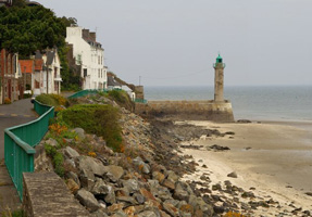
| [Le] Tréport Jetée de l'Ouest
latitude 50° 3' 52.7" N longitude 1° 22' 8.2" E
Located at the end of the short west jetty in the fishing port of Le Tréport. Accessible by walking the jetty. (A 1222) ARLHS # FRA-522
Photo courtesy francois et fier de l'Être [Flickr] |
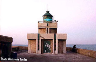
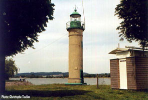
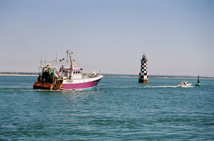
FR 25
[FR27] |
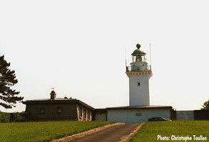
Dieppe Jetée de l'Ouest
latitude 49° 56' 14.3" N longitude 1° 4' 58.8" E
Located at the end of the west jetty in Dieppe. Accessible by walking the jetty. (A 1230) ARLHS # FRA-755
Photo courtesy Christophe Toullec [Carceller] |
|
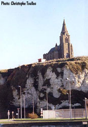
| FR 26 |
| Falaise du Pollet
latitude 49° 55' 55.2" N longitude 1° 5' 18" E
Located on a bluff on the east side of Dieppe harbor. (A 1232.1) ARLHS # FRA-851
Photo courtesy Christophe Toullect [Carceller] |
FR 27
[FR25] |
Dieppe Alignement (feu postérieur)
The range has been discontinued, and a single light is now displayed from a small concrete structure in front of the church (next entry). Located on a bluff on the east side of Dieppe harbor. ARLHS # FRA-849
Photo courtesy Christophe Toullect [Carceller] |
|
| FR 28 |
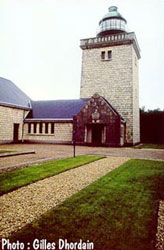
| Pointe d'Ailly
latitude 49° 54' 57.6" N longitude 57' 30" E
Located near Ste.-Marguerite-sur-Mer, about 16 km west of Dieppe. (A 1234) ARLHS # FRA-012
Photo courtesy Gilles Dhordain [Carceller] |
| FR 29 |
St.-Valéry-en-Caux (Jetée de l'Ouest)
latitude 49° 52' 24.4" N longitude 42' 31.3" E
Located at the end of the west jetty in St.-Valéry-en-Caux, about 50 km east of Fécamp and the same distance west of Dieppe. Accessible by walking the jetty. (A 1238) ARLHS # FRA-152
Photo courtesy fotopages [fotopages] |
|
FR 30
[FR31] |
| Fécamp (Digue Nord)
latitude 49° 45' 56.6" N longitude 21' 47.3" E
Located at the end of the north pier in Fécamp, accessible by walking the pier. (A 1244) ARLHS # FRA-162
Photo courtesy Michael Artz [Flickr] |
FR 31
[FR32] |
Fécamp Digue Sud (Pilot Feu Postérieur)
latitude 49° 45' 53.7" N longitude 21' 48.5" E
Located at the end of the south pier in Fécamp; accessible by walking the pier. (A 1246) ARLHS # FRA-163
Photo courtesy Micael Reynaud [Flickr] |
|
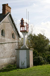
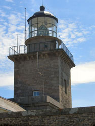
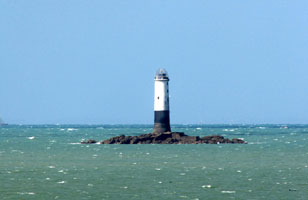
FR 32
[FR30] |
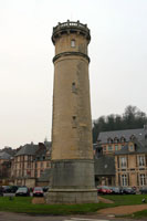
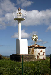
Cap Fagnet (Pointe Fagnet)
latitude 49° 46' 2.8" N longitude 22' 11" E |
Located atop a steep bluff on the north side of Fécamp. photo ARLHS # FRA-773 |
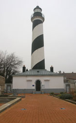
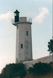
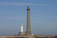
| FR 33 |
Cap d'Antifer
latitude 49° 41' 0.6" N longitude 9' 55.2" E
Located atop the cliffs west of Étretat, the same cliffs made famous by some 20 paintings of Monet. (A 1250) ARLHS # FRA-220
Photo courtesy Nicolas Duthu [Flickr] |
|
Central Channel Lights
| FR 34 |
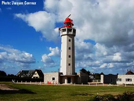
| Cap de la Hève
latitude 49° 30' 44.4" N longitude 4' 9.6" E
A few miles west of Le Havre. (A 1256) ARLHS # FRA-223
Photo courtesy Jacques Conreux [Carceller] |
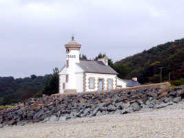
| FR 35 |
Le Havre Nouvelle Digue Nord
latitude 49° 29' 11.8" N longitude 5' 26.6" E
Located at the end of the north breakwater at Le Havre, accessible in good weather by walking the breakwater. (A 1262) ARLHS # FRA-164
Photo courtesy Heloise [Flickr] |
|
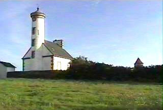
| FR 36 |
| Le Havre Nouvelle Digue Sud
latitude 49° 29' 3.1" N longitude 5' 22.6" E
Located at the end of the south breakwater at Le Havre, accessible by walking the breakwater. (A 1264) ARLHS # FRA-165
Photo courtesy Douglas Cameron [ListOfLights] |
| FR 37 |
Quai d'Escale Antérieur (Quai Roger Meunier)
The Quai d'Escale is one of the major quays of Le Havre, located southeast of the breakwaters. This light is on the West Corner. ARLHS # FRA-764
Photo courtesy Alexander Trabas [ListOfLights] |
|
|
|
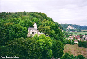
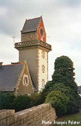
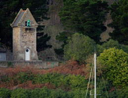
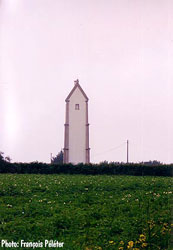
| FR 39 |
Tancarville
Located on a bluff on the north side of the Seine near Tancarville. private property. ARLHS # FRA-766
Photo courtesy François Peleter [Carceller] |
|
| FR 40 |
| Quillebeuf-sur-Seine
Located on the south bank of the river near the quay at Quillebeuf-sur-Seine, about 4 km above the Tancarville bridge. ARLHS # FRA-444
Photo courtesy Cristophe Toullec [Carceller] |
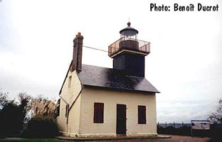
| FR 41 |
Pointe de la Roque
Located atop a steep bluff overlooking the floodplain on the south side of the river near Samson-la-Roque, about 5 km west of the Tancarville bridge. ARLHS # FRA-460
Photo courtesy Benoît Ducrot [Carceller] |
|
| FR 42 |
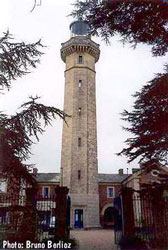
| Fatouville
Follow D312 to Fetouville Grestain, then D161 to the lighthouse. ARLHS # FRA-282
Photo courtesy Bruno Berlioz [Carceller] |
| FR 43 |
Falaise des Fonds (Le Butin)
Located on the west side of the entrance to the harbor of Honfleur, on the south side of the Seine estuary. ARLHS # FRA-851
Photo courtesy Daniela de Amici [phares] |
|
| FR 44 |
| Honfleur (Feu de l'Hôpital)
Located a short distance south of the Falaise des Fonds lighthouse.
Photo courtesy Marc de Kleijn [Pbase] |
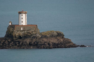
| FR 45 |
Honfleur Jetée de l'Est
latitude 49° 25' 23.3" N longitude 14' 6.4" E
Located at the point of the jetty, marking the entrance to the Avant Port in old city section of Honfleur. (A 1294) ARLHS # FRA-680
Photo courtesy Marc de Kleijn [Pbase] |
|
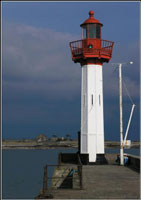
| FR 46 |
| Trouville Jetée de l'Est
latitude 49° 22' 2.2" N longitude 4' 29.1" E
Located at the end of the jetty on the northeast side of the entrance to Trouville-sur-Mer harbor, accessible by walking the jetty. (A 1283) ARLHS # FRA-527
Photo courtesy Marc de Kleijn [Pbase] |
| FR 47 |
Trouville Jetée de l'Ouest
latitude 49° 22' 2.2" N longitude 4' 25.8" E
Located at the end of the jetty on the southeast side of the entrance to Trouville-sur-Mer harbor; accessible by walking the jetty. (A 1284) ARLHS # FRA-528
Photo courtesy Marc de Kleijn [Pbase] |
|
| FR 48 |
Dives-sur-Mer
latitude 49° 18' 17.5" N longitude 5' 32.5" W |
Located at the mouth of the Dives estuary at Dives-sur-Mer, about 30 km northeast of Caen. ARLHS # FRA-675 |
| FR 49 |
Ouistreham
latitude 49° 16' 47.7" N longitude 14' 52.3" W
Entrance to the Orne River, Calvados
This light was a surprise, we thought we were on a tour covering the Celtic Lands. Seems we were going to see some lights as well. (A 1377) ARLHS # FRA-377 |
|
| FR 51 |
Ver sur Mer (Pointe de Ver)
latitude 49° 20' 24.6" N longitude 31' 7.8" W
The village of Ver-sur-Mer is about 20 km northwest of Caen. (A 1396) ARLHS # FRA-532
Photo courtesy Christophe Toullec [Carceller] |
|
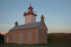
| FR 52 |
| Port en Bessin Antérieur
latitude 49° 20' 58" N longitude 45' 31.9" W
Located atop a bluff overlooking the harbor entrance, about 10 km northwest of Bayeux. (A 1400) ARLHS # FRA-406
Photo courtesy Alexander Trabas [ListOfLights] |
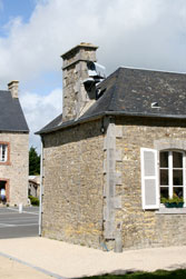
| FR 53 |
Port en Bessin Postérieur
latitude 49° 20' 55.4" N longitude 45' 32.6" W
The lantern is in the center of the end of the house facing the sea, that end is covered with concrete, painted white. (A 1400.1) ARLHS # FRA-795
Photo courtesy Marc de Kleijn [Pbase] |
|
| FR 54 |
Grandcamp-Maisy Jetée Est |
Accessible by walking the east jetty at Grandcamp-Maisy. ARLHS # FRA-703 |
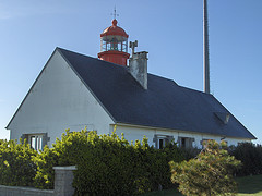
| FR 55 |
Carentan Feu Antérieur
latitude 49° 20' 28.6" N longitude 1° 11' 9.8" W
on the Canal de Carentan, rear light above the village of Le Port (A 1418) ARLHS # FRA-692
Photo courtesy Alexander Trabas [ListOfLights] |
|
| FR 56 |
Îles Saint-Marcouf
latitude 49° 29' 52.2" N longitude 1° 8' 46.8" W |
Located at the foot of the pier at Brévands, in the extreme southwest corner of the Baie de la Seine. (A 1424) ARLHS # FRA-055 |
| FR 57 |
Morsalines (La Hougue Feu Postérieur)
latitude 49° 34' 10.2" N longitude 1° 19' 3.6" W
Located atop a high hill south of Morsalines. (A 1428.1) ARLHS # FRA-365
Photo courtesy John Cristophe Fichou [PharesFrance] |
|
| FR 58 |
| St. Vaast la Hougue
latitude 49° 34' 15.6" N longitude 1° 16' 22.8" W
Identified as "Phare et Prison" at Cotentin.
Located on the end of the jetty of the new harbor of St.-Vaast-la-Hougue, on the east side of town facing l'Île de Tatihou. (A 1434) ARLHS # FRA-151
Photo courtesy Eric Pouheir [PBase] |
| FR 59 |
Pointe de Saire (Réville)
latitude 49° 36' 21.6" N longitude 1° 13' 44.4" W
Located on the Pointe de Saire about 3 km east southeast of Réville. (A 1442) ARLHS # FRA-761
Photo courtesy Marc de Kleijn [Pbase] |
|
| FR 60 |
| Barfleur Antérieur
latitude 49° 40' 19.2" N longitude 1° 15' 36" W
Located near the jetty in Barfleur, a traditional fishing port at the northeastern corner of the Cotentin peninsula. (A 1444) ARLHS # FRA-545
Photo courtesy Marc de Kleijn [Pbase] |
| FR 61 |
Barfleur Postérieur
latitude 49° 40' 4.8" N longitude 1° 15' 45" W
This is a 13 m square cylindrical stone tower with lantern and gallery, attached to the rear of a 2-story stone keeper's house. (A 1444.1) ARLHS # FRA-815
Photo courtesy Marc de Kleijn [Pbase] |
|
| FR 62 |
| Pointe de Barfleur (Gatteville)
latitude 49° 41' 47.1" N longitude 1° 15' 56.6" W
Located 2 km north of Barfleur, close to the village of Gatteville-le-Phare. (A 1454) ARLHS # FRA-300
Photo courtesy Eric Pouhier [PBase] |
| FR 63 |
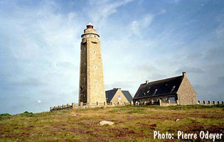
Cap Lévi
latitude 49° 41' 45.1" N longitude 1° 28' 23.5" W
Located on a headland jutting into the Manche about 20 km northeast of Cherbourg and 2.5 km northwest of the village of Fermanville. (A 1462) ARLHS # FRA-719
Photo courtesy Pierre Odeyer [Carceller] |
|
| FR 64 |
| Le Becquet Feu Antérieur
latitude 49° 39' 13.6" N longitude 1° 32' 50.5" W
Located on the waterfront in Le Becquet, about 5 km east of the Cherbourg waterfront. (A 1466) ARLHS # FRA-191
Photo courtesy Alexander Trabas [ListOfLights] |
| FR 65 |
Le Becquet Feu Postérieur
latitude 49° 39' 12.1" N longitude 1° 32' 50.8" W
east of Cherbourg (A 1466.1) ARLHS # FRA-192
Photo courtesy Alexander Trabas [ListOfLights] |
|
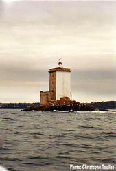
| FR 66 |
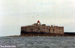
| Cherbourg Fort de l'Ouest
latitude 49° 40' 27.6" N longitude 1° 38' 52.2" W
Located about 2.5 km northwest of the Cherbourg waterfront. Accessible only by boat. (A 1480) ARLHS # FRA-046
Photo courtesy Christophe Toullec [Carceller] |
| FR 67 |
[La] Plate
latitude 49° 43' 58.5" N longitude 1° 55' 45.5" W
Located atop a wave swept rock 3 km northeast of the Cap de la Hague lighthouse. Accessible only by boat. Not to be confused with Feu de la Plate. FR 102A (A 1514) ARLHS # FRA-758
Photo courtesy Alexander Trabas [ListOfLights] |
![[La] Plate](CE/France/Plate.jpg)
|
| FR 68 |
| Cap de la Hague
latitude 49° 43' 18.9" N longitude 1° 57' 15.7" W
Located on a small waveswept island, Gros-du-Raz, just west of the cape. Accessible only by boat, but there is a good view from the beach at the end of the road about 1.6 km west of Auderville. (A 1512) ARLHS # FRA-031
Photo courtesy BJ Clarke [Webshots] |
| FR 69 |
Diélette (Digue Ouest, feu antérieur)
latitude 49° 33' 10" N longitude 1° 51' 54" W
Located at the end of breakwater pier at Diélette on the west side of the Cotentin peninsula. (A 1632) ARLHS # FRA-261
Photo courtesy Marc de Kleijn [Pbase] |
|
| FR 71 |
Cap de Carteret
latitude 49° 22' 24.6" N longitude 1° 48' 28.8" W
West side of Coneenti Peninsula (A 1638) ARLHS # FRA-084
Photo courtesy courtecuisse [Webshots] |
|
| FR 72 |
| Portbail Feu Postérieur (Église de Notre-Dame)
latitude 49° 20' 6" N longitude 1° 42' 1.2" W
The building is no longer a church; it is now used as the town meeting hall. Located on the waterfront in Portbail, about 10 km southeast of Barneville-Carteret. Ferries from Jersey dock near the church. (A 1644.1) ARLHS # FRA-763
Photo courtesy Alexander Trabas [ListOfLights] |
|
|
| FR 73 |
Le Sénéquet
Located on a rock about 5 km west of Gouville-sur-Mer. Accessible only by boat. (A 1648) ARLHS # FRA-035
Photo courtesy Alexander Trabas [ListOfLights] |
|
| FR 74 |
| Pointe d'Agon (Régneville)
Located at the end of a long point of land about 7 km south of Agon. (A 1650) ARLHS # FRA-166
Photo courtesy courtesy Wolfgang Wander [PBase] |
| FR 75 |
Regnéville-sur-Mer
The light is mounted on a chimney at one end of a 1-story stone building, perhaps the port captain's office. (A 1651) ARLHS # FRA-852
Photo courtesy Alexander Trabas [ListOfLights] |
|
| FR 76 |
| Granville (Pointe du Roc)
latitude 48° 50' 4.4" N longitude 1° 36' 46.7" W
Located atop a rocky promontory the Roc du Granville, marking the entrance to Granville harbor. (A 1660) ARLHS # FRA-126
Photo courtesy La Mouette Noire [Flickr] |
| FR 77 |
Îles Chausey
latitude 48° 52' 10.2" N longitude 1° 49' 19.8" W
13 miles West of Granville (A 1654) ARLHS # FRA-005
Photo courtesy courtecuisse [Webshots] |
|
FR 79
[FR78B] |
[La] Houle sous Cancale
latitude 48° 40' 5.9" N longitude 1° 51' 6.1" W
Located on the waterfront in Cancale, on the west side of the Baie du Mont Saint-Michel. (A 1672) ARLHS # FRA-210
Photo courtesy loleig [Flickr] |
![[La] Houle sous Cancale](CE/France/Cancale.jpg)
|
FR 80
[FR118R] |
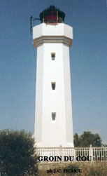
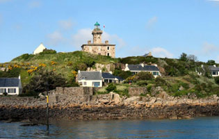
| Pointe du Grouin du Cou
The lighthouse guards the entrance to the Pertuis Breton, the sound sheltered by the Île de Ré. Located on a prominent point of land on the west side of La-Tranche-sur-Mer. (D 1214) ARLHS # FRA-311
Photo courtesy John Cristophe Fichou [PharesFrance] |
FR 81
[FR78C] |
Pierre de Herpin
Located on a wave swept rock northeast of the Pointe de Chemoulin, marking the entrance to the Baie du Mont Saint-Michel. Accessible only by boat in rough seas. (A 1670) ARLHS # FRA-049
Photo courtesy Anthony Metayer [Flickr] |
|
FR 82
[FR78F] |
| Rochebonne (feu postérieur)
Located on the northeast side of St.-Malo, near Rothéneuf. (A 1676.1) ARLHS # FRA-453
Photo courtesy François Peleter [Carceller] |
FR 83
[FR78J] |
[Les] Bas-Sablons (feu antérieur)
latitude 48° 38' 10" N longitude 2° 1' 18.4" W
Located on the old waterfront of St.-Malo. (A 1686) ARLHS # FRA-343
Photo courtesy François Peleter [Carceller] |
![[Les] Bas-Sablons](CE/France/BasSablons.jpg)
|
FR 84
[FR78K] |
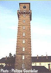
| La Balue (feu postérieur)
latitude 48° 37' 36" N longitude 2° 14.4" W
Located in the middle of St.-Malo, 1.65 km southwest of the front lighthouse. (A 1686.1)
Photo courtesy Philippe Gourdelier [Carceller] |
FR 85
[FR78G] |
[Le] Buron
latitude 48° 39' 19.8" N longitude 2° 3' 39.6" W
Located about 1/3 of the way from the Phare du Grand Jardin to the St.-Malo waterfront. Accessible only by boat. (A 1680) ARLHS # FRA-538
Photo courtesy Heike + Friedrich Klatt [ListOfLights] |
![[Le] Buron](CE/France/Buron.jpg)
|
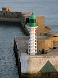
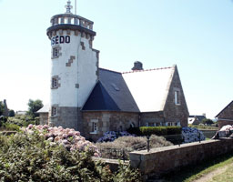
FR 85M
[FR98] |
| Mole des Noires
June 4, 2005
On the end of a long curved Jetty in Saint-Malo. This picture is taken from a boat leaving St. Malo, and significantly digitally zoomed to make the light visible. (A 1682) ARLHS # FRA-373 |
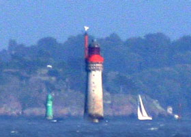
FR 86
[FR78E] |
Grand Jardin (feu antérieur)
latitude 48° 40' 12" N longitude 2° 4' 58.1" W
The lighthouse serves as the front light for two ranges; for the Grande Porte range the rear tower is the Phare de Rochebonne and for the outer Petite Porte range the rear light is the Phare de la Balue. FR 78K
Located on a waveswept rock off the west end of the Île de Cézembre about 7 km northwest of the St.-Malo waterfront. Accessible only by boat in rough seas. (A 1676) ARLHS # FRA-030
Photo courtesy Laure Chappuis [Carceller] |
|
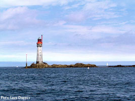
FR 87
[FR78D] |
![[Les] Courtis](CE/France/Courtis.jpg)
| [Les] Courtis
latitude 48° 48' 60" N longitude 2° 5' 48" W
Located on a wave swept rock about 1.1 km west of the Phare du Grand Jardin. Accessible only by boat in rough seas. (A 1674) ARLHS # FRA-344
Photo courtesy Thomas Philipp [ListOfLights] |
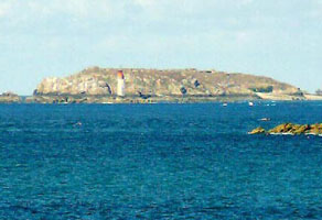
FR 89
[FR78L] |
St.-Briac-sur-Mer
Located on what appears to be a small, rocky island, just off the Pointe de la Garde Guérin on the north side of the entrance to the Frémur estuary and the port of St.-Briac. Accessible only by boat. ARLHS # FRA-474
Photo courtesy François Peleter [Carceller] |
|
FR 90
[FR79] |
| Cap Fréhel
halfway between Saint-Malo and Saint Brieuc.
Follow N12 east of St.-Brieuc to D786; follow signs to Cap Fréhel. (A 1698) ARLHS # FRA-085
Photo courtesy Brian W. Ogilvie [PBase] |
Western Channel Lights
FR 91
[FR80A] |
Erquy Jetée Intérieur
latitude 48° 38' 4.6" N longitude 2° 28' 42.9" W
Located at the end of the inner jetty at Erquy, on the east side of the Baie de Saint-Brieuc. (A1702) ARLHS # FRA-273
Photo courtesy David U. Thomas [PBase] |
|
FR 92
[FR80B] |
| Dahouët (La Petite Muette)
latitude 48° 35' 0.9" N longitude 2° 34' 9.8" W
Located in the entrance to the harbor of Dahouët, about 20 km northeast of St.-Brieuc. (A 1704) ARLHS # FRA-392
Photo courtesy Alexander Trabas [ListOfLights] |
FR 93
[FR80C] |
Le Légué (Pointe à l'Aigle, St. Laurent de la Me
latitude 48° 32' 7.8" N longitude 2° 43' 7.2" W
This lighthouse is located in Le Légué on the end of a short, narrow jetty at the entrance to the river Gouët, which leads to Saint-Brieuc. It isn't clear if the jetty is open (it may be too narrow to walk safely), but the light can easily be viewed from shore. (A 1708) ARLHS # FRA-335
Photo courtesy rore [Flickr] |
|
FR 94
[FR80D] |
| Binic (Môle de Penthièvre)
latitude 48° 36' 4.1" N longitude 2° 48' 55.3" W
Located at the end of the mole in Binic, about 13 km northwest of Saint-Brieuc. (A 1710) ARLHS # FRA-198
Photo courtesy Jean Michel Daoudal [Flickr] |
FR 95
[FR80E] |
Île Harbour (Îles Saint Quay)
latitude 48° 38' 43" N longitude 2° 49' 21.1" W
Located at the end of the north mole at Saint-Quay-Portrieux, at the northwestern corner of the Baie de St.-Brieuc. (A 1714) ARLHS # FRA-020
Photo courtesy Jean Michel Daoudal [Flickr] |
|
FR 96
[FR80G] |
| Le Grand Léjon
Located on an isolated rock 16.5 km northeast of St.-Quay-Portrieux. Accessible only by boat. ARLHS # FRA-018
Photo courtesy Laure Chappuis [Carceller] |
FR 97
[FR80H] |
Lost Pic (L'Ost Pic)
latitude 48° 46' 46.4" N longitude 2° 56' 25.2" W
Located about 7.5 km east of Paimpol but only 1.5 km off the coast northeast of Plouézec. Accessible only by boat, but there may well be good views from shore. (A 1720) ARLHS # FRA-039
Photo courtesy Marc de Kleijn [pbase] |
|
FR 97D
[FR80] |
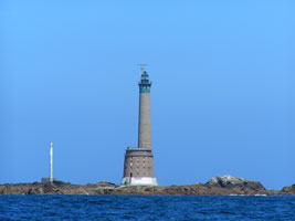
| Les Roches Douvres
Located about 30 km off the French coast and about 42 km west of Jersey in the Channel Islands. Accessible only by boat in very rough seas. (A 1734) ARLHS # FRA-011
Photo courtesy Kees Aalbersberg [ListOfLights] |
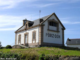
FR 98
[FR80J] |
Pointe de Porz-Don (Paimpol)
latitude 48° 47' 29.2" N longitude 3° 1' 34.1" W
Located on the north side of the entrance to Paimpol, about 1.5 km southeast of Ploubazlenac. (A 1722) ARLHS # FRA-441
Photo courtesy Benoit Le Goff [phares] |
|
FR 99
[FR80K] |
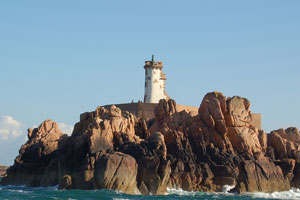
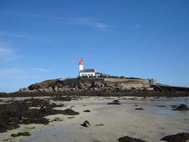
| Le Paon (Île de Bréhat)
latitude 48° 51' 55.3" N longitude 2° 59' 10.2" W
Located on a wave swept rock off the entrance to the Rivière de Trieux. Accessible only by boat. (A 1740) ARLHS # FRA-382
Photo courtesy Arnet [Flickr] |
FR 100
[FR80L] |
Rosédo
latitude 48° 51' 22.5" N longitude 3° 40" W
Located at the northwest point of the Île de Bréhat, which is accessible by ferry from L'Arcouest. (A 1742) ARLHS # FRA-462
Photo courtesy Dirk van der Eecken [Flickr] |
|
FR 101
[FR81] |
| La Croix (Trieux Feu Antérieur)
latitude 48° 50' 1" N longitude 3° 3' 18" W
Located on a wave swept rock off the entrance to the Rivière de Trieux. Accessible only by boat. (not to be confused with several others FR 105C (A 1748) ARLHS # FRA-025
Photo courtesy pastina [Flickr] |
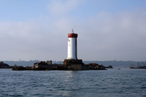
FR 102
[FR81A] |
Bodic (Trieux Feu Postérieur)
latitude 48° 49' 17.3" N longitude 3° 5' 7.1" W
Located on the west side of the Trieux estuary near Kermouster, 3.8 km southwest of the front light. (A 1748.1) ARLHS # FRA-200
Photo courtesy Christophe Toullec [Carceller] |
|
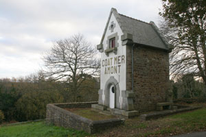
FR 103
[FR81B] |
| Coat Mer Feu Antérieur
latitude 48° 48' 17.1" N longitude 3° 5' 44.1" W
Located in the Pointe de Coat Mer, on the west side of the Trieux estuary about 2.5 km north of Lézardrieux. (A 1752) ARLHS # FRA-242
Photo courtesy Marc de Kleijn [pbase] |
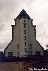
FR 105
[FR81D] |
| Les Perdrix (Cotes d/Armor)
latitude 48° 47' 44.4" N longitude 3° 5' 48" W
Located in the Trieux estuary at Lézardrieux. Accessible only by boat, but easily viewed from shore. (A 1758) ARLHS # FRA-588
Photo courtesy Christophe Alary [Flickr] |
FR 106
[FR82] |
Les Héaux de Bréhat
latitude 48° 54' 30" N longitude 3° 5' 10.8" W
6 miles NW of Bréhat Island on the Plateau des Héaux (A 1738) ARLHS # FRA-021
Photo courtesy Cyril Poulingue [Flickr] |
|
FR 107
[FR82A] |
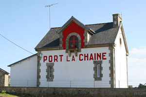
| Port-la-Chaîne (Grande Passe Feu Antérieur)
latitude 48° 51' 36" N longitude 3° 7' 54.1" W
Located in the village of Port-la-Chaîne, about 1.5 km north of Pleubian. (A 1762) ARLHS # FRA-425
Photo courtesy Alexander Trabas [ListOfLights] |
FR 109
[FR82C] |
| La Corne
latitude 48° 51' 20.7" N longitude 3° 10' 36.6" W
Located in the northeastern entrance to Jaudy or Tréguier estuary. Vaur's photos suggest that at low tide it is possible to walk fairly close to the tower. (A 1760) ARLHS # FRA-250
Photo courtesy Alexander Trabas [ListOfLights] |
Perros-Guirec and Ploumanac'h
FR 111
[FR82F] |
| Kerjean (Passe de l'Ouest Feu Postérieur)
latitude 48° 47' 47.2" N longitude 3° 23' 23.8" W
Located on a hillside east of Louannec. (A 1770) ARLHS # FRA-326
Photo courtesy Alexander Trabas [ListOfLights] |
FR 112
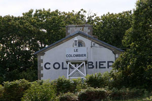
[FR82G] |
La Colombier (Passe de l'Est Feu Antérieur)
latitude 48° 47' 52.2" N longitude 3° 26' 38.4" W
Located above the waterfront in Saint-Quay-Perros. (A 1774) ARLHS # FRA-244
Photo courtesy Alexander Trabas [ListOfLights] |
|
FR 113
[FR82E] |
| Nantouar (Passe de l'Ouest Feu Antérieur)
Located on the coast east of Louannec. ARLHS # FRA-368
Photo courtesy Marco Spruit Bleeker [Flickr] |
FR 114
[FR82H] |
Kerprigent (Passe de l'Est Feu Postérieur)
latitude 48° 47' 7" N longitude 3° 27' 29.8" W
Located west of Saint-Quay-Perros, 2.9 km southwest of the Colombier light. (A 1774.1) ARLHS # FRA-769
Photo courtesy Julien Rodriguez [Carceller] |
|
FR 115
[FR82J] |
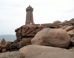
| Men-Ruz (Ploumanac'h)
latitude 48° 50' 15.5" N longitude 3° 28' 59.9" W
Located on a rocky promontory at the northeastern entrance to the harbor of Ploumanac'h. (A 1784) ARLHS # FRA-351
Photo courtesy Dirk van der Eecken [Flickr] |
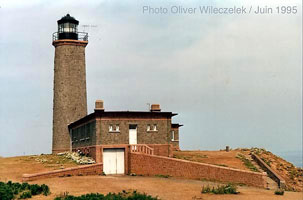
FR 116
[FR83] |
Les Sept Îles
latitude 48° 52' 43.2" N longitude 3° 29' 24" W
Located on l'Île aux Moines, one of the highest of the islets. Accessible only by boat, tours available from Trégastel. (A 1786) ARLHS # FRA-042
Photo courtesy Oliver Wileczelek [Carceller] |
|
Baie de Lannion
FR 117
[FR85] |
![[Les] Triagoz](CE/France/Triagoz.jpg)
| [Les] Triagoz
The light marks the entrance to the Baie de Lannion. Located on a waveswept rock, la Roche de Guen-Bras, about 9 km offshore northwest of Trégastel. Accessible only by boat in rough seas. (A 1790) ARLHS # FRA-062
Photo courtesy Béatrice et Guy [Carceller] |
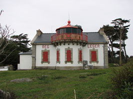
FR 118
[FR85A] |
Beg-Léger (Bec-Léquer, Lannion)
latitude 48° 44' 30.6" N longitude 3° 32' 55" W
This lighthouse is a sibling of the Pointe du Millier light on the Pointe du Raz. Located on the north side of the entrance to the Lannion (also called Leger) estuary, about 8 km southeast of Trébeurden. (A 1792) ARLHS # FRA-193
Photo courtesy Cyril [Flickr] |
|
FR 119
[FR85B] |
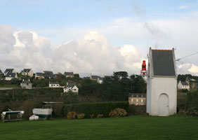
| Locquémeau Feu Postérieur
latitude 48° 43' 16.8" N longitude 3° 34' 6.2" W
Located on the north side of the entrance to the Lannion (also called Leger) estuary, about 8 km southeast of Trébeurden. (A 1794.1) ARLHS # FRA-770
Photo courtesy Marc de Kleijn [pbase] |
FR 120
[FR84N] |
Île Noire (feu antérieur)
latitude 48° 40' 21" N longitude 3° 52' 31.8" W
This is the front light of the entrance range for the Rade (Roads) de Morlaix, the Phare de la Lande is the rear light. Located in the center of the entrance, which is about 2 km wide, between Térénez and Carentec. Accessible only by boat. (A 1799.9)
Photo courtesy Christope Toullec [Carceller] |
|
FR 121
[FR84] |
![[La] Lande](CE/France/LaLande.jpg)
| [La] Lande
latitude 48° 38' 3.9" N longitude 3° 51' 51.6" W
Located on the southwest side of the Rade de Morlaix about 2 km northeast of Locquénolé. (A 1800) ARLHS # FRA-329
Photo courtesy Mikaël Milin [Flickr] |
FR 122
[FR84A] |
Île Louët (feu antérieur)
latitude 48° 40' 49.3" N longitude 3° 55' 40" W
Located on a small island on the west side of the entrance to the Rade de Morlaix from the Baie de Morlaix. Accessible only by boat, but there should be good views from the mainland east of Carantec. (A 1800.1) ARLHS # FRA-040
Photo courtesy arnet [Flickr] |
|
FR 123
[FR85F] |
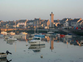
| Roscoff (feu postérieur)
latitude 48° 43' 34.2" N longitude 3° 58' 40.6" W
Located on the waterfront in Roscoff. (A 1812.1) ARLHS # FRA-461
Photo courtesy Roscoff-quotidien [Flickr] |
FR 124
[FR85D] |
Men Guen Bras
latitude 48° 43' 46" N longitude 3° 58' 3.4" W
Located on an islet northeast of Roscoff harbor and a short distance from shore. Accessible only by boat, but it is possible to get a good view from shore. (A 1810) ARLHS # FRA-781
Photo courtesy Alexander Trabas [ListOfLights] |
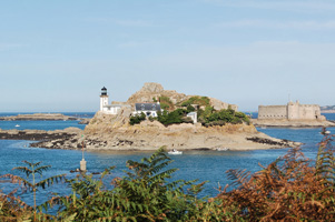
|
FR 125
[FR85E] |
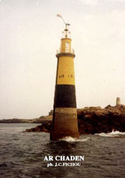
| Ar Chaden
Located northeast of Roscoff, marking a group of rocky islets obstructing the approach to the harbor. (A 1808) ARLHS # FRA-782
Photo courtesy John Cristophe Fichou [PharesFrance] |
Morlaix, Roscoff, and Brignogan
FR 126
[FR86] |
Île de Batz
latitude 48° 44' 43.2" N longitude 4° 1' 37.2" W
The island is accessible from Roscoff by ferry. Located on the heights in the western portion of the island. (A 1816) ARLHS # FRA-071
Photo courtesy Roscoff-quotidien [Flickr] |
|
FR 127
[FR86A] |
| Port de Moguériec Antérieur
latitude 48° 41' 21" N longitude 4° 4' 29.6" W
Located at the end of the jetty in the harbor of Moguériec, a fishing port about 15 km southwest of Roscoff. (A 1818) ARLHS # FRA-361
Photo courtesy Skol Louarn [Flickr] |
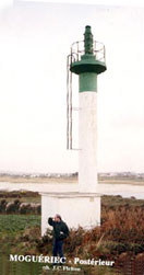
FR 128
[FR86C] |
Port de Moguériec Postérieur
latitude 48° 41' 7.1" N longitude 4° 4' 23.1" W
This photo shows the rear range. (A 1818.1) ARLHS # FRA-594
Photo courtesy John Cristophe Fichou [PharesFrance] |
|
FR 129
[FR86B] |
| Pontusval (Pointe de Beg-Pol)
latitude 48° 40' 40.1" N longitude 4° 20' 47.4" W
Located on a point at the end of Route du Phare, about 2 km northwest of Brignogan-Plage. (A 1820) ARLHS # FRA-404
Photo courtesy Serge Nérac [Flickr] |
FR 130
[FR88B] |
Lanvaon (feu postérieur)
latitude 48° 36' 36.2" N longitude 4° 32' 9" W
Located off the D71 highway about 2.5 km west of Plouguerneau. (A 1826.1) ARLHS # FRA-332
Photo courtesy François Péléter [Carceller] |
|
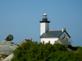
FR 131
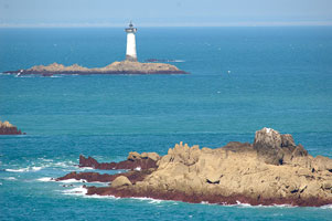
[FR88] |
| Île Vierge
latitude 48° 38' 20.1" N longitude 4° 34' 1.6" W
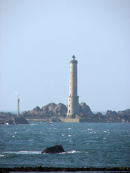
North Finistère, Brittany Coast. Located on a small island about 1.5 km offshore at Lilia, northwest of Plouguerneau. Tours to the island, including access to the lighthouse, can be arranged in Lilia. Note that you can see both the original (1845) and the new (1902) light in this photo. (A 1822) ARLHS # FRA-064
Photo courtesy Mark M 69 [Flickr] |
FR 132
[FR88A] |
Île Wrac'h (feu antérieur)
latitude 48° 36' 53.4" N longitude 4° 34' 33.8" W
Located on an island on the north side of the entrance to L'Aber Wrac'h. Accessible only by boat. (A 1826) ARLHS # FRA-065
Photo courtesy Edwige Cochois [Flickr] |
|
FR 133
[FR88F] |
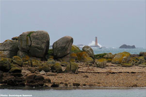
| Corn Carhai (Rochers de Portsall)
latitude 48° 35' 12" N longitude 4° 43' 56.4" W
Located on wave swept rocks about 5 km northwest of Portsall. Accessible only by boat in very rough seas. (A 1836) ARLHS # FRA-008
Photo courtesy Dominique Resmon [phares] |
FR 134
[FR89] |
[Le] Four
latitude 48° 31' 23.4" N longitude 4° 48' 18.6" W
Located on a wave swept rock about 4 km west of Argenton. Accessible only by boat; there is a distant view from shore. (A 1854) ARLHS # FRA-013
Photo courtesy C. Mauguier [wanadoo] |
![[Le] Four](CE/France/DuFour.jpg)
|
FR 135
[FR88D] |
![[La] Palue](CE/France/Palue.jpg)
| [La] Palue
latitude 48° 28' 19.8" N longitude 4° 44' 48.7" W
Located on the Quay de la Palue in Aber Wrac'h. ARLHS # FRA-784
Photo courtesy François Peleter [Carceller] |
|
|
 Western France
 England