latitude 52° 16' 10.3" N
longitude 128° 24' 25.7" W
August 30, 2014
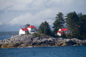
Located on the south side of the island in the entrance to the Seaforth Channel from Milbanke Sound, about 15 miles northwest of Bella Bella. ARLHS # CAN-252 (G 5713)
| home | BritishColumbia lights | map this |
| prev | region page | next |
| WC/BritishColumbia () / BritishColumbia BC8 |