latitude 55° 56' 32.4" N
longitude 4° 52' 43.8" W
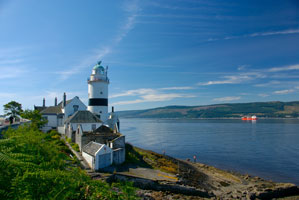
This historic light station marks a right-angle curve in the Clyde, where the estuary turns from west to south for ships headed downstream. Located just off the A770 highway about 3 km west of Gourock, directly across the Clyde from Dunoon. ARLHS # SCO-047 (A 4404)
| home | Scotland lights | map this |
| prev | region page | next |
| UK/Scotland () / Scotland SC55F |