latitude 55° 39' 28.8" N
longitude 1° 47' 42" W
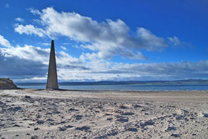
This obelisk and the nearby Guile Point West (a small framework tower) marks the southeastern entrance to the harbor of Holy Island, which is just off the mainland southeast of Berwick Upon Tweed.
Located on the mainland about 5 km northeast of Detchant. ARLHS # ENG-222 (A 2816)
| home | England lights | map this |
| prev | region page | next |
| UK/EnglandN () / England EN230 |