latitude 38° 39' 48.7" N
longitude 1° 35' 1.7" E
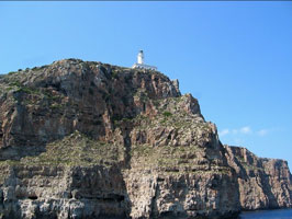
This lighthouse stands at the eastern tip of the island and is an important guide for ships passing to the south of the islands; it has a listed range of 23 nautical miles. 'Sa Mola' is a roughly circular plateau that forms the eastern portion of Formentera and is connected to the main part of the island by a sandy isthmus. Located about 15 km east of the town of Formentera, accessible by road. ARLHS # BAL-047 (E 0250)
| home | SpainE lights | map this |
| prev | region page | next |
| Med/Balearic () / SpainE SP158 |